Category:Sophienberg (Haag)
Jump to navigation
Jump to search
| Object location | | View all coordinates using: OpenStreetMap |
|---|
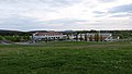
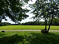
Mountain in Germany  Sophienberg as seen from Wolfsbach | |||||
| Upload media | |||||
| Instance of | |||||
|---|---|---|---|---|---|
| Named after | |||||
| Location | Haag, Bayreuth, Upper Franconia, Bavaria, Germany | ||||
| Elevation above sea level |
| ||||
 | |||||
English: The Sophienberg, up until the 17th Century named Culm or Culmberg, is located in the Municipality of Haag, Landkreis Bayreuth, Bavaria, Germany.
Deutsch: Der Sophienberg (bis zum 17. Jahrhundert Culm oder Culmberg) liegt in der Gemeinde Haag im Landkreis Bayreuth, Bayern.
Subcategories
This category has only the following subcategory.
L
- Landschaftsschutzgebiet Sophienberg (empty)
Media in category "Sophienberg (Haag)"
The following 19 files are in this category, out of 19 total.
-
 Bayreuth - Mai 2020 - Lohengrin Therme.jpg 5,472 × 3,080; 9.89 MB
-
 Bayreuth 1680.JPG 2,672 × 1,533; 1.48 MB
-
 Grundmauerreste vom Schloss Sophienberg.JPG 3,072 × 2,304; 4.27 MB
-
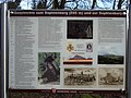 Infotafel Sophienberg.JPG 2,848 × 2,136; 1.48 MB
-
 Kriegsdenkmal Sophienberg (01).jpg 3,127 × 4,788; 18.85 MB
-
 Kriegsdenkmal Sophienberg (02).jpg 2,576 × 3,466; 9.78 MB
-
 Lattenkapelle auf dem Sophienberg (Ende 2015 entfernt) - panoramio.jpg 4,608 × 3,456; 2.12 MB
-
 Sophienberg Kulm Haag 2017 xy1.jpg 4,000 × 3,000; 4 MB
-
 Sophienberg Kulm Haag 2017 xy2.jpg 4,000 × 3,000; 4.21 MB
-
 Sophienberg Kulm Haag 2017 xy3.jpg 4,000 × 3,000; 4.04 MB
-
 Sophienberg Kulm Haag 2017 xy4.jpg 4,000 × 3,000; 4.17 MB
-
 Sophienberg Kulm Haag 2017 xy5.jpg 4,000 × 3,000; 4.17 MB
-
 Sophienberg Kulm Haag 2017 xy6.jpg 4,000 × 3,000; 4.11 MB
-
 Sophienberg Kulm Haag 2017 xy7.jpg 4,000 × 3,000; 4.15 MB
-
 Sophienberg Kulm Haag 2017 xy8.jpg 4,000 × 3,000; 4.15 MB
-
 Sophienberg Kulm Haag 2017 xy9.jpg 4,000 × 3,000; 3.93 MB
-
 Sophienberg P1020797.JPG 2,048 × 1,536; 1.45 MB
-
 Sophienberg von Bürgerreuth.jpg 1,280 × 600; 293 KB
-
 Sophienberg von Wolfsbach.jpg 2,560 × 1,440; 1.34 MB


.jpg)
.jpg)
_-_panoramio.jpg)


