Category:Soodener Bergland
Jump to navigation
Jump to search
mountains in Germany | |||||
| Upload media | |||||
| Instance of | |||||
|---|---|---|---|---|---|
| Location | Hesse, Germany | ||||
| Highest point | |||||
 | |||||
Subcategories
This category has the following 10 subcategories, out of 10 total.
B
F
G
- Großer Habichtstein (4 F)
H
- Hainskopf (3 F)
- Hoher Ahrenberg (4 F)
L
R
S
- Solberg (Soodener Bergland)) (5 F)
Media in category "Soodener Bergland"
The following 30 files are in this category, out of 30 total.
-
 Aussichtspunkt Hörne (2) X5H.jpg 3,264 × 2,448; 2.75 MB
-
 Blick von Kalbe auf die Gobert.jpg 1,221 × 500; 427 KB
-

-
 GobertSchöneAussichtTalblick.jpg 2,560 × 1,920; 2.88 MB
-
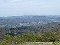
 Kalbe Soodener Bergland.jpg 1,033 × 500; 374 KB
-
 Ludwigstein 02.jpg 3,000 × 4,000; 4.18 MB
-
 Naturdenkmal Jägereiche X5H.jpg 3,264 × 2,448; 3.81 MB
-
 Naturschutzgebiet Harthberg, WDPA ID 163534.jpg 3,664 × 2,748; 4.12 MB
-
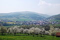 Oberriedenkirschbluete2013.JPG 3,008 × 2,000; 3.01 MB
-
 P7 - Ausblick Werratal 2024-05.jpg 1,536 × 2,048; 1.7 MB
-
 P7 - Aussichtspunkt Meissnerblick.jpg 2,048 × 1,536; 1.71 MB
-
 P7 - Blick auf BSA von SW.jpg 2,048 × 1,536; 2.18 MB
-
 P7 - Blick vom Rabenstein auf BSA 2024-05.jpg 2,048 × 1,536; 2.11 MB
-
 P7 - GeoInfotafel Dohlsbachtal.jpg 1,536 × 2,048; 1.82 MB
-
 P7 - Infotafel Otterbachstein 2024-05.jpg 1,536 × 2,048; 2 MB
-
 P7 - Otterbachstein 2024-05.jpg 1,536 × 2,048; 2.97 MB
-
 P7 - Soeder Weg - Dohlsbachtal.jpg 2,048 × 1,536; 3.02 MB
-
 Schloss Rothestein.jpg 3,264 × 2,448; 1.96 MB
-
 SoodenAllendorf02.jpg 2,272 × 1,704; 944 KB
-
 Sooder Wald - Hindenburg-Denkmal gesamt.jpg 2,048 × 1,536; 2.87 MB
-
 Sooder Wald - Hindenburg-Denkmal Mitte.jpg 1,536 × 2,048; 2.64 MB
-
 Sooder Wald - Hindenburg-Denkmal Rueckseite.jpg 1,536 × 2,048; 2.89 MB
-
 Sooder Wald - Hindenburg-Denkmal Tafel gross.jpg 2,048 × 1,536; 2.09 MB
-
 Tour 19.4 Oberrieden (37).jpg 4,276 × 3,182; 4.09 MB
-
 Unterrieden Kirschbluete 2013.JPG 6,299 × 4,199; 3.66 MB
-
 Wanderweg13 - Infotafel sogRoemerlager nahe BSA.jpg 1,536 × 2,048; 1.84 MB
-
 Werleshausen 2006-07-02.jpg 708 × 485; 312 KB
-
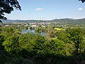
 Werraschleife.jpg 1,024 × 683; 666 KB
-
 Werratal.jpg 4,000 × 3,000; 4.42 MB
-
 X5H Abschnitt 5 (10).jpg 3,264 × 2,448; 2.09 MB
_X5H.jpg)


.jpg)


.jpg)