Category:Somerton, Somerset
Jump to navigation
Jump to search
town in Somerset, England  | |||||
| Upload media | |||||
| Instance of | |||||
|---|---|---|---|---|---|
| Location | South Somerset, Somerset, South West England, England | ||||
| Population |
| ||||
| Different from | |||||
| official website | |||||
 | |||||
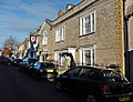
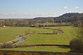
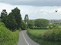
English: Somerton is a small town in South Somerset, England. It is situated on the River Cary, near Yeovil, Street and Glastonbury. Somerton has a wide market square surrounded by old stone houses and an octagonal, roofed Market Cross as a focal point at the centre.
Français : Somerton habitants.
Polski: Somerton - miasto w Wielkiej Brytanii, w Anglii w hrabstwie Somerset, nad rzeką Cary między Yeovil i Street. W centrum charakterystyczny ośmiokątny budynek Market Cross.
Română: Somerton este un oraş în comitatul Somerset, regiunea South West, Anglia. Oraşul se află în districtul South Somerset.
Subcategories
This category has the following 8 subcategories, out of 8 total.
H
- Hext Almshouses (2 F)
L
M
O
- Old Town Hall, Somerton (3 F)
S
- Market Cross, Somerton, Somerset (12 F)
U
- Unicorn Hotel, Somerton (3 F)
Media in category "Somerton, Somerset"
The following 200 files are in this category, out of 354 total.
(previous page) (next page)-
 'Natural Meats', Butchers, West Street, Somerton - geograph.org.uk - 2167432.jpg 1,600 × 1,200; 438 KB
-
 2013 Morgan Plus 4.jpg 4,896 × 3,672; 7.15 MB
-

-
 A372 near Highbrooks Farm - geograph.org.uk - 5265116.jpg 1,024 × 787; 193 KB
-
 A372 passes The Lime Kiln Inn - geograph.org.uk - 4011541.jpg 3,537 × 2,578; 1,010 KB
-
 A372 west of Glenda Spooner Farm - geograph.org.uk - 4011564.jpg 3,648 × 2,736; 1.19 MB
-
 A372 west of Highbrooks Farm - geograph.org.uk - 4011553.jpg 3,552 × 2,601; 1.03 MB
-
 Approach to Somerton - geograph.org.uk - 2469479.jpg 640 × 480; 116 KB
-
 Approaching Somerton on the B3153 - geograph.org.uk - 5245450.jpg 1,024 × 746; 243 KB
-
 Approaching the railway Bridge on the B3153 - geograph.org.uk - 5377107.jpg 1,024 × 762; 227 KB
-
 Arable field near Somerton - geograph.org.uk - 1912384.jpg 640 × 480; 146 KB
-
 Ashen Cross - geograph.org.uk - 5265244.jpg 1,024 × 805; 136 KB
-
 Ashen Cross, Mill Lane - geograph.org.uk - 495933.jpg 640 × 480; 61 KB
-
 B3151 - geograph.org.uk - 5777759.jpg 640 × 426; 41 KB
-
 B3151 - geograph.org.uk - 5817847.jpg 1,024 × 851; 111 KB
-
 B3151 on Kingsdon Hill - geograph.org.uk - 5357537.jpg 1,024 × 768; 315 KB
-
 B3153 road nr Somerton - geograph.org.uk - 1805054.jpg 1,024 × 629; 169 KB
-
 B3153 road to Somerton - geograph.org.uk - 349362.jpg 640 × 480; 296 KB
-
 Badgers Cross Farm - geograph.org.uk - 5265753.jpg 1,024 × 786; 123 KB
-
 Bancombe Road - geograph.org.uk - 5356812.jpg 1,024 × 768; 204 KB
-
 Barbers, Somerton - geograph.org.uk - 1014436.jpg 451 × 640; 85 KB
-
 Bare field and water trough, Hurcot - geograph.org.uk - 5631896.jpg 1,024 × 768; 239 KB
-
 Barn at Hurcot - geograph.org.uk - 5631885.jpg 1,024 × 768; 155 KB
-
 Bench Mark, Market Place, Somerton - geograph.org.uk - 1913889.jpg 480 × 640; 163 KB
-
 Bend on Huish Road - geograph.org.uk - 5357530.jpg 1,024 × 776; 221 KB
-

-
 Bernard Stacey, Somerton - geograph.org.uk - 2483657.jpg 640 × 480; 134 KB
-
 Beside the River Cary - geograph.org.uk - 6622316.jpg 1,024 × 683; 189 KB
-
 Big Yellow digger - geograph.org.uk - 5552276.jpg 640 × 426; 75 KB
-
 Bradley Hill Lane - geograph.org.uk - 5986285.jpg 1,600 × 1,200; 405 KB
-
 Broad Street, Somerton - geograph.org.uk - 1961580.jpg 640 × 480; 308 KB
-
 Broad Street, Somerton - geograph.org.uk - 978321.jpg 640 × 428; 65 KB
-
 Bus stop on Langport Road - geograph.org.uk - 5245787.jpg 1,024 × 812; 161 KB
-
 Buttercross, Somerton - geograph.org.uk - 6450154.jpg 640 × 480; 85 KB
-
 By the Reading to Taunton Line - geograph.org.uk - 5552273.jpg 640 × 426; 81 KB
-
 Cartway Lane, Somerton - geograph.org.uk - 5245793.jpg 1,024 × 796; 132 KB
-
 Cary Valley - geograph.org.uk - 1589599.jpg 640 × 429; 57 KB
-
 Cary valley - geograph.org.uk - 4768697.jpg 2,492 × 1,204; 516 KB
-
 Cary Valley - geograph.org.uk - 5452729.jpg 640 × 426; 36 KB
-
 Cary View - geograph.org.uk - 5356404.jpg 1,024 × 801; 187 KB
-
 Catsgore Farm - geograph.org.uk - 5608678.jpg 1,024 × 768; 169 KB
-
 Catsgore Road - geograph.org.uk - 5608679.jpg 1,024 × 768; 166 KB
-
 Catsgore Road - geograph.org.uk - 5628825.jpg 640 × 427; 194 KB
-
 Catsgore, entrance sign - geograph.org.uk - 2414855.jpg 640 × 433; 53 KB
-
 Cottage at end of New Street, Somerton - geograph.org.uk - 6292685.jpg 1,024 × 768; 176 KB
-
 Cottage in Lower Somerton - geograph.org.uk - 5628826.jpg 640 × 427; 195 KB
-
 Cottages, Lower Somerton - geograph.org.uk - 1014544.jpg 640 × 480; 92 KB
-
 Cover crop by Liver Moor Drove - geograph.org.uk - 5357752.jpg 1,600 × 1,120; 475 KB
-
 Cows by Liver Moor Drove - geograph.org.uk - 5353733.jpg 1,600 × 1,200; 489 KB
-
 CTC sign at Unicorn Hotel - geograph.org.uk - 4181201.jpg 1,064 × 1,600; 403 KB
-

-

-
 Direction Sign - Signpost on the B3151 at Midney - geograph.org.uk - 6098932.jpg 1,788 × 1,162; 214 KB
-
 Direction Sign – Signpost - geograph.org.uk - 6537672.jpg 540 × 720; 224 KB
-
 Direction Sign – Signpost - geograph.org.uk - 6537680.jpg 859 × 644; 196 KB
-

-
 Ditch on Somerton Moor - geograph.org.uk - 5986164.jpg 1,600 × 1,200; 570 KB
-
 Ditch on Somerton Moor - geograph.org.uk - 5986168.jpg 1,600 × 1,200; 517 KB
-

-
 Drain on Butleigh Moor - geograph.org.uk - 5375930.jpg 1,024 × 731; 155 KB
-
 Drainage cut on Somerton Moor - geograph.org.uk - 5986159.jpg 1,600 × 1,200; 599 KB
-
 Drinking trough in Cow Square, Somerset - geograph.org.uk - 978333.jpg 640 × 428; 125 KB
-
 Drove on Walton Moor - geograph.org.uk - 5375194.jpg 1,024 × 768; 234 KB
-
 Eighteen Feet Rhyne - geograph.org.uk - 5375695.jpg 1,024 × 768; 180 KB
-
 Etsome Hill Cottages - geograph.org.uk - 5356412.jpg 1,024 × 765; 131 KB
-
 Etsome Road - geograph.org.uk - 5356409.jpg 1,024 × 787; 169 KB
-
 Farm Track Near Hurcot - geograph.org.uk - 5632534.jpg 640 × 427; 193 KB
-
 Farmland near Hurcot - geograph.org.uk - 2905333.jpg 640 × 380; 48 KB
-
 Farmland near Somerton - geograph.org.uk - 4768694.jpg 3,052 × 1,330; 917 KB
-
 Farmland, Carey Valley - geograph.org.uk - 5112985.jpg 640 × 426; 39 KB
-
 Farmland, Hurcot - geograph.org.uk - 4936227.jpg 640 × 437; 53 KB
-
 Farmland, Hurcott - geograph.org.uk - 4862444.jpg 640 × 521; 48 KB
-
 Farmland, Somerton - geograph.org.uk - 5112979.jpg 640 × 426; 41 KB
-
 Farmland, The Cary Valley - geograph.org.uk - 4936220.jpg 640 × 426; 38 KB
-
 Farmland, Welham Farm - geograph.org.uk - 5112996.jpg 640 × 426; 39 KB
-
 Field beside Park Lane - geograph.org.uk - 6622277.jpg 1,024 × 683; 182 KB
-
 Field by Grove Lane - geograph.org.uk - 5986283.jpg 1,600 × 999; 296 KB
-
 Field by Liver Moor Drove - geograph.org.uk - 5357751.jpg 1,600 × 1,245; 481 KB
-
 Field by River Cary - geograph.org.uk - 5354063.jpg 1,600 × 1,143; 519 KB
-
 Field near Spyall - geograph.org.uk - 5628197.jpg 640 × 427; 183 KB
-
 Field Next to Ashen Cross Quarry - geograph.org.uk - 5628201.jpg 640 × 427; 208 KB
-
 Field Next to Catsgore Rd - geograph.org.uk - 5628195.jpg 640 × 427; 206 KB
-
 Field Next to River Cary - geograph.org.uk - 5632531.jpg 640 × 480; 186 KB
-
 Field, north of Park Lane - geograph.org.uk - 5357278.jpg 1,024 × 791; 198 KB
-
 Fields by Bradley Hill Lane - geograph.org.uk - 5986286.jpg 1,600 × 1,189; 293 KB
-
 Fields in the Cary valley - geograph.org.uk - 5357115.jpg 1,024 × 780; 166 KB
-
 Fishing lake at Somerton - geograph.org.uk - 6622314.jpg 1,024 × 683; 149 KB
-
 Fishing Lakes - geograph.org.uk - 5184401.jpg 640 × 380; 45 KB
-
 Fishing lakes - geograph.org.uk - 5452720.jpg 640 × 426; 44 KB
-
 Fishing lakes - geograph.org.uk - 5509790.jpg 640 × 425; 39 KB
-
 Fishing lakes by River Cary - geograph.org.uk - 5552277.jpg 640 × 426; 61 KB
-
 Fishing lakes by the River Cary - geograph.org.uk - 5433138.jpg 640 × 309; 42 KB
-
 Fishing lakes by the River Cary - geograph.org.uk - 5668302.jpg 640 × 426; 61 KB
-
 Flock of starlings in tree, Somerton, Somerset 01.jpg 5,152 × 3,864; 4.44 MB
-
 Flock of starlings in tree, Somerton, Somerset 02.jpg 5,152 × 3,864; 4.67 MB
-
 Flock of starlings in tree, Somerton, Somerset 03.jpg 5,152 × 3,864; 4.52 MB
-
 Footbridge across the River Cary - geograph.org.uk - 6622315.jpg 1,024 × 683; 261 KB
-
 Footbridge near Walton Sluice - geograph.org.uk - 5298792.jpg 1,024 × 768; 203 KB
-
 Footpath by River Cary - geograph.org.uk - 5353681.jpg 1,600 × 1,200; 401 KB
-
 Former Bank In Market Place - geograph.org.uk - 4479783.jpg 1,600 × 1,200; 410 KB
-
 Gated entrance, Little Park Farm - geograph.org.uk - 5356835.jpg 1,024 × 801; 148 KB
-
 Grassy Field - geograph.org.uk - 495954.jpg 640 × 480; 122 KB
-
 Great Coombe Spinney - geograph.org.uk - 5357507.jpg 1,024 × 780; 236 KB
-
 Greystones House - geograph.org.uk - 5245434.jpg 1,024 × 781; 184 KB
-
 Grove Lane - geograph.org.uk - 5356424.jpg 1,024 × 768; 350 KB
-
 Grove Lane - geograph.org.uk - 5986308.jpg 1,600 × 1,200; 751 KB
-
 Headland strip - geograph.org.uk - 5816002.jpg 1,024 × 681; 88 KB
-
 Hedge and track - geograph.org.uk - 5033892.jpg 640 × 426; 40 KB
-
 Hedge near Hurcot - geograph.org.uk - 4936225.jpg 640 × 426; 44 KB
-
 Highbrooks Road - geograph.org.uk - 5265261.jpg 1,024 × 792; 211 KB
-
 Highbrooks Road - geograph.org.uk - 5265273.jpg 1,024 × 768; 205 KB
-
 Horse Mill Lane, Somerton - geograph.org.uk - 3929845.jpg 4,000 × 3,000; 2.88 MB
-
 House on Langport Road - geograph.org.uk - 5245467.jpg 1,024 × 768; 192 KB
-
 Housing development at Northfield Farm - geograph.org.uk - 5245473.jpg 1,024 × 768; 125 KB
-
 Huish Road - geograph.org.uk - 5357516.jpg 1,024 × 768; 238 KB
-
 Huish Road - geograph.org.uk - 5694965.jpg 1,024 × 768; 232 KB
-
 Hurcot farmhouse - geograph.org.uk - 5631897.jpg 1,024 × 768; 189 KB
-
 Hurcott Railway Bridge - geograph.org.uk - 3929206.jpg 4,000 × 3,000; 3.4 MB
-
 Hurcott, Fields to the south-east - geograph.org.uk - 2935762.jpg 900 × 596; 383 KB
-
 Junction of B3151 and B3153 - geograph.org.uk - 1456871.jpg 640 × 477; 386 KB
-
 Kingsdon Drove - geograph.org.uk - 5651702.jpg 640 × 427; 235 KB
-
 Kingsdon, Somerset (8591270740).jpg 3,648 × 2,736; 2.47 MB
-
 Lane leading towards Hurcott near Somerton - geograph.org.uk - 5618949.jpg 5,184 × 2,920; 5.25 MB
-
 Liver Moor Drove - geograph.org.uk - 5357747.jpg 1,600 × 1,185; 698 KB
-
 Looking down from Grove Lane - geograph.org.uk - 5353662.jpg 1,600 × 1,198; 359 KB
-
 Looking east along West Street (B3165) - geograph.org.uk - 4933139.jpg 3,264 × 2,448; 2.17 MB
-
 Looking northeast along West Street (B3165) - geograph.org.uk - 4933121.jpg 3,264 × 2,448; 1.94 MB
-
 Lower Hurcot Farmhouse - geograph.org.uk - 5631881.jpg 1,024 × 791; 155 KB
-
 Lower Somerton - geograph.org.uk - 1014519.jpg 640 × 449; 90 KB
-
 Lower Somerton 01.jpg 5,152 × 3,864; 4.37 MB
-
 Lower Somerton 02.jpg 5,152 × 3,864; 4.31 MB
-
 Lower Somerton 03.jpg 5,152 × 3,864; 4.44 MB
-
 Lower Somerton 04.jpg 5,152 × 3,864; 4.5 MB
-
 Lower Somerton 05.jpg 5,152 × 3,864; 4.35 MB
-
 Macmillan Way - geograph.org.uk - 5653255.jpg 640 × 427; 212 KB
-
 Macmillan Way West - geograph.org.uk - 5694964.jpg 1,024 × 761; 171 KB
-
 Main line to Paddington - geograph.org.uk - 5245620.jpg 1,024 × 789; 243 KB
-
 Maize stubble by River Cary - geograph.org.uk - 5986296.jpg 1,600 × 1,258; 564 KB
-
 Market Cross, Somerton - geograph.org.uk - 4172705.jpg 1,774 × 1,183; 530 KB
-
 Market Square, Somerton - geograph.org.uk - 1961587.jpg 640 × 480; 330 KB
-
 Marketplace, Somerton - geograph.org.uk - 2167430.jpg 1,600 × 1,200; 382 KB
-
 Meadow land beside the River Cary - geograph.org.uk - 4491689.jpg 1,600 × 1,200; 444 KB
-
-
 Melbury - geograph.org.uk - 5265768.jpg 1,024 × 749; 340 KB
-
 Mill Lane Junction with B3151 - geograph.org.uk - 2113301.jpg 640 × 480; 110 KB
-
 Narrow house on Acre Lane - geograph.org.uk - 5357471.jpg 1,024 × 772; 161 KB
-
 New build in Somerton - geograph.org.uk - 5552275.jpg 640 × 426; 79 KB
-
 Newly ploughed field, east of Highbrooks Road - geograph.org.uk - 5265266.jpg 1,024 × 768; 277 KB
-
 Oilseed rape, Hurcott - geograph.org.uk - 2483705.jpg 640 × 480; 112 KB
-
 Oilseed rape, Somerton - geograph.org.uk - 2483700.jpg 640 × 480; 157 KB
-

-
 Old signs, West Street, Somerton - geograph.org.uk - 2480734.jpg 640 × 345; 88 KB
-
 Old Somerton Mill - geograph.org.uk - 5357498.jpg 1,024 × 768; 240 KB
-
 Orchard on Grove Lane - geograph.org.uk - 5356415.jpg 1,024 × 768; 196 KB
-
 Ordnance Survey Flush Bracket 10717 - geograph.org.uk - 3929237.jpg 4,000 × 3,000; 3.8 MB
-
 Ordnance Survey Flush Bracket 10817 - geograph.org.uk - 3929851.jpg 4,000 × 3,000; 4.09 MB
-
 Ordnance Survey Flush Bracket S6092 - geograph.org.uk - 3929897.jpg 4,000 × 3,000; 3.77 MB
-
 Park Bridge over River Cary - geograph.org.uk - 5353743.jpg 1,600 × 1,200; 432 KB
-
 Park Lane - geograph.org.uk - 5356845.jpg 1,024 × 768; 188 KB
-
 Pasture, Melbury Farm - geograph.org.uk - 2480730.jpg 640 × 359; 81 KB
-
 Path by River Cary - geograph.org.uk - 5986289.jpg 1,600 × 1,227; 443 KB
-
 Path by River Cary - geograph.org.uk - 5986300.jpg 1,600 × 1,200; 484 KB
-
 Perry Hill Road - geograph.org.uk - 5265279.jpg 1,024 × 786; 173 KB
-
 Pesters Lane - geograph.org.uk - 2438729.jpg 3,072 × 2,304; 3.11 MB
-
 Pesters Lane - geograph.org.uk - 5265253.jpg 1,024 × 793; 130 KB
-
 Pollen beetle on a celandine (6863567406).jpg 2,035 × 3,053; 1.39 MB
-
 Post office at The Triangle, Somerton - geograph.org.uk - 5245581.jpg 1,024 × 768; 133 KB
-
 Quarry workings, Hurcott - geograph.org.uk - 2483718.jpg 640 × 442; 93 KB
-
 Railway Bridge at Hurcot - geograph.org.uk - 5632533.jpg 640 × 427; 263 KB
-
 Railway bridge near Hurcot - geograph.org.uk - 5631880.jpg 1,024 × 768; 260 KB
-
 Railway bridge on Littleton Hill - geograph.org.uk - 5305023.jpg 1,024 × 797; 193 KB
-
 Railway bridge, Hurcot - geograph.org.uk - 5631901.jpg 1,024 × 818; 284 KB
-
 Railway bridge, West Street, Somerton - geograph.org.uk - 1961636.jpg 640 × 480; 295 KB
-
 Railway girder bridge on West Street - geograph.org.uk - 5245752.jpg 1,024 × 768; 208 KB
-
 Railway Viaduct above River Cary - geograph.org.uk - 5356444.jpg 1,024 × 773; 191 KB
-
 Railway, Somerton - geograph.org.uk - 2483651.jpg 640 × 359; 90 KB
-
 Randle Lodge - geograph.org.uk - 5357478.jpg 1,024 × 768; 244 KB
-
 Red Lion Court, Somerton (geograph 5245596).jpg 1,024 × 781; 197 KB
-
 Redundant radio relay building - geograph.org.uk - 5265764.jpg 1,024 × 668; 136 KB
-
 Rhyne on Somerton Moor - geograph.org.uk - 5357331.jpg 1,024 × 768; 254 KB
-
 Rhyne on Somerton Moor - geograph.org.uk - 5357340.jpg 1,024 × 768; 203 KB
-
 Rhyne on Walton Moor - geograph.org.uk - 5375706.jpg 1,024 × 768; 147 KB
-
 River Cary - geograph.org.uk - 1014500.jpg 480 × 640; 114 KB
-
 River Cary - geograph.org.uk - 231027.jpg 640 × 480; 95 KB
-
 River Cary - geograph.org.uk - 231037.jpg 640 × 480; 95 KB
-
 River Cary - geograph.org.uk - 4862443.jpg 640 × 426; 55 KB
-
 River Cary - geograph.org.uk - 4936216.jpg 640 × 307; 26 KB
-
 River Cary - geograph.org.uk - 5112981.jpg 640 × 426; 50 KB
-
 River Cary - geograph.org.uk - 5184402.jpg 640 × 571; 52 KB
-
 River Cary - geograph.org.uk - 5452728.jpg 640 × 426; 42 KB
-
 River Cary - geograph.org.uk - 5509786.jpg 640 × 426; 40 KB
-
 River Cary - geograph.org.uk - 5557781.jpg 640 × 426; 58 KB
-
 River Cary - geograph.org.uk - 5772590.jpg 640 × 426; 53 KB
-
 River Cary - geograph.org.uk - 5904481.jpg 1,024 × 681; 96 KB
-
 River Cary - geograph.org.uk - 6423327.jpg 1,024 × 491; 86 KB
-
 River Drove - geograph.org.uk - 5357328.jpg 1,024 × 768; 214 KB
-
 Road drops down towards Somerton - geograph.org.uk - 2469472.jpg 640 × 480; 73 KB
-
 Road through Hurcot - geograph.org.uk - 5631900.jpg 1,024 × 794; 202 KB
-
 Road to Hurcot - geograph.org.uk - 5631892.jpg 1,024 × 771; 219 KB
-
 Rural Lane - geograph.org.uk - 1828668.jpg 640 × 445; 61 KB


.jpg)


_-_geograph.org.uk_-_4933139.jpg)
_-_geograph.org.uk_-_4933121.jpg)


.jpg)


.jpg)


