Category:Snow line
Jump to navigation
Jump to search
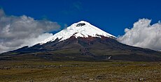
English: The climatic snow line is the boundary between a snow-covered and snow-free surface. The actual snow line may adjust seasonally, and be either significantly higher in elevation, or lower. The permanent snow line is the level above which snow will lie all year.
point above which snow and ice cover the ground throughout the year | |||||
| Upload media | |||||
| Subclass of | |||||
|---|---|---|---|---|---|
| Facet of | |||||
| Different from | |||||
| |||||
Media in category "Snow line"
The following 49 files are in this category, out of 49 total.
-
00 126 2685 Vulcano Osorno Chile.jpg 2,168 × 1,440; 1.53 MB
-
00 2684 Vulkan Osorno - Chile.jpg 1,080 × 1,440; 1.42 MB
-
06 NP Cotopaxi (39).jpg 1,024 × 768; 172 KB
-
06 NP Cotopaxi (65).JPG 4,000 × 3,000; 2.35 MB
-
A la falda del Volcán Osorno.JPG 2,592 × 1,944; 2.77 MB
-
Aerosillas en el volcán Osorno.jpg 4,288 × 3,216; 3.32 MB
-
Artist’s impression of snow lines around TW Hydrae (9329010073).jpg 1,500 × 1,800; 786 KB
-
Car in there somewhere.JPG 1,143 × 474; 62 KB
-
Cotopaxi volcano 2008-06-27T1322.jpg 900 × 462; 106 KB
-
Cotopaxi with horse.jpg 7,000 × 2,238; 5.08 MB
-
Cotopaxi.JPG 1,536 × 1,024; 1.07 MB
-
CotopaximitLaguna.jpg 1,024 × 768; 379 KB
-
CotopaxiSE.jpg 800 × 600; 167 KB
-
DSCN6336.JPG 1,600 × 1,200; 727 KB
-
Ecua 2004 Cotopaxi 1.jpg 1,600 × 1,200; 1.26 MB
-
En el cruce de lagos (408502830).jpg 1,752 × 1,180; 330 KB
-
Fell birch forest in malla strict nature reserve.jpg 4,000 × 3,000; 6.2 MB
-
Birch tree at the Simplonpass June 2023 08.jpg 6,960 × 4,640; 13.28 MB
-
Lago Todos Los Santos, Volcan Osorno.JPG 3,648 × 2,736; 4.11 MB
-
Lago Villarrica mit Vulkan Villarrica.jpg 3,264 × 2,448; 745 KB
-
Laguna Todos Los Santos.jpg 3,296 × 2,472; 1.03 MB
-
Landscape osorno petrohue 2.jpg 894 × 631; 223 KB
-
Llanquihue -Totoral -vista al Osorno dede mon Unsern Ahnen.jpg 3,796 × 2,474; 2.4 MB
-
Osorno (33627573964).jpg 6,000 × 4,000; 12 MB
-
Osorno - panoramio.jpg 2,592 × 1,944; 1.86 MB
-
Osorno Petrohué.jpg 2,560 × 1,440; 1.57 MB
-
Osorno Volcano and Petrohué Waterfalls.jpg 5,957 × 3,395; 9.49 MB
-
Patagônia (17832500503).jpg 4,608 × 3,072; 5.26 MB
-
Piz Terri e Michela.jpg 3,000 × 1,992; 1.96 MB
-
Rakhiv, Zakarpats'ka oblast, Ukraine, 90600 - panoramio.jpg 1,280 × 833; 608 KB
-
Schneefallgrenze Jenins.jpg 2,570 × 1,756; 1,019 KB
-
Schneegrenze.jpg 2,592 × 1,944; 1,019 KB
-
Scuol-Motta Naluns, 11-10-2024. (actm.) 21.jpg 5,184 × 2,916; 12.24 MB
-
Villarrica 2245.jpg 1,024 × 768; 478 KB
-
Volcan Calbuco 2006.jpg 5,729 × 2,178; 5.85 MB
-
Volcan Calbuco.jpeg 820 × 620; 110 KB
-
Volcan Lascar.jpg 2,000 × 1,500; 686 KB
-
Volcan Osorno Campo.jpg 2,048 × 1,536; 422 KB
-
Volcan Osorno-- Vista Turistica (27007722351).jpg 900 × 615; 139 KB
-
Volcan Villarrica 2.jpg 4,248 × 2,821; 2.59 MB
-
Volcano Osorno - Petrohue - panoramio (1).jpg 2,816 × 2,112; 2.12 MB
-
Volcano Osorno and Petrohué waterfalls.JPG 1,600 × 1,200; 566 KB
-
Volcán calbuco - Flickr - jackripper.jpg 5,184 × 3,456; 3.43 MB
-
Volcán Calbuco 1.JPG 4,608 × 3,456; 2.81 MB
-
Volcán Calbuco desde Panitao.jpg 5,184 × 3,456; 4.19 MB
-
Volcán y lago Villarrica.jpg 4,288 × 3,216; 3.78 MB
-
Αυλώνας χιόνι 7032.JPG 4,608 × 3,456; 3.18 MB


