Category:Snow in the Metropolitan Borough of Kirklees
Jump to navigation
Jump to search
Subcategories
This category has only the following subcategory.
Media in category "Snow in the Metropolitan Borough of Kirklees"
The following 30 files are in this category, out of 30 total.
-
 A snow-covered field north of Roberttown, Liversedge - geograph.org.uk - 6345618.jpg 2,000 × 1,133; 1.45 MB
-
 A616 at Berry Brow - geograph.org.uk - 3383994.jpg 640 × 437; 75 KB
-
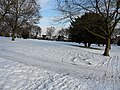 Almondbury Cemetery, winter-time - geograph.org.uk - 3309964.jpg 4,320 × 3,240; 3 MB
-
 Back Lane in the snow - geograph.org.uk - 3303089.jpg 1,024 × 768; 232 KB
-
 Bullace Trees Lane, Liversedge, on a snowy day - geograph.org.uk - 6344140.jpg 2,000 × 1,399; 2.02 MB
-
 Bullace Trees Lane, Liversedge, on a snowy day - geograph.org.uk - 6344141.jpg 2,000 × 1,500; 2.02 MB
-
 Church Road, Roberttown, Liversedge - geograph.org.uk - 6345616.jpg 2,000 × 1,245; 1.96 MB
-
-

-
 Jackson's Lane, after snow - geograph.org.uk - 3303100.jpg 1,024 × 768; 169 KB
-
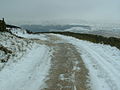
 Kirklees Way, nr Ramsden Lane - geograph.org.uk - 138364.jpg 640 × 480; 118 KB
-
 Linton Close in the snow - geograph.org.uk - 3828455.jpg 2,000 × 1,351; 706 KB
-
 Memorial Park, Cleckheaton, covered in snow - geograph.org.uk - 6344946.jpg 2,000 × 1,086; 1.43 MB
-
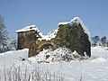
 Pack Horse Tap Yard 1962 - geograph.org.uk - 3007153.jpg 2,119 × 3,096; 778 KB
-
-
 Pule Hill - geograph.org.uk - 1119325.jpg 640 × 480; 47 KB
-
 Ramsden Road - geograph.org.uk - 138367.jpg 640 × 480; 82 KB
-
 Roberttown Lane, Liversedge - geograph.org.uk - 6344926.jpg 2,000 × 1,118; 1.88 MB
-
 Roberttown Lane, Roberttown, Liversedge - geograph.org.uk - 6345614.jpg 2,000 × 1,244; 1.91 MB
-
 Snowy field corner, north of Bunkers Hill - geograph.org.uk - 3303042.jpg 1,024 × 768; 96 KB
-
 Snowy field west of Foxroyd Shrogg - geograph.org.uk - 3303078.jpg 1,024 × 768; 110 KB
-
 Snowy footpath, Penny Spring Wood, Almondbury - geograph.org.uk - 3309672.jpg 4,320 × 3,240; 2.97 MB
-
 Snowy hillside, east of Golgreave - geograph.org.uk - 3303067.jpg 1,024 × 768; 70 KB
-
 Toys R Us - Birstall Retail Park - geograph.org.uk - 1147903.jpg 640 × 399; 174 KB
-
 Winter 1947 - Path from Hall Bower to Newsome - geograph.org.uk - 1846818.jpg 1,027 × 682; 105 KB
-

-

-
 Winter Birches near Wood Nook, Honley - geograph.org.uk - 92412.jpg 640 × 426; 91 KB
-
 Winter cattle at Foxroyd Shrogg - geograph.org.uk - 3303031.jpg 1,024 × 768; 150 KB
-
 Winter on Slaithwaite Moor - geograph.org.uk - 2780952.jpg 3,072 × 2,304; 797 KB


