Category:Snape, Suffolk
Jump to navigation
Jump to search
Deutsch: Snape ist ein Dorf in der englischen Grafschaft Suffolk (Region East Anglia). Es befindet sich an dem Fluss Alde und liegt in der Nähe der Stadt Aldeburgh. Snape hat etwa 600 Einwohner.
English: Snape is a small village in the English county of Suffolk, on the River Alde close to Aldeburgh. It has about 600 inhabitants. Snape is now best known for Snape Maltings, no longer in commercial use, but converted into a tourist centre together with a concert hall that hosts the major part of the annual Aldeburgh Festival. Also, Severus Snape, of the Harry Potter books, was named after the village.
village and civil parish in Suffolk, England, UK  | |||||
| Upload media | |||||
| Instance of | |||||
|---|---|---|---|---|---|
| Location |
| ||||
| Population |
| ||||
 | |||||
Subcategories
This category has the following 13 subcategories, out of 13 total.
B
- Snape Bridge (12 F)
C
- The Crown Inn, Snape (9 F)
E
F
G
- The Golden Key, Snape (7 F)
J
P
S
- Snape Enclosure Award, 1859 (24 F)
- Snape Methodist Church (3 F)
- Snape Village Sign (6 F)
V
Media in category "Snape, Suffolk"
The following 200 files are in this category, out of 333 total.
(previous page) (next page)-
 'Snape' village sign - geograph.org.uk - 2956810.jpg 1,024 × 836; 251 KB
-
 A house called Whitewalls - geograph.org.uk - 4361703.jpg 1,024 × 768; 329 KB
-
 A1069 Church Rd Snape and Snape SPSO Postbox - geograph.org.uk - 1433106.jpg 3,072 × 2,304; 1.4 MB
-
 A1069 Church Road, Snape - geograph.org.uk - 1433104.jpg 3,072 × 2,304; 1.52 MB
-
 A1094 Approaching Snape - geograph.org.uk - 3864806.jpg 640 × 480; 320 KB
-
 A1094 bridge over the River Fromus - geograph.org.uk - 3589909.jpg 3,648 × 2,736; 1.85 MB
-
 A1094 Farnham Road - geograph.org.uk - 2330355.jpg 3,072 × 2,304; 1.28 MB
-
 A1094 Farnham Road - geograph.org.uk - 2330360.jpg 3,072 × 2,304; 1.29 MB
-
 A1094 Farnham Road - geograph.org.uk - 2334407.jpg 3,072 × 2,304; 1.34 MB
-
 A1094 Farnham Road - geograph.org.uk - 2334415.jpg 3,072 × 2,304; 1.42 MB
-
 A1094 Farnham Road and Bridge - geograph.org.uk - 1883099.jpg 3,072 × 2,304; 1.36 MB
-
 A1094 junction for Friston - geograph.org.uk - 4068920.jpg 1,536 × 768; 603 KB
-
 A1094 near Snape - geograph.org.uk - 177606.jpg 640 × 480; 98 KB
-
 A1094 north of Croft Farm - geograph.org.uk - 3589906.jpg 3,648 × 2,736; 1.8 MB
-
 Abbey Farm entrance - geograph.org.uk - 2341559.jpg 3,072 × 2,304; 1.51 MB
-
 Abbey Farm sign - geograph.org.uk - 2341561.jpg 3,072 × 2,304; 1.43 MB
-
 Aldeburgh 6 - geograph.org.uk - 2212503.jpg 1,200 × 1,600; 581 KB
-

-
 B1069 Church Road ^ the footpath to Gromford Lane - geograph.org.uk - 2514015.jpg 3,072 × 2,304; 1.38 MB
-
 B1069 Church Road, Snape - geograph.org.uk - 1448037.jpg 3,072 × 2,304; 1.4 MB
-
 B1069 Church Road, Snape - geograph.org.uk - 2335801.jpg 3,072 × 2,304; 1.34 MB
-
 B1069 Church Road, Snape - geograph.org.uk - 2335810.jpg 3,072 × 2,304; 1.26 MB
-
 B1069 Church Road, Snape - geograph.org.uk - 2514028.jpg 3,072 × 2,304; 1.28 MB
-
 B1069 Church Road, Snape - geograph.org.uk - 4448551.jpg 3,072 × 2,304; 1.85 MB
-
 B1069 Church Road, Snape - geograph.org.uk - 4448577.jpg 3,072 × 2,304; 1.83 MB
-
 B1069 Church Road, Snape - geograph.org.uk - 4448613.jpg 3,072 × 2,304; 3.35 MB
-
 B1069 Church Road, Snape - geograph.org.uk - 4448632.jpg 3,072 × 2,304; 1.87 MB
-
 B1069 east of Snape Hall Farm - geograph.org.uk - 3576211.jpg 3,336 × 2,420; 1.22 MB
-
 B1069 passes The Crown (southbound) - geograph.org.uk - 3576237.jpg 3,368 × 2,505; 864 KB
-
 B1069 passes The Crown - geograph.org.uk - 3559956.jpg 3,209 × 2,477; 1.16 MB
-
 Back Lane footpath to Sternfield Road - geograph.org.uk - 2330390.jpg 3,072 × 2,304; 1.34 MB
-
 Back Lane footpath to Sternfield Road - geograph.org.uk - 2330396.jpg 3,072 × 2,304; 1.32 MB
-
 Back Lane footpath to the A1094 Farnham Road - geograph.org.uk - 2335841.jpg 3,072 × 2,304; 1.41 MB
-
 Barn at Snape Watering Farm - geograph.org.uk - 185018.jpg 640 × 480; 87 KB
-
 Bend in the River Alde, below Snape - geograph.org.uk - 6280074.jpg 1,600 × 1,064; 286 KB
-
 Beside Abbey Farm - geograph.org.uk - 6651441.jpg 768 × 1,024; 248 KB
-
 Boats moored at Snape Maltings - geograph.org.uk - 6103361.jpg 6,000 × 4,000; 5.36 MB
-
 Bow of MV Nadir - geograph.org.uk - 666292.jpg 427 × 640; 44 KB
-
 Brick Kiln Park sign - geograph.org.uk - 4448336.jpg 3,072 × 2,304; 1.83 MB
-
 Brick Kiln Park, Snape - geograph.org.uk - 4448348.jpg 3,072 × 2,304; 1.78 MB
-
 Bridleway in Snape Warren - geograph.org.uk - 6651403.jpg 768 × 1,024; 391 KB
-
 Buildings at Rookery Farm - geograph.org.uk - 3386082.jpg 640 × 480; 117 KB
-
 Canoes at Cliff Reach - North - geograph.org.uk - 4568706.jpg 3,860 × 2,552; 1.79 MB
-
 CEL Design Ltd sign - geograph.org.uk - 4448368.jpg 2,291 × 3,046; 2.5 MB
-
 CEL Design Ltd sign - geograph.org.uk - 4448463.jpg 2,265 × 3,011; 2.79 MB
-
 Church Farm entrance off Sternfield Road - geograph.org.uk - 4983961.jpg 3,017 × 2,307; 2.59 MB
-
 Church Farm sign off Sternfield road - geograph.org.uk - 4984020.jpg 2,304 × 3,072; 4.3 MB
-
 Church Road - geograph.org.uk - 4758809.jpg 1,024 × 768; 205 KB
-
 Church Road, Snape - geograph.org.uk - 5568290.jpg 1,600 × 1,064; 317 KB
-
 Cliff Reach, River Alde - geograph.org.uk - 666253.jpg 640 × 427; 112 KB
-
 Country house on Priory Road, Snape - geograph.org.uk - 2300732.jpg 760 × 570; 313 KB
-
 Crossroads in Priory Road, Snape - geograph.org.uk - 1121715.jpg 3,072 × 2,304; 1.33 MB
-

-
 Ditch clearing on the Snape Marshes reserve - geograph.org.uk - 3225807.jpg 1,142 × 857; 354 KB
-
 Entering Snape on the A1094 Farnham Road - geograph.org.uk - 4448302.jpg 3,072 × 2,304; 1.71 MB
-
 Entering Snape on the B1069 Church Road - geograph.org.uk - 4448314.jpg 3,072 × 2,187; 3.38 MB
-
 Entrance to CPL Design Ltd - geograph.org.uk - 4448455.jpg 2,304 × 3,072; 2.71 MB
-
 Entrance to Friston Lodge ^ Restricted Byway to Kiln Lane - geograph.org.uk - 2522798.jpg 3,072 × 2,304; 1.33 MB
-
 Entrance to Snape Playing Field - geograph.org.uk - 5347192.jpg 2,592 × 3,901; 6.58 MB
-
 Entrance to Snape Playing Field - geograph.org.uk - 5347236.jpg 4,608 × 3,072; 1.77 MB
-
 Estate Agent Sale Board off Sternfield Road - geograph.org.uk - 4983971.jpg 2,265 × 3,011; 4.05 MB
-
 Farm Buildings - geograph.org.uk - 4492173.jpg 1,024 × 768; 246 KB
-
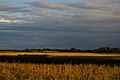
 Farmland near Snape - geograph.org.uk - 177618.jpg 640 × 480; 121 KB
-

-
 Farnham Road - geograph.org.uk - 3864865.jpg 640 × 480; 320 KB
-
 Farnham Road, the A1094, heading towards Snape - geograph.org.uk - 4066405.jpg 3,648 × 2,736; 2.55 MB
-
 Fence And Path - geograph.org.uk - 4492187.jpg 768 × 1,024; 396 KB
-
 Ferny heathland east of Snape - geograph.org.uk - 4165525.jpg 640 × 427; 87 KB
-
 Field at Gromford - geograph.org.uk - 5863978.jpg 1,600 × 1,064; 276 KB
-
 Field next to the footpath to Gromford Lane - geograph.org.uk - 2514024.jpg 3,072 × 2,304; 1.31 MB
-
 Fields near Snape Warren - geograph.org.uk - 4578854.jpg 3,676 × 2,424; 1.92 MB
-

-
 Flat lands east of Snape - geograph.org.uk - 5770714.jpg 1,600 × 1,064; 457 KB
-
 Footbridge near Snape Maltings - geograph.org.uk - 16693.jpg 640 × 480; 50 KB
-
 Footpath around Snape Warren - geograph.org.uk - 3225641.jpg 1,142 × 857; 325 KB
-
 Footpath from Snape Warren to the Maltings - geograph.org.uk - 6103317.jpg 5,703 × 3,801; 3.54 MB
-
 Footpath heading south at Snape Warren - geograph.org.uk - 5770717.jpg 1,064 × 1,600; 647 KB
-
 Footpath heading south at Snape Warren - geograph.org.uk - 6300088.jpg 1,600 × 1,064; 660 KB
-
 Footpath junction near Snape Warren - geograph.org.uk - 229418.jpg 640 × 480; 144 KB
-
 Footpath off Gromford Lane - geograph.org.uk - 2341615.jpg 2,304 × 3,072; 1.44 MB
-
 Footpath off Gromford Lane - geograph.org.uk - 2341618.jpg 2,304 × 3,072; 1.45 MB
-
 Footpath off Gromford Lane - geograph.org.uk - 2341632.jpg 3,072 × 2,304; 1.29 MB
-
 Footpath on the south side of Snape Warren - geograph.org.uk - 3225801.jpg 1,142 × 857; 344 KB
-
 Footpath Sign - geograph.org.uk - 4492130.jpg 768 × 1,024; 379 KB
-
 Footpath to Abbey Farm ^ B1069 Bridge Road - geograph.org.uk - 2341600.jpg 3,072 × 2,304; 1.44 MB
-
 Footpath to Church Common - geograph.org.uk - 2334437.jpg 3,072 × 2,304; 1.39 MB
-
 Footpath to Church Common - geograph.org.uk - 2334446.jpg 3,072 × 2,304; 1.63 MB
-
 Footpath to Cundle Green Lane (U2332) - geograph.org.uk - 2341611.jpg 3,072 × 2,304; 1.5 MB
-
 Footpath to Gromford Lane - geograph.org.uk - 2330710.jpg 2,304 × 3,072; 1.54 MB
-
 Footpath to Gromford Lane - geograph.org.uk - 2330813.jpg 3,072 × 2,304; 1.68 MB
-
 Footpath to Gromford Lane ^ entrance to Chagford - geograph.org.uk - 2514018.jpg 3,072 × 2,304; 1.37 MB
-
 Footpath to Gromford Lane ^ entrance to Chagford - geograph.org.uk - 2514021.jpg 3,072 × 2,304; 1.54 MB
-
 Footpath to Gromford Lane ^ entrance to Chagford - geograph.org.uk - 2514030.jpg 3,072 × 2,304; 1.34 MB
-
 Footpath to Gromford Lane ^ entrance to Chagford - geograph.org.uk - 2514031.jpg 2,304 × 3,072; 1.46 MB
-
 Footpath to Hulver Lane (U2313) - geograph.org.uk - 2330343.jpg 3,072 × 2,304; 1.65 MB
-
 Footpath to Hulver Lane (U2313) - geograph.org.uk - 2330347.jpg 3,072 × 2,304; 1.5 MB
-
 Footpath to Hulver Lane - geograph.org.uk - 2330798.jpg 3,072 × 2,304; 1.4 MB
-
-
 Footpath to Hulver ^ Wadd Lanes ^ entrance to Croft Farm - geograph.org.uk - 2330383.jpg 3,072 × 2,304; 1.43 MB
-
 Footpath to Hulver ^ Wadd Lanes ^ entrance to Croft Farm - geograph.org.uk - 2330387.jpg 3,072 × 2,304; 1.54 MB
-
 Footpath to Mill Road - geograph.org.uk - 2522809.jpg 3,072 × 2,304; 1.27 MB
-
 Footpath to Mill Road - geograph.org.uk - 2522813.jpg 3,072 × 2,304; 1.35 MB
-
 Footpath to Snape Common - geograph.org.uk - 2334682.jpg 3,072 × 2,304; 1.53 MB
-
 Footpath to Snape Common - geograph.org.uk - 2334691.jpg 2,304 × 3,072; 1.38 MB
-
 Footpath to Snape Common - geograph.org.uk - 2334725.jpg 3,072 × 2,304; 1.34 MB
-
 Footpath to Snape Common - geograph.org.uk - 2334735.jpg 2,304 × 3,072; 1.33 MB
-
 Footpath to Snape Warren - geograph.org.uk - 2334710.jpg 3,072 × 2,304; 1.51 MB
-
 Footpath to the A1094 Farnham Road - geograph.org.uk - 2330430.jpg 2,304 × 3,072; 1.4 MB
-
 Footpath to the B1069 Church Road - geograph.org.uk - 2330633.jpg 2,304 × 3,072; 1.37 MB
-
 Footpath to the B1069 Church Road - geograph.org.uk - 2330648.jpg 2,304 × 3,072; 1.48 MB
-
 Footpath to the B1069 Church Road - geograph.org.uk - 2330659.jpg 3,072 × 2,304; 1.47 MB
-
 Footpath to the B1069 Church Road - geograph.org.uk - 2334490.jpg 3,072 × 2,304; 1.43 MB
-
 Footpath to the B1069 Church Road - geograph.org.uk - 2341623.jpg 3,072 × 2,304; 1.29 MB
-
 Footpath to the B1069 Church Road - geograph.org.uk - 2522828.jpg 2,304 × 3,072; 1.45 MB
-
 Footpath to the B1069 Church Road - geograph.org.uk - 2522831.jpg 3,072 × 2,304; 1.39 MB
-
 Footpath to the B1069 Church Road - geograph.org.uk - 2522833.jpg 2,304 × 3,072; 1.46 MB
-
 Footpath to Wadd Lane (U2314) - geograph.org.uk - 2341624.jpg 3,072 × 2,304; 1.39 MB
-
 Footpath to Wadd Lane - geograph.org.uk - 2335807.jpg 3,072 × 2,304; 1.36 MB
-
 Footpath to Wadd Lane ^ entrance to Croft Farm - geograph.org.uk - 2331049.jpg 3,072 × 2,304; 1.35 MB
-
 Footpath to Wadd Lane ^ entrance to Croft Farm - geograph.org.uk - 2331051.jpg 3,072 × 2,304; 1.34 MB
-
 Footpath to Wood Lane - geograph.org.uk - 2331059.jpg 3,072 × 2,304; 1.33 MB
-
 Footpath ^ entrance to Abbey Farm - geograph.org.uk - 2341558.jpg 2,304 × 3,072; 1.42 MB
-
 Footpaths to the A1094 Farnham Road ^ Priory Road - geograph.org.uk - 2335794.jpg 3,072 × 2,304; 1.36 MB
-
 Friston Lodge sign - geograph.org.uk - 2522788.jpg 3,072 × 2,304; 1.51 MB
-
 From Iken Cliff - geograph.org.uk - 5863395.jpg 1,024 × 768; 172 KB
-
 Gate onto marshes, Snape - geograph.org.uk - 6857032.jpg 1,600 × 1,064; 586 KB
-
 Gates at Brick Kiln Park - geograph.org.uk - 4448459.jpg 3,072 × 2,304; 1.82 MB
-
 Gomford Lane, Snape - geograph.org.uk - 1434806.jpg 3,072 × 2,304; 1.45 MB
-
 Gorse and Silver Birch on Snape Warren - geograph.org.uk - 2300786.jpg 760 × 570; 206 KB
-
 Gromford Ford - geograph.org.uk - 3189335.jpg 3,872 × 2,592; 2.39 MB
-
 Gromford Lane, Snape - geograph.org.uk - 2341606.jpg 3,072 × 2,304; 1.51 MB
-
 Gromford Lane, Snape - geograph.org.uk - 2341609.jpg 2,304 × 3,072; 1.44 MB
-
 Gromford Lane, Snape - geograph.org.uk - 2341617.jpg 2,304 × 3,072; 1.44 MB
-
 Gromford Lane, Snape - geograph.org.uk - 2341630.jpg 2,304 × 3,072; 1.29 MB
-
 Gromford Lane, Snape - geograph.org.uk - 2341631.jpg 3,072 × 2,304; 1.43 MB
-
 Guilding's Lane Bridleway sign - geograph.org.uk - 2335789.jpg 3,072 × 2,304; 1.5 MB
-
 Guilding's Lane Bridleway to Church Common - geograph.org.uk - 2334479.jpg 3,072 × 2,304; 1.37 MB
-
 Guilding's Lane Bridleway to Church Common - geograph.org.uk - 2334503.jpg 3,072 × 2,304; 1.69 MB
-
 Guilding's Lane Bridleway to Priory Road - geograph.org.uk - 2335784.jpg 3,072 × 2,304; 1.28 MB
-
 Head of Navigation, River Alde - geograph.org.uk - 4567462.jpg 1,600 × 1,066; 285 KB
-
 Heathland at Snape Warren - geograph.org.uk - 2300778.jpg 760 × 570; 346 KB
-
 Heathland view - geograph.org.uk - 3635556.jpg 640 × 480; 69 KB
-
 Hulver Lane - geograph.org.uk - 1437501.jpg 3,072 × 2,304; 1.44 MB
-
 Hulver Lane - geograph.org.uk - 1437502.jpg 3,072 × 2,304; 1.61 MB
-
 Hulver Lane - geograph.org.uk - 2330434.jpg 2,304 × 3,072; 1.44 MB
-
 Hulver Lane - geograph.org.uk - 2330438.jpg 2,304 × 3,072; 1.64 MB
-
 Hulver Lane - geograph.org.uk - 2331071.jpg 3,072 × 2,304; 1.44 MB
-
 Hulver Lane - geograph.org.uk - 2331080.jpg 3,072 × 2,304; 1.61 MB
-
 Junction of Hulver Lane and Farnham Road - geograph.org.uk - 4361597.jpg 1,024 × 768; 624 KB
-
 Junction On The Sandlings Walk - geograph.org.uk - 4487487.jpg 1,024 × 768; 326 KB
-
 Kiwi Services sign - geograph.org.uk - 4984003.jpg 3,011 × 2,262; 4.09 MB
-
 Log Bench, Snape Warren - geograph.org.uk - 4566327.jpg 4,000 × 2,664; 3.12 MB
-
 Looking down the River Alde towards Iken, below Snape - geograph.org.uk - 6280084.jpg 1,600 × 1,064; 278 KB
-
 Looking down to the River Alde from Snape Warren - geograph.org.uk - 5892636.jpg 1,600 × 1,064; 435 KB
-
-
 Maize crops near Rookery Farm - geograph.org.uk - 3379671.jpg 640 × 480; 116 KB
-
 Near The Priory looking to Snape Church - geograph.org.uk - 5892951.jpg 5,184 × 3,888; 6.61 MB
-
 New England Farm, Snape warren - geograph.org.uk - 2300783.jpg 760 × 570; 340 KB
-
 No room for passing in Gromford Lane - geograph.org.uk - 4361687.jpg 1,024 × 768; 506 KB
-
 Old Milestone - geograph.org.uk - 2212498.jpg 1,600 × 1,200; 574 KB
-
 On the Sailors' Path - geograph.org.uk - 3225805.jpg 783 × 1,044; 362 KB
-
 On the Sailors' Path beside the lagoon at Snape - geograph.org.uk - 3225806.jpg 1,142 × 857; 343 KB
-
 Open land on Snape Warren - geograph.org.uk - 3225803.jpg 1,142 × 857; 339 KB
-
 OSBM Bolt Snape Bridge - geograph.org.uk - 5094107.jpg 1,920 × 1,473; 845 KB
-
 Pace filling station, Farnham Road - geograph.org.uk - 4070034.jpg 1,536 × 1,152; 913 KB
-

-
 Parasol mushrooms beside the footpath - geograph.org.uk - 3231229.jpg 1,142 × 857; 366 KB
-
 Path to The Maltings from Snape Warren - geograph.org.uk - 5059659.jpg 3,456 × 2,304; 3.84 MB
-

-

-
 Ploughed Field - geograph.org.uk - 4487495.jpg 768 × 1,024; 241 KB
-
 Poppies and borage at the end of Sloe Lane - geograph.org.uk - 6180576.jpg 1,600 × 1,200; 479 KB
-
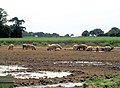 Porcine agriculture north of Rookery Farm - geograph.org.uk - 3560713.jpg 3,590 × 2,646; 1.72 MB
-
 Postbox at the crossroads in Gromford - geograph.org.uk - 4361673.jpg 1,024 × 768; 496 KB
-
 Postbox at the crossroads in Gromford - geograph.org.uk - 4361676.jpg 768 × 1,024; 672 KB
-
 Pottery sculpture, Sailors' Path, Black Heath - geograph.org.uk - 2619600.jpg 4,048 × 3,040; 5.87 MB
-
 Prior Close, Snape - geograph.org.uk - 4448596.jpg 3,072 × 2,304; 1.81 MB
-
 Priory Road junction with A1094 - geograph.org.uk - 3560724.jpg 3,381 × 2,450; 1.22 MB
-
 Priory Road junction with Sailors Path - geograph.org.uk - 3560130.jpg 3,457 × 2,492; 1.51 MB
-
 Priory Road sign - geograph.org.uk - 2334430.jpg 3,072 × 2,304; 1.48 MB
-
 Priory Road, Snape - geograph.org.uk - 1121707.jpg 3,072 × 2,304; 1.49 MB
-
 Priory Road, Snape - geograph.org.uk - 1121712.jpg 3,072 × 2,304; 1.51 MB
-
 Priory Road, Snape - geograph.org.uk - 2334418.jpg 3,072 × 2,304; 1.52 MB
-
 Priory Road, Snape - geograph.org.uk - 2334451.jpg 2,304 × 3,072; 1.63 MB
-
 Priory Road, Snape - geograph.org.uk - 2334462.jpg 3,072 × 2,304; 1.42 MB
-
 Priory Road, Snape - geograph.org.uk - 2334464.jpg 3,072 × 2,304; 1.25 MB
-
 Priory Road, Snape - geograph.org.uk - 2334511.jpg 3,072 × 2,304; 1.7 MB
-
 Priory Road, Snape - geograph.org.uk - 2334515.jpg 2,304 × 3,072; 1.48 MB
-
 Priory Road, Snape - geograph.org.uk - 2334702.jpg 3,072 × 2,304; 1.69 MB
-
 Priory Road, Snape - geograph.org.uk - 2334720.jpg 3,072 × 2,304; 1.68 MB
-
 Priory Road, Snape - geograph.org.uk - 4577366.jpg 1,600 × 1,032; 369 KB
-
 Priory Road, Snape ^ footpath to Church Common - geograph.org.uk - 2334570.jpg 3,072 × 2,304; 1.66 MB
-
 Protective Covering - geograph.org.uk - 4492160.jpg 1,024 × 768; 131 KB
-
 Pryor Close sign - geograph.org.uk - 4448591.jpg 3,072 × 2,304; 1.99 MB
-
 Pryor Close, Snape - geograph.org.uk - 4448583.jpg 3,072 × 2,304; 2.55 MB
-
 Pylon lines at Snape, evening - geograph.org.uk - 5714059.jpg 1,600 × 1,064; 233 KB
-
 Pylon lines west of Snape - geograph.org.uk - 5716431.jpg 1,064 × 1,600; 302 KB
-
 Pylons across farmland - geograph.org.uk - 42483.jpg 480 × 640; 91 KB
-
 Red Barn Lane Restricted Byway to Kiln Lane - geograph.org.uk - 2334394.jpg 3,072 × 2,304; 1.47 MB
-
 Redbarn Lane Restricted Byway to Kiln Lane - geograph.org.uk - 2334387.jpg 3,072 × 2,304; 1.43 MB


_-_geograph.org.uk_-_3576237.jpg)


_Approaching_Crossroads_at_Snape_-_geograph.org.uk_-_3864860.jpg)


_-_geograph.org.uk_-_2341611.jpg)


_-_geograph.org.uk_-_2330343.jpg)
_-_geograph.org.uk_-_2330347.jpg)


_-_geograph.org.uk_-_2341624.jpg)


_(18409258916).jpg)