Category:Smithy Bridge
Jump to navigation
Jump to search
English: Smithy Bridge is a village within the Metropolitan Borough of Rochdale, in Greater Manchester, England. Historically a part of Lancashire it is located between Rochdale and Littleborough.
village in United Kingdom  | |||||
| Upload media | |||||
| Instance of | |||||
|---|---|---|---|---|---|
| Location | Rochdale, Greater Manchester, North West England, England | ||||
 | |||||
Subcategories
This category has the following 2 subcategories, out of 2 total.
M
S
Media in category "Smithy Bridge"
The following 62 files are in this category, out of 62 total.
-
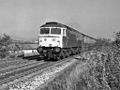
 25062 approaches Smithy Bridge.jpg 1,024 × 768; 242 KB
-
 25288 approaches Smithy Bridge.jpg 1,024 × 768; 322 KB
-
 45116 approaches Smithy Bridge.jpg 1,024 × 768; 362 KB
-
 47357 approaches Smithy Bridge.jpg 1,024 × 768; 379 KB
-
 47559 passes Smithy Bridge signal box.jpg 1,024 × 768; 347 KB
-
 Ampere Flickr 27 August 2023.jpg 2,886 × 3,536; 10.16 MB
-
 Branch Road Farm - geograph.org.uk - 680944.jpg 640 × 480; 105 KB
-
 Branch Road, Smithy Bridge - geograph.org.uk - 578236.jpg 640 × 470; 108 KB
-
 Bridge 49.jpg 2,949 × 2,949; 7.68 MB
-
 Brown Lodge Street Bridge - geograph.org.uk - 399793.jpg 640 × 471; 137 KB
-
 Cat in the long grass - geograph.org.uk - 2326806.jpg 2,048 × 1,536; 1.98 MB
-
 Class 110 E51819 E59817 and E51831 approaches Smithy Bridge.jpg 1,024 × 768; 387 KB
-
 Clegg Hall area - geograph.org.uk - 477793.jpg 640 × 490; 66 KB
-
 Clegg Hall restored - geograph.org.uk - 336925.jpg 640 × 487; 90 KB
-

-
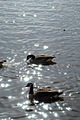
 Feeding time - geograph.org.uk - 365384.jpg 640 × 425; 122 KB
-
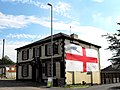 Flag of St George - geograph.org.uk - 1901240.jpg 640 × 480; 96 KB
-
 Grazing off Wildhouse Lane - geograph.org.uk - 3467496.jpg 640 × 480; 59 KB
-

-
 Just visiting - geograph.org.uk - 365401.jpg 489 × 640; 157 KB
-
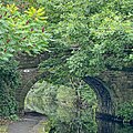
 Little Clegg Swing Bridge - geograph.org.uk - 400382.jpg 640 × 446; 105 KB
-

-
 Lock 39 (Second Below West Summit).jpg 2,584 × 2,067; 4.91 MB
-
 Luke Bank (B6225) - geograph.org.uk - 3467514.jpg 640 × 480; 63 KB
-
 Mill Warehouse, Rochdale Canal - geograph.org.uk - 754300.jpg 640 × 419; 85 KB
-
 Milnrow Road (B6225) - geograph.org.uk - 3467505.jpg 640 × 480; 84 KB
-
 No Cycling - geograph.org.uk - 702627.jpg 640 × 465; 94 KB
-
 Owl Hill - geograph.org.uk - 2070620.jpg 3,872 × 2,475; 3.05 MB
-
 Owl Hill, Smithy Bridge - geograph.org.uk - 400386.jpg 640 × 473; 91 KB
-
 Rochdale Canal Flickr 27 August 2023.jpg 3,024 × 3,780; 10.45 MB
-
 Rochdale Canal Smithybridge Flickr 27 August 2023.jpg 2,945 × 2,945; 7.14 MB
-
 Rochdale Canal, Smithy Bridge - geograph.org.uk - 3976646.jpg 3,928 × 2,546; 3.32 MB
-
 Rochdale Canal, Smithy Bridge - geograph.org.uk - 3976843.jpg 3,800 × 2,454; 1.97 MB
-
 Rooms with a view - geograph.org.uk - 1059385.jpg 640 × 466; 110 KB
-

-
 Smithy Bridge (No 54), Rochdale Canal - geograph.org.uk - 3980522.jpg 1,024 × 768; 139 KB
-
 Smithy Bridge - Brown Lodge Street - geograph.org.uk - 2326766.jpg 2,048 × 1,536; 1.47 MB
-
 Smithy Bridge - geograph.org.uk - 2216635.jpg 800 × 600; 281 KB
-
 Smithy Bridge - geograph.org.uk - 373228.jpg 640 × 480; 109 KB
-
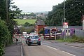
 Smithy Bridge level crossing - geograph.org.uk - 1704131.jpg 1,024 × 768; 230 KB
-
 Smithy Bridge Level Crossing - geograph.org.uk - 373538.jpg 640 × 480; 91 KB
-
 Smithy Bridge library - geograph.org.uk - 2326769.jpg 2,048 × 1,536; 2.09 MB
-
 Smithy Bridge Road - 18th century houses - geograph.org.uk - 2326793.jpg 2,048 × 1,536; 1.44 MB
-
 Smithy Bridge Road - geograph.org.uk - 1704162.jpg 1,024 × 768; 354 KB
-
 Smithy Bridge Road - geograph.org.uk - 2326773.jpg 640 × 480; 64 KB
-
 Smithy Bridge Road - geograph.org.uk - 3467507.jpg 640 × 480; 63 KB
-
 Smithy Bridge Road - geograph.org.uk - 680087.jpg 640 × 426; 228 KB
-
 Sun Gate - geograph.org.uk - 2070613.jpg 3,872 × 2,592; 3.86 MB
-
 Sun Gate, Branch Road - geograph.org.uk - 2618152.jpg 640 × 432; 117 KB
-
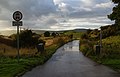 The beginning of Branch Road after a rain shower - geograph.org.uk - 2070277.jpg 3,872 × 2,475; 3.17 MB
-
 The level crossing at Smithy Bridge - geograph.org.uk - 3098243.jpg 3,872 × 2,592; 4.37 MB
-
 The railway tracks at Smithy Bridge - panoramio.jpg 4,000 × 3,000; 4.75 MB
-
 The Roch valley below Wuerdle - geograph.org.uk - 3098132.jpg 3,872 × 2,592; 3.95 MB
-
 Tophams Tavern (14146242719).jpg 2,268 × 2,268; 3.77 MB
-
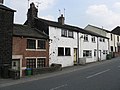
 Tophams Tavern - geograph.org.uk - 1704119.jpg 1,024 × 768; 243 KB
-
 Tranquility - geograph.org.uk - 365269.jpg 425 × 640; 103 KB
-
 Weavers' cottages at Smithybridge - geograph.org.uk - 2427697.jpg 2,592 × 1,944; 1.25 MB
-
 Wildhouse Lane - geograph.org.uk - 1704044.jpg 1,024 × 768; 293 KB
-
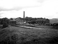
 Akzo Nobel site, Littleborough - geograph.org.uk - 343309.jpg 640 × 473; 114 KB
-

-
 River Beal meets River Roch - geograph.org.uk - 336919.jpg 640 × 480; 149 KB
-
 Rochdale Canal SW of Smithy Bridge - geograph.org.uk - 80904.jpg 640 × 480; 120 KB


,_Rochdale_Canal_-_geograph.org.uk_-_3980542.jpg)
.jpg)
_-_geograph.org.uk_-_3467514.jpg)

_-_geograph.org.uk_-_3467505.jpg)


,_Rochdale_Canal_-_geograph.org.uk_-_3980522.jpg)


.jpg)


