Category:Smeeth
Jump to navigation
Jump to search
English: Smeeth is a village and civil parish, with a population of 846, adjacent to the parish of Brabourne, 5 miles from Ashford in Kent, South East England. It is a small village near Mersham Hatch Park on the A20 road from Ashford to Folkestone.
village in Kent, England, UK  | |||||
| Upload media | |||||
| Instance of | |||||
|---|---|---|---|---|---|
| Location | Ashford, Kent, South East England, England | ||||
| Population |
| ||||
| Area |
| ||||
 | |||||
Subcategories
This category has the following 4 subcategories, out of 4 total.
Media in category "Smeeth"
The following 163 files are in this category, out of 163 total.
-
 A20 Hythe Road, Mersham - geograph.org.uk - 2418165.jpg 4,320 × 3,240; 4.72 MB
-
 A20 Hythe Road, Smeeth - geograph.org.uk - 2418190.jpg 4,320 × 3,240; 4.77 MB
-
 Andrews Garage, off Plain Road - geograph.org.uk - 3737085.jpg 3,696 × 2,448; 2.27 MB
-
 Beggar's Roost - geograph.org.uk - 1981543.jpg 3,072 × 2,304; 1.29 MB
-
 Blue and White cafe, Mersham - geograph.org.uk - 2418151.jpg 4,320 × 3,240; 5.07 MB
-
 Bob Fisher's Car Sales, Stone Hill - geograph.org.uk - 4903482.jpg 2,048 × 1,536; 1.49 MB
-
 Brabourne Baptist Church, Plain Road, Brabourne Lees - geograph.org.uk - 5060309.jpg 3,830 × 2,560; 7.43 MB
-
 Brabourne Lees Baptist Church - geograph.org.uk - 1857777.jpg 1,024 × 683; 194 KB
-
 Church Farm (geograph 1981587).jpg 3,072 × 2,304; 2.12 MB
-
 Coast-bound M20 - geograph.org.uk - 5835519.jpg 1,024 × 684; 213 KB
-
 Coast-bound M20 - geograph.org.uk - 5837146.jpg 1,024 × 684; 211 KB
-
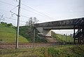
 CTRL railway to Ashford - geograph.org.uk - 2117466.jpg 3,072 × 2,304; 1.98 MB
-
 Deer at Deer Park - geograph.org.uk - 400494.jpg 640 × 480; 120 KB
-
 Deer park kissing gate and gate near Jacob's Plantation - geograph.org.uk - 1850201.jpg 3,072 × 2,304; 2.21 MB
-
 East Stour River near lower Evegate lakes - geograph.org.uk - 3997915.jpg 1,109 × 831; 221 KB
-
 East Stour Valley - geograph.org.uk - 2957987.jpg 640 × 430; 30 KB
-
 Eurostar train heading for the coast - geograph.org.uk - 413920.jpg 640 × 480; 97 KB
-
 Eurostar Train on the Channel Tunnel Rail Link - geograph.org.uk - 1891264.jpg 3,072 × 2,304; 1.25 MB
-
 Evegate Business Centre - geograph.org.uk - 1891204.jpg 3,072 × 2,304; 1.9 MB
-
 Evegate Mill - geograph.org.uk - 1343774.jpg 640 × 480; 76 KB
-
 Evegate Mill in 1984 - geograph.org.uk - 2474390.jpg 812 × 548; 135 KB
-
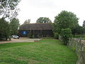
 Evegate Park Barn - geograph.org.uk - 1891216.jpg 3,072 × 2,304; 1.32 MB
-
 Fallow field - geograph.org.uk - 2957967.jpg 640 × 430; 27 KB
-
-
 Farmland by HS1 - geograph.org.uk - 4028695.jpg 640 × 396; 43 KB
-
 Farmland by the railway - geograph.org.uk - 2703887.jpg 640 × 430; 42 KB
-
 Farmland near lower Evegate lakes - geograph.org.uk - 3996292.jpg 1,044 × 783; 222 KB
-
 Farmland south of the railway line - geograph.org.uk - 2957980.jpg 640 × 430; 25 KB
-
 Farmland, East Stour Valley - geograph.org.uk - 5780249.jpg 640 × 426; 32 KB
-
 Felling, Barrack Wood - geograph.org.uk - 6385907.jpg 1,024 × 768; 392 KB
-
 Field near Park Wood - geograph.org.uk - 1857750.jpg 1,024 × 768; 150 KB
-
 Fields near Brabourne Lees - geograph.org.uk - 3737092.jpg 3,496 × 2,328; 4.48 MB
-
 Fields near Mersham - geograph.org.uk - 3500549.jpg 1,600 × 940; 227 KB
-
 Flooding at the Lower Evegate Lakes - geograph.org.uk - 3874999.jpg 1,142 × 856; 189 KB
-
 Flooding near the lower Evegate lakes - geograph.org.uk - 3874995.jpg 1,142 × 856; 188 KB
-
 Footbridge over HS1 - geograph.org.uk - 4028696.jpg 640 × 386; 54 KB
-
 Footbridge over Park Wood Stream - geograph.org.uk - 1891255.jpg 3,072 × 2,304; 2.04 MB
-
 Footbridge over the railway - geograph.org.uk - 1890186.jpg 3,072 × 2,304; 1.53 MB
-
 Footpath in a field towards East Stour River - geograph.org.uk - 1890036.jpg 3,072 × 2,304; 2.17 MB
-
 Footpath in Mersham-le-Hatch Park - geograph.org.uk - 1850181.jpg 3,072 × 2,304; 2.25 MB
-
 Footpath junction near Church Lane - geograph.org.uk - 1891385.jpg 3,072 × 2,304; 2.28 MB
-
 Footpath to Park Wood - geograph.org.uk - 1891269.jpg 3,072 × 2,304; 1.64 MB
-
 Footpath to Smeeth Church - geograph.org.uk - 1981567.jpg 3,072 × 2,304; 1.95 MB
-
 Footpath towards Bower Road - geograph.org.uk - 1890236.jpg 3,072 × 2,304; 2.83 MB
-
 Footpath towards Evegate Mill - geograph.org.uk - 1890167.jpg 3,072 × 2,304; 2.06 MB
-
 Footpath towards Mersham - geograph.org.uk - 1890126.jpg 3,072 × 2,304; 1.91 MB
-
 Footpath towards Park Wood Cottage - geograph.org.uk - 1891246.jpg 3,072 × 2,304; 1.6 MB
-
 Footpath towards Station Road - geograph.org.uk - 1890098.jpg 3,072 × 2,304; 2.06 MB
-
 Granary Court Road - geograph.org.uk - 1857779.jpg 1,024 × 768; 231 KB
-
 Hatch Park by Hythe Road - geograph.org.uk - 4903485.jpg 2,048 × 1,536; 1.45 MB
-
 Hazel Hatch House - geograph.org.uk - 1981650.jpg 1,024 × 768; 199 KB
-
 HGV's queuing south under the power lines - geograph.org.uk - 4585297.jpg 1,024 × 448; 81 KB
-
 High Speed 1 Railway towards Ashford - geograph.org.uk - 3099922.jpg 2,256 × 1,496; 907 KB
-
 Hythe Road west of Smeeth - geograph.org.uk - 4903483.jpg 2,048 × 1,536; 1.53 MB
-
 Hythe Road west of Smeeth - geograph.org.uk - 4903484.jpg 2,048 × 1,536; 1.51 MB
-
 Hythe Road, Smeeth - geograph.org.uk - 4907618.jpg 2,048 × 1,536; 987 KB
-
 Information Board about the Evegate Farm Wetland Trail - geograph.org.uk - 1891211.jpg 3,072 × 2,304; 1.84 MB
-
 Isolated trees in a fallow field - geograph.org.uk - 2957970.jpg 640 × 430; 32 KB
-
 Joe Farm - geograph.org.uk - 1981560.jpg 800 × 600; 101 KB
-
 Ladder stile near Jacob's Plantation - geograph.org.uk - 1850194.jpg 3,072 × 2,304; 3.08 MB
-
 Lake by HS1 - geograph.org.uk - 4028706.jpg 640 × 309; 46 KB
-
 Lake through the trees - geograph.org.uk - 4028707.jpg 640 × 428; 71 KB
-

-
 Lilyvale Road - geograph.org.uk - 5315046.jpg 640 × 480; 203 KB
-
 Little Stock Farm track - geograph.org.uk - 1890226.jpg 3,072 × 2,304; 1.42 MB
-
 M20 Motorway near Smeeth - geograph.org.uk - 3099908.jpg 2,256 × 1,496; 962 KB
-
 M20 Motorway over Church Lane - geograph.org.uk - 1891388.jpg 3,030 × 2,237; 1.26 MB
-
 M20 Motorway to Folkestone - geograph.org.uk - 1890270.jpg 3,072 × 2,304; 1.64 MB
-
 M20 Motorway towards Ashford - geograph.org.uk - 1891188.jpg 3,072 × 2,304; 1.56 MB
-
 M20, coastbound - geograph.org.uk - 4613280.jpg 640 × 412; 41 KB
-
 Mass Dial, St Mary's church, Smeeth - geograph.org.uk - 3100702.jpg 1,496 × 2,256; 777 KB
-
 Mersham-le-Hatch Parkland - geograph.org.uk - 1850185.jpg 3,072 × 2,304; 2.38 MB
-
 Millstream and Evegate mill - geograph.org.uk - 404887.jpg 480 × 640; 317 KB
-
 Mobile Phone mast in Walnut Tree Farm - geograph.org.uk - 1981618.jpg 3,072 × 2,304; 1.29 MB
-
 Monitoring Point on a railway bridge - geograph.org.uk - 1890076.jpg 3,072 × 2,304; 1.46 MB
-
 Old Milestone by the A20, Hyde Road, Smeeth (geograph 5345464).jpg 435 × 640; 102 KB
-
 On and on the stack of lorries goes - geograph.org.uk - 4585300.jpg 1,024 × 451; 98 KB
-
 Permissive Path beside Park Wood - geograph.org.uk - 1891228.jpg 3,072 × 2,304; 2.06 MB
-
 Permissive Path in Park Wood - geograph.org.uk - 1891239.jpg 2,304 × 3,072; 2.91 MB
-
 Ploughed field south of Bower Road - geograph.org.uk - 5315020.jpg 640 × 480; 143 KB
-
 Pylons - geograph.org.uk - 4054991.jpg 640 × 309; 19 KB
-
 Pylons and the M20 - geograph.org.uk - 4613283.jpg 640 × 374; 31 KB
-
 Railway Bridge on Station Road - geograph.org.uk - 5315212.jpg 640 × 428; 101 KB
-
 Railway bridges over a footpath - geograph.org.uk - 1890061.jpg 3,072 × 2,304; 1.66 MB
-
 Railway Line - geograph.org.uk - 1857745.jpg 1,024 × 683; 198 KB
-
 Railways to Ashford - geograph.org.uk - 1890194.jpg 3,072 × 2,304; 2.05 MB
-
 Railways to Folkestone - geograph.org.uk - 1890213.jpg 3,033 × 2,242; 1.34 MB
-
 Road junctions on Plain Road - geograph.org.uk - 1981675.jpg 1,024 × 768; 194 KB
-
 Rough grassland - geograph.org.uk - 5780247.jpg 640 × 426; 55 KB
-
 Sellindge Converter Station - geograph.org.uk - 6706762.jpg 1,024 × 684; 152 KB
-
 Shepway District , Aerial Scenery - geograph.org.uk - 3127364.jpg 2,560 × 1,920; 1.66 MB
-
 Smeeth church - geograph.org.uk - 5315034.jpg 640 × 480; 144 KB
-
 Smeeth County Primary School - geograph.org.uk - 1857770.jpg 1,024 × 683; 196 KB
-
 Smeeth, St. Mary's Church - geograph.org.uk - 6266980.jpg 5,828 × 3,885; 5.95 MB
-
 Smeeth, St. Mary's Church - geograph.org.uk - 6266983.jpg 6,483 × 4,322; 7.33 MB
-

-

-
 Smeeth, St. Mary's Church, East window (Wallace Wood 1966) - geograph.org.uk - 6267107.jpg 4,313 × 6,470; 3.92 MB
-
 Smeeth, St. Mary's Church, Jacobean pulpit (detail) - geograph.org.uk - 6267017.jpg 6,930 × 4,619; 7.65 MB
-
 Smeeth, St. Mary's Church, Jacobean pulpit - geograph.org.uk - 6266994.jpg 3,715 × 5,574; 3.74 MB
-
 Smeeth, St. Mary's Church, Jacobean pulpit tester - geograph.org.uk - 6267020.jpg 7,039 × 4,693; 6.02 MB
-
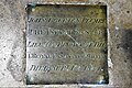 Smeeth, St. Mary's Church, John Egerton Plumbe floor brass - geograph.org.uk - 6267024.jpg 6,115 × 4,077; 7.57 MB
-
-
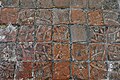
 Smeeth, St. Mary's Church, Medieval tiles in the chancel 2 - geograph.org.uk - 6267010.jpg 5,532 × 3,689; 6.39 MB
-

-

-

-
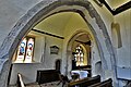
 Smeeth, St. Mary's Church, Norman chancel arch - geograph.org.uk - 6266996.jpg 6,722 × 4,481; 5.44 MB
-
 Smeeth, St. Mary's Church, Norman chancel arch - geograph.org.uk - 6267002.jpg 6,862 × 4,575; 5.33 MB
-
 Smeeth, St. Mary's Church, Norman chancel arch - geograph.org.uk - 6267109.jpg 6,571 × 4,380; 6.42 MB
-
 Smeeth, St. Mary's Church, Norman chancel arch - geograph.org.uk - 6267110.jpg 6,021 × 4,014; 4.83 MB
-
 Smeeth, St. Mary's Church, Stained glass window - geograph.org.uk - 6267079.jpg 4,681 × 7,022; 6.22 MB
-

-

-

-

-

-

-

-
-
 Smeeth, St. Mary's Church, The font - geograph.org.uk - 6267098.jpg 3,598 × 5,397; 3.97 MB
-
 Smeeth, St. Mary's Church, The nave - geograph.org.uk - 6266988.jpg 8,247 × 5,497; 7.62 MB
-
 Smeeth, St. Mary's Church, The nave from the chancel - geograph.org.uk - 6267026.jpg 6,232 × 4,155; 4.33 MB
-
 Smeeth, St. Mary's Church, The nave roof (detail) - geograph.org.uk - 6267111.jpg 7,809 × 5,205; 6.38 MB
-
 Smeeth, St. Mary's Church, The nave roof - geograph.org.uk - 6266992.jpg 7,765 × 5,176; 6.28 MB
-

-
 Smeeth, St. Mary's Church, The Reverend David Ball memorial - geograph.org.uk - 6267062.jpg 6,664 × 4,443; 5.84 MB
-

-

-

-

-

-
 Smeeth, St. Mary's Church, Western entrance - geograph.org.uk - 6266985.jpg 5,136 × 3,423; 5.52 MB
-
 Smeeth, St. Mary's Churchyard from the south porch - geograph.org.uk - 6267114.jpg 6,782 × 4,521; 6.68 MB
-
 St Mary the Virgin, Smeeth - geograph.org.uk - 5059660.jpg 3,546 × 2,118; 7.3 MB
-
 St. Mary's Oak Room - geograph.org.uk - 1981602.jpg 3,072 × 2,304; 1.27 MB
-
 Station Road Bridge - geograph.org.uk - 4028698.jpg 640 × 430; 59 KB
-
 Station Road Bridge over the CTRL railway - geograph.org.uk - 2117446.jpg 3,072 × 2,304; 2.14 MB
-
 Station Road bridge over the M20 Motorway - geograph.org.uk - 1890252.jpg 3,072 × 2,304; 1.85 MB
-
 Station Road Bridge, M20 - geograph.org.uk - 4613277.jpg 640 × 347; 36 KB
-
 Stock lane Bridge, M20 - geograph.org.uk - 4613276.jpg 640 × 440; 40 KB
-
 Stock Lane, Smeeth - geograph.org.uk - 2418163.jpg 4,320 × 3,240; 4.88 MB
-
 The lower Evegate lakes - geograph.org.uk - 3997932.jpg 1,044 × 783; 241 KB
-
 The M20 Motorway - geograph.org.uk - 3602239.jpg 4,590 × 2,619; 2.13 MB
-
 The Ridgeway, Smeeth - geograph.org.uk - 2418137.jpg 4,320 × 3,240; 4.85 MB
-
 The Ridgeway, Smeeth - geograph.org.uk - 5062084.jpg 3,772 × 2,508; 7.24 MB
-
 The Ridgeway, Smeeth - geograph.org.uk - 6385900.jpg 1,024 × 684; 231 KB
-
 View from Scott's Hall Plantation - geograph.org.uk - 1981643.jpg 3,072 × 1,728; 1,001 KB
-
 View of the North Downs - geograph.org.uk - 2076185.jpg 3,072 × 1,728; 1.41 MB
-
 View of Warren Hill and Brabourne Lees - geograph.org.uk - 2076177.jpg 3,072 × 1,728; 1.2 MB
-
 Vine Cottage, The Ridgeway, Smeeth - geograph.org.uk - 5059617.jpg 3,610 × 2,400; 6.33 MB
-
 Wembdon Farm - geograph.org.uk - 1890244.jpg 3,072 × 2,304; 1.31 MB
-
 Woodland by HS1 - geograph.org.uk - 4028703.jpg 640 × 430; 54 KB
-
 Apple Barn - geograph.org.uk - 1435923.jpg 640 × 480; 82 KB
-
 Bircholt Wood - geograph.org.uk - 402176.jpg 640 × 480; 67 KB
-

-
 Cottages - geograph.org.uk - 402260.jpg 640 × 480; 81 KB
-
 Fine pines - geograph.org.uk - 413730.jpg 640 × 480; 134 KB
-
 Furniture of Modernity - geograph.org.uk - 415418.jpg 480 × 640; 74 KB
-
 Garage - geograph.org.uk - 445201.jpg 640 × 480; 201 KB
-
 Narrow wooded lane. - geograph.org.uk - 445182.jpg 480 × 640; 320 KB
-
 Once someone's pride and joy - geograph.org.uk - 478897.jpg 640 × 480; 104 KB
-
 Paddock - geograph.org.uk - 445206.jpg 640 × 480; 189 KB


.jpg)


.jpg)


_-_geograph.org.uk_-_6267107.jpg)
_-_geograph.org.uk_-_6267017.jpg)


_-_geograph.org.uk_-_6267081.jpg)


_-_geograph.org.uk_-_6267111.jpg)


_1_-_geograph.org.uk_-_6267082.jpg)
_2_-_geograph.org.uk_-_6267087.jpg)
_3_-_geograph.org.uk_-_6267088.jpg)
_4_-_geograph.org.uk_-_6267094.jpg)


