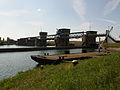
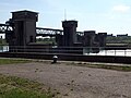
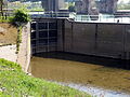
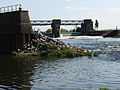
Category:Sluis- en Stuwcomplex Borgharen
Jump to navigation
Jump to search
| Object location | | View all coordinates using: OpenStreetMap |
|---|
weir near Maastricht, Netherlands  | |||||
| Upload media | |||||
| Instance of | |||||
|---|---|---|---|---|---|
| Named after | |||||
| Location |
| ||||
| Located in or next to body of water | |||||
| Street address |
| ||||
| Located on street |
| ||||
| Heritage designation |
| ||||
 | |||||
|
This is a category about rijksmonument number 506744
|
| Address |
|
Subcategories
This category has only the following subcategory.
Media in category "Sluis- en Stuwcomplex Borgharen"
The following 37 files are in this category, out of 37 total.
-
 20130505 Maastricht Ship at Sluis- en Stuwcomplex Borgharen 07.JPG 3,968 × 2,976; 2.43 MB
-
 20130505 Maastricht Sluis- en Stuwcomplex Borgharen 01.JPG 3,968 × 2,976; 2.72 MB
-
 20130505 Maastricht Sluis- en Stuwcomplex Borgharen 02.JPG 3,968 × 2,976; 2.72 MB
-
 20130505 Maastricht Sluis- en Stuwcomplex Borgharen 03.JPG 3,968 × 2,976; 2.83 MB
-
 20130505 Maastricht Sluis- en Stuwcomplex Borgharen 04.JPG 3,220 × 2,419; 1.66 MB
-
 20130505 Maastricht Sluis- en Stuwcomplex Borgharen 05.JPG 3,968 × 2,976; 2.65 MB
-
 20130505 Maastricht Sluis- en Stuwcomplex Borgharen 06.JPG 3,968 × 2,976; 2.71 MB
-
 20130505 Maastricht Sluis- en Stuwcomplex Borgharen 08.JPG 3,968 × 2,976; 2.69 MB
-
 20130505 Maastricht Sluis- en Stuwcomplex Borgharen 09.JPG 3,968 × 2,976; 2.53 MB
-
 20130505 Maastricht Sluis- en Stuwcomplex Borgharen 11.JPG 3,968 × 2,976; 2.25 MB
-
 20130505 Maastricht Sluis- en Stuwcomplex Borgharen 13.JPG 3,968 × 2,976; 2.35 MB
-
 20130505 Maastricht Sluis- en Stuwcomplex Borgharen 14.JPG 3,968 × 2,976; 2.18 MB
-
 20130505 Maastricht Sluis- en Stuwcomplex Borgharen 15.JPG 3,968 × 2,976; 2.47 MB
-
 20130505 Maastricht Sluis- en Stuwcomplex Borgharen 16.JPG 3,968 × 2,976; 2.01 MB
-
 20130505 Maastricht Sluis- en Stuwcomplex Borgharen 18.JPG 3,968 × 2,976; 2.81 MB
-
 20130505 Maastricht Sluis- en Stuwcomplex Borgharen 19.JPG 3,968 × 2,976; 2.51 MB
-
 20130505 Maastricht Sluis- en Stuwcomplex Borgharen 20.JPG 3,968 × 2,976; 2.13 MB
-
 20130505 Maastricht Sluis- en Stuwcomplex Borgharen 21.JPG 3,968 × 2,976; 2.47 MB
-
 20130505 Maastricht Sluis- en Stuwcomplex Borgharen 22.JPG 3,968 × 2,976; 2.82 MB
-
 20130505 Maastricht Sluis- en Stuwcomplex Borgharen 24.JPG 3,968 × 2,976; 2.24 MB
-
 20130505 Maastricht Sluis- en Stuwcomplex Borgharen 25.JPG 3,968 × 2,976; 2.2 MB
-
 20130505 Maastricht Sluis- en Stuwcomplex Borgharen 26.JPG 3,968 × 2,976; 2.89 MB
-
 20130505 Maastricht Sluis- en Stuwcomplex Borgharen 27.JPG 3,968 × 2,976; 2.86 MB
-
 20130505 Maastricht Sluis- en Stuwcomplex Borgharen 28.JPG 2,262 × 1,415; 753 KB
-
 20130505 Maastricht Sluis- en Stuwcomplex Borgharen 29.JPG 2,976 × 3,968; 2.59 MB
-
 20140525 Maastricht, Meuse 02.JPG 3,968 × 2,976; 2.37 MB
-
 20140525 Maastricht, Meuse 03.JPG 3,968 × 2,976; 2.2 MB
-
 20140525 Maastricht, Meuse 07.JPG 3,968 × 2,976; 2.69 MB
-
 20140525 Maastricht, Meuse 08.JPG 3,845 × 2,260; 2.15 MB
-

-
 Maastricht - rijksmonument 506744 - schuifstuw Borgharen 20100906.jpg 800 × 486; 154 KB
-
 Maastricht - stuw Borgharen 20180908 brug, schuif en torens.jpg 1,915 × 3,000; 1.57 MB
-
 Maastricht - stuw Borgharen 20180908 schuif.jpg 3,000 × 1,993; 1.58 MB
-
 Maastricht - stuw Borgharen 20180908 sluis.jpg 3,000 × 2,025; 1.77 MB
-
 Maastricht - stuw Borgharen 20180908 vistrap.jpg 3,000 × 1,873; 1.2 MB
-
 Maastricht 2012 Afvoerkanaal 4 stuwencomplex Borgharen op achtergrond.JPG 3,264 × 2,448; 1.12 MB
-
 Overzicht stuw- en sluiscomplex in de Maas - Borgharen - 20355650 - RCE.jpg 1,192 × 1,200; 277 KB


