Category:Sleddale (Hawes), North Yorkshire
Jump to navigation
Jump to search
Media in category "Sleddale (Hawes), North Yorkshire"
The following 36 files are in this category, out of 36 total.
-
 Above Sleddale - geograph.org.uk - 1753293.jpg 640 × 480; 72 KB
-
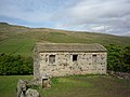
 Barn in Sleddale - geograph.org.uk - 1207335.jpg 640 × 426; 106 KB
-
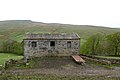
 Barn in Sleddale - geograph.org.uk - 1343480.jpg 640 × 480; 144 KB
-
 Barn in Sleddale - geograph.org.uk - 3471515.jpg 640 × 427; 105 KB
-
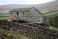
 Barn in Sleddale - geograph.org.uk - 814049.jpg 640 × 478; 296 KB
-
 Beggarmans Road, looking down Sleddale - geograph.org.uk - 3884669.jpg 1,024 × 768; 141 KB
-
 Beggarmans Road, looking up Sleddale - geograph.org.uk - 3884665.jpg 1,024 × 768; 149 KB
-
 Dodd Fell - geograph.org.uk - 814045.jpg 640 × 478; 247 KB
-
 Dodd Fell and Duerley Bottom - geograph.org.uk - 814162.jpg 640 × 478; 229 KB
-
 Footpath on east edge of Sleddale (7321).jpg 4,288 × 2,848; 6.29 MB
-
 Footpath on east edge of Sleddale (7322).jpg 4,288 × 2,848; 6.38 MB
-
 Great Shunner Fell from Sleddale (7320).jpg 4,288 × 2,848; 4.81 MB
-
 Looking down Sleddale from near Fleet Moss - geograph.org.uk - 2016204.jpg 3,648 × 2,528; 2.6 MB
-
 Mine tips - geograph.org.uk - 1207412.jpg 640 × 426; 59 KB
-
 Road in Sleddale (7310).jpg 4,288 × 2,848; 6.29 MB
-

-
 Sheep in Sleddale - geograph.org.uk - 1343420.jpg 640 × 478; 131 KB
-
 Sleddale (7308).jpg 4,288 × 2,848; 6.5 MB
-
 Sleddale (7309).jpg 4,288 × 2,848; 6.3 MB
-
 Sleddale (7316).jpg 4,288 × 2,848; 6.34 MB
-
 Sleddale (7318).jpg 4,288 × 2,848; 6.28 MB
-
 Sleddale (7319).jpg 4,288 × 2,848; 6.63 MB
-
 Sleddale (7323).jpg 4,288 × 2,848; 5.1 MB
-
 Sleddale - geograph.org.uk - 1343408.jpg 640 × 478; 156 KB
-
 Sleddale - geograph.org.uk - 1343470.jpg 640 × 480; 119 KB
-
 Sleddale - geograph.org.uk - 3471526.jpg 640 × 427; 90 KB
-
 Sleddale - geograph.org.uk - 814167.jpg 640 × 478; 244 KB
-
 Sleddale from Rottenstone Hill (7173).jpg 4,288 × 2,848; 6.05 MB
-
 Sleddale from Rottenstone Hill (7177).jpg 4,288 × 2,848; 6.03 MB
-
 Sleddale from the Hawes to Buckden Road - geograph.org.uk - 2016202.jpg 3,648 × 2,736; 3.31 MB
-
 Sleddale, just upstream of West Close Barn - geograph.org.uk - 3883188.jpg 1,024 × 768; 145 KB
-
 The road up Sleddale - geograph.org.uk - 1999779.jpg 4,592 × 3,056; 4.98 MB
-
 Towards Dodd Fell - geograph.org.uk - 1343405.jpg 640 × 478; 140 KB
-
 Towards Duerley Farm - geograph.org.uk - 1343424.jpg 640 × 478; 142 KB
-
 Beggermans Road. - geograph.org.uk - 92888.jpg 640 × 480; 57 KB
-
 Duerley Bottom. - geograph.org.uk - 93258.jpg 640 × 480; 74 KB


.jpg)
.jpg)
.jpg)


.jpg)


.jpg)
.jpg)
.jpg)
.jpg)
.jpg)
.jpg)


.jpg)
.jpg)


