Category:Slavíč mountain hut
Jump to navigation
Jump to search
| Object location | | View all coordinates using: OpenStreetMap |
|---|
.JPG) Kolářova chata Slavíč | |||||
| Upload media | |||||
| Instance of | |||||
|---|---|---|---|---|---|
| Location |
| ||||
| Dissolved, abolished or demolished date |
| ||||
| Mountain range | |||||
 | |||||
Media in category "Slavíč mountain hut"
The following 5 files are in this category, out of 5 total.
-
 Beskydy, chata slavíč.JPG 2,816 × 2,112; 1.42 MB
-
 Beskydy, Slavic.jpg 5,880 × 4,000; 15.43 MB
-
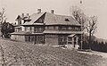 Kolarova chata 1930s.jpg 769 × 474; 129 KB
-
 Moravskoslezské Beskydy, Slavíč (1).JPG 4,000 × 3,000; 5.4 MB
-
 Moravskoslezské Beskydy, Slavíč (2).JPG 3,054 × 2,130; 3.22 MB


.JPG)