Category:Slagveld 54, Brielle
Jump to navigation
Jump to search
| Object location | | View all coordinates using: OpenStreetMap |
|---|
 | |||||
| Upload media | |||||
| Instance of |
| ||||
|---|---|---|---|---|---|
| Location | Brielle, Voorne aan Zee, South Holland, Netherlands | ||||
| Street address |
| ||||
| Located on street | |||||
| Heritage designation |
| ||||
 | |||||
|
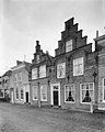
This is a category about rijksmonument number 10861
|
| Address |
|
Media in category "Slagveld 54, Brielle"
The following 10 files are in this category, out of 10 total.
-
 Brielle - rijksmonument 10861 - Slagveld 54 20111112.jpg 707 × 800; 240 KB
-
 Brielle, Netherlands - panoramio (24).jpg 4,896 × 3,264; 4.93 MB
-
 Exterieur OVERZICHT VANAF MAARLAND - Brielle - 20315317 - RCE.jpg 1,200 × 1,200; 290 KB
-
 Exterieur OVERZICHT VANAF MAARLAND - Brielle - 20315318 - RCE.jpg 1,193 × 1,200; 282 KB
-
 Exterieur OVERZICHT ZEVENHUIZEN - Brielle - 20316328 - RCE.jpg 1,200 × 960; 227 KB
-
 Exterieur VOORGEVELS - Brielle - 20316330 - RCE.jpg 1,200 × 960; 245 KB
-
 Overzicht (Zevenhuizen) - Brielle - 20043275 - RCE.jpg 1,200 × 804; 183 KB
-
 Overzicht voorgevels - Brielle - 20043274 - RCE.jpg 1,200 × 952; 210 KB
-
 Voorgevels - Brielle - 20043272 - RCE.jpg 964 × 1,200; 230 KB
-
 Voorgevels - Brielle - 20043273 - RCE.jpg 953 × 1,200; 267 KB
.jpg)


_-_Brielle_-_20043275_-_RCE.jpg)


