Category:Skutterskelfe
Jump to navigation
Jump to search
English: Skutterskelfe is a civil parish in the Hambleton district, in the county of North Yorkshire, England.
hamlet and civil parish in Hambleton, North Yorkshire, England | |||||
| Upload media | |||||
| Instance of | |||||
|---|---|---|---|---|---|
| Location | Hambleton, North Yorkshire, Yorkshire and the Humber, England | ||||
| Population |
| ||||
| Area |
| ||||
 | |||||
Media in category "Skutterskelfe"
The following 13 files are in this category, out of 13 total.
-
 Bus Stop, near Rudby Hall - geograph.org.uk - 37375.jpg 360 × 480; 37 KB
-
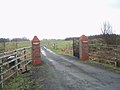 Entrance to South Lund Farm - geograph.org.uk - 1706323.jpg 3,072 × 2,304; 1.22 MB
-
 Farm Buildings, Thoraldby Farm - geograph.org.uk - 39092.jpg 640 × 480; 126 KB
-
 Farmland at Broadmire - geograph.org.uk - 5987622.jpg 2,560 × 1,920; 2.38 MB
-
 Holme Lane, heading west - geograph.org.uk - 5987620.jpg 2,015 × 1,511; 911 KB
-
 Hutton Rudby Ford - geograph.org.uk - 5508700.jpg 3,000 × 2,000; 6.25 MB
-
 Road heading east towards Stokesley - geograph.org.uk - 5987639.jpg 2,560 × 1,920; 2.35 MB
-
 Skutterskelfe - Please drive carefully - geograph.org.uk - 5987642.jpg 1,992 × 1,494; 533 KB
-
 Skutterskelfe UK parish locator map.svg 1,425 × 1,037; 4.3 MB
-
 Tree in a hedgerow, south of Holme Lane - geograph.org.uk - 5987626.jpg 1,689 × 1,266; 512 KB
-
 Tree on the parish boundary in Tame Bridge - geograph.org.uk - 5989009.jpg 2,038 × 1,529; 592 KB
-
 Trees along a field boundary, south of Oak Hill - geograph.org.uk - 5987644.jpg 2,560 × 1,920; 2.43 MB
-
 Brown Field Site, Folly Hill - geograph.org.uk - 101893.jpg 640 × 480; 60 KB


