Category:Skellingthorpe
Jump to navigation
Jump to search
English: Skellingthorpe is a large village in the North Kesteven district of Lincolnshire, located 4 miles / 6.5 km southwest of Lincoln city centre.
human settlement in United Kingdom  | |||||
| Upload media | |||||
| Instance of | |||||
|---|---|---|---|---|---|
| Location | North Kesteven, Lincolnshire, East Midlands, England | ||||
| Population |
| ||||
 | |||||
Subcategories
This category has the following 12 subcategories, out of 12 total.
A
D
H
J
- Jerusalem, Lincolnshire (2 F)
O
- Old Wood, Skellingthorpe (8 F)
P
S
- Streets in Skellingthorpe (6 F)
W
Media in category "Skellingthorpe"
The following 200 files are in this category, out of 250 total.
(previous page) (next page)-
 'The Monson' playing fields, Skellingthorpe - geograph.org.uk - 2392178.jpg 4,000 × 3,000; 2.52 MB
-
 A family of swans on Main Drain - geograph.org.uk - 5117505.jpg 3,776 × 2,520; 4.01 MB
-
 A view of Jerusalem - geograph.org.uk - 6060631.jpg 5,067 × 3,801; 4.92 MB
-
 A wet autumn day in cattle country - geograph.org.uk - 3202414.jpg 640 × 427; 52 KB
-
 A46 ahead - geograph.org.uk - 4728538.jpg 1,024 × 768; 210 KB
-
 A46 bridge over Fossdyke Navigation - geograph.org.uk - 5996668.jpg 1,600 × 1,200; 1,022 KB
-
 A46 bridge over the Fossdyke - geograph.org.uk - 2829992.jpg 640 × 480; 60 KB
-
-

-

-
 Approaching Skellingthorpe - geograph.org.uk - 1174845.jpg 640 × 480; 91 KB
-
 Barley field - geograph.org.uk - 3496257.jpg 640 × 427; 113 KB
-
 Bike hire site Skellingthorpe - geograph.org.uk - 4728766.jpg 1,024 × 768; 252 KB
-
 Birch woodland near the Fossdyke - geograph.org.uk - 2829982.jpg 640 × 480; 170 KB
-
 Bird's nests, Skellingthorpe.jpg 2,560 × 1,920; 1.54 MB
-
 Brick Kiln Lake, Skellingthorpe.jpg 3,264 × 2,448; 2.52 MB
-
 Bridge over disused railway, Skellingthorpe - geograph.org.uk - 2429708.jpg 2,256 × 1,496; 855 KB
-
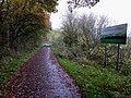
 Bridleway to Lincoln - geograph.org.uk - 4728548.jpg 1,024 × 768; 191 KB
-
 Bridleway to Old Wood - geograph.org.uk - 3294080.jpg 1,024 × 768; 219 KB
-
 By Foss Dyke heading to the Pyewipe Inn - geograph.org.uk - 4697724.jpg 5,184 × 3,888; 6.49 MB
-

-
 Catchwater Drain - geograph.org.uk - 3293994.jpg 1,024 × 768; 200 KB
-
 Catchwater Drain - geograph.org.uk - 6127996.jpg 1,024 × 768; 223 KB
-
 Catchwater Drain - geograph.org.uk - 6128004.jpg 1,024 × 768; 321 KB
-

-
 Corner Oak - geograph.org.uk - 3008086.jpg 640 × 480; 108 KB
-
 Cottages on High Street, Skellingthorpe - geograph.org.uk - 3294007.jpg 1,024 × 768; 156 KB
-
 County Boundary waymark - geograph.org.uk - 387031.jpg 640 × 427; 90 KB
-
 Cruising towards Lincoln on the Fossdyke - geograph.org.uk - 5330050.jpg 5,376 × 3,024; 2.59 MB
-
 Cycle path on disused railway - geograph.org.uk - 3653396.jpg 640 × 480; 104 KB
-
 Cycle Route 64 - geograph.org.uk - 2392114.jpg 4,000 × 3,000; 2.9 MB
-
 Cycle Route 64 crossing Fossdyke - geograph.org.uk - 2392200.jpg 4,000 × 3,000; 2.94 MB
-
 Decaying trailer - geograph.org.uk - 3306499.jpg 1,024 × 768; 195 KB
-

-

-

-
 Ditch leading off Saxilby Road - geograph.org.uk - 5930617.jpg 4,000 × 3,000; 4.61 MB
-
 Dovecote Park - geograph.org.uk - 3294036.jpg 1,024 × 768; 157 KB
-
 Dovecote Park, dedicated to Waitrose - geograph.org.uk - 3201984.jpg 640 × 427; 43 KB
-
 Down the ramp - geograph.org.uk - 1174602.jpg 640 × 480; 75 KB
-
 Drain running parallel to Main Drain - geograph.org.uk - 3306922.jpg 1,024 × 768; 141 KB
-
 Entrance to Monson Farm - geograph.org.uk - 2429702.jpg 2,256 × 1,496; 861 KB
-
 Farm bridge from Old Wood Nursery - geograph.org.uk - 6060622.jpg 4,679 × 3,409; 5.33 MB
-
 Farmland between Fossdyke and a catchwater drain - geograph.org.uk - 3693724.jpg 1,024 × 768; 120 KB
-
 Farmland off Saxilby Road - geograph.org.uk - 2429717.jpg 2,256 × 1,496; 811 KB
-
 Farmland off Saxilby Road - geograph.org.uk - 3653387.jpg 640 × 480; 63 KB
-
 Farmland off Saxilby Road - geograph.org.uk - 3653389.jpg 640 × 480; 79 KB
-
 Farmland, Jerusalem - geograph.org.uk - 3653398.jpg 640 × 480; 79 KB
-
 Farmland, Skellingthorpe - geograph.org.uk - 3653376.jpg 640 × 480; 84 KB
-
 Ferry Farm - geograph.org.uk - 3789177.jpg 800 × 533; 177 KB
-
 Ferry Lane in Skellingthorpe.jpg 3,264 × 1,836; 3.12 MB
-
 Ferry Lane, Skellingthorpe.jpg 3,264 × 1,836; 2.36 MB
-
 Field entrance off Lincoln Road - geograph.org.uk - 3653364.jpg 640 × 480; 63 KB
-
 Fields North of Cycle Route 64, near Lincoln - geograph.org.uk - 6634661.jpg 1,600 × 1,067; 312 KB
-
 Fields off Saxilby Road, Skellingthorpe, Lincs - geograph.org.uk - 2429722.jpg 1,545 × 979; 852 KB
-
 Flat Lincolnshire farmland - geograph.org.uk - 4728536.jpg 1,024 × 768; 211 KB
-
 Footbridge on the path from Doddington - geograph.org.uk - 3306539.jpg 1,024 × 768; 338 KB
-
 Footpath and railway line beside Fossdyke Navigation - geograph.org.uk - 5996647.jpg 1,600 × 1,200; 857 KB
-
 Footpath crossing Cycle Route 64 - geograph.org.uk - 5117492.jpg 3,776 × 2,520; 4.11 MB
-
 Footpath crossing NCN64 at Skellingthorpe - geograph.org.uk - 4728523.jpg 1,024 × 768; 297 KB
-
 Former village Hall, Skellingthorpe - geograph.org.uk - 3202875.jpg 640 × 427; 50 KB
-
 Fossdyke and its towpath north of Burton Waters - geograph.org.uk - 5989512.jpg 1,600 × 1,200; 817 KB
-
 Fossdyke by Burton Waters - geograph.org.uk - 5330031.jpg 5,376 × 3,024; 2.29 MB
-
 Fossdyke Navigation near Burton Waters - geograph.org.uk - 5996651.jpg 1,600 × 1,200; 957 KB
-
 Fossdyke, looking north-west - geograph.org.uk - 3693727.jpg 1,024 × 768; 102 KB
-
 Garden of Corner Oak - geograph.org.uk - 3008085.jpg 640 × 480; 129 KB
-
 Gas pipeline marker post north of Old Wood - geograph.org.uk - 6060554.jpg 5,184 × 3,888; 5.05 MB
-
 Geese beside the Fossdyke Navigation - geograph.org.uk - 5329090.jpg 800 × 600; 116 KB
-
 Graffiti sprayed on wall following demonstration in Skellingthorpe.jpg 3,264 × 2,448; 2.53 MB
-
 Grazing sheep, Manor Farm, Skellingthorpe - geograph.org.uk - 3294024.jpg 1,024 × 768; 134 KB
-
 Hedge alongside Saxilby Road - geograph.org.uk - 5930635.jpg 4,000 × 3,000; 5.02 MB
-
 Henry Stone's grave - geograph.org.uk - 3202475.jpg 640 × 427; 113 KB
-
 Henry Stone's grave - geograph.org.uk - 3202480.jpg 640 × 427; 110 KB
-

-
 Horses in view - geograph.org.uk - 4728514.jpg 1,024 × 768; 229 KB
-
 Jerusalem - geograph.org.uk - 3653399.jpg 640 × 480; 80 KB
-
 Jerusalem Farm (2) - geograph.org.uk - 3306913.jpg 1,024 × 768; 110 KB
-
 Jerusalem Farm - geograph.org.uk - 3306566.jpg 1,024 × 768; 130 KB
-
 Jerusalem Farm outbuildings, Skellingthorpe.jpg 3,264 × 2,448; 2.82 MB
-
 Jerusalem on the horizon - geograph.org.uk - 3306491.jpg 1,024 × 768; 219 KB
-
 Jerusalem Road - geograph.org.uk - 3653397.jpg 640 × 480; 63 KB
-
 Jerusalem Road - geograph.org.uk - 5930590.jpg 4,000 × 3,000; 4.88 MB
-
 Junction of paths, Old Wood - geograph.org.uk - 6140825.jpg 1,024 × 768; 364 KB
-
 Lane to Skellingthorpe, near Wood Bank farm - geograph.org.uk - 2429712.jpg 2,256 × 1,496; 916 KB
-
 Lincoln bound beside Fossdyke - geograph.org.uk - 5330005.jpg 5,376 × 3,024; 2.63 MB
-
 Lincoln Holiday Retreat, Swanpool - geograph.org.uk - 6638975.jpg 1,600 × 1,067; 472 KB
-
 Lincoln Road - geograph.org.uk - 3653369.jpg 640 × 480; 48 KB
-
 Lincoln Road - geograph.org.uk - 3653378.jpg 640 × 480; 90 KB
-
 Lincoln Road Skellingthorpe - geograph.org.uk - 3200822.jpg 640 × 427; 57 KB
-
 Line of poplars alongside a farm track - geograph.org.uk - 3293975.jpg 1,024 × 768; 291 KB
-
 Look both ways - geograph.org.uk - 4728527.jpg 1,024 × 768; 259 KB
-
 Lound Farm, Saxilby Road - geograph.org.uk - 2429726.jpg 2,091 × 1,222; 1.18 MB
-
 Lower Church Road, Skellingthorpe - geograph.org.uk - 3653383.jpg 640 × 480; 74 KB
-
 Main Drain - geograph.org.uk - 3294030.jpg 1,024 × 768; 111 KB
-
 Main Drain - geograph.org.uk - 3496252.jpg 640 × 427; 108 KB
-
 Main drain - geograph.org.uk - 3496254.jpg 640 × 427; 117 KB
-
 Main Drain - geograph.org.uk - 5361512.jpg 1,024 × 683; 165 KB
-
 Main Drain - geograph.org.uk - 6026420.jpg 1,024 × 768; 234 KB
-
 Main Drain bank - geograph.org.uk - 2790859.jpg 640 × 427; 108 KB
-
 Main Drain dredger - geograph.org.uk - 2790856.jpg 640 × 427; 100 KB
-
 Main Drain dredger - geograph.org.uk - 2790860.jpg 640 × 427; 100 KB
-
 Main drain from Ferry Lane - geograph.org.uk - 3032034.jpg 1,504 × 2,256; 898 KB
-
 Main Drain, Swanpool, Lincoln - geograph.org.uk - 6638971.jpg 1,600 × 1,067; 468 KB
-
 Main Drain, Swanpool, Lincoln - geograph.org.uk - 6638973.jpg 1,600 × 1,067; 382 KB
-
 Marked blue trail in Old Wood (Woodland Trust) - geograph.org.uk - 4728765.jpg 1,024 × 768; 343 KB
-
 Methodist Church, Skellingthorpe - geograph.org.uk - 6060626.jpg 4,889 × 3,572; 3.45 MB
-
 Monkey Puzzle Tree at Daisy Made Farm - geograph.org.uk - 3404085.jpg 1,396 × 2,120; 1.84 MB
-
 Motor cruiser on the Fossdyke Navigation - geograph.org.uk - 5329086.jpg 800 × 600; 161 KB
-
 Mr Moles Scrapyard, Skellingthorpe - geograph.org.uk - 2429710.jpg 2,256 × 1,496; 818 KB
-
 My brief sweet life is over ....... - geograph.org.uk - 6269813.jpg 4,428 × 2,952; 2.5 MB
-
 National Cycle Network passing under Jerusalem Road - geograph.org.uk - 5930585.jpg 4,000 × 3,000; 4.71 MB
-
 National Cycle Network Route 64 - geograph.org.uk - 1174817.jpg 480 × 640; 94 KB
-
 New arch - old wood - geograph.org.uk - 4868856.jpg 1,024 × 683; 398 KB
-
 Next stop Lincoln - geograph.org.uk - 4728529.jpg 1,024 × 768; 239 KB
-
 No crossing this former railway bridge - geograph.org.uk - 4728517.jpg 1,024 × 768; 274 KB
-
 Northern trains passenger train - geograph.org.uk - 1988470.jpg 640 × 426; 97 KB
-
 Old crane in Skellingthorpe Old Wood - geograph.org.uk - 191406.jpg 640 × 427; 130 KB
-
 Old oak - geograph.org.uk - 4269248.jpg 1,024 × 692; 261 KB
-
 Old Pits Close, Skellingthorpe - geograph.org.uk - 6060628.jpg 4,946 × 3,587; 3.23 MB
-
 Old Wood bridleway junction - geograph.org.uk - 4728774.jpg 1,024 × 768; 273 KB
-
 Old Wood byway - geograph.org.uk - 2103025.jpg 640 × 480; 129 KB
-
 Old Wood South - geograph.org.uk - 6140806.jpg 1,024 × 768; 234 KB
-
 One at a time if you please - geograph.org.uk - 1174582.jpg 640 × 480; 64 KB
-
 Only just in the square - geograph.org.uk - 4728531.jpg 1,024 × 768; 294 KB
-
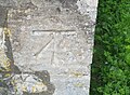 Ordnance Survey Cut Mark - geograph.org.uk - 5483961.jpg 640 × 467; 120 KB
-
 Painting the view - geograph.org.uk - 4728512.jpg 1,024 × 768; 278 KB
-
 Path along the north bank, Fossdyke - geograph.org.uk - 3693716.jpg 1,024 × 768; 143 KB
-
 Path by Waterloo Farm - geograph.org.uk - 281879.jpg 640 × 427; 106 KB
-
 Path in Cross Holts Woods - geograph.org.uk - 2401543.jpg 1,600 × 1,200; 900 KB
-
 Path in Old Wood - geograph.org.uk - 6140811.jpg 1,024 × 768; 414 KB
-
 Path to Jerusalem - geograph.org.uk - 3294100.jpg 1,024 × 768; 155 KB
-
 Pipe bridge at the end of Ferry Lane - geograph.org.uk - 3294043.jpg 1,024 × 768; 178 KB
-
 Pipe on the south bank of Fossdyke - geograph.org.uk - 3693736.jpg 1,024 × 768; 124 KB
-
 Pipeline across the Fossdyke - geograph.org.uk - 5329999.jpg 5,376 × 3,024; 2.27 MB
-
 Pond near Jerusalem - geograph.org.uk - 3294093.jpg 1,024 × 768; 200 KB
-
 Poplars and farm track - geograph.org.uk - 1104582.jpg 427 × 640; 104 KB
-
 Poppiespoppiespoppies - geograph.org.uk - 3519751.jpg 640 × 427; 109 KB
-
 Poppiespoppiespoppies - geograph.org.uk - 3519756.jpg 640 × 427; 82 KB
-
 Poppiespoppiespoppies........ - geograph.org.uk - 4728760.jpg 1,024 × 768; 255 KB
-
 RAF Skellingthorpe Memorial - geograph.org.uk - 6269795.jpg 4,608 × 3,072; 2.95 MB
-
 Railway Bridge over a spur of the Main Drain, Lincoln - geograph.org.uk - 6634746.jpg 1,600 × 1,067; 705 KB
-
 Rainclouds over Skellingthorpe Moor - geograph.org.uk - 5362807.jpg 4,848 × 3,176; 7.82 MB
-
 Road in Skellingthorpe Old Wood - geograph.org.uk - 3008087.jpg 480 × 640; 115 KB
-
 Road in Skellingthorpe Old Wood - geograph.org.uk - 3008089.jpg 640 × 480; 117 KB
-
 Road to Jerusalem, near Skellingthorpe, Lincs - geograph.org.uk - 2429704.jpg 2,256 × 1,496; 888 KB
-
 Road to Monson Farm - geograph.org.uk - 5930562.jpg 4,000 × 3,000; 4.98 MB
-
 Roadway to Fen Farm - geograph.org.uk - 6126606.jpg 1,024 × 768; 372 KB
-
 Roadway to Fen Farm - geograph.org.uk - 6128009.jpg 1,024 × 768; 331 KB
-
 Route 64 - geograph.org.uk - 2139102.jpg 640 × 427; 156 KB
-
 Route 64 - geograph.org.uk - 2581199.jpg 480 × 640; 102 KB
-
 Route 64 - geograph.org.uk - 2696402.jpg 640 × 427; 146 KB
-
 Route 64 - geograph.org.uk - 3338766.jpg 640 × 427; 151 KB
-
 Route 64 - geograph.org.uk - 3788436.jpg 800 × 533; 291 KB
-
 Route 64 - geograph.org.uk - 3788458.jpg 800 × 533; 297 KB
-
 Route 64 - geograph.org.uk - 387200.jpg 640 × 427; 95 KB
-
 Route 64 - geograph.org.uk - 6684306.jpg 1,024 × 683; 484 KB
-
 Route 64 - geograph.org.uk - 6684309.jpg 1,024 × 683; 389 KB
-
 Route 64 waymark - geograph.org.uk - 2696389.jpg 427 × 640; 173 KB
-
 Saxilby Road - geograph.org.uk - 3653388.jpg 640 × 480; 79 KB
-
 Saxilby Road - geograph.org.uk - 3653390.jpg 640 × 480; 68 KB
-
 Saxilby Road - geograph.org.uk - 5930633.jpg 4,000 × 3,000; 4.97 MB
-
 Saxilby Road - geograph.org.uk - 5930647.jpg 4,000 × 3,000; 4.92 MB
-
 Saxilby Road view - geograph.org.uk - 1104588.jpg 640 × 427; 60 KB
-

-
 Sewage treatment works on Ferry Lane - geograph.org.uk - 5117511.jpg 3,776 × 2,520; 4.07 MB
-
 Sewage Works next to Main Drain - geograph.org.uk - 3201985.jpg 640 × 427; 75 KB
-
 Skellingthorpe at dusk - geograph.org.uk - 4269247.jpg 1,024 × 683; 157 KB
-
 Skellingthorpe bench est.1937.jpg 3,264 × 2,448; 5.85 MB
-

-
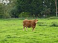 Skellingthorpe bullock - geograph.org.uk - 2079864.jpg 640 × 480; 116 KB
-
 Skellingthorpe Community Centre - geograph.org.uk - 6269792.jpg 4,608 × 3,072; 5.17 MB
-

-
 Skellingthorpe Farm.jpg 3,264 × 1,836; 2.81 MB
-
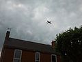 Skellingthorpe flypast.jpg 2,560 × 1,920; 1.54 MB
-

-
 Skellingthorpe Fossdyke.jpg 3,264 × 1,836; 1.57 MB
-
 Skellingthorpe Heritage Room - geograph.org.uk - 6269816.jpg 4,608 × 3,072; 5.84 MB
-
 Skellingthorpe Heritage Room, Lincoln Road - geograph.org.uk - 4807930.jpg 2,744 × 1,832; 3.82 MB
-
 Skellingthorpe hit by the Beast from the East.jpg 3,264 × 2,448; 2.29 MB
-
 Skellingthorpe Moor - geograph.org.uk - 2434068.jpg 1,600 × 1,200; 222 KB
-
 Skellingthorpe Moor - geograph.org.uk - 5362832.jpg 4,928 × 3,264; 5.98 MB
-

-
 Skellingthorpe Sewage Works - geograph.org.uk - 120980.jpg 640 × 480; 98 KB
-
 Skellingthorpe village sign.jpg 1,920 × 2,560; 1.57 MB
-
 Squirrel Corner, Old Wood, Skellingthorpe - geograph.org.uk - 6060556.jpg 5,184 × 3,888; 6.69 MB
-
 St Lawrence Church, Skellingthorpe - geograph.org.uk - 5930594.jpg 4,000 × 3,000; 4.65 MB
-
 St Lawrence Churchyard, Skellingthorpe - geograph.org.uk - 5930598.jpg 4,000 × 3,000; 4.62 MB
-
 St Lawrence's Church, Skellingthorpe - geograph.org.uk - 6060625.jpg 4,887 × 3,665; 4.21 MB
-
 St. Lawrence Church of England Primary School - geograph.org.uk - 3306926.jpg 1,024 × 768; 168 KB
-
 Stone Arms - geograph.org.uk - 2079858.jpg 640 × 480; 79 KB
-
 Stone's Cottages, Skellingthorpe - geograph.org.uk - 3202810.jpg 640 × 427; 83 KB
-
 Stoney Lane, Skellingthorpe - geograph.org.uk - 3294017.jpg 1,024 × 768; 156 KB
-
 Stopping for lunch at Burton Watesr on the Fossdyke - geograph.org.uk - 5330044.jpg 5,376 × 3,024; 2.38 MB
-
 Sustrans waymark - geograph.org.uk - 387210.jpg 640 × 427; 107 KB
-
 Swanpool farmland - geograph.org.uk - 5362195.jpg 1,024 × 683; 266 KB
-
 The bridleway from Old Wood - geograph.org.uk - 3306560.jpg 1,024 × 768; 155 KB
-
 The edge of Skellingthorpe Old Wood - geograph.org.uk - 6060555.jpg 3,888 × 5,184; 6.36 MB
-
 The end of Ferry Lane - geograph.org.uk - 3306916.jpg 1,024 × 768; 236 KB
-

-
 The Fossdyke - geograph.org.uk - 2746849.jpg 640 × 427; 64 KB


_-_geograph.org.uk_-_3306913.jpg)


_-_geograph.org.uk_-_4728765.jpg)


