Category:Skeffling
Jump to navigation
Jump to search
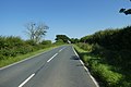
English: Skeffling is a village and civil parish in the East Riding of Yorkshire, England, in an area known as Holderness. It is situated approximately 5 miles (8 km) south of the town of Withernsea and 4 miles (6.4 km) south east of the village of Patrington on the B1445 road from Patrington to Easington.
village and civil parish in East Riding of Yorkshire, UK  | |||||
| Upload media | |||||
| Instance of | |||||
|---|---|---|---|---|---|
| Location | East Riding of Yorkshire, Yorkshire and the Humber, England | ||||
| Population |
| ||||
 | |||||
Subcategories
This category has the following 3 subcategories, out of 3 total.
H
S
- Skeffling Pumping Station (5 F)
- St Helen's Church, Skeffling (14 F)
Media in category "Skeffling"
The following 175 files are in this category, out of 175 total.
-
 A drain near Marsh Cott, Easington - geograph.org.uk - 2293327.jpg 800 × 600; 259 KB
-
 A drain near Winsetts Farm, Skeffling - geograph.org.uk - 2293359.jpg 800 × 600; 284 KB
-
 A Drain off Humber Lane, Skeffling - geograph.org.uk - 2269726.jpg 800 × 600; 311 KB
-
 A Green Lane north towards Holmpton - geograph.org.uk - 2269713.jpg 800 × 600; 230 KB
-
 A house to the East of Weeton - geograph.org.uk - 2293389.jpg 800 × 715; 195 KB
-
 A Square of wheat - geograph.org.uk - 28404.jpg 640 × 480; 104 KB
-
 B1445 at Skeffling village boundary - geograph.org.uk - 5255478.jpg 640 × 513; 74 KB
-

-
 B1445 Main Road leaving Skeffling - geograph.org.uk - 5255484.jpg 640 × 512; 36 KB
-
 Barn at Skeffling - geograph.org.uk - 5300109.jpg 1,024 × 682; 170 KB
-
 Barn on Main Road, Skeffling - geograph.org.uk - 6376563.jpg 800 × 556; 67 KB
-
 Barn on Main Road, Skeffling - geograph.org.uk - 6378134.jpg 800 × 466; 97 KB
-

-
 Burstall Bank along the Humber shoreline (geograph 5562214).jpg 800 × 600; 147 KB
-
 Burstall Lane, Skeffling - geograph.org.uk - 322174.jpg 469 × 640; 97 KB
-
 Burstall Priory - geograph.org.uk - 322572.jpg 640 × 481; 113 KB
-
 Chapel Lane, Skeffling - geograph.org.uk - 293407.jpg 640 × 460; 93 KB
-
 Chapel Lane, Skeffling - geograph.org.uk - 617840.jpg 640 × 427; 83 KB
-
 Church Road, Skeffling - geograph.org.uk - 2155184.jpg 800 × 600; 284 KB
-
 Church Road, Skeffling - geograph.org.uk - 6376445.jpg 4,513 × 3,278; 3.22 MB
-
 Coast SW of Skeffling - aerial 2018 (geograph 5719041).jpg 640 × 427; 43 KB
-
 Communications mast and field of oilseed arpe - geograph.org.uk - 5603635.jpg 1,024 × 768; 136 KB
-
 Communications mast near Easington - geograph.org.uk - 6376574.jpg 703 × 800; 80 KB
-
 Crop field near Weeton (geograph 6376391).jpg 800 × 600; 95 KB
-
 Day's End - geograph.org.uk - 1391405.jpg 480 × 640; 62 KB
-

-
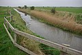
 Drainage Channel - geograph.org.uk - 290099.jpg 640 × 497; 98 KB
-
 Easington, aerial 2018 - geograph.org.uk - 5719024.jpg 640 × 427; 44 KB
-
 East Level Bank (geograph 5748910).jpg 640 × 480; 59 KB
-
 East Level Bank - geograph.org.uk - 2070214.jpg 2,816 × 2,112; 2.58 MB
-
 East Level Bank - geograph.org.uk - 617435.jpg 640 × 427; 70 KB
-

-
 Entering Skeffling - geograph.org.uk - 1472576.jpg 640 × 480; 77 KB
-
 Entering Skeffling - geograph.org.uk - 6376557.jpg 800 × 600; 159 KB
-
 Entering Skeffling heading west - geograph.org.uk - 2155177.jpg 800 × 600; 204 KB
-
 Farm building, Skeffling - geograph.org.uk - 6378133.jpg 640 × 435; 51 KB
-
 Farm buildings, Cottage Farm, Skeffling - geograph.org.uk - 2407744.jpg 1,600 × 1,200; 426 KB
-
 Farm buildings, Skeffling - geograph.org.uk - 6378145.jpg 800 × 600; 128 KB
-
 Farm buildings, Skeffling - geograph.org.uk - 6378148.jpg 800 × 600; 125 KB
-
 Farm cottage in Skeffling, East Riding of Yorkshire, England.jpg 480 × 640; 90 KB
-
 Farmland near Skeffling - geograph.org.uk - 2407738.jpg 640 × 480; 78 KB
-
 Farmland near Skeffling - geograph.org.uk - 2407746.jpg 1,600 × 1,200; 392 KB
-
 Farmland near Skeffling - geograph.org.uk - 5562201.jpg 800 × 670; 147 KB
-
 Farmland near Weeton - geograph.org.uk - 2407344.jpg 1,600 × 1,200; 679 KB
-
 Field of oilseed rape (geograph 5635584).jpg 1,024 × 768; 153 KB
-
 Fields off Weeton Road, Skeffling - geograph.org.uk - 5300113.jpg 1,024 × 682; 130 KB
-
 Fields toward Winsetts - geograph.org.uk - 2069187.jpg 2,816 × 2,112; 2.98 MB
-
 Footbridge over Fosse Drain - geograph.org.uk - 4542676.jpg 3,024 × 4,032; 1.71 MB
-
 Fosse Drain from footbridge - geograph.org.uk - 2069193.jpg 2,816 × 2,112; 2.85 MB
-
 Fosse Drain near Skeffling - geograph.org.uk - 5562152.jpg 800 × 604; 150 KB
-
 Fosse Hill, Skeffling - geograph.org.uk - 321725.jpg 640 × 464; 108 KB
-

-
 Gilcross Road - geograph.org.uk - 5635587.jpg 1,024 × 768; 137 KB
-
 Grass field and farm buildings at Skeffling - geograph.org.uk - 5449570.jpg 1,024 × 768; 206 KB
-
 Grazing land near Skeffling (geograph 5471113).jpg 640 × 480; 387 KB
-
 Hare on Out Newton Road - geograph.org.uk - 5468423.jpg 640 × 487; 187 KB
-
 Harvested Field near Skeffling - geograph.org.uk - 524673.jpg 640 × 480; 88 KB
-
 Hodgson's Fields Nature Reserve - geograph.org.uk - 5449579.jpg 1,024 × 768; 213 KB
-
 Hodgson's Fields, near Skeffling - geograph.org.uk - 5468753.jpg 640 × 480; 385 KB
-
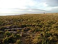
 Holderness farmland - geograph.org.uk - 40940.jpg 640 × 480; 113 KB
-
 House on Main Road, Skeffling - geograph.org.uk - 6376561.jpg 800 × 600; 109 KB
-
 Houses on Church Road, Skeffling - geograph.org.uk - 6376442.jpg 5,045 × 3,538; 3.61 MB
-
 Houses on Church Road, Skeffling - geograph.org.uk - 6376444.jpg 4,499 × 3,039; 2.69 MB
-
 Hull Road (B1445) - geograph.org.uk - 6376571.jpg 800 × 600; 65 KB
-
 Humber Bank, Skeffling Clays - geograph.org.uk - 5748896.jpg 640 × 480; 71 KB
-
 Humber Bank, Winsetts Clough - geograph.org.uk - 5748892.jpg 640 × 480; 75 KB
-
 Humber Estuary, Skeffling - geograph.org.uk - 1261334.jpg 640 × 430; 95 KB
-
 Humber Lane, near Skeffling - geograph.org.uk - 5471114.jpg 640 × 480; 319 KB
-
 Humber shoreline at Winsetts Bank - geograph.org.uk - 5560742.jpg 800 × 600; 157 KB
-
 Humber View and Skeffling Church - geograph.org.uk - 2069205.jpg 2,816 × 2,112; 2.74 MB
-
 Laurel Farm, Main Road, Skeffling - geograph.org.uk - 2155193.jpg 800 × 600; 290 KB
-
 Laurel Farm, Skeffling - geograph.org.uk - 2407748.jpg 1,600 × 1,200; 371 KB
-
 Laurel Farm, Skeffling - geograph.org.uk - 321723.jpg 478 × 640; 130 KB
-
 Laurel Farm, Skeffling - geograph.org.uk - 322557.jpg 428 × 640; 163 KB
-
 Laurel Farm, Skeffling - geograph.org.uk - 3690360.jpg 640 × 444; 197 KB
-
 Levee at Easington Clays - geograph.org.uk - 28400.jpg 640 × 480; 77 KB
-
 Long Lane Skeffling - geograph.org.uk - 2069200.jpg 2,816 × 2,112; 2.78 MB
-

-

-
 Looking to Skeffling - geograph.org.uk - 28398.jpg 640 × 480; 98 KB
-
 Main Road, Skeffling - geograph.org.uk - 983263.jpg 640 × 408; 56 KB
-
 Mulberry Tree - Skeffling - 2007.11.24 - geograph.org.uk - 620612.jpg 480 × 640; 146 KB
-
 North bank of the Humber - geograph.org.uk - 6054998.jpg 1,600 × 1,200; 403 KB
-
 Oil seed rape crop along Easington Road - geograph.org.uk - 5572112.jpg 800 × 610; 194 KB
-
 Old fuel pumps, Skeffling - geograph.org.uk - 6378144.jpg 800 × 645; 201 KB
-
 Out Newton Road - geograph.org.uk - 40949.jpg 640 × 480; 95 KB
-
 Out Newton Road south towards Skeffling - geograph.org.uk - 2269717.jpg 800 × 600; 196 KB
-
 Out Newton Wind Farm seen from Fosse Hill - geograph.org.uk - 5546536.jpg 1,024 × 768; 153 KB
-
 Oxlands Bank - geograph.org.uk - 6055001.jpg 1,600 × 1,164; 292 KB
-
 Oxlands Bank along the Humber shoreline - geograph.org.uk - 5562136.jpg 800 × 487; 132 KB
-

-
 Oxlands Bank, Skeffling - geograph.org.uk - 316557.jpg 640 × 480; 110 KB
-
 Pond near Skeffling - geograph.org.uk - 6378132.jpg 800 × 600; 75 KB
-

-
 Restricted by way near Winsetts - geograph.org.uk - 5603633.jpg 1,024 × 768; 187 KB
-
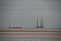 Rig and a ship in the Humber Estuary - geograph.org.uk - 3009957.jpg 640 × 427; 26 KB
-
 River Humber Flood Bank - geograph.org.uk - 2070243.jpg 2,816 × 2,112; 2.97 MB
-
 Road between Weeton and Skeffling (geograph 6909154).jpg 1,024 × 683; 484 KB
-
 Sheep and farmland near Skeffling (geograph 5562213).jpg 800 × 552; 105 KB
-
 Sheep at Bleak House Farm, Skeffling - geograph.org.uk - 5572101.jpg 800 × 534; 158 KB
-
 Skeffling Chapel.jpg 640 × 427; 79 KB
-
 Skeffling Church - geograph.org.uk - 759760.jpg 640 × 460; 227 KB
-
 Skeffling Clays - geograph.org.uk - 2407729.jpg 1,600 × 1,200; 534 KB
-
 Skeffling Clays - geograph.org.uk - 316537.jpg 486 × 640; 136 KB
-
 Skeffling Clays - geograph.org.uk - 617430.jpg 640 × 427; 71 KB
-
 Skeffling Clays TA359185 - geograph.org.uk - 28396.jpg 640 × 480; 102 KB
-
 Skeffling Clays TA368183 - geograph.org.uk - 28394.jpg 640 × 480; 93 KB
-
 Skeffling Clays TA379179 - geograph.org.uk - 28399.jpg 640 × 480; 101 KB
-
 Skeffling Clough - aerial 2018 (geograph 5719062).jpg 640 × 427; 49 KB
-
 Skeffling Clough - geograph.org.uk - 1262621.jpg 640 × 428; 96 KB
-
 Skeffling Clough - geograph.org.uk - 1472555.jpg 640 × 480; 49 KB
-
 Skeffling Clough - geograph.org.uk - 305523.jpg 479 × 640; 51 KB
-
 Skeffling Clough - geograph.org.uk - 316598.jpg 640 × 480; 74 KB
-
 Skeffling Clough - geograph.org.uk - 617427.jpg 640 × 427; 63 KB
-
 Skeffling Clough - geograph.org.uk - 759754.jpg 640 × 480; 89 KB
-
 Skeffling Clough on the Humber shoreline (geograph 5562205).jpg 800 × 465; 100 KB
-
 Skeffling Junction - geograph.org.uk - 261168.jpg 640 × 480; 95 KB
-
 Skeffling main road - geograph.org.uk - 40946.jpg 640 × 480; 128 KB
-
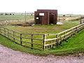
 Skeffling Pumping Station (geograph 5562209).jpg 800 × 535; 97 KB
-
 Skeffling Pumping Station - geograph.org.uk - 2069213.jpg 2,816 × 2,112; 2.95 MB
-
 Skeffling Pumping Station - geograph.org.uk - 2069221.jpg 2,816 × 2,112; 2.67 MB
-
 Skeffling Pumping Station - geograph.org.uk - 290015.jpg 640 × 480; 110 KB
-
 Skeffling Soak Dike - geograph.org.uk - 313849.jpg 640 × 480; 94 KB
-

-
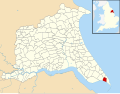 Skeffling UK parish locator map.svg 1,425 × 1,107; 1.68 MB
-
 Skeffling view - geograph.org.uk - 617483.jpg 640 × 427; 55 KB
-
 Skeffling view - geograph.org.uk - 617488.jpg 640 × 427; 52 KB
-
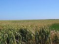 Skeffling Wheat field - geograph.org.uk - 28415.jpg 640 × 480; 111 KB
-
 Soak Dike - geograph.org.uk - 617446.jpg 640 × 427; 58 KB
-
 Soak Dike - geograph.org.uk - 617469.jpg 640 × 427; 81 KB
-
 Soak Dike - geograph.org.uk - 617472.jpg 640 × 427; 75 KB
-
 Soak Dike and East Level Bank (geograph 5449576).jpg 1,024 × 768; 234 KB
-
 Soak Dike at South End Bank - geograph.org.uk - 5562151.jpg 800 × 540; 133 KB
-
 Soak Dike near Skeffling - geograph.org.uk - 2407736.jpg 1,600 × 1,200; 383 KB
-
 Soak Dike near Skeffling at Sunset - geograph.org.uk - 524651.jpg 640 × 480; 94 KB
-
 Soak Dike near Skeffling at Sunset - geograph.org.uk - 524665.jpg 640 × 480; 70 KB
-
 Soak Dike, Skeffling - geograph.org.uk - 1262634.jpg 640 × 428; 86 KB
-
 Soak Dyke by the Humber Bank - geograph.org.uk - 5748903.jpg 640 × 480; 56 KB
-
 South End Bank, Skeffling - geograph.org.uk - 1472552.jpg 640 × 480; 60 KB
-
 South End Bank, Skeffling - geograph.org.uk - 316574.jpg 640 × 475; 84 KB
-
 South of Rysome Garth, Holmpton - geograph.org.uk - 321722.jpg 470 × 640; 88 KB
-
 Spraying the crops near Skeffling (geograph 5562212).jpg 800 × 415; 79 KB
-
 Spraying the crops near Winsetts Farm - geograph.org.uk - 5562142.jpg 800 × 481; 114 KB
-
 Spurn Point from the air - geograph.org.uk - 3845854.jpg 640 × 480; 65 KB
-
 Spurn Point from the air - geograph.org.uk - 3845860.jpg 640 × 480; 63 KB
-
 St Helen's Church, Skeffling - geograph.org.uk - 2407743.jpg 1,600 × 1,200; 696 KB
-
 St Helen's Church, Skeffling - geograph.org.uk - 3690359.jpg 640 × 426; 202 KB
-
 St Helen's church, Skeffling - geograph.org.uk - 5784967.jpg 2,592 × 1,944; 1.85 MB
-
 St Helen's Church, Skeffling - geograph.org.uk - 5785649.jpg 1,600 × 1,200; 696 KB
-

-
 Sunset Boulevard - geograph.org.uk - 1395738.jpg 640 × 480; 54 KB
-
 Telephone Exchange, Easington (1) - geograph.org.uk - 3844843.jpg 640 × 480; 53 KB
-
 The Cedars, Scorborough Hill - geograph.org.uk - 322556.jpg 640 × 475; 137 KB
-
 The Humber estuary from the air - geograph.org.uk - 3845831.jpg 640 × 405; 72 KB
-
 The Humber estuary from the air - geograph.org.uk - 3845834.jpg 640 × 387; 83 KB
-

-
 The road to Weeton - geograph.org.uk - 322558.jpg 640 × 371; 77 KB
-
 The western approach to Skeffling - geograph.org.uk - 40943.jpg 640 × 480; 103 KB
-
 Three Foot Lane - geograph.org.uk - 293404.jpg 472 × 640; 91 KB
-

-
 Track along Humber flood defences - geograph.org.uk - 2407731.jpg 1,600 × 1,200; 484 KB
-
 Track on East Level Bank - geograph.org.uk - 2407741.jpg 1,600 × 1,183; 357 KB
-
 Tug-o-War above Mr Hill's sheds - geograph.org.uk - 302878.jpg 640 × 487; 69 KB
-
 View towards Skeffling from South End bank - geograph.org.uk - 5449574.jpg 1,024 × 768; 188 KB
-
 Village Hall, Skeffling - geograph.org.uk - 6376565.jpg 800 × 600; 108 KB
-

-
 Weeton Beck - geograph.org.uk - 321754.jpg 479 × 640; 132 KB
-
 Weeton Road near Scorborough House (geograph 6909152).jpg 1,024 × 683; 471 KB
-
 West Level Bank - geograph.org.uk - 1472560.jpg 640 × 480; 65 KB
-
 Wilberforce Farm, Skeffling - geograph.org.uk - 983252.jpg 640 × 453; 67 KB
-
 Winsetts Clough and Mud Flats - geograph.org.uk - 2070261.jpg 2,816 × 2,112; 2.96 MB
-
 Winsetts Farm near Skeffling - geograph.org.uk - 2293335.jpg 800 × 600; 188 KB
-
 Winsetts Jump - geograph.org.uk - 316498.jpg 640 × 476; 91 KB
-
 Winsetts, Skeffling - geograph.org.uk - 1472550.jpg 640 × 480; 46 KB
-
 Winsetts, Skeffling - geograph.org.uk - 321726.jpg 640 × 468; 81 KB


.jpg)


.jpg)


.jpg)


.jpg)


.jpg)


.jpg)


_-_geograph.org.uk_-_6376571.jpg)


.jpg)
.jpg)


.jpg)


.jpg)


.jpg)


.jpg)


.jpg)


_-_geograph.org.uk_-_3844843.jpg)


.jpg)


