Category:Situation maps of the Mahdist War
Jump to navigation
Jump to search
English: This category is to collect large-scale maps of the Mahdist War that are dated to the time of a battle, action, campsite or troop movement (unlike general topographic maps that show the Sudan on a small scale). Maps are to be sorted by keys of YYYY-MM(-DD). Maps not containing dates should not be categorized in here.
Subcategories
This category has the following 2 subcategories, out of 2 total.
M
- Map of Fort Bodo by Stanley (10 F)
- Maps of the Battle of Omdurman (21 F)
Media in category "Situation maps of the Mahdist War"
The following 69 files are in this category, out of 69 total.
-
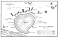
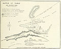 Battle of Tamai map.jpg 1,803 × 1,446; 624 KB
-
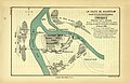
 Plan of Khartoum.png 2,017 × 1,804; 564 KB
-
 Rivercolumn00brac 0248.png 1,550 × 1,000; 1.94 MB
-
 Fort Omdurman (295).png 1,315 × 1,213; 1.25 MB
-
 Fort Omdurman (297).png 1,311 × 830; 887 KB
-
 Fort Omdurman (302).png 1,306 × 943; 1.01 MB
-
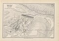
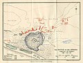
 Action of Abu Klea Jan. 17th 1885.png 7,137 × 2,961; 10.92 MB
-
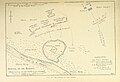
 Position at Gubat, Jany.1885.png 3,039 × 2,368; 6.21 MB
-
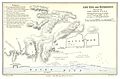
 Suakin and defences, January 1885.png 9,547 × 7,442; 47.31 MB
-
-
 MACDONALD(1887) p245 SKETCH MAP OF ZEREBA AT ABU-KLEA.jpg 1,331 × 1,485; 888 KB
-
 MACDONALD(1887) p245 SKETCH MAP ROAD FROM METAMMEH TO ABU-KLEA.jpg 1,329 × 689; 371 KB
-
 MACDONALD(1887) p263 SKETCH MAP OF BATTLE FIELD OF ABU-KLEA.jpg 2,989 × 2,079; 3.79 MB
-

-

-

-

-

-
 MACDONALD(1887) p317 SKETCH MAP OF ABU-KRU AND METAMMEH.jpg 2,053 × 1,357; 1.42 MB
-

-
-

-
 Battle of Kirbekan map.jpg 1,770 × 1,164; 629 KB
-
 Rivercolumn00brac 0184.png 1,520 × 1,000; 2.28 MB
-
 Warinegyptsoudan0304archuoft 0343.png 2,212 × 3,582; 4.99 MB
-
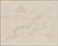 Sketch of the River Nile between Merowi and Huella.png 8,038 × 6,378; 35.45 MB
-
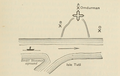
 Tofrek Zeriba Map.jpg 1,076 × 1,451; 275 KB
-
 Attack upon Ginnis - 30th december 1885.jpg 2,163 × 1,704; 599 KB
-
 MACDONALD(1887) p293 SKETCH MAP OF NIGHT MARCH TO METAMMEH.jpg 2,063 × 1,395; 1.17 MB
-
 PK D052 Sketch accompanying the author's capture.jpg 2,157 × 2,170; 409 KB
-
 Sketch accompanying author's account of capture.png 2,120 × 2,070; 3.73 MB
-
 Sketch of Action against Handub - 17th January 1888.jpg 1,764 × 1,134; 308 KB
-
 Sketch of Country round Fort Hudson.jpg 1,764 × 1,134; 254 KB
-
 Plan of Khor Mussa Fort.jpg 1,134 × 1,764; 313 KB
-
 Sketch of Action near Suakin - 20th December 1888.jpg 2,211 × 1,695; 662 KB
-
 Sketch of Movements of troops in A. S. W. El Teb on the night of the 30th April 1889.jpg 1,134 × 1,764; 258 KB
-
 Sketch of the attempted Dervish raid on Serra West on 9th May 1889.jpg 1,764 × 1,134; 217 KB
-
 Sketch of action at Argin, 2nd July 1889.jpg 1,764 × 1,134; 354 KB
-

-
 Action of Afafit - 19th February 1891.jpg 1,764 × 1,134; 382 KB
-

-
 River War 1-4 The Advance to Akasha.jpg 1,293 × 1,863; 222 KB
-
 Sketch showing military situation at the front, 2nd week of April 1896.png 1,701 × 1,449; 1.42 MB
-
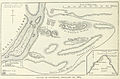
 Egyptian position at the end of May of 1896.png 2,622 × 1,863; 2.25 MB
-
 Plan of Akasha May 1896.png 2,548 × 2,056; 3.76 MB
-
 Scene of the May-Day Cavalry Fight.png 1,632 × 2,342; 2.56 MB
-
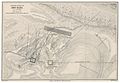
 Battle of Ferkeh, June 7 1896.png 1,648 × 1,804; 2.24 MB
-

-

-
 River War 1-5 Firket.jpg 2,103 × 1,992; 604 KB
-
 The Night March, June 6-7 1896.png 1,676 × 2,511; 2.52 MB
-
 The pursuit after Ferkeh, June 7th-8th 1896.png 1,566 × 1,530; 1.41 MB
-
 River War 1-6 Capture Dongola.jpg 1,293 × 1,881; 276 KB
-
 The final advance of Dongola, September 18th-23rd 1896.png 1,664 × 3,373; 4.31 MB
-
 River War 1-10 Atbara.jpg 1,881 × 1,209; 853 KB
-
 River War 1-13 Atbara Campaign.jpg 1,350 × 1,923; 229 KB
-
 River War 1-11 Mahmuds Zeriba.jpg 1,800 × 1,977; 606 KB
-
 River War 1-12 Reconnaissance 5th April.jpg 2,433 × 1,995; 691 KB
-
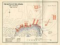
 Battle of the Atbara. Time 7.40 a.m.png 2,865 × 1,857; 993 KB
-
 River War 1-14 Night March Nakheila.jpg 2,172 × 1,983; 556 KB
-
 River War 1-15 Atbara Battle 6.15am.jpg 2,559 × 1,974; 742 KB
-
 River War 1-16 Atbara Battle 7.40am.jpg 2,556 × 1,959; 693 KB
-
 River War 1-17 Atbara Battle 7.55am.jpg 2,661 × 2,001; 643 KB
-

-
-
 River War 1-8 Merawi - Abu Hamed.jpg 2,310 × 1,977; 355 KB
-
 River War 2-13 Blue Nile Campaign.jpg 1,263 × 1,482; 259 KB
-
 River War 2-3 Omdurman 1st September 1.30pm.jpg 1,911 × 1,971; 638 KB
-
 River War 2-15 Shirkela.jpg 1,335 × 1,176; 125 KB


.png)
.png)
.png)


.jpg)
_p245_SKETCH_MAP_OF_ZEREBA_AT_ABU-KLEA.jpg)
_p245_SKETCH_MAP_ROAD_FROM_METAMMEH_TO_ABU-KLEA.jpg)
_p263_SKETCH_MAP_OF_BATTLE_FIELD_OF_ABU-KLEA.jpg)
.jpg)
.jpg)
.jpg)
.jpg)
.jpg)
_p317_SKETCH_MAP_OF_ABU-KRU_AND_METAMMEH.jpg)
.jpg)


_p293_SKETCH_MAP_OF_NIGHT_MARCH_TO_METAMMEH.jpg)


.jpg)
.jpg)


.jpg)
.jpg)


