Category:Site plans of Hamburg
Jump to navigation
Jump to search
Federal states of Germany:
Subcategories
This category has only the following subcategory.
Media in category "Site plans of Hamburg"
The following 56 files are in this category, out of 56 total.
-
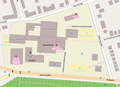 AK Wandsbek Lageplan.png 731 × 530; 122 KB
-
 Schule Alsterredder in Hamburg-Sasel, Lageplan.jpg 4,031 × 3,008; 2.13 MB
-
 Garten de l'Aigle 2021 (4).jpg 4,361 × 3,260; 2.35 MB
-
 Bahrenfelder Chaussee 49 in Hamburg-Bahrenfeld (03).jpg 1,884 × 1,057; 528 KB
-
 Schule Baumacker in Hamburg-Eidelstedt, Lageplan (2).jpg 1,404 × 2,336; 559 KB
-
 Schule Beltgens Garten in Hamburg-Hamm, Lageplan.jpg 3,768 × 2,916; 2.76 MB
-
 Berufsschule Eulenkamp in Hamburg-Wandsbek (4).JPG 2,716 × 2,620; 2.65 MB
-
 Berufsschule für Medien, Eulenkamp, Hamburg-Wandsbek, Wegweiser (1).jpg 4,032 × 3,024; 5.32 MB
-
 Berufsschule Wendenstraße 268 in Hamburg (4).JPG 1,847 × 3,795; 2.05 MB
-
 Berufsschulen Dratelnstraße in Hamburg-Wilhelmsburg, Lageplan.jpg 3,024 × 4,032; 2.9 MB
-
 2016 01 21 DW Plan 1922 IMG 6489 P k.JPG 1,024 × 685; 150 KB
-
 Schule Francoper Straße in Hamburg-Neugraben, Lageplan 2020.JPG 2,724 × 1,876; 1.43 MB
-
 Schule Friedrichstraße in Hamburg-St. Pauli, Lageplan (2).jpg 1,356 × 2,860; 883 KB
-
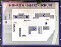 Heinrich-Hertz-Schule in Hamburg - Lageplan.jpg 2,250 × 1,719; 684 KB
-
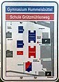 Gymnasium Hummelsbüttel und Schule Grützmühlenweg, Lageplan.jpg 994 × 1,380; 489 KB
-
 Gymnasium Blankenese in Hamburg-Blankenese, Lageplan (2).JPG 1,092 × 972; 344 KB
-
 Gymnasium Corveystraße in Hamburg-Lokstedt (02).JPG 2,959 × 3,944; 3.08 MB
-
 Gyula-Trebitsch-Schule in Hamburg-Tonndorf, Lageplan.jpg 3,820 × 2,844; 3.23 MB
-
 HUSB 1914, Band 2, Abbildung 1093, Maschinenbauschule Altona.jpg 1,100 × 900; 96 KB
-
 HUSB1918-1929, Abbildung 367, zu Bahnhof Ochsenwerder.jpg 1,163 × 849; 94 KB
-
 HUSB1918-1929, Abbildung 369, zu Bahnhof Kiebitzbraak.jpg 1,226 × 872; 111 KB
-
 HUSB1918-1929, Abbildung 489, zu Rundfunksender Lokstedt.jpg 1,197 × 762; 102 KB
-
 HUSB1918-1929, Abbildung 524-525, zu Wohnhausblock Schützenstraße.jpg 1,174 × 606; 202 KB
-
 Immanuel-Kant-Gymnasium in Hamburg-Marmstorf, Aushang (2).JPG 2,115 × 2,763; 866 KB
-
 Schule In der alten Forst in Hamburg-Eißendorf, Wegweiser (1).JPG 1,808 × 2,604; 1.51 MB
-
 Schule In der alten Forst in Hamburg-Eißendorf, Wegweiser (2).JPG 1,012 × 2,007; 531 KB
-
 Jugendmusikschule Hamburg. Wegweiser.jpg 2,540 × 3,372; 3.22 MB
-
 Karte Kampnagel-Gelände.svg 1,325 × 781; 20 KB
-
 Krankenhaus St. Georg nach dem Umbau 1915 - Lageplan (ZfB 1917).png 2,330 × 1,146; 481 KB
-
 Lageplan Geschwister-Scholl-Schule in Hamburg (1971-1978).jpg 857 × 783; 54 KB
-
 Lageplan Gymnasium Marienthal - Max-Schmeling-Stadtteilschule in Hamburg.pdf 1,752 × 1,239; 289 KB
-
 Lageplan Jungiusstraße 9-11, Hamburg-Neustadt.jpg 2,546 × 1,468; 781 KB
-
 Schule Querkamp in Hamburg-Billstedt, Wegweiser (1).jpg 1,716 × 2,937; 1.94 MB
-
 Schule Querkamp in Hamburg-Billstedt, Wegweiser (2).jpg 2,864 × 3,856; 3.63 MB
-
 Schule Röthmoorweg in Hamburg-Schnelsen, Lageplan (01).jpg 3,015 × 2,607; 2.35 MB
-
 Schule Röthmoorweg in Hamburg-Schnelsen, Lageplan (02).jpg 2,696 × 2,700; 1.34 MB
-
 Schröderstift Lageplan.jpg 1,402 × 1,035; 281 KB
-
 Schule Am Johannisland in Hamburg (08).JPG 738 × 1,155; 236 KB
-
 Schule Budapester Straße in Hamburg-St. Pauli, Lageplan (3).JPG 848 × 1,154; 223 KB
-
 Schule Fischbeker Moor in Hamburg-Neugraben-Fischbek, Lageplan (1).JPG 2,547 × 3,487; 3.7 MB
-
 Schule Fischbeker Moor in Hamburg-Neugraben-Fischbek, Lageplan (2).JPG 1,324 × 2,412; 653 KB
-
 Schule Fischbeker Moor in Hamburg-Neugraben-Fischbek, Lageplan (3).JPG 1,277 × 914; 254 KB
-
 Schule Göhlbachtal in Hamburg-Eißendorf (8).JPG 3,883 × 2,888; 4.42 MB
-
 Schule Jenfelder Straße in Hamburg-Jenfeld, Lageplan.JPG 1,374 × 1,486; 356 KB
-
 Schule Neuenfelder Straße in Hamburg-Wilhelmsburg (08).JPG 2,991 × 3,961; 3.91 MB
-
 Schule Neuenfelder Straße in Hamburg-Wilhelmsburg (10).JPG 3,024 × 3,911; 3.95 MB
-
 Schule Neumoorstück in Hamburg-Neugraben-Fischbek (03).JPG 1,996 × 1,436; 820 KB
-
 Schule Schenefelder Landstraße in Hamburg, Lageplan.jpg 2,811 × 3,174; 2.47 MB
-
 Schule Schnuckendrift in Hamburg-Neugraben-Fischbek, Lageplan.JPG 2,002 × 1,556; 675 KB
-
 St. Sophien Hamburg-Barmbek Lageplan.PNG 744 × 647; 20 KB
-
 Stadtteilschule Groß Flottbek, Lageplan Ohlenkamp.jpg 2,349 × 2,453; 1.31 MB
-
 Stadtteilschule Oldenfelde in Hamburg-Rahlstedt (3).JPG 3,625 × 2,921; 2.42 MB
-
 Lageplan Museumsdorf.JPG 3,000 × 2,250; 1.12 MB
-
 Lageplan Schulstandort Walter-Rothenburg-Weg.jpg 1,316 × 1,904; 696 KB
-
 Westerschule Finkenwerder in Hamburg, Lageplan.JPG 1,824 × 2,244; 1.13 MB
-
 Wohnanlage Das Rauhe Haus, Hamburg-Horn, Lageplan.jpg 3,174 × 2,969; 1.94 MB


.jpg)
.jpg)
.jpg)

.JPG)
.jpg)
.JPG)


.jpg)


.JPG)


.JPG)
.JPG)
.JPG)


.png)
.jpg)

.jpg)
.jpg)
.jpg)
.jpg)

.JPG)
.JPG)
.JPG)
.JPG)
.JPG)
.JPG)

.JPG)
.JPG)
.JPG)


.JPG)


.JPG)