Category:Sirhowy Valley Walk
Jump to navigation
Jump to search

Media in category "Sirhowy Valley Walk"
The following 26 files are in this category, out of 26 total.
-
 Approaching Fourteen Locks from the west - geograph.org.uk - 773918.jpg 640 × 480; 164 KB
-

-
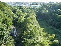
 Disused railway bridge, Argoed, Caerphilly - geograph.org.uk - 69803.jpg 640 × 420; 154 KB
-
 Entrance to Tredegar House Country Park - geograph.org.uk - 641464.jpg 640 × 480; 130 KB
-
 Man-moel Road - geograph.org.uk - 930041.jpg 640 × 427; 142 KB
-
 Mill Cottages, Lighthouse Road - geograph.org.uk - 718264.jpg 640 × 480; 130 KB
-

-

-
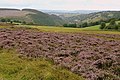 Nant yr Helyg from the Man-moel Road - geograph.org.uk - 930003.jpg 640 × 427; 163 KB
-
 Pen-deri farm. Argoed, Caerphilly - geograph.org.uk - 70713.jpg 640 × 420; 86 KB
-
 Pont Ebbw - Ebbw Bridge - geograph.org.uk - 618007.jpg 640 × 481; 161 KB
-
 Sirhowy Valley - geograph.org.uk - 871812.jpg 640 × 480; 160 KB
-
 Sirhowy Valley Walk (1) - geograph.org.uk - 1021272.jpg 640 × 476; 181 KB
-
 Sirhowy Valley Walk (2) - geograph.org.uk - 1021268.jpg 640 × 480; 166 KB
-
 Sirhowy Valley Walk 1 - geograph.org.uk - 624899.jpg 640 × 481; 217 KB
-
 Sirhowy Valley Walk 2 - geograph.org.uk - 624900.jpg 640 × 480; 207 KB
-
 Sirhowy Valley Walk, Gaer, Newport - geograph.org.uk - 527293.jpg 640 × 480; 132 KB
-
 Sirhowy Valley Walk, southwest slope of Mynydd Machen - geograph.org.uk - 5182241.jpg 5,179 × 3,451; 4.04 MB
-
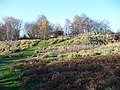 Tredegar Fort summit - geograph.org.uk - 619433.jpg 640 × 480; 164 KB
-
 View northeast from Tredegar Fort - geograph.org.uk - 620893.jpg 640 × 480; 165 KB
-
 View northwest from Ridgeway - geograph.org.uk - 624897.jpg 640 × 480; 153 KB
-
 View towards Rogerstone - geograph.org.uk - 675487.jpg 640 × 480; 166 KB
-

-
 Wild horse on Man-Moel Road - geograph.org.uk - 926010.jpg 640 × 427; 210 KB
-
 Coed Melyn Park, Glasllwch - geograph.org.uk - 621882.jpg 640 × 480; 186 KB
-
 Riverside Court - geograph.org.uk - 154909.jpg 480 × 640; 78 KB


_-_geograph.org.uk_-_648005.jpg)
_-_geograph.org.uk_-_674540.jpg)


_-_geograph.org.uk_-_1021272.jpg)
_-_geograph.org.uk_-_1021268.jpg)


