Category:Sint Felixweg 3, Kamperland
Jump to navigation
Jump to search
| Object location | | View all coordinates using: OpenStreetMap |
|---|
 | |||||
| Upload media | |||||
| Instance of | |||||
|---|---|---|---|---|---|
| Location | Kamperland, Noord-Beveland, Zeeland, Netherlands | ||||
| Street address |
| ||||
| Located on street |
| ||||
| Heritage designation |
| ||||
 | |||||
|
This is a category about rijksmonument number 39101
|
| Address |
|
Media in category "Sint Felixweg 3, Kamperland"
The following 27 files are in this category, out of 27 total.
-
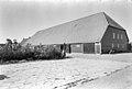
 "Land en Zeezicht", huis - Kamperland - 20123719 - RCE.jpg 1,200 × 806; 194 KB
-
-
 Aanbouw zijgevel - Kamperland - 20457786 - RCE.jpg 1,200 × 900; 157 KB
-
 Boerderij buiten 19 06 2006 023.jpg 1,792 × 1,312; 679 KB
-
 Deeldeuren zijgevel schuur nr. Kamperland 11 - Kamperland - 20457781 - RCE.jpg 1,200 × 900; 178 KB
-

-
 Interieur - Kamperland - 20457778 - RCE.jpg 1,200 × 900; 149 KB
-
 Kop- en zijgevel - Kamperland - 20457783 - RCE.jpg 1,200 × 900; 111 KB
-
 Kop- en zijgevel - Kamperland - 20457785 - RCE.jpg 1,200 × 900; 144 KB
-
 Kopgevel - Kamperland - 20457771 - RCE.jpg 1,200 × 900; 79 KB
-
 Kopgevel - Kamperland - 20457772 - RCE.jpg 1,200 × 900; 120 KB
-
 Kopgevel - Kamperland - 20457780 - RCE.jpg 1,200 × 900; 94 KB
-
 Land en Zeezicht - Kamperland - 20123722 - RCE.jpg 1,200 × 797; 195 KB
-
 Luiken zijgevel nr. Kamperland 13 - Kamperland - 20457773 - RCE.jpg 918 × 891; 131 KB
-

-
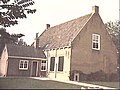
 Overzicht van de de voorgevel van het woonhuis - Kamperland - 20421717 - RCE.jpg 1,200 × 803; 245 KB
-
 Overzicht van de schuur - Kamperland - 20421716 - RCE.jpg 1,200 × 803; 257 KB
-

-
 Schuur en woning nr. Kamperland 8 - Kamperland - 20457775 - RCE.jpg 1,200 × 900; 170 KB
-
 Zij- en kopgevel - Kamperland - 20457769 - RCE.jpg 1,200 × 900; 137 KB
-
 Zij- en kopgevel - Kamperland - 20457770 - RCE.jpg 1,200 × 900; 141 KB
-
 Zij- en kopgevel - Kamperland - 20457784 - RCE.jpg 1,200 × 900; 148 KB
-

-

-
 Zijgevel - Kamperland - 20457782 - RCE.jpg 1,200 × 900; 123 KB
-
 Zijgevel nr. Kamperland 9 - Kamperland - 20457787 - RCE.jpg 1,200 × 900; 160 KB
-


