Category:Sint-Petruskerk, Ureterp
Jump to navigation
Jump to search
| Object location | | View all coordinates using: OpenStreetMap |
|---|
church in Ureterp, Netherlands  | |||||
| Upload media | |||||
| Instance of | |||||
|---|---|---|---|---|---|
| Dedicated to | |||||
| Location | Ureterp, Friesland, Netherlands | ||||
| Street address |
| ||||
| Has part(s) | |||||
| Heritage designation |
| ||||
| Inception |
| ||||
| official website | |||||
 | |||||
Kerk
|
This is a category about rijksmonument number 31865
|
Toren
|
This is a category about rijksmonument number 31866
|
| Address |
|
Media in category "Sint-Petruskerk, Ureterp"
The following 25 files are in this category, out of 25 total.
-
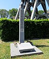 2023 Oarlochsmonumint foar Reinder Spriensma (Sachsenhausen 31.01.1945).jpg 2,592 × 3,128; 1.92 MB
-
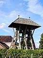
 2023 Oerterp, de klokken yn 'e klokkestoel.jpg 2,059 × 1,371; 1,002 KB
-

-
 2023 Oerterp, Petrus of Pitertsjerke.jpg 2,922 × 1,947; 4.32 MB
-
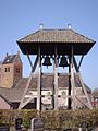
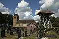
 2023 Oerterp, Petrustsjerke (of Pitertsjerke) mei klokkestoel.jpg 3,249 × 2,162; 1.32 MB
-
 Interieur naar het oosten - Ureterp - 20211580 - RCE.jpg 1,200 × 973; 181 KB
-
 Interieur naar het westen - Ureterp - 20211579 - RCE.jpg 1,200 × 952; 190 KB
-
 Kerk - Ureterp - 20211582 - RCE.jpg 1,200 × 1,198; 316 KB
-
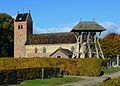
 Kerk en klokkenstoel vanuit het zuiden - Ureterp - 20211575 - RCE.jpg 875 × 1,200; 241 KB
-
 Kerk en klokkestoel - Ureterp - 20211583 - RCE.jpg 1,200 × 1,197; 306 KB
-
 Kerk naar het noorden - Ureterp - 20211578 - RCE.jpg 1,200 × 941; 312 KB
-
 Kerk vanuit het noorden - Ureterp - 20211576 - RCE.jpg 874 × 1,200; 273 KB
-
 Kerk vanuit het zuid-oosten - Ureterp - 20211577 - RCE.jpg 1,200 × 775; 187 KB
-
 Klokkenstoel Ureterp 11cw.JPG 575 × 768; 92 KB
-
 Klokkenstoel.JPG 3,456 × 4,608; 2.57 MB
-
 Klokkestoel - Ureterp - 20211584 - RCE.jpg 1,200 × 1,198; 232 KB
-
 N.H.Kerk met graven..JPG 2,048 × 1,536; 499 KB
-
 Oerterp, Petrustsjerke, oargel.jpg 2,436 × 3,416; 2.88 MB
-
 Oerterp, Petrustsjerke.jpg 5,529 × 3,950; 10.98 MB
-
 Sint Petruskerk Ureterp.jpg 1,764 × 1,272; 508 KB
-
 Sint Petruskerk.JPG 4,608 × 3,456; 1.8 MB
-
 Sint-Petruskerk Ureterp.jpg 2,048 × 1,536; 568 KB
-
 Torenplaat west-zijde - Ureterp - 20211581 - RCE.jpg 2,658 × 2,134; 2.51 MB
-
 Ureterp, de Sint Petruskerk RM31865 foto2 2015-05-10 13.59.jpg 4,327 × 3,245; 10.73 MB
-
 Ureteterp..jpg 4,770 × 3,177; 3.99 MB
.jpg)

_en_Jan_Lammer_van_der_Broek_(14.04.1945).jpg)

_mei_klokkestoel.jpg)


