
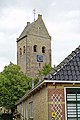
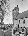
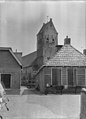
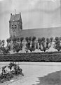
Category:Sint-Laurentiuskerk, Kimswerd
| Object location | | View all coordinates using: OpenStreetMap |
|---|
church building in Kimswerd, Netherlands  | |||||
| Upload media | |||||
| Instance of | |||||
|---|---|---|---|---|---|
| Location | Kimswerd, Súdwest-Fryslân, Friesland, Netherlands | ||||
| Street address |
| ||||
| Located on street |
| ||||
| Heritage designation |
| ||||
| Inception |
| ||||
| Significant event |
| ||||
 | |||||
|
This is a category about rijksmonument number 39359
|
| Address |
|
Subcategories
This category has only the following subcategory.
Media in category "Sint-Laurentiuskerk, Kimswerd"
The following 43 files are in this category, out of 43 total.
-
 20190903 Laurentiuskerk1 in Kimswerd.jpg 3,456 × 5,184; 3.4 MB
-
 20190903 Laurentiuskerk2 in Kimswerd.jpg 3,456 × 5,184; 3.99 MB
-
 20190903 molen de Eendracht bij Kimswerd met Laurentiuskerk.jpg 5,134 × 3,422; 3.53 MB
-
 20190903 toren Laurentiuskerk Kimswerd.jpg 3,456 × 5,184; 3.1 MB
-
 20190903 toren2 Laurentiuskerk Kimswerd.jpg 3,456 × 5,184; 2.91 MB
-
 20190903 zicht op Kimswerd met Laurentiuskerk.jpg 5,184 × 3,456; 3.95 MB
-
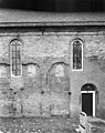
 Detail noord-gevel - Kimswerd - 20125190 - RCE.jpg 2,892 × 2,104; 3.67 MB
-
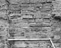 Detail spaarvelden, muurwerk met schaalstok, noord gevel - Kimswerd - 20125207 - RCE.jpg 3,083 × 2,433; 4.98 MB
-
 Detail spaarvelden, muurwerk met schaalstok, noord gevel - Kimswerd - 20125208 - RCE.jpg 3,071 × 2,439; 4.86 MB
-
 Detail tufsteen muurwerk, noordgevel - Kimswerd - 20125209 - RCE.jpg 3,083 × 2,439; 4.57 MB
-
 Detail tufsteen muurwerk, noordgevel - Kimswerd - 20125210 - RCE.jpg 3,100 × 2,422; 4.8 MB
-
 Dichtgemetselde venster in noord-gevel - Kimswerd - 20125206 - RCE.jpg 2,446 × 3,030; 4.14 MB
-
 Dichtgemetselde venster in noordgevel - Kimswerd - 20125205 - RCE.jpg 2,451 × 3,089; 4.09 MB
-
 Dichtgemetselde vensters in noordgevel - Kimswerd - 20125201 - RCE.jpg 3,100 × 2,457; 3.75 MB
-
 Dichtgemetselde vensters in noordgevel - Kimswerd - 20125202 - RCE.jpg 2,457 × 3,100; 4 MB
-
 Dichtgemetselde vensters in noordgevel - Kimswerd - 20125203 - RCE.jpg 2,451 × 3,100; 3.97 MB
-
 Exterieur - Kimswerd - 20125185 - RCE.jpg 2,118 × 2,122; 1.44 MB
-
 Exterieur - Kimswerd - 20125187 - RCE.jpg 2,122 × 2,652; 2.8 MB
-
 Exterieur - Kimswerd - 20377763 - RCE.jpg 2,130 × 2,110; 1.41 MB
-
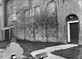
 Exterieur naar het westen, tijdens restauratie toren - Kimswerd - 20125186 - RCE.jpg 2,117 × 2,664; 2.69 MB
-
 Exterieur NOORDGEVEL - Kimswerd - 20272683 - RCE.jpg 3,089 × 2,463; 4.03 MB
-
 Exterieur NOORDGEVEL - Kimswerd - 20272684 - RCE.jpg 3,089 × 2,440; 4.1 MB
-
 Exterieur OOSTGEVEL - Kimswerd - 20272686 - RCE.jpg 2,452 × 3,066; 3.37 MB
-
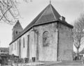
 Exterieur OVERZICHT VOORGEVEL - Kimswerd - 20272797 - RCE.jpg 3,072 × 3,078; 4.3 MB
-
 Exterieur OVERZICHT VOORGEVEL - Kimswerd - 20272798 - RCE.jpg 3,078 × 3,078; 3.58 MB
-
 Exterieur OVERZICHT, NOORDOOST GEVEL - Kimswerd - 20272685 - RCE.jpg 3,100 × 2,445; 3.88 MB
-
 Exterieur OVERZICHT, ZUIDOOST GEVEL - Kimswerd - 20272687 - RCE.jpg 3,089 × 2,428; 3.77 MB
-
 Exterieur TOREN, WESTGEVEL - Kimswerd - 20272682 - RCE.jpg 2,439 × 3,048; 2.96 MB
-
 Exterieur ZUIDGEVEL - Kimswerd - 20272688 - RCE.jpg 3,100 × 2,480; 4.51 MB
-
 Exterieur ZUIDGEVEL, GEDEELTE - Kimswerd - 20272689 - RCE.jpg 2,451 × 3,095; 3.81 MB
-
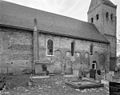
 Kerk en toren - Kimswerd - 20125188 - RCE.jpg 2,092 × 2,898; 3.35 MB
-
 Kimswerd - Kerktoren Sint-Laurentiuskerk.jpg 3,000 × 4,000; 4.06 MB
-
 Kimswerd - Noordelijke ingang Sint-Laurentiuskerk.jpg 3,000 × 4,000; 4.04 MB
-
 Kimswerd 2012 -022.JPG 3,888 × 2,592; 5.03 MB
-
 Kimswerd 2012kerk022noordzij.JPG 3,888 × 2,592; 8.91 MB
-
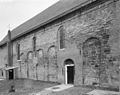
 Noord-oost gevel - Kimswerd - 20125200 - RCE.jpg 2,445 × 3,100; 2.05 MB
-
 Noordwand - Kimswerd - 20125193 - RCE.jpg 3,240 × 2,231; 1.75 MB
-
 Schuur L 2175 - Kimswerd - 20469605 - RCE.jpg 1,200 × 900; 101 KB
-
 Schuur L 2822 - Kimswerd - 20469607 - RCE.jpg 1,200 × 900; 155 KB
-
 Steen boven ingang (vergroting) - Kimswerd - 20125191 - RCE.jpg 3,231 × 2,216; 1.5 MB
-
 Tufsteen muurwerk noordgevel - Kimswerd - 20125204 - RCE.jpg 2,440 × 3,078; 2.43 MB
-
-
 Zijgevel - Kimswerd - 20125213 - RCE.jpg 3,087 × 3,083; 2.14 MB


_-_Kimswerd_-_20125191_-_RCE.jpg)


