Category:Sint-Lambertuskerk (Horpmaal)
Jump to navigation
Jump to search
| Object location | | View all coordinates using: OpenStreetMap |
|---|
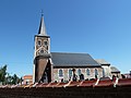
church in Horpmaal, Belgium  | |||||
| Upload media | |||||
| Instance of | |||||
|---|---|---|---|---|---|
| Dedicated to | |||||
| Location | Horpmaal, Heers, Arrondissement of Tongeren, Limburg, Flemish Region, Belgium | ||||
| Diocese | |||||
| Heritage designation |
| ||||
 | |||||
|
This is a category about onroerend erfgoed number 32100
|
Media in category "Sint-Lambertuskerk (Horpmaal)"
The following 3 files are in this category, out of 3 total.
-
 Horpmaal - Sint-Lambertuskerk.jpg 2,048 × 1,536; 555 KB
-
 Horpmaal, de Sint Lambertuskerk foto2 2012-07-01 16.15.JPG 4,416 × 3,312; 7.68 MB
-
 Horpmaal-Kerk.JPG 4,000 × 3,000; 4.48 MB

