Category:Sint-Barbaraklooster (Delft)
Jump to navigation
Jump to search
| Object location | | View all coordinates using: OpenStreetMap |
|---|
 | |||||
| Upload media | |||||
| Instance of | |||||
|---|---|---|---|---|---|
| Location | Delft, South Holland, Netherlands | ||||
| Street address |
| ||||
| Located on street | |||||
| Heritage designation |
| ||||
 | |||||
|
This is a category about rijksmonument number 11987
|
| Address |
|
Subcategories
This category has only the following subcategory.
Media in category "Sint-Barbaraklooster (Delft)"
The following 69 files are in this category, out of 69 total.
-
 Achterkamer, balklaag - Delft - 20052494 - RCE.jpg 1,190 × 1,200; 210 KB
-
 Achterkamer, detail balklaag - Delft - 20052495 - RCE.jpg 1,188 × 1,200; 220 KB
-
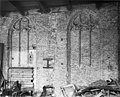 Blindtraceringen noord-gevel van de zuid vleugel - Delft - 20050436 - RCE.jpg 2,634 × 2,128; 2.48 MB
-
 Bovenzaal zuid vleugel, naar het oosten - Delft - 20050435 - RCE.jpg 1,200 × 955; 305 KB
-
 Bovenzaal, zuid vleugel, naar het westen - Delft - 20050432 - RCE.jpg 1,200 × 950; 307 KB
-
 Delft - Sint-Barbaraklooster.jpg 1,944 × 2,592; 2.18 MB
-
 Detail metselwerk - Delft - 20052497 - RCE.jpg 1,195 × 1,200; 375 KB
-
 Detail metselwerk - Delft - 20052498 - RCE.jpg 1,188 × 1,200; 422 KB
-
 Detail metselwerk - Delft - 20052499 - RCE.jpg 1,183 × 1,200; 397 KB
-
 Deur in de vergaderzaal - Delft - 20050445 - RCE.jpg 950 × 1,200; 184 KB
-
 Exterieur - Delft - 20050470 - RCE.jpg 1,200 × 964; 298 KB
-
 Exterieur - Delft - 20050471 - RCE.jpg 958 × 1,200; 357 KB
-
 Exterieur ACHTERGEVEL - Delft - 20295166 - RCE.jpg 1,200 × 960; 262 KB
-
 Exterieur ACHTERGEVEL - Delft - 20295167 - RCE.jpg 954 × 1,200; 281 KB
-
 Exterieur BINNENPLAATS - Delft - 20295165 - RCE.jpg 948 × 1,200; 355 KB
-
 Exterieur GEDEELTE VOORGEVEL - Delft - 20295162 - RCE.jpg 958 × 1,200; 296 KB
-
 Exterieur GEVEL BINNENPLAATS - Delft - 20295164 - RCE.jpg 1,200 × 960; 332 KB
-
 Exterieur OVERZICHT VOORGEVEL - Delft - 20295159 - RCE.jpg 962 × 1,200; 365 KB
-
 Exterieur OVERZICHT VOORGEVEL - Delft - 20295160 - RCE.jpg 953 × 1,200; 265 KB
-
 Exterieur VOORGEVEL - Delft - 20295161 - RCE.jpg 1,200 × 955; 309 KB
-
 Exterieur ZIJGEVEL - Delft - 20295163 - RCE.jpg 952 × 1,200; 336 KB
-
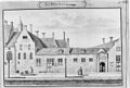 Exterieur, door A.Rademaker - Delft - 20050492 - RCE.jpg 1,200 × 807; 206 KB
-
 Exterieur, Oude Delft - Delft - 20050477 - RCE.jpg 805 × 1,200; 212 KB
-
 Exterieur, overzicht gevel oost - Delft - 20050437 - RCE.jpg 1,200 × 935; 344 KB
-
 Exterieur, overzicht gevel oost - Delft - 20050438 - RCE.jpg 1,200 × 936; 351 KB
-
 Exterieur, overzicht gevel oost - Delft - 20050439 - RCE.jpg 1,200 × 946; 330 KB
-
 Fragment zuid gevel van de zuid vleugel - Delft - 20050442 - RCE.jpg 956 × 1,200; 300 KB
-
 Gang begane grond met trappenhuis - Delft - 20052493 - RCE.jpg 1,200 × 1,200; 184 KB
-
 Gebouwen aan de binnenplaats vanuit het oosten - Delft - 20050443 - RCE.jpg 949 × 1,200; 257 KB
-
 Gedeelte gevel binnenplaats - Delft - 20050440 - RCE.jpg 1,200 × 928; 328 KB
-
 Grote benedenzaal zuid vleugel, naar het oosten - Delft - 20050433 - RCE.jpg 1,200 × 957; 235 KB
-
 Grote benedenzaal zuid vleugel, naar het westen - Delft - 20050434 - RCE.jpg 1,200 × 944; 242 KB
-
 Ingang voorhof - Delft - 20050472 - RCE.jpg 944 × 1,200; 317 KB
-
 Interieur naar het westen - Delft - 20050474 - RCE.jpg 1,200 × 877; 149 KB
-
 Interieur naar het zuid-westen - Delft - 20050473 - RCE.jpg 1,200 × 896; 157 KB
-
 Interieur regentenzaal - Delft - 20050475 - RCE.jpg 890 × 1,200; 164 KB
-
 Inwendig - Delft - 20050451 - RCE.jpg 953 × 1,200; 230 KB
-
 Inwendig - Delft - 20050452 - RCE.jpg 954 × 1,200; 246 KB
-
 Inwendig - Delft - 20050453 - RCE.jpg 1,200 × 953; 238 KB
-
 Inwendig - Delft - 20050454 - RCE.jpg 964 × 1,200; 189 KB
-
 Inwendig - Delft - 20050455 - RCE.jpg 949 × 1,200; 296 KB
-
 Inwendig - Delft - 20050456 - RCE.jpg 959 × 1,200; 228 KB
-
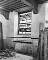
 Muurnis - Delft - 20050469 - RCE.jpg 958 × 1,200; 354 KB
-
 Noord-gevel - Delft - 20050458 - RCE.jpg 894 × 1,200; 203 KB
-
Opening studentensociëteit in Delft.ogv 2 min 40 s, 352 × 288; 23.6 MB
-
 Oude Delft 59, voorgevel - Delft - 20050457 - RCE.jpg 891 × 1,200; 230 KB
-

-
 Overzicht zijgevel naar het westen - Delft - 20050468 - RCE.jpg 965 × 1,200; 290 KB
-
 Poortje - Delft - 20050465 - RCE.jpg 884 × 1,200; 251 KB
-
 Poortje - Delft - 20050466 - RCE.jpg 887 × 1,200; 265 KB
-
 Poortje - Delft - 20050467 - RCE.jpg 889 × 1,200; 230 KB
-
 Reproductie naar gravure Rademaker - Delft - 20050478 - RCE.jpg 1,200 × 941; 410 KB
-
 Schoorsteen regentenzaal - Delft - 20050476 - RCE.jpg 890 × 1,200; 175 KB
-
 Schouw in vergaderzaal - Delft - 20050446 - RCE.jpg 958 × 1,200; 188 KB
-
 Schouw in zijkamertje vergaderzaal - Delft - 20050447 - RCE.jpg 959 × 1,200; 184 KB
-
 Steeg, Barbaraklooster - Delft - 20052492 - RCE.jpg 1,200 × 1,200; 275 KB
-
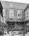
 Uitwendig - Delft - 20050448 - RCE.jpg 956 × 1,200; 317 KB
-
 Uitwendig - Delft - 20050449 - RCE.jpg 1,200 × 951; 306 KB
-
 Uitwendig - Delft - 20050450 - RCE.jpg 957 × 1,200; 342 KB
-
 Vensterfragm. in oost en zuid vleugel - Delft - 20050444 - RCE.jpg 958 × 1,200; 294 KB
-

-
 West-gevel - Delft - 20050463 - RCE.jpg 1,200 × 886; 258 KB
-
 West-gevel - Delft - 20050464 - RCE.jpg 1,200 × 880; 242 KB
-
 West-gevel aan de zuid vleugel - Delft - 20050462 - RCE.jpg 1,145 × 1,200; 365 KB
-
 Zijgevel met steeg tussen nr. 53 - Delft - 20052491 - RCE.jpg 1,192 × 1,200; 359 KB
-
 Zuid vleugel naar het westen - Delft - 20050441 - RCE.jpg 959 × 1,200; 298 KB
-
 Zuid-gevel en detail - Delft - 20050459 - RCE.jpg 890 × 1,200; 335 KB
-
 Zuid-gevel en detail - Delft - 20050460 - RCE.jpg 888 × 1,200; 335 KB
-
 Zuid-gevel en detail - Delft - 20050461 - RCE.jpg 891 × 1,200; 367 KB


_-_Delft.jpg)


