Category:Sint-Amands
Jump to navigation
Jump to search
former municipality in Antwerp, Belgium  Sint-Amands stadshus    | |||||
| Upload media | |||||
| Instance of |
| ||||
|---|---|---|---|---|---|
| Location | Puurs-Sint-Amands, Arrondissement of Mechelen, Province of Antwerp, Flemish Region, Belgium | ||||
| Located in or next to body of water | |||||
| Capital |
| ||||
| Population |
| ||||
| Area |
| ||||
| Elevation above sea level |
| ||||
| Replaced by |
| ||||
| official website | |||||
 | |||||
Subcategories
This category has the following 9 subcategories, out of 9 total.
C
H
- Houses in Sint-Amands (5 F)
M
- Molenmuseum, Sint-Amands (3 F)
O
P
- Praalgraf Emile Verhaeren (5 F)
S
V
- Views of Sint-Amands (4 F)
Media in category "Sint-Amands"
The following 91 files are in this category, out of 91 total.
-
 Abeelestraat - panoramio.jpg 2,000 × 2,667; 3.16 MB
-
 Domein 'Het Riet' - panoramio.jpg 1,500 × 2,000; 2.08 MB
-
 Dorpen-mariekerke-en-sint-amands-1343976005.jpg 4,608 × 3,456; 3.05 MB
-
 Droge Winter - panoramio.jpg 4,180 × 2,351; 11.21 MB
-
 Duivelsbeeldje (24017258390).jpg 3,212 × 4,283; 6.05 MB
-
 Gedenktplaat Emile Verhaeren.JPG 2,592 × 3,872; 2.43 MB
-
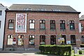
 Gemeentehuis Sint-Amands.JPG 3,872 × 2,592; 3.09 MB
-
 KerkstraatSintAmands.jpg 1,840 × 1,232; 680 KB
-
 Langs de Abeelestraat - panoramio.jpg 3,000 × 4,000; 9.14 MB
-
 Langs domein 'Het Riet' - panoramio.jpg 3,967 × 2,956; 5.1 MB
-
 Les Heures - Liefdegetijden.jpg 3,788 × 5,051; 13.93 MB
-
 Liefdesgetijden.jpg 640 × 480; 167 KB
-
 MartheMassintuin.jpg 480 × 640; 160 KB
-
 Mozaic Emile Verhaeren.jpg 2,578 × 3,495; 2.64 MB
-
 Muldersweg - panoramio.jpg 2,000 × 1,333; 3.72 MB
-
 Museum stoomspoorlijn - panoramio (1).jpg 2,698 × 3,601; 3.51 MB
-
 Nationaal Park Scheldevallei 05.jpg 6,960 × 4,640; 12.75 MB
-
 Nationaal Park Scheldevallei 06.jpg 6,960 × 4,640; 10.98 MB
-
 Nationaal Park Scheldevallei 07.jpg 6,960 × 4,640; 11.79 MB
-
 Nationaal Park Scheldevallei 08.jpg 6,960 × 4,640; 15.14 MB
-
 Nationaal Park Scheldevallei 09.jpg 6,960 × 4,640; 16.94 MB
-
 Nationaal Park Scheldevallei 10.jpg 6,960 × 4,640; 17.05 MB
-
 Nationaal Park Scheldevallei 11.jpg 6,960 × 4,640; 13.82 MB
-
 Nationaal Park Scheldevallei 12.jpg 6,960 × 4,640; 16.66 MB
-
 Nationaal Park Scheldevallei 13.jpg 6,960 × 4,640; 13.06 MB
-
 Nationaal Park Scheldevallei 14.jpg 6,960 × 4,640; 15.45 MB
-
 Nationaal Park Scheldevallei 15.jpg 6,960 × 4,640; 14.28 MB
-
 Nationaal Park Scheldevallei 16.jpg 6,960 × 4,640; 16.79 MB
-
 Nationaal Park Scheldevallei 17.jpg 6,960 × 4,640; 17.44 MB
-
 Nationaal Park Scheldevallei 18.jpg 6,960 × 4,640; 17.04 MB
-
 Nationaal Park Scheldevallei 19.jpg 6,960 × 4,640; 15.59 MB
-
 Nationaal Park Scheldevallei 20.jpg 6,960 × 4,640; 19.18 MB
-
 Nationaal Park Scheldevallei 21.jpg 6,960 × 4,640; 19.35 MB
-
 Nationaal Park Scheldevallei 22.jpg 6,960 × 4,640; 17.87 MB
-
 Nationaal Park Scheldevallei 23.jpg 6,960 × 4,640; 17.48 MB
-
 Nationaal Park Scheldevallei 24.jpg 6,960 × 4,640; 18.14 MB
-
 Nationaal Park Scheldevallei 25.jpg 6,960 × 4,640; 9.46 MB
-
 Nationaal Park Scheldevallei 26.jpg 6,960 × 4,640; 19.04 MB
-
 Nationaal Park Scheldevallei 27.jpg 6,960 × 4,640; 17.36 MB
-
 Nationaal Park Scheldevallei 28.jpg 6,960 × 4,640; 16.88 MB
-
 Nationaal Park Scheldevallei 29.jpg 6,960 × 4,640; 14.44 MB
-
 Nationaal Park Scheldevallei 30.jpg 6,960 × 4,640; 18.91 MB
-
 Nationaal Park Scheldevallei 31.jpg 6,960 × 4,640; 16.48 MB
-
 Nationaal Park Scheldevallei 32.jpg 6,960 × 4,640; 11.73 MB
-
 Nationaal Park Scheldevallei 33.jpg 6,960 × 4,640; 11.17 MB
-
 Nationaal Park Scheldevallei 34.jpg 6,960 × 4,640; 11.63 MB
-
 Nationaal Park Scheldevallei 35.jpg 6,960 × 4,640; 13.68 MB
-
 Nationaal Park Scheldevallei 36.jpg 6,960 × 4,640; 11.94 MB
-
 Natte Winter - panoramio.jpg 3,996 × 2,248; 9.56 MB
-
 Schelde in Sint-Amands.JPG 1,945 × 1,297; 1.31 MB
-
 Sint-Amands 01.jpg 6,960 × 4,640; 10.18 MB
-
 Sint-Amands 02.jpg 6,960 × 4,640; 8.61 MB
-
 Sint-Amands 03.jpg 6,960 × 4,640; 13.41 MB
-
 Sint-Amands 04.jpg 4,640 × 6,960; 9.45 MB
-
 Sint-Amands 05.jpg 4,640 × 6,960; 7.59 MB
-
 Sint-Amands 06.jpg 6,960 × 4,640; 12.87 MB
-
 Sint-Amands 07.jpg 4,640 × 6,960; 12.13 MB
-
 Sint-Amands 08.jpg 6,960 × 4,640; 14.41 MB
-
 Sint-Amands 09.jpg 6,960 × 4,640; 9.99 MB
-
 Sint-Amands 10.jpg 6,960 × 4,640; 10.36 MB
-
 Sint-Amands 11.jpg 4,640 × 6,960; 12.75 MB
-
 Sint-Amands 12.jpg 4,640 × 6,960; 8.56 MB
-
 Sint-Amands 13.jpg 6,960 × 4,640; 12.69 MB
-
 Sint-Amands 14.jpg 4,640 × 6,960; 9.33 MB
-
 Sint-Amands 16.jpg 6,960 × 4,640; 12.52 MB
-
 Sint-Amands 17.jpg 6,960 × 4,640; 11.64 MB
-
 Sint-Amands 18.jpg 6,960 × 4,640; 10.92 MB
-
 Sint-Amands 19.jpg 4,640 × 6,960; 10.39 MB
-
 Sint-Amands 20.jpg 6,960 × 4,640; 10.32 MB
-
 Sint-Amands 21.jpg 6,960 × 4,640; 10.1 MB
-
 Sint-Amands 22.jpg 6,960 × 4,640; 10.45 MB
-
 Sint-Amands 23.jpg 6,960 × 4,640; 9.74 MB
-
 Sint-Amands 24.jpg 4,640 × 6,960; 9.12 MB
-
 Sint-Amands 25.jpg 4,640 × 6,960; 7.03 MB
-
 Sint-Amands 26.jpg 6,960 × 4,640; 6.48 MB
-
 Sint-Amands 27.jpg 4,640 × 6,960; 12.08 MB
-
 Sint-Amands 28.jpg 4,640 × 6,960; 9.68 MB
-
 Sint-Amands 29.jpg 4,640 × 6,960; 9.5 MB
-
 Sint-Amands 30.jpg 4,640 × 6,960; 9.84 MB
-
 Sint-Amands 31.jpg 4,640 × 6,960; 12.24 MB
-
 Sint-Amands 32.jpg 4,640 × 6,960; 10.55 MB
-
 Sint-Amands 33.jpg 4,640 × 6,960; 7.54 MB
-
 Sint-Amands Kaai - 268755 - onroerenderfgoed.jpg 968 × 1,440; 174 KB
-
 Sint-Amands Vlag - 25553 - onroerenderfgoed.jpg 1,000 × 1,500; 110 KB
-
 Sint-Amands vlag.svg 538 × 360; 122 KB
-
 Sint-Amands Wapen - 25554 - onroerenderfgoed.jpg 1,000 × 1,500; 135 KB
-
 Sint-Amands wapen.svg 272 × 337; 389 KB
-
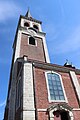
 SintAmanduskerkSintAmands.jpg 1,840 × 1,232; 634 KB
-
 Spoorlijn - panoramio.jpg 3,384 × 2,532; 5.75 MB
-
 Tussen Nijven en Pandgatheide - panoramio.jpg 2,778 × 3,704; 3.87 MB
-
 Wapen Sint Amands.jpg 258 × 305; 14 KB


.jpg)


.jpg)


