Category:Singlewell or Ifield
Jump to navigation
Jump to search
English: Singlewell or Ifield is the name given to the area south of Gravesend in Kent, England. Originally two separate parishes on either side of Watling Street, it is now separated by the A2 road and bears little resemblance to its past. The two parishes became one; although until 1935 the municipal boundary of Gravesend excluded some of the combined parish (the remainder being in Northfleet Urban District). Singlewell Road leads from the town southwards to the A2.
village in the United Kingdom | |||||
| Upload media | |||||
| Instance of | |||||
|---|---|---|---|---|---|
| Location | Gravesham, Kent, South East England, England | ||||
 | |||||
Subcategories
This category has the following 2 subcategories, out of 2 total.
O
- Oasts in Ifield (2 F)
Media in category "Singlewell or Ifield"
The following 8 files are in this category, out of 8 total.
-
-
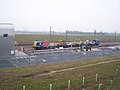
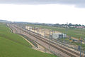 Geograph-194925-ctrl-singlewell-infrastructure-depot.jpg 640 × 426; 51 KB
-
 Holy Family Church, Singlewell - geograph.org.uk - 1112042.jpg 640 × 481; 55 KB
-
 Ifield Oast House - geograph.org.uk - 1112184.jpg 640 × 481; 67 KB
-
 Mobile Phone Mast, near CTRL - geograph.org.uk - 1147654.jpg 640 × 481; 49 KB
-
 Nell's cafe, A2 near Singlewell - geograph.org.uk - 931467.jpg 640 × 480; 58 KB
-
-
 Singlewell Library - geograph.org.uk - 1149994.jpg 640 × 481; 52 KB


