Category:Singel 466, Amsterdam
Jump to navigation
Jump to search
|
This is a category about rijksmonument number 5409
|
| Object location | | View all coordinates using: OpenStreetMap |
|---|
 | |||||
| Upload media | |||||
| Instance of |
| ||||
|---|---|---|---|---|---|
| Location | Amsterdam, North Holland, Netherlands | ||||
| Street address |
| ||||
| Located on street | |||||
| Heritage designation |
| ||||
 | |||||
Media in category "Singel 466, Amsterdam"
The following 8 files are in this category, out of 8 total.
-
 Amsterdam - Singel 464.JPG 3,056 × 4,592; 3.3 MB
-
 Amsterdam - Singel 466.JPG 3,056 × 4,592; 3.64 MB
-
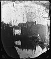
 Gerrit Lamberts (1776-1850), Afb 010055000279.jpg 3,096 × 2,544; 1.36 MB
-
 Pieter Oosterhuis, Afb 010005001889.jpg 2,027 × 1,319; 378 KB
-
 Singel 443 tm 461 (ged) (vlnr) Jacob Olie (max res).jpg 4,961 × 3,783; 3.01 MB
-
 Singel 443 tm 469 (vlnr) Jacob Olie (max res).jpg 7,032 × 5,655; 6.22 MB
-
 Singel 448-476 (links vrnl) Jacob Olie (max res).jpg 4,961 × 3,753; 3.42 MB
-
 Singel 498 tot en met 478, Koningsplein, 476 tot en met 448 (vlnr) Jacob Olie (max res).jpg 4,361 × 5,021; 3.95 MB

,_Afb_010055000279.jpg)

_(vlnr)_Jacob_Olie_(max_res).jpg)
_Jacob_Olie_(max_res).jpg)
_Jacob_Olie_(max_res).jpg)
_Jacob_Olie_(max_res).jpg)