Category:Singel 434, Amsterdam
Jump to navigation
Jump to search
| Object location | | View all coordinates using: OpenStreetMap |
|---|
 | |||||
| Upload media | |||||
| Instance of |
| ||||
|---|---|---|---|---|---|
| Location | Amsterdam, North Holland, Netherlands | ||||
| Street address |
| ||||
| Located on street | |||||
| Heritage designation |
| ||||
 | |||||
|
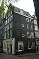
This is a category about rijksmonument number 5396
|
| Address |
|
Media in category "Singel 434, Amsterdam"
The following 3 files are in this category, out of 3 total.
-
 Amsterdam (30185235302).jpg 5,184 × 3,456; 6.78 MB
-
 Amsterdam - Singel 434.JPG 3,056 × 4,592; 4.59 MB
-
 Stadsarchief Amsterdam, Afb 012000003302.jpg 2,058 × 1,506; 552 KB
.jpg)
