Category:Sinderhope
Jump to navigation
Jump to search
village in Northumberland, England, UK | |||||
| Upload media | |||||
| Instance of | |||||
|---|---|---|---|---|---|
| Location | Allendale, Northumberland, North East England, England | ||||
 | |||||
Main Wikipedia article: Sinderhope.

Subcategories
This category has the following 4 subcategories, out of 4 total.
Media in category "Sinderhope"
The following 200 files are in this category, out of 750 total.
(previous page) (next page)-

-

-

-

-

-
 A bridleway to Sinderhope - geograph.org.uk - 2947024.jpg 800 × 600; 202 KB
-
 Across valley of Sinderhope Burn - geograph.org.uk - 4016900.jpg 1,500 × 1,000; 1.79 MB
-
 Acton Burn (2) - geograph.org.uk - 686624.jpg 640 × 480; 126 KB
-
 Acton Burn - geograph.org.uk - 686617.jpg 640 × 480; 140 KB
-
 Acton Burn footbridge - geograph.org.uk - 1199468.jpg 640 × 480; 139 KB
-
 Allendale Golf Club - geograph.org.uk - 391003.jpg 640 × 480; 87 KB
-
-
 Back road to Sinderhope - geograph.org.uk - 389218.jpg 640 × 480; 82 KB
-
 Backstone Cleugh (2) - geograph.org.uk - 454939.jpg 640 × 480; 117 KB
-
 Backstone Cleugh - geograph.org.uk - 384457.jpg 640 × 424; 101 KB
-
 Backstone Cleugh - geograph.org.uk - 795337.jpg 533 × 400; 84 KB
-
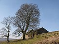
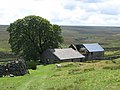
 Barn at Harwood Shield - geograph.org.uk - 685117.jpg 640 × 480; 146 KB
-
 Barn at Riddlehamhope (2) - geograph.org.uk - 685010.jpg 640 × 480; 94 KB
-
 Barn at Riddlehamhope - geograph.org.uk - 685006.jpg 640 × 480; 93 KB
-
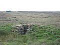
 Blocked up sheephole in drystone wall - geograph.org.uk - 507435.jpg 640 × 480; 137 KB
-

-

-
 Bridge on the Long Drag - geograph.org.uk - 839930.jpg 640 × 480; 105 KB
-
 Bridge over Sinderhope Burn (2) - geograph.org.uk - 1802781.jpg 640 × 480; 143 KB
-
 Bridge over Sinderhope Burn - geograph.org.uk - 529001.jpg 640 × 480; 162 KB
-
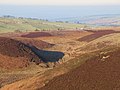
 Broad Mere - geograph.org.uk - 1419809.jpg 640 × 480; 80 KB
-

-
 Cliffs above the East Allen - geograph.org.uk - 408316.jpg 640 × 480; 164 KB
-
 Come on then, fold me - geograph.org.uk - 507481.jpg 640 × 480; 137 KB
-

-

-
 Dangerous bridge - geograph.org.uk - 705977.jpg 640 × 480; 133 KB
-
 Double rainbow over Shieldburn Hall - geograph.org.uk - 948632.jpg 640 × 456; 33 KB
-
 East Allen Dale (2) - geograph.org.uk - 682019.jpg 640 × 480; 88 KB
-
 East Allen Dale (2) - geograph.org.uk - 685151.jpg 640 × 411; 64 KB
-
 East Allen Dale (3) - geograph.org.uk - 685759.jpg 640 × 480; 72 KB
-
 East Allen Dale (4) - geograph.org.uk - 685763.jpg 640 × 480; 63 KB
-
 East Allen Dale (5) - geograph.org.uk - 685769.jpg 640 × 480; 81 KB
-
 East Allen Dale - geograph.org.uk - 620519.jpg 640 × 480; 86 KB
-
 East Allen Dale - geograph.org.uk - 679496.jpg 640 × 377; 60 KB
-
 East Allen Dale - geograph.org.uk - 682013.jpg 640 × 480; 91 KB
-

-

-
 East Allen Dale at Sinderhope (10) - geograph.org.uk - 1585640.jpg 640 × 480; 118 KB
-
 East Allen Dale at Sinderhope (11) - geograph.org.uk - 1585663.jpg 640 × 480; 103 KB
-
 East Allen Dale at Sinderhope (12) - geograph.org.uk - 1585835.jpg 640 × 480; 107 KB
-
 East Allen Dale at Sinderhope (13) - geograph.org.uk - 1586057.jpg 640 × 480; 85 KB
-
 East Allen Dale at Sinderhope (14) - geograph.org.uk - 1587411.jpg 640 × 480; 65 KB
-
 East Allen Dale at Sinderhope (2) - geograph.org.uk - 1216547.jpg 640 × 480; 79 KB
-
 East Allen Dale at Sinderhope (2) - geograph.org.uk - 1221979.jpg 640 × 480; 58 KB
-
 East Allen Dale at Sinderhope (3) - geograph.org.uk - 1216592.jpg 640 × 480; 73 KB
-
 East Allen Dale at Sinderhope (3) - geograph.org.uk - 1588160.jpg 640 × 480; 69 KB
-
 East Allen Dale at Sinderhope (4) - geograph.org.uk - 1221705.jpg 640 × 480; 81 KB
-
 East Allen Dale at Sinderhope (4) - geograph.org.uk - 1588164.jpg 640 × 480; 77 KB
-
 East Allen Dale at Sinderhope (5) - geograph.org.uk - 1221712.jpg 640 × 480; 69 KB
-
 East Allen Dale at Sinderhope (5) - geograph.org.uk - 1588168.jpg 640 × 480; 101 KB
-
 East Allen Dale at Sinderhope (6) - geograph.org.uk - 1227425.jpg 640 × 480; 74 KB
-
 East Allen Dale at Sinderhope (7) - geograph.org.uk - 1227429.jpg 640 × 480; 81 KB
-
 East Allen Dale at Sinderhope (8) - geograph.org.uk - 1227463.jpg 640 × 480; 73 KB
-
 East Allen Dale at Sinderhope (9) - geograph.org.uk - 1227475.jpg 640 × 480; 84 KB
-
 East Allen Dale at Sinderhope - geograph.org.uk - 1221958.jpg 640 × 479; 68 KB
-
 East Allen Dale at Sinderhope - geograph.org.uk - 274381.jpg 640 × 419; 63 KB
-
 East Allen Dale at Sinderhope - geograph.org.uk - 738942.jpg 640 × 480; 68 KB
-
 Edge of Allendale Moor - geograph.org.uk - 611502.jpg 640 × 480; 91 KB
-

-
 Edward VII postbox near Turf House - geograph.org.uk - 685129.jpg 480 × 640; 98 KB
-
 Embley Edge with heather in bloom - geograph.org.uk - 1540275.jpg 640 × 480; 142 KB
-
 Farm at Sinderhope - geograph.org.uk - 1221970.jpg 640 × 480; 70 KB
-
 Farm near Sinderhope - geograph.org.uk - 1212933.jpg 640 × 426; 83 KB
-
 Farmhouses at Sinderhope Gate - geograph.org.uk - 379526.jpg 640 × 424; 81 KB
-

-
 Footbridge over Acton Burn - geograph.org.uk - 405484.jpg 640 × 424; 162 KB
-
 Footbridge over Knockshield Burn - geograph.org.uk - 405479.jpg 640 × 424; 152 KB
-
 Footbridge over Quickcleugh Burn - geograph.org.uk - 507438.jpg 640 × 480; 102 KB
-
 Footbridge over sike near Crowberry Hall - geograph.org.uk - 685739.jpg 640 × 480; 151 KB
-
 Footbridge over the River East Allen (2) - geograph.org.uk - 651123.jpg 480 × 640; 133 KB
-
 Footbridge over the River East Allen (3) - geograph.org.uk - 1586037.jpg 640 × 480; 148 KB
-
 Footbridge over the River East Allen (4) - geograph.org.uk - 1586064.jpg 640 × 480; 161 KB
-
 Footbridge over the River East Allen - geograph.org.uk - 1700812.jpg 1,600 × 1,095; 496 KB
-
 Footbridge over the River East Allen - geograph.org.uk - 390990.jpg 640 × 480; 142 KB
-

-

-

-
 Footpath to Finney Hill Green - geograph.org.uk - 680785.jpg 480 × 640; 106 KB
-
 Footpath to Holms Linn (2) - geograph.org.uk - 1585824.jpg 640 × 480; 99 KB
-
 Footpath to Holms Linn (3) - geograph.org.uk - 1802762.jpg 640 × 480; 136 KB
-
 Footpath to Holms Linn - geograph.org.uk - 1585658.jpg 640 × 480; 112 KB
-
 Footpath to Snowland - geograph.org.uk - 649936.jpg 640 × 480; 76 KB
-
 Foxglove near Allendale Town - geograph.org.uk - 475451.jpg 480 × 640; 49 KB
-

-
-

-
 GR "Ludlow" postbox at Sinderhope - geograph.org.uk - 1216577.jpg 480 × 640; 105 KB
-
 Grouse butt - geograph.org.uk - 443680.jpg 640 × 480; 83 KB
-
 Halleywell Farm (3) - geograph.org.uk - 508180.jpg 640 × 480; 94 KB
-
 Halleywell Farm (4) - geograph.org.uk - 694067.jpg 640 × 480; 95 KB
-
 Halleywell Farm (5) - geograph.org.uk - 705889.jpg 640 × 481; 65 KB
-
 Halleywell Farm - geograph.org.uk - 504232.jpg 640 × 480; 94 KB
-
 Harwood Carrs - geograph.org.uk - 443711.jpg 640 × 480; 115 KB
-
 Hay Rake and beyond - geograph.org.uk - 679493.jpg 640 × 480; 64 KB
-
 Heather burning on Hexhamshire Common - geograph.org.uk - 578993.jpg 640 × 424; 49 KB
-
 Hexhamshire Common (2) - geograph.org.uk - 692323.jpg 640 × 480; 95 KB
-
 Hexhamshire Common (3) - geograph.org.uk - 692326.jpg 640 × 480; 78 KB
-
 Hexhamshire Common (4) - geograph.org.uk - 692333.jpg 640 × 480; 94 KB
-
 Hexhamshire Common (5) - geograph.org.uk - 692353.jpg 640 × 480; 91 KB
-
 Hexhamshire Common (6) - geograph.org.uk - 692385.jpg 640 × 480; 93 KB
-
 Hexhamshire Common (7) - geograph.org.uk - 1419817.jpg 640 × 480; 73 KB
-
 Hexhamshire Common - geograph.org.uk - 692318.jpg 640 × 480; 78 KB
-

-

-

-
 High Green Dyke - geograph.org.uk - 229869.jpg 640 × 480; 353 KB
-
 Hill 374 on Westburnhope Moor - geograph.org.uk - 692378.jpg 640 × 480; 81 KB
-
 Hill 421 - geograph.org.uk - 444452.jpg 640 × 480; 96 KB
-
 Holmes Linn Mine. - geograph.org.uk - 274386.jpg 640 × 432; 99 KB
-

-

-
 Long Drag - geograph.org.uk - 385970.jpg 640 × 424; 108 KB
-
 Most drystone walls are straight - geograph.org.uk - 1081495.jpg 640 × 480; 102 KB
-
 Newfold House, Sinderhope - geograph.org.uk - 480818.jpg 640 × 480; 83 KB
-
 Old field gate - geograph.org.uk - 628120.jpg 640 × 480; 104 KB
-
 Old lime kiln - geograph.org.uk - 385888.jpg 640 × 424; 108 KB
-
 On Allendale Moor - geograph.org.uk - 611499.jpg 640 × 480; 88 KB
-
 Panorama from Shield Bank (1, S) - geograph.org.uk - 1390694.jpg 640 × 480; 80 KB
-
 Panorama from Shield Bank (2, SSE) - geograph.org.uk - 1390698.jpg 640 × 480; 77 KB
-
 Panorama from Shield Bank (3, SE) - geograph.org.uk - 1390703.jpg 640 × 480; 75 KB
-
 Panorama from Shield Bank (4, ESE) - geograph.org.uk - 1390727.jpg 640 × 480; 80 KB
-
 Panorama from Shield Bank (5, E) - geograph.org.uk - 1390728.jpg 640 × 480; 90 KB
-
 Panorama from Shield Bank (6, ENE) - geograph.org.uk - 1390729.jpg 640 × 480; 87 KB
-
 Panorama from Shield Bank (7, NE) - geograph.org.uk - 1390732.jpg 640 × 480; 80 KB
-
 Panorama from Shield Bank (8, NNE) - geograph.org.uk - 1390734.jpg 640 × 480; 81 KB
-
 Panorama from Shield Bank (9, N) - geograph.org.uk - 1390736.jpg 640 × 480; 73 KB
-

-
 Pastures above the East Allen - geograph.org.uk - 618766.jpg 640 × 480; 71 KB
-

-

-

-

-

-
 River East Allen - geograph.org.uk - 155755.jpg 640 × 480; 101 KB
-

-

-

-

-

-
 Rowley Burn - geograph.org.uk - 385819.jpg 640 × 424; 120 KB
-
 Rowley Burn - geograph.org.uk - 385827.jpg 640 × 424; 136 KB
-
 Rowley Burn valley - geograph.org.uk - 385936.jpg 640 × 424; 101 KB
-
 Self portrait in snow - geograph.org.uk - 648877.jpg 640 × 480; 39 KB
-
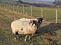 Sheep grazing near Pry Hill - geograph.org.uk - 686654.jpg 640 × 480; 114 KB
-
 Sheep hole near High Acton - geograph.org.uk - 620430.jpg 640 × 480; 94 KB
-
 Sheep in the snow - geograph.org.uk - 1080864.jpg 640 × 480; 41 KB
-
 Sheep looking for the crock of gold - geograph.org.uk - 948640.jpg 640 × 480; 39 KB
-
 Sheepfold (2) - geograph.org.uk - 509357.jpg 640 × 480; 92 KB
-
 Sheepfold and upper valley of Sipton Burn - geograph.org.uk - 444534.jpg 640 × 480; 111 KB
-

-
 Sheephole near The Spittal - geograph.org.uk - 692469.jpg 640 × 480; 91 KB
-

-
 Should ewe be here^ - geograph.org.uk - 1805728.jpg 480 × 640; 93 KB
-
 Sign to Heatheryburn - geograph.org.uk - 685111.jpg 480 × 640; 105 KB
-
 Sinderhope - geograph.org.uk - 298435.jpg 640 × 480; 173 KB
-
 Sinderhope Burn in the snow - geograph.org.uk - 2214308.jpg 640 × 480; 119 KB
-
 Sinderhope Carrs (2) - geograph.org.uk - 444522.jpg 640 × 480; 87 KB
-
 Sinderhope Carrs (2) - geograph.org.uk - 5183008.jpg 640 × 480; 97 KB
-
 Sinderhope Carrs (2) - geograph.org.uk - 5243588.jpg 640 × 480; 115 KB
-
 Sinderhope Carrs (2) - geograph.org.uk - 5376810.jpg 640 × 480; 90 KB
-
 Sinderhope Carrs (3) - geograph.org.uk - 5183010.jpg 640 × 480; 108 KB
-
 Sinderhope Carrs (3) - geograph.org.uk - 5243590.jpg 640 × 480; 125 KB
-
 Sinderhope Carrs - geograph.org.uk - 1140359.jpg 640 × 376; 61 KB
-
 Sinderhope Carrs - geograph.org.uk - 442806.jpg 640 × 480; 108 KB
-
 Sinderhope Carrs - geograph.org.uk - 5183005.jpg 640 × 480; 92 KB
-
 Sinderhope Carrs - geograph.org.uk - 5217018.jpg 640 × 480; 92 KB
-
 Sinderhope Carrs - geograph.org.uk - 5243584.jpg 640 × 480; 99 KB
-
 Sinderhope Carrs - geograph.org.uk - 5376807.jpg 640 × 480; 89 KB
-
 Sinderhope Carrs - geograph.org.uk - 5406129.jpg 640 × 480; 91 KB
-
 Sinderhope Community Centre - geograph.org.uk - 461282.jpg 640 × 480; 115 KB
-
 Sinderhope Gate - geograph.org.uk - 389234.jpg 640 × 480; 106 KB
-
 Sinderhope Gate around Newfold House - geograph.org.uk - 4202680.jpg 640 × 480; 110 KB
-
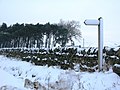
 Sinderhope Gate in the snow - geograph.org.uk - 1672040.jpg 640 × 480; 66 KB
-
 Sinderhope Gate in the snow - geograph.org.uk - 3414750.jpg 640 × 480; 44 KB
-
 Sinderhope in the snow - geograph.org.uk - 1672152.jpg 640 × 480; 68 KB
-
 Sinderhope in the snow - geograph.org.uk - 2199091.jpg 640 × 480; 88 KB
-
 Sinderhope Lodge - geograph.org.uk - 444524.jpg 640 × 480; 80 KB
-
 Sinderhope Methodist Chapel, Allendale - geograph.org.uk - 3654239.jpg 1,824 × 1,368; 896 KB
-
 Sinderhope Pony Trekking Centre - geograph.org.uk - 1221943.jpg 640 × 480; 67 KB
-
 Sinderhope Post Box - geograph.org.uk - 274382.jpg 469 × 640; 100 KB
-
 Sipton Burn below the Long Drag bridge - geograph.org.uk - 444538.jpg 480 × 640; 132 KB
-

-
 Snowy East Allen Dale at Sinderhope - geograph.org.uk - 1745407.jpg 640 × 480; 80 KB
-

-

-

-
 Snowy pastures east of Holms Hill - geograph.org.uk - 1670622.jpg 640 × 480; 42 KB
-
 Soulsby's Allotment - geograph.org.uk - 692442.jpg 640 × 480; 99 KB
-
 Steps on the footpath down to Acton Burn - geograph.org.uk - 686633.jpg 480 × 640; 135 KB
-
 Stone parapets of Sinderhope Bridge - geograph.org.uk - 3654275.jpg 1,507 × 887; 351 KB
-

-

-
 Swampy Sike and Sinderhope Lodge - geograph.org.uk - 385590.jpg 640 × 424; 90 KB
-
 The B6295, Sinderhope - geograph.org.uk - 298442.jpg 640 × 480; 180 KB
_-_geograph.org.uk_-_1540356.jpg)

_currick_on_Sinderhope_Carrs_-_geograph.org.uk_-_5183009.jpg)
_sheephole_in_a_drystone_wall_near_High_Scotch_Hall_-_geograph.org.uk_-_822095.jpg)
_Hexhamshire_Common_with_heather_in_bloom_-_geograph.org.uk_-_537449.jpg)


_-_geograph.org.uk_-_686624.jpg)


_-_geograph.org.uk_-_454939.jpg)


_-_geograph.org.uk_-_685010.jpg)


_-_geograph.org.uk_-_1802781.jpg)


_-_geograph.org.uk_-_681965.jpg)


_-_geograph.org.uk_-_682019.jpg)
_-_geograph.org.uk_-_685151.jpg)
_-_geograph.org.uk_-_685759.jpg)
_-_geograph.org.uk_-_685763.jpg)
_-_geograph.org.uk_-_685769.jpg)


_-_geograph.org.uk_-_1039489.jpg)

_-_geograph.org.uk_-_1585640.jpg)
_-_geograph.org.uk_-_1585663.jpg)
_-_geograph.org.uk_-_1585835.jpg)
_-_geograph.org.uk_-_1586057.jpg)
_-_geograph.org.uk_-_1587411.jpg)
_-_geograph.org.uk_-_1216547.jpg)
_-_geograph.org.uk_-_1221979.jpg)
_-_geograph.org.uk_-_1216592.jpg)
_-_geograph.org.uk_-_1588160.jpg)
_-_geograph.org.uk_-_1221705.jpg)
_-_geograph.org.uk_-_1588164.jpg)
_-_geograph.org.uk_-_1221712.jpg)
_-_geograph.org.uk_-_1588168.jpg)
_-_geograph.org.uk_-_1227425.jpg)
_-_geograph.org.uk_-_1227429.jpg)
_-_geograph.org.uk_-_1227463.jpg)
_-_geograph.org.uk_-_1227475.jpg)


_bus_shelter_near_Turf_House_-_geograph.org.uk_-_685127.jpg)


_-_geograph.org.uk_-_737580.jpg)


_-_geograph.org.uk_-_651123.jpg)
_-_geograph.org.uk_-_1586037.jpg)
_-_geograph.org.uk_-_1586064.jpg)


_-_geograph.org.uk_-_1586083.jpg)


_-_geograph.org.uk_-_1585824.jpg)
_-_geograph.org.uk_-_1802762.jpg)


_-_geograph.org.uk_-_681988.jpg)
_-_geograph.org.uk_-_685106.jpg)
_-_geograph.org.uk_-_701131.jpg)


_-_geograph.org.uk_-_508180.jpg)
_-_geograph.org.uk_-_694067.jpg)
_-_geograph.org.uk_-_705889.jpg)


_-_geograph.org.uk_-_692323.jpg)
_-_geograph.org.uk_-_692326.jpg)
_-_geograph.org.uk_-_692333.jpg)
_-_geograph.org.uk_-_692353.jpg)
_-_geograph.org.uk_-_692385.jpg)
_-_geograph.org.uk_-_1419817.jpg)

_-_geograph.org.uk_-_2461028.jpg)


_-_geograph.org.uk_-_1390694.jpg)
_-_geograph.org.uk_-_1390698.jpg)
_-_geograph.org.uk_-_1390703.jpg)
_-_geograph.org.uk_-_1390727.jpg)
_-_geograph.org.uk_-_1390728.jpg)
_-_geograph.org.uk_-_1390729.jpg)
_-_geograph.org.uk_-_1390732.jpg)
_-_geograph.org.uk_-_1390734.jpg)
_-_geograph.org.uk_-_1390736.jpg)
_-_geograph.org.uk_-_1536347.jpg)


_-_geograph.org.uk_-_648084.jpg)
_-_geograph.org.uk_-_648086.jpg)
_-_geograph.org.uk_-_651116.jpg)
_-_geograph.org.uk_-_1585860.jpg)


_-_geograph.org.uk_-_509357.jpg)


_-_geograph.org.uk_-_444522.jpg)
_-_geograph.org.uk_-_5183008.jpg)
_-_geograph.org.uk_-_5243588.jpg)
_-_geograph.org.uk_-_5376810.jpg)
_-_geograph.org.uk_-_5183010.jpg)
_-_geograph.org.uk_-_5243590.jpg)


