Category:Simpson and Ashland
Jump to navigation
Jump to search
civil parish in Milton Keynes, Buckinghamshire, England | |||||
| Upload media | |||||
| Instance of | |||||
|---|---|---|---|---|---|
| Location | City of Milton Keynes, Buckinghamshire, South East England, England | ||||
| Population |
| ||||
 | |||||
Subcategories
This category has only the following subcategory.
S
Media in category "Simpson and Ashland"
The following 58 files are in this category, out of 58 total.
-
 24 Flexerne Crescent, Milton Keynes - geograph.org.uk - 2828474.jpg 4,000 × 3,000; 1.3 MB
-
 A weir on the River Ouzel - geograph.org.uk - 5770211.jpg 2,700 × 2,002; 395 KB
-
 A weir on the River Ouzel - geograph.org.uk - 5770227.jpg 2,700 × 2,025; 711 KB
-
 Around Simpson - geograph.org.uk - 5153861.jpg 480 × 640; 84 KB
-
 Around Simpson - geograph.org.uk - 5153863.jpg 640 × 480; 52 KB
-
 Around Simpson - geograph.org.uk - 5153865.jpg 640 × 480; 66 KB
-
 Ashland fountain - geograph.org.uk - 2862757.jpg 1,600 × 1,068; 344 KB
-
 Ashland housing - geograph.org.uk - 2862749.jpg 640 × 427; 67 KB
-
 Beneath Simpson Road Bridge No 92A - geograph.org.uk - 4750744.jpg 646 × 800; 89 KB
-
 Bowlers Bridge No 91 - geograph.org.uk - 4750715.jpg 800 × 598; 163 KB
-
 Bridge 90C, Grand Junction Canal - geograph.org.uk - 2668223.jpg 4,000 × 3,000; 5.07 MB
-
 Bridge 91, Grand Junction Canal - geograph.org.uk - 2668218.jpg 4,000 × 3,000; 5.04 MB
-
 Bridge 92, Grand Junction Canal - geograph.org.uk - 2668211.jpg 4,000 × 3,000; 4.66 MB
-
 Caldecote Lake and Pub, Milton Keynes - geograph.org.uk - 1908743.jpg 640 × 450; 335 KB
-
 Canalside living - geograph.org.uk - 2845594.jpg 1,600 × 1,200; 394 KB
-
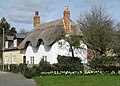 Chocolate box thatch - geograph.org.uk - 1219850.jpg 640 × 460; 83 KB
-
 Domino's Distribution Centre - geograph.org.uk - 2862739.jpg 640 × 428; 74 KB
-
 Footbridge connecting Ashland to Simpson - geograph.org.uk - 1866450.jpg 640 × 480; 217 KB
-
 Footbridge over the River Ouzel - geograph.org.uk - 5770201.jpg 2,700 × 2,025; 578 KB
-
 Footbridge over the River Ouzel - geograph.org.uk - 5770207.jpg 2,700 × 2,025; 833 KB
-
 Footbridge over the River Ouzel - geograph.org.uk - 5770286.jpg 2,700 × 2,025; 502 KB
-

-
 Grand Union Canal Walk - geograph.org.uk - 5628004.jpg 640 × 480; 121 KB
-
 Grand Union Canal Walk - geograph.org.uk - 5628006.jpg 640 × 480; 94 KB
-
 Grand Union Canal Walk - geograph.org.uk - 5628007.jpg 640 × 480; 91 KB
-
 Grand Union Canal, Bridge Number 91 - geograph.org.uk - 3683570.jpg 640 × 480; 104 KB
-
 Grand Union Canal, Bridge Number 92 - geograph.org.uk - 3683615.jpg 640 × 480; 90 KB
-
 Grand Union Canal, Reach in Simpson - geograph.org.uk - 3683602.jpg 640 × 480; 81 KB
-
 Groveway - Milton Keynes - geograph.org.uk - 2674288.jpg 640 × 412; 57 KB
-
 Groveway crossing River Ouzel - geograph.org.uk - 2670467.jpg 800 × 505; 70 KB
-
 Layby on the A5, Bletchley - geograph.org.uk - 6559546.jpg 1,892 × 1,236; 1.62 MB
-
 Marlborough Street from a Footbridge - geograph.org.uk - 1866429.jpg 640 × 480; 190 KB
-
 Milestone 37 - geograph.org.uk - 4797518.jpg 1,000 × 750; 237 KB
-
 Milton Keynes , Groveway - geograph.org.uk - 5733013.jpg 6,000 × 4,000; 7.64 MB
-
 Milton Keynes , Groveway - geograph.org.uk - 5733016.jpg 6,000 × 4,000; 7.38 MB
-
 Milton Keynes , Groveway - geograph.org.uk - 5733027.jpg 6,000 × 4,000; 7.73 MB
-
 Milton Keynes , Redmoor Roundabout - geograph.org.uk - 5733018.jpg 6,000 × 4,000; 6.74 MB
-
 Milton Keynes , Simpson Roundabout - geograph.org.uk - 5733014.jpg 6,000 × 4,000; 7.73 MB
-
 Milton Keynes , The A5 - geograph.org.uk - 5733028.jpg 6,000 × 4,000; 5.85 MB
-
 Milton Keynes , The A5 - geograph.org.uk - 5733029.jpg 6,000 × 4,000; 6.1 MB
-
 Milton Keynes , The A5 - geograph.org.uk - 5733030.jpg 6,000 × 4,000; 7.01 MB
-
 MK Roundabout01.JPG 2,304 × 1,536; 714 KB
-
 New Housing at Ashland - geograph.org.uk - 1866463.jpg 640 × 480; 208 KB
-
 Path to Netherfield - geograph.org.uk - 2862745.jpg 640 × 427; 109 KB
-
 Penshurst Crescent, Milton Keynes - geograph.org.uk - 2828471.jpg 4,000 × 3,000; 1.73 MB
-
 Saxon Street - geograph.org.uk - 2674285.jpg 640 × 391; 48 KB
-
 Simpson Bridge over the River Ouzel - geograph.org.uk - 5770237.jpg 2,700 × 2,025; 653 KB
-
 Simpson Road - geograph.org.uk - 1586883.jpg 640 × 480; 349 KB
-
 Simpson-m-k-1.jpg 1,148 × 825; 184 KB
-
 Slip road to A5 from Bletcham Way - geograph.org.uk - 3675578.jpg 640 × 410; 58 KB
-
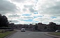
 The City of Roundabouts - geograph.org.uk - 1866407.jpg 640 × 480; 162 KB
-
 The Plough in Simpson, Milton Keynes - geograph.org.uk - 4750723.jpg 800 × 716; 203 KB
-
 The River Ouzel in Milton Keynes - geograph.org.uk - 5770196.jpg 2,700 × 2,025; 482 KB
-
 The River Ouzel in Milton Keynes - geograph.org.uk - 5770199.jpg 2,700 × 2,025; 915 KB
-
 The River Ouzel in Milton Keynes - geograph.org.uk - 5770216.jpg 2,700 × 2,025; 721 KB
-
 The Showhouse at Ashland - geograph.org.uk - 1866478.jpg 640 × 480; 184 KB
-
 Walton Road - geograph.org.uk - 1586876.jpg 640 × 480; 225 KB
-
 Weir on the River Ouzel - geograph.org.uk - 5895530.jpg 768 × 1,024; 140 KB


