Category:Signs of educational trails in Czechia
Jump to navigation
Jump to search
Subcategories
This category has the following 2 subcategories, out of 2 total.
G
- Signs of Greenway Botič (16 F)
Media in category "Signs of educational trails in Czechia"
The following 71 files are in this category, out of 71 total.
-
 1.díl html m57a2104b.jpg 1,200 × 1,600; 1.95 MB
-
 25.8.16 Pamatnik Lety 03 (28940934700).jpg 6,016 × 4,000; 7.83 MB
-
 350 02 Lipová, Czech Republic - panoramio (3).jpg 2,048 × 1,536; 1.56 MB
-
 350 02 Lipová, Czech Republic - panoramio (9).jpg 2,048 × 1,536; 1.62 MB
-
 Břežanské údolí, Keltská stezka.jpg 3,264 × 2,448; 1.32 MB
-
 Chapel of Saint Odile (Žireč) 02.JPG 1,984 × 1,488; 649 KB
-
 Choceň, turistické značky u Hlavačova.jpg 3,264 × 2,448; 1.16 MB
-
 Davle-šipka-naučné-stezky-Střed-Čech-u-Starého-davelského-mostu2016.jpg 6,000 × 4,000; 10.97 MB
-
 Dubá, rozcestník u autobusového nádraží, modrá a Dubský okruh.jpg 3,264 × 2,448; 911 KB
-
 Hiking signs Divci kamen.jpg 768 × 1,054; 138 KB
-
 Hloubětín, K náhonu, cyklotrasa a naučná stezka (01).jpg 3,888 × 5,184; 7.2 MB
-
 Hloubětín, K náhonu, cyklotrasa a naučná stezka (02).jpg 3,888 × 5,184; 6.79 MB
-
 Hloubětín, K náhonu, cyklotrasa a naučná stezka, šipky.jpg 3,888 × 5,184; 4.4 MB
-
 Hloubětín, K náhonu, cyklotrasa a naučná stezka.jpg 2,448 × 3,264; 2.08 MB
-
 Hostivař, naučná stezka a Greenway Botič.jpg 2,448 × 3,264; 1.83 MB
-
 Humpolec, Na štulách, značky (01).jpg 3,648 × 2,736; 3.5 MB
-
 Humpolec, Na štulách, značky (02).jpg 3,648 × 2,736; 4.49 MB
-
 Humpolec, Na štulách, značky (03).jpg 2,466 × 3,223; 1.23 MB
-
 Humpolec, Orlík, značka naučné stezky.jpg 3,489 × 2,573; 699 KB
-
 Háje, naučná stezka, 16.jpg 3,264 × 2,448; 693 KB
-
 Háje, naučná stezka.jpg 3,264 × 2,448; 637 KB
-
 Jizerka, Mořina a pralouka.jpg 3,242 × 1,877; 777 KB
-
 Jizerka-Mořina, samorosty a poražený rozcestník.jpg 3,264 × 2,448; 2.73 MB
-
 Jizerske-hory-110.jpg 1,704 × 2,272; 1.57 MB
-
 Jílové u Prahy, rozcestník u kaple svaté Anny.jpg 2,246 × 3,115; 778 KB
-
 Jílové u Prahy, turistické značky na elektrickém sloupu pod Pepřem.jpg 1,942 × 3,129; 680 KB
-
 Jílové u Prahy, šipky u Studeného.jpg 2,448 × 3,264; 1.43 MB
-
 K Dalejím, směrovka naučné stezky u Jezírka.jpg 3,264 × 2,448; 1.51 MB
-
 Liberec-Hluboká, U Lomu.jpg 2,048 × 1,536; 739 KB
-
 Na Jetelce, značka TVO VPS.jpg 3,264 × 2,448; 895 KB
-
 Nature trail.svg 390 × 390; 666 bytes
-
 Naucna-stezka.svg 390 × 390; 666 bytes
-
 Nauč.stezka.jpg 640 × 480; 184 KB
-
 Naučná stezka mezi Hronovem a Velkým Poříčím.jpg 4,000 × 3,000; 6.09 MB
-
 Naučná stezka, šipka.jpg 2,048 × 1,536; 644 KB
-
 Naučný chodník na Radhošti - panoramio.jpg 3,648 × 2,736; 1.99 MB
-
 Neřežín, směrovky naučné stezky Okolím Komárova.jpg 3,648 × 2,736; 3.41 MB
-
 NS Dubsko - Kokořínsko, směrovka k zastavení 8.jpg 3,264 × 2,448; 1.23 MB
-
 NS Jílovské zlaté doly 6, Pepř - vyhlídka, značky na sloupku.jpg 2,448 × 3,264; 902 KB
-
 Opatská stezka 01.jpg 2,736 × 3,648; 901 KB
-
 Opatská stezka 06.jpg 2,736 × 3,648; 1.74 MB
-
 Opočno, 2015 (03).jpg 4,272 × 2,848; 7.63 MB
-
 Pahýl u Doutnáče, kmen.jpg 2,448 × 3,264; 1.68 MB
-
 Pastevní vrch u Růžové, výhledy, 2018 (5).jpg 3,072 × 2,304; 2.65 MB
-
 Pitkovice a Křeslice, turistické značky.jpg 3,264 × 2,448; 2.41 MB
-
 Pomník padlých z bitvy u Náchoda na křižovatce do Bražce.jpg 5,472 × 3,648; 2.83 MB
-
 Prokopské údolí, turistické značky na pilíři.jpg 2,448 × 3,264; 1.69 MB
-
 Rejkovice, značkařský kolík se značkou naučné stezky.jpg 3,648 × 2,736; 4.53 MB
-
 Rozceník NS Turyně.jpg 3,264 × 2,448; 1.57 MB
-
 Rozcestník Ještědka.jpg 1,536 × 2,048; 317 KB
-
 Rozcestník Kubrychtova bouda.jpg 1,536 × 2,048; 670 KB
-
 Rozcestník u Dubu sedmi bratří.jpg 3,264 × 2,448; 3.26 MB
-
 Satalice, K Radonicům, rozcestník u otočky.jpg 3,264 × 2,448; 801 KB
-
 Sebranice(okrSvitavy)-naučná-stezka2015b.jpg 3,264 × 2,448; 3.83 MB
-
 Smerova tabule ns u eremita.JPG 3,456 × 1,944; 2.43 MB
-
 Smolotely, rybník.jpg 3,264 × 2,448; 2.3 MB
-
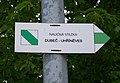 Směrovka naučné stezky Dubeč - Uhříněves.jpg 3,130 × 2,164; 444 KB
-
 Směrové šipky, žlutá a naučná, zookoutek Chuchle.jpg 2,448 × 3,264; 2.19 MB
-
 Srbsko, turistické značky na skále.jpg 2,448 × 3,264; 1.18 MB
-
 Stezka od říčky Jizerky k Bukovci.jpg 3,264 × 2,448; 3.29 MB
-
 Střekov, rozcestník Pod Setuzou.jpg 2,448 × 3,264; 642 KB
-
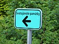 Svatojánské památky, směrovka.jpg 3,264 × 2,448; 904 KB
-
 Svatý Jan pod Skalou, rozcestník.jpg 2,448 × 3,264; 2.65 MB
-
 Svatý Jan pod Skalou, turistické směrovky.jpg 2,448 × 3,264; 1.22 MB
-
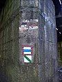
 Svatý Jan pod Skalou, turistické značky na zdi kláštera (01).jpg 3,264 × 2,448; 2.47 MB
-
 Svatý Jan pod Skalou, turistické značky na zdi kláštera.jpg 2,448 × 3,264; 2.99 MB
-
 Svatý Jan pod Skalou, turistické značky.jpg 2,448 × 3,264; 2.06 MB
-
 Turistické šipky - pásová, naučná, místní.jpg 2,448 × 3,264; 2.18 MB
-
 Z Pastevního vrchu 2020 (3).jpg 3,003 × 2,253; 1.84 MB
-
 Značení v Troji 1.jpg 2,048 × 1,536; 695 KB
-
 Úhošť 01.jpg 2,736 × 3,648; 7.51 MB

.jpg)
.jpg)
.jpg)

_02.JPG)


.jpg)
.jpg)


.jpg)
.jpg)
.jpg)


.jpg)

.jpg)


-nau%C4%8Dn%C3%A1-stezka2015b.jpg)


.jpg)


.jpg)

