Category:Signs in the London Borough of Havering
Jump to navigation
Jump to search

Subcategories
This category has the following 3 subcategories, out of 3 total.
Media in category "Signs in the London Borough of Havering"
The following 45 files are in this category, out of 45 total.
-
 All Saints Church Sign Cranham - geograph.org.uk - 2642446.jpg 1,600 × 1,200; 418 KB
-

-

-
 Conservation area information board, Gidea Park-1 - geograph.org.uk - 5365160.jpg 1,067 × 1,600; 429 KB
-
 Conservation area information board, Gidea Park-2 - geograph.org.uk - 5365152.jpg 1,067 × 1,600; 427 KB
-
 Cranham Brickfields Nature Reserve - geograph.org.uk - 4185133.jpg 3,648 × 2,736; 3.09 MB
-
 Cranham Village Sign - geograph.org.uk - 2781377.jpg 1,200 × 1,600; 298 KB
-
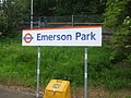
 Emerson Park Signage.jpg 4,160 × 3,120; 2.91 MB
-
 Emerson Park stn new signage.JPG 1,600 × 1,200; 642 KB
-
 Emerson Park stn old signage.JPG 1,600 × 1,200; 496 KB
-
 Emerson Park stn signage 2015.JPG 2,592 × 1,944; 1.18 MB
-
 Gidea Park stn signage.JPG 1,600 × 1,200; 472 KB
-
 Harold Wood stn signage.JPG 1,600 × 1,200; 624 KB
-
 St George, Kenilworth Gardens, Hornchurch - geograph.org.uk - 1754256.jpg 1,000 × 756; 171 KB
-
 St George, Kenilworth Gardens, Hornchurch - geograph.org.uk - 1754259.jpg 1,000 × 749; 130 KB
-
 Information board for Ingrebourne Marshes SSSI - geograph.org.uk - 5310278.jpg 3,956 × 2,586; 1.61 MB
-
 Information board, Coldharbour Lane - geograph.org.uk - 1601743.jpg 594 × 640; 128 KB
-
 Level crossing - geograph.org.uk - 4148282.jpg 640 × 480; 94 KB
-
 London Loop sign.JPG 897 × 830; 61 KB
-
 Main Lake, Bedfords Park - geograph.org.uk - 5526224.jpg 640 × 480; 154 KB
-

-
 Parish Church, Collier Row - geograph.org.uk - 91148.jpg 640 × 480; 121 KB
-
 Pillbox in Hornchurch Country Park - geograph.org.uk - 5225691.jpg 4,000 × 3,000; 4.62 MB
-
 Rainham (Essex) station signage.JPG 2,592 × 1,944; 1.21 MB
-
 Rainham Station - geograph.org.uk - 5302018.jpg 640 × 426; 81 KB
-
 Rainham Station - geograph.org.uk - 5302023.jpg 640 × 426; 67 KB
-
 Rainham Station - geograph.org.uk - 5302033.jpg 640 × 426; 76 KB
-
 Romford station signage 2015.JPG 2,592 × 1,944; 1.23 MB
-
 Romford station signage.JPG 1,600 × 1,200; 311 KB
-
 Sign, Upminster Station - geograph.org.uk - 3913579.jpg 640 × 430; 52 KB
-

-

-

-

-
 The Last Line of Defence - geograph.org.uk - 5310231.jpg 4,000 × 3,000; 4.64 MB
-
 The London loop above Pyrgo Park - geograph.org.uk - 5431498.jpg 4,000 × 3,000; 5.02 MB
-
 Train on the Romford to Upminster Line - geograph.org.uk - 5173511.jpg 1,600 × 1,200; 561 KB
-
 Train on the Romford to Upminster line near footpath 172 - geograph.org.uk - 5182123.jpg 1,600 × 1,200; 592 KB
-
 Upminster Station - geograph.org.uk - 5277763.jpg 640 × 426; 60 KB
-
 Upminster Station - geograph.org.uk - 5277764.jpg 640 × 405; 61 KB
-
 Upminster station MMB 11.jpg 3,748 × 2,576; 2.6 MB
-
 Upminster Station sign - geograph.org.uk - 3913574.jpg 640 × 430; 58 KB
-
 Upminster station signage.JPG 1,600 × 1,200; 624 KB
-

-
 Village sign on village green - geograph.org.uk - 2444258.jpg 1,000 × 718; 200 KB


_station_signage.JPG)


