Category:Signs in Southrepps
Jump to navigation
Jump to search

Subcategories
This category has the following 2 subcategories, out of 2 total.
S
- Southrepps village sign (5 F)
- Street signs in Southrepps (10 F)
Media in category "Signs in Southrepps"
The following 17 files are in this category, out of 17 total.
-
 -2018-09-29 Name sign, Antingham and Southrepps primary school, Southrepps.JPG 5,152 × 3,864; 5.88 MB
-
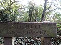 -2018-09-29 Sign, Jubilee Boardwalk, School common, Southrepps.JPG 5,152 × 3,864; 6.83 MB
-
 -2018-12-08 Sign post, Paston Way, Southrepps.JPG 3,864 × 5,152; 4.47 MB
-
 -2018-12-08 Southrepps parish council playground rules notice.JPG 5,152 × 3,864; 5.2 MB
-
 -2019-02-03 Vernon Arms pub sign, Southrepps.JPG 3,864 × 5,152; 6.98 MB
-
 -2020-06-08 Name sign, The Old Rectory, Southrepps, Norfolk.JPG 5,152 × 3,864; 7.54 MB
-
 -2020-12-21 Southern Rhodesia memorial avenue, Southrepps, Norfolk (2).JPG 1,719 × 1,323; 799 KB
-
 -2022-05-08 Direction sign, Whitegates Road, Southrepps.JPG 3,864 × 5,152; 7.49 MB
-
 2018-09-13 Network rail sign, Bittern Line, Southrepps.JPG 3,864 × 5,152; 6.8 MB
-
 Bretts Hill Railway Bridge sign, Thorpe Road, Southrepps - geograph.org.uk - 2364410.jpg 3,072 × 2,304; 1.4 MB
-
 -2020-06-08 GPO marker post, Whitegates road Southrepps.JPG 3,864 × 5,152; 6.04 MB
-
 Notice Board of St. James Church, Southrepps - geograph.org.uk - 2364551.jpg 3,072 × 2,304; 1.48 MB
-
 Roadside Nature Reserve - geograph.org.uk - 527338.jpg 480 × 640; 127 KB
-
 Sign for Wayside Cottages and Loke End - geograph.org.uk - 3136908.jpg 640 × 480; 137 KB
-
 Southern Rhodesia Memorial Avenue - geograph.org.uk - 535140.jpg 640 × 480; 87 KB
-
 Southrepps roadsign - geograph.org.uk - 2364662.jpg 2,304 × 3,072; 1.39 MB
-
 Southrepps sign - geograph.org.uk - 2364579.jpg 3,072 × 2,304; 1.19 MB


.JPG)


