Category:Signs in Hermsdorf (bei Ruhland)
Jump to navigation
Jump to search
| Object location | | View all coordinates using: OpenStreetMap |
|---|
Deutsch: Schilder in Hermsdorf (bei Ruhland)
Media in category "Signs in Hermsdorf (bei Ruhland)"
The following 20 files are in this category, out of 20 total.
-
-
-

-

-
-

-
 Hermsdorf (bei Ruhland), Eichenweg, Ostansicht von Hauptstraße, Frühsommer 2023, 01.jpg 5,328 × 4,000; 11.74 MB
-

-

-
-

-

-

-

-
 Hermsdorf (bei Ruhland), Jannowitzer Straße ostwärts vor Ortsschild, Frühsommer 2023, 01.jpg 5,328 × 4,000; 10.59 MB
-
 Hermsdorf (bei Ruhland), Jannowitzer Straße westwärts vor Ortsschild, Frühsommer 2023, 01.jpg 5,328 × 4,000; 13.07 MB
-

-

-

-

,_Abzweig_Wiesenstra%C3%9Fe_von_der_Hauptstra%C3%9Fe,_Blick_nordostw%C3%A4rts,_Fr%C3%BChsommer_2023,_01.jpg)
,_Abzweig_Wiesenstra%C3%9Fe_von_der_Hauptstra%C3%9Fe,_Blick_nordw%C3%A4rts,_Fr%C3%BChsommer_2023,_01.jpg)
,_Alte_Guteborner_Stra%C3%9Fe_nordostw%C3%A4rts_bei_Hausnr._18,_Fr%C3%BChsommer_2023,_01.jpg)
,_Alte_Guteborner_Stra%C3%9Fe_s%C3%BCdwestw%C3%A4rts_beim_Ortsschild,_Fr%C3%BChsommer_2023,_01.jpg)
,_Alte_Guteborner_Stra%C3%9Fe_s%C3%BCdwestw%C3%A4rts_beim_Ortsschild,_Fr%C3%BChsommer_2023,_02.jpg)
,_Eichenweg_bei_Kreuzung_Hauptstra%C3%9Fe,_Stieleiche_mit_Wanderwegeschild,_Fr%C3%BChsommer_2023,_01.jpg)
,_Eichenweg,_Ostansicht_von_Hauptstra%C3%9Fe,_Fr%C3%BChsommer_2023,_01.jpg)
,_Gartenstra%C3%9Fe_bei_Einm%C3%BCndung_Hauptstra%C3%9Fe,_Stra%C3%9Fenschild,_Fr%C3%BChsommer_2023,_01.jpg)
,_Gartenstra%C3%9Fe_nordostw%C3%A4rts_bei_Einm%C3%BCndung_Hauptstra%C3%9Fe,_Fr%C3%BChsommer_2023,_01.jpg)
,_Hauptstra%C3%9Fe_bei_Abzweig_Wiesenstra%C3%9Fe,_Hinweistafel_zum_Dorfbrunnen,_Fr%C3%BChsommer,_01.jpg)
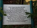
,_Hauptstra%C3%9Fe_bei_Abzweig_Wiesenstra%C3%9Fe,_NABU_Hinweistafel,_Fr%C3%BChsommer,_04.jpg)
,_Hauptstra%C3%9Fe_nordwestw%C3%A4rts_bei_Einm%C3%BCndung_Jannowitzer_Stra%C3%9Fe,_Fr%C3%BChsommer_2023,_02.jpg)
,_Hauptstra%C3%9Fe_s%C3%BCdostw%C3%A4rts_bei_Einm%C3%BCndung_Jannowitzer_Stra%C3%9Fe,_Fr%C3%BChsommer_2023,_01.jpg)
,_Jannowitzer_Stra%C3%9Fe_ostw%C3%A4rts_vor_Einm%C3%BCndung_Hauptstra%C3%9Fe,_Fr%C3%BChsommer_2023,_01.jpg)
,_Jannowitzer_Stra%C3%9Fe_ostw%C3%A4rts_vor_Ortsschild,_Fr%C3%BChsommer_2023,_01.jpg)
,_Jannowitzer_Stra%C3%9Fe_westw%C3%A4rts_vor_Ortsschild,_Fr%C3%BChsommer_2023,_01.jpg)
,_Stra%C3%9Fenschild_Friedensstra%C3%9Fe_bei_Einm%C3%BCndung_Alte_Guteborner_Stra%C3%9Fe,_Fr%C3%BChsommer_2023,_01.jpg)
,_Stra%C3%9Fenschild_Hauptstra%C3%9Fe_gegen%C3%BCber_Einm%C3%BCndung_Alte_Guteborner_Stra%C3%9Fe,_Fr%C3%BChsommer_2023,_01.jpg)
,_Stra%C3%9Fenschild_Wuppenweg_Ecke_Alte_Guteborner_Stra%C3%9Fe,_Fr%C3%BChsommer_2023,_01.jpg)
,_Wiesenstra%C3%9Fe_s%C3%BCdwestw%C3%A4rts_bei_Kreuzung_Hauptstra%C3%9Fe_und_Eichenweg,_Fr%C3%BChsommer_2023,_01.jpg)