Category:Signs in Greater Poland Voivodeship
Jump to navigation
Jump to search
Voivodeships of Poland: Greater Poland · Kuyavian-Pomeranian · Lesser Poland · Łódź · Lower Silesian · Lublin · Lubusz · Masovian · Opole · Podlaskie · Pomeranian · Silesian · Subcarpathian · Świętokrzyskie · Warmian-Masurian · West Pomeranian ·
Media in category "Signs in Greater Poland Voivodeship"
The following 200 files are in this category, out of 376 total.
(previous page) (next page)-
 Albertowsko-tablica informacyjna.jpg 1,944 × 2,592; 871 KB
-
 Bagno Chlebowo, plaque.JPG 1,360 × 2,048; 1,024 KB
-
 Bagno Chlebowo, ways (5).JPG 2,048 × 1,360; 974 KB
-
 Berzyńskie Lake in Niałek Wielki (marina) (2).jpg 2,976 × 3,968; 2.75 MB
-
 Berzyńskie Lake in Niałek Wielki (marina, plaque).jpg 3,968 × 2,976; 2.69 MB
-
 Bialosliwie Wask, impresja (7).JPG 2,048 × 1,360; 718 KB
-
 Bicycle lane in Grodzisk Wlkp..jpg 2,592 × 1,944; 961 KB
-
 Biezdruchowo Lake in Pobiedziska (7).JPG 1,986 × 1,216; 490 KB
-
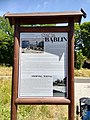 Bikeway Oborniki - Stobnica (Bablin) (2).jpg 2,976 × 3,968; 4.03 MB
-
 Bikeway Oborniki - Stobnica (Slonawy) (4).jpg 2,976 × 3,968; 3.1 MB
-
 Bikeway Oborniki - Stobnica (Slonawy, table).jpg 2,976 × 3,968; 2.37 MB
-
 Bikeway Oborniki - Stobnica (Stobnica end) (2).jpg 2,976 × 3,968; 4.57 MB
-
 Boruja Nowa - tablica informacyjna.jpg 3,264 × 2,448; 2.89 MB
-
 Buczyna Natural Reserve (5).JPG 2,048 × 1,360; 1,005 KB
-
 Budzynskie Lake WPN (2).JPG 2,048 × 1,360; 885 KB
-
 Camelus Bactrianus in ZOO Nowy Tomysl (plaque).jpg 3,968 × 2,976; 1.66 MB
-
 Castle in Sierakow (4) Warta river.JPG 2,048 × 1,360; 686 KB
-
 Cemetery Wrzesnia, money.JPG 2,738 × 1,824; 803 KB
-
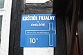 Chelst, church (5).JPG 2,048 × 1,360; 717 KB
-
 Chodziez ski slope.JPG 2,048 × 1,360; 610 KB
-
 Church of Our Lady Queen of the Polish Crown in Kotusz (5).jpg 2,736 × 3,648; 1.93 MB
-
 Church of Saint Adalbert in Dalewo (28).jpg 2,204 × 2,550; 836 KB
-
 Church of Saint Thecla in Dobrzyca (2).jpg 2,736 × 3,648; 1.91 MB
-
 Church of the Assumption in Czerlejno (16).jpg 2,488 × 2,361; 1.51 MB
-
 Church of the Assumption in Mórka (13).jpg 3,648 × 2,736; 2.27 MB
-
 Cmentarzysko kurhanowe w Wilanowie - tablica informacyjna.jpg 2,272 × 1,704; 1.22 MB
-
 Czapury, os. Lesne.JPG 2,048 × 1,360; 588 KB
-
 Message board Czermin.jpg 2,592 × 1,944; 1.03 MB
-
 Daniele (plaque).jpg 3,648 × 2,736; 1.96 MB
-
 Debno natural reserve (gm. Rawicz) (2).JPG 2,048 × 1,360; 649 KB
-
 Debno natural reserve (gm. Rawicz) (9).JPG 2,048 × 1,360; 967 KB
-
 Debno, plan of reserve.JPG 703 × 1,016; 129 KB
-
 Dobrzyca plan plaque.jpg 2,991 × 2,563; 1.79 MB
-
 Dworzyska, Instytut Zootechniki 03.JPG 1,365 × 1,142; 353 KB
-
 Dziedzictwo kulinarne Wielkopolska.JPG 2,048 × 1,360; 675 KB
-
 Dziewicza Gora (osada, village) (11).JPG 2,020 × 1,057; 957 KB
-
 Dziewicza Gora (osada, village) (13).JPG 1,698 × 1,319; 487 KB
-
 Dzwonowo (2).JPG 2,048 × 1,360; 700 KB
-
 Dąb Napoleon, tablica informacyjna.jpg 1,530 × 2,040; 370 KB
-
 Evangelical cemetery in Stobnica, Notec Forest (6).jpg 3,968 × 2,976; 5.48 MB
-
 Evangelical church in Swarzedz (3).jpg 3,648 × 2,736; 2.2 MB
-
 Ferry Wartoslaw 2.JPG 2,048 × 1,360; 685 KB
-
 Gajowka Sobota.JPG 1,365 × 909; 435 KB
-
 Gebiczyn, gm. Czarnkow (4).JPG 1,726 × 989; 310 KB
-
 Gebiczyn, gm. Czarnkow (7).JPG 1,366 × 1,259; 345 KB
-
 Glowki Lake, Mialy.JPG 2,048 × 1,360; 1.03 MB
-
 Gmina Olszowka, UMiG (1).jpg 2,332 × 2,492; 1.11 MB
-
 Gorka village, WPN (3).jpg 3,648 × 2,736; 2.12 MB
-
 Gozdzik Siny winter.JPG 1,921 × 1,360; 565 KB
-
 Granica lesnictw Wronki i Potrzebowo (2).JPG 2,048 × 1,360; 849 KB
-
 Groby Lasy Kobylnickie 2012 (2).JPG 2,048 × 1,360; 901 KB
-
 Groby Roznowo (14).JPG 2,736 × 3,648; 1.9 MB
-
 Grodziska Strefa Przemysłowa.jpg 2,592 × 1,944; 959 KB
-
 Grzebienisko-08112905.jpg 1,653 × 1,653; 378 KB
-
 Grzybno (Wlkp) (3).JPG 2,048 × 1,360; 707 KB
-
 Holy Cross church in Karolinki (2).jpg 3,968 × 2,976; 2.62 MB
-
 Hotel pod Złotym Orłem-Nowy Tomyśl.jpg 2,592 × 1,944; 1.32 MB
-
 Huragan 2017 okolice Gniezna (6).jpg 3,648 × 2,736; 2.13 MB
-
 Janusz Korczak camp Antoniewo (3).JPG 2,048 × 1,360; 737 KB
-
 Jewish cemetery in Wągrowiec (3).jpg 3,968 × 2,976; 4.6 MB
-
 Jezierce, pow. Poznan (5).JPG 2,048 × 1,360; 634 KB
-
 Jezioro Dlugie kolo Pilki, Puszcza Notecka (3).JPG 2,048 × 1,207; 416 KB
-
 Jezioro Drazynek.jpg 3,407 × 2,270; 3 MB
-
 Kaminskie Lake (Puszcza Zielonka) (1).jpg 3,968 × 2,976; 2.91 MB
-
 Kaminsko, Puszcza Zielonka (3) WOPR.jpg 1,938 × 1,983; 495 KB
-
 Kamionna mile sign (2).JPG 1,365 × 1,310; 432 KB
-
 Kapliczka leśna w Ujeździe - tablica informacyjna.jpg 2,272 × 1,704; 1.33 MB
-
 Klasztorne Modrzewie plan.jpg 972 × 469; 97 KB
-
 Kociolek Lake, WPN (2).jpg 3,648 × 2,736; 1.97 MB
-
 Kolejarz, Water tower in Lobzenica (2).JPG 1,360 × 1,680; 627 KB
-
 Kosciół w Czaczu - tablica informacyjna.jpg 2,272 × 1,704; 1.27 MB
-
 Koszuty, museum, plaque.JPG 2,048 × 1,360; 676 KB
-
 Kowanowko forests, gm. Oborniki (dojazd do Grobow Roznowskich).JPG 3,648 × 2,736; 2.19 MB
-
 Kowanowko forests, gm. Oborniki (plaque).JPG 2,895 × 2,323; 1.06 MB
-
 Kowanowko, hospital (4).JPG 3,648 × 2,257; 1.32 MB
-
 Krosinko, old evang. cemetery (3).jpg 3,648 × 2,736; 2.07 MB
-
 Kuznik reservat Pila (24).JPG 2,048 × 1,360; 808 KB
-
 Kuznik reservat Pila.JPG 1,360 × 2,048; 692 KB
-
 Kwatera Aniolow in Witkowo cemetery.JPG 3,648 × 2,736; 2.74 MB
-
 Kwatera sw. Antoniego in Witkowo cemetery.JPG 3,316 × 2,401; 1.7 MB
-
 Kwiryn (erratic) (4).jpg 3,648 × 2,388; 1.21 MB
-
 Las Bytynski (23).JPG 1,366 × 909; 527 KB
-
 Las Bytynski (3).JPG 2,048 × 1,360; 1 MB
-
 Las Bytynski (Brzeki przy Starej Gajowce nat res.JPG 2,048 × 1,360; 707 KB
-
 Las Bytynski (Grzebienisko Las, Monument to victims of the Second World War) (2).JPG 1,813 × 1,360; 718 KB
-
 Las Bytynski (Huby Grzebieniskie).JPG 1,132 × 1,293; 647 KB
-
 Las Bytynski (Huby Grzebieniskie, nat. res (4).JPG 1,360 × 1,818; 750 KB
-
 Las Bytynski (Lesniczowka Bytyn).JPG 2,048 × 1,360; 503 KB
-
 Las Bytynski, Bytynskie Brzeki nat. res (2).JPG 2,048 × 1,360; 986 KB
-
 Las ktory chcialbys zwiedzac.JPG 1,219 × 1,142; 507 KB
-
 Las Laszczynski, kolo Rawicza (6).JPG 2,048 × 1,360; 952 KB
-
 Las mieszany w nadlesnictwie Lopuchowko map.jpg 519 × 444; 61 KB
-
 Las mieszany w nadlesnictwie Lopuchowko.jpg 2,592 × 1,944; 1.82 MB
-
 Lasy okolic Soboty, gm. Rokietnica 05.JPG 2,048 × 1,360; 962 KB
-
 Lasy okolic Soboty, gm. Rokietnica 06.JPG 2,048 × 1,360; 692 KB
-
 Lasy Ryczywol.JPG 2,048 × 1,360; 793 KB
-
 Lasy w okolicy Mialow.JPG 3,031 × 2,008; 1.37 MB
-
 Lednogora Poland (os. Pod Wiatrakami).JPG 1,360 × 2,048; 621 KB
-
 Leg, powiat sremski Natura 2000 Rogalinska dolina warty.jpg 3,377 × 2,262; 1.76 MB
-
 Legowskie Lake PL plaque.jpg 2,592 × 1,944; 1.07 MB
-
 Lesnictwo Bieczyny.JPG 2,048 × 1,360; 684 KB
-
 Ludwikowo Sanatorium (plan).jpg 1,323 × 1,453; 323 KB
-
 Lusowo (av.).JPG 2,048 × 1,360; 941 KB
-
 Lusowskie Lake in Lusowko village (7).JPG 2,048 × 1,360; 709 KB
-
 Lusowskie Lake x.JPG 1,360 × 2,048; 666 KB
-
 Lysy Mlyn kolo Poznania (10).jpg 2,048 × 1,536; 1.39 MB
-
 Lysy Mlyn kolo Poznania (2).jpg 1,859 × 1,535; 530 KB
-
 Marina in Czarnkow.JPG 3,648 × 2,736; 2.17 MB
-
 Memory Garden, Komorniki (9).JPG 1,360 × 1,710; 526 KB
-
 MGOK Buk - tablica.jpg 4,000 × 3,000; 4.95 MB
-
 Miala w Mialach (3).JPG 2,048 × 1,360; 754 KB
-
 Miasteczko Krajenskie PL (3).JPG 1,365 × 958; 380 KB
-
 Mieczewo, lesnictwo.JPG 1,360 × 1,811; 538 KB
-
 Mieleszyn (5).JPG 3,127 × 2,305; 1.11 MB
-
 Moczydlo Lake (2).jpg 3,968 × 2,976; 7.24 MB
-
 MOPS Dobrzyca.jpg 3,648 × 2,736; 2.2 MB
-
 MOs810 WG 14 2016 (Chatka Ornitologa) (2).JPG 3,481 × 2,475; 2.68 MB
-
 MOs810 WG 14 2016 (Excavation of bog iron in Wierzchy) (3).JPG 3,648 × 2,502; 1.9 MB
-
 MOs810 WG 14 2016 (Gorne Grady) (2).JPG 3,648 × 2,736; 2.23 MB
-
 MOs810 WG 15 2016 (Pyzdry Forest II) (bog iron mine in Lazinsk Drugi) (2).JPG 3,648 × 2,736; 2.16 MB
-
 MOs810 WG 15 2016 (Pyzdry Forest II) (Borkowo zapora) (2).JPG 3,648 × 2,736; 1.85 MB
-
 MOs810 WG 15 2016 (Pyzdry Forest II) (Borkowo zapora) (5).JPG 3,648 × 2,736; 1.69 MB
-
 MOs810 WG 15 2016 (Pyzdry Forest II) (Cemetery in Lad).JPG 3,648 × 2,594; 2.02 MB
-
 MOs810 WG 15 2016 (Pyzdry Forest II) (Grabina plaque) (2).JPG 3,648 × 2,736; 2.03 MB
-
 MOs810 WG 15 2016 (Pyzdry Forest II) (Natura 2000 in Chrusciki).JPG 3,648 × 2,736; 2.12 MB
-
 MOs810 WG 15 2016 (Pyzdry Forest II) (place of nazi executions, Grabina north) (2).JPG 2,909 × 2,292; 2.18 MB
-
 MOs810 WG 2015 22 (Notecka III) (bike road in Drawsko).JPG 2,048 × 1,360; 721 KB
-
 MOs810 WG 2015 22 (Notecka III) (Ciszkowo ferry) (5).JPG 2,048 × 1,360; 391 KB
-
 MOs810 WG 2015 22 (Notecka III) (Drawsko, wies gminna) (USC).JPG 1,681 × 909; 291 KB
-
 MOs810 WG 2015 22 (Notecka III) (national way 22 in Stare Osieczno, Poland) (2).JPG 2,048 × 1,360; 705 KB
-
 MOs810 WG 2015 22 (Notecka III) (Natura 2000, Nadnoteckie Legi) (2).JPG 2,048 × 1,360; 687 KB
-
 MOs810 WG 2015 22 (Notecka III) (pond in Nowe Dwory) (Piaskownia Surminex).JPG 2,048 × 1,360; 709 KB
-
 MOs810 WG 2017 2 (Notec Polder) (Notec Forest, Mezyk, Pozarzysko).jpg 3,035 × 2,297; 1.33 MB
-
 MOs810 WG 2017 2 (Notec Polder) (Przedlesie, nadlesnictwo Miedzychod).jpg 2,736 × 3,114; 1.75 MB
-
 MOs810 WG 2017 6 Krajna i Ziemia Zlotowska (Cemetery in Blugowo) (2).jpg 3,648 × 2,736; 2.09 MB
-
 MOs810 WG 2017 6 Krajna i Ziemia Zlotowska (Gromadno cemetery) (13).jpg 3,648 × 2,563; 1.6 MB
-
 MOs810 WG 29 2017 Opolskie Zakamarki (Moja Wola, educ. path).jpg 3,648 × 2,736; 2.11 MB
-
 MOs810 WG 29 2017 Opolskie Zakamarki (zbiornik Sosnie) (4).jpg 2,673 × 2,314; 1,004 KB
-
 MOs810 WG 55 2016 Pyzdry Forest III (Evangelical Cemetery in Stawiszyn) (plaque, entry).jpg 3,648 × 2,736; 2.18 MB
-
 MOs810 WG 55 2016 Pyzdry Forest III (Evangelical cemetery in Zamety) (sand mile).jpg 3,648 × 2,736; 2.23 MB
-
 MOs810 WG 55 2016 Pyzdry Forest III (Rychwal cemetery plan).jpg 2,939 × 1,439; 806 KB
-
 MOs810, WG 2013 21, OChK Baszkow Rochy (morena plaque).JPG 2,048 × 1,360; 643 KB
-
 MOs810, WG 2013 21, OChK Baszkow Rochy, Natural Reserve Baszkow (2).JPG 2,048 × 1,360; 878 KB
-
 MOs810, WG 2013 21, OChK Baszkow Rochy, Natural Reserve Baszkow (4).JPG 2,048 × 1,360; 704 KB
-
 MOs810, WG 2013 21, OChK Baszkow Rochy, Natural Reserve Baszkow (9).JPG 2,048 × 1,360; 718 KB
-
 MOs810, WG 2013 21, OChK Baszkow Rochy, Natural Reserve Baszkow.JPG 2,048 × 1,360; 663 KB
-
 MOs810, WG 2013 21, OChK Baszkow Rochy, Nature Reserve Mszar Bogdaniec (3).JPG 2,048 × 1,360; 694 KB
-
 MOs810, WG 2013 21, OChK Baszkow Rochy, Nature Reserve Mszar Bogdaniec (4).JPG 2,048 × 1,360; 664 KB
-
 MOs810, WG 2013 21, OChK Baszkow Rochy, Nature Reserve Mszar Bogdaniec (6).JPG 2,048 × 1,360; 723 KB
-
 MOs810, WG 2013 21, OChK Baszkow Rochy, Trafary Pond (2).JPG 2,048 × 1,360; 703 KB
-
 MOs810, WG 2013 21, OChK Baszkow Rochy, Wegielnik Pond (8).JPG 2,048 × 1,360; 723 KB
-
 MOs810, WG 2013 21, OChK Baszkow Rochy, Wegielnik Pond.JPG 2,048 × 1,360; 685 KB
-
 MOs810, WG 2014 17, OChK Jasne Pole (Lesny Punkt Edukacyjny, Dabrowa) (2).JPG 2,048 × 1,360; 697 KB
-
 MOs810, WG 2014 20, OChK Glisnica (41).JPG 1,360 × 2,048; 698 KB
-
-
-
 MOs810, WG 2014 20, OChK Las Miejski (Dabrowa Smoszew natural reserved) (10).JPG 2,048 × 1,360; 671 KB
-
 MOs810, WG 2014 20, OChK Las Miejski (Dabrowa Smoszew natural reserved) (3).JPG 2,048 × 1,360; 698 KB
-
 MOs810, WG 2014 20, OChK Las Miejski (Dabrowa Smoszew natural reserved) (5).JPG 2,048 × 1,360; 721 KB
-
 MOs810, WG 2014 20, OChK Las Miejski (Dabrowa Smoszew natural reserved) (8).JPG 2,048 × 1,360; 644 KB
-
 MOs810, WG 2014 20, OChK Las Miejski (glacial erratic, Bargly).JPG 2,048 × 1,360; 683 KB
-
 MOs810, WG 2014 20, OChK Las Miejski (Krotoszyn, szaniec powstanczy) (2).JPG 2,048 × 1,360; 617 KB
-
 MOs810, WG 2014 20, OChK Las Miejski (Lesnictwo Smoszew) (2).JPG 2,048 × 1,360; 655 KB
-
 MOs810, WG 2014 20, OChK Las Miejski (Lesniczowka Helenopol) (2).JPG 2,048 × 1,360; 695 KB
-
 MOs810, WG 2014 20, OChK Las Miejski (Leśnictwo Smoszew, tilia cordata, 2).JPG 2,048 × 1,360; 810 KB
-
 MOs810, WG 2014 20, OChK Las Miejski (Miejski Bor, Krotoszyn) (10).JPG 2,048 × 1,360; 654 KB
-
 MOs810, WG 2014 20, OChK Las Miejski (Miejski Bor, Krotoszyn) (2).JPG 2,048 × 1,360; 1,001 KB
-
 MOs810, WG 2014 20, OChK Las Miejski (Miejski Bor, Krotoszyn) (5).JPG 1,360 × 2,048; 694 KB
-
 MOs810, WG 2014 20, OChK Las Miejski (Panienka church) (9).JPG 2,048 × 1,360; 655 KB
-
 MOs810, WG 2014 20, OChK Las Miejski (Rozdrazewski Quercus).JPG 2,048 × 1,360; 825 KB
-
 MOs810, WG 2014 20, OChK Las Miejski (St Martin well).JPG 2,048 × 1,360; 690 KB
-
 MOs810, WG 2014 48, powiat obornicki (12).JPG 1,360 × 1,471; 454 KB
-
 MOs810, WG 2014 48, powiat obornicki (Oborniki water power station) (3).JPG 1,835 × 1,287; 460 KB
-
 MOs810, WG 2014 48, powiat obornicki (Oborniki water power station) (6).JPG 1,109 × 1,187; 369 KB
-
 MOs810, WG 2014 48, powiat obornicki (rezerwat Promenada) (4).JPG 2,048 × 1,360; 900 KB
-
 MOs810, WG 2014 48, powiat obornicki (rezerwat przyrody Slonawy) (26).JPG 2,048 × 1,360; 895 KB
-
 MOs810, WG 2014 48, powiat obornicki (rezerwat przyrody Slonawy).JPG 1,365 × 924; 317 KB
-
 MOs810, WG 2014 48, powiat obornicki (rezerwat Welna) (2).JPG 2,048 × 1,360; 827 KB
-
 MOs810, WG 2014 48, powiat obornicki (rezerwat Welna) (33).JPG 2,048 × 1,360; 826 KB
-
 MOs810, WG 2014 48, powiat obornicki (rezerwat Welna).JPG 2,048 × 1,360; 641 KB
-
 MOs810, WG 2014 48, powiat obornicki (Roznowo Mlyn) (6).JPG 2,048 × 1,360; 652 KB
-
 MOs810, WG 2014 48, powiat obornicki, rezerwat Dolega (9).JPG 1,360 × 2,048; 705 KB
-
 MOs810, WG 2014 56 Oledry nowotomyskie (Chojniki) (10).JPG 2,048 × 1,360; 748 KB
-
 MOs810, WG 2014 56 Oledry nowotomyskie (Przylek, stalag) (3).JPG 1,360 × 1,899; 562 KB
-
 MOs810, WG 2014 56 Oledry nowotomyskie (zalew Miedzichowo) (6).JPG 2,048 × 1,360; 620 KB
-
 MOs810, WG 2015 54 Okonecczyzna (Borucino church) (5).JPG 2,218 × 1,824; 1.04 MB
-
 MOs810, WG 2015 54 Okonecczyzna (Brokecino, church) (2) plaque.JPG 3,648 × 2,736; 2.08 MB
-
 MOs810, WG 2015 54 Okonecczyzna (Bąk Lake in Okonek).JPG 3,648 × 2,414; 1.69 MB
-
 MOs810, WG 2015 54 Okonecczyzna (murawy kserotermiczne Ujscie).JPG 2,681 × 2,126; 1.11 MB
-
 MOs810, WG 2015 54 Okonecczyzna (Samborsko) (church plaque).JPG 3,473 × 2,681; 1.85 MB
-
 MOs810, WG 2015 54 Okonecczyzna (Ujscie, stairs to observation tower).JPG 3,648 × 2,638; 2.22 MB
-
 MOs810, WG 2015 54 Okonecczyzna (UMiG Lipka Krajenska).JPG 2,799 × 2,651; 1.23 MB
-
 MOs810, WG 2015 54 Okonecczyzna, Lubnica, Greater Poland Voivodeship (Insect Park).JPG 2,117 × 1,579; 1,011 KB
-

-
 MOs810, WG 2015 8 (Bucharzewo, Nadl. Sierakow).JPG 1,426 × 1,137; 430 KB
-
 MOs810, WG 2015 8 (Ev. cemetery in Popowo, gm. Wronki) (2).JPG 2,048 × 1,360; 753 KB
-
 MOs810, WG 2015 8 (Lesny Ogrod Edukacyjny, Nadl. Sierakow, Bucharzewo) (2).JPG 1,360 × 1,867; 474 KB
-
 MOs810, WG 2015 8 (okolice wsi Bucharzewo) Sierakowski Park Krajobrazowy.JPG 1,360 × 2,048; 1.07 MB
-
 Mosciejewo, church (5).jpg 2,349 × 2,108; 1.01 MB
-
 Mosina Pozegowo Tower (3).JPG 2,048 × 1,360; 693 KB


.JPG)
_(2).jpg)
.jpg)
.JPG)

.JPG)
_(2).jpg)
_(4).jpg)
.jpg)
_(2).jpg)

.JPG)
.JPG)
.jpg)
_Warta_river.JPG)

.JPG)

.jpg)
.jpg)
.jpg)
.jpg)
.jpg)


.jpg)
_(2).JPG)
_(9).JPG)


_(11).JPG)
_(13).JPG)
.JPG)

.jpg)
.jpg)


.JPG)
.JPG)

.jpg)
.jpg)

.JPG)
.JPG)
.JPG)


_(3).JPG)
.jpg)

.jpg)
.JPG)
.jpg)
.JPG)
.JPG)

_(1).jpg)
_WOPR.jpg)
.JPG)


.jpg)
.JPG)


.JPG)
.JPG)
.JPG)
.jpg)
.JPG)


_(4).jpg)
.JPG)
.JPG)

_(2).JPG)
.JPG)
.JPG)
.JPG)
.JPG)

.JPG)


.JPG)


.jpg)
.JPG)
.JPG)

.jpg)
.jpg)

.JPG)

.JPG)
.JPG)

.JPG)
.jpg)

_(2).JPG)
_(3).JPG)
_(2).JPG)
_(bog_iron_mine_in_Lazinsk_Drugi)_(2).JPG)
_(Borkowo_zapora)_(2).JPG)
_(Borkowo_zapora)_(5).JPG)
_(Cemetery_in_Lad).JPG)
_(Grabina_plaque)_(2).JPG)
_(Natura_2000_in_Chrusciki).JPG)
_(place_of_nazi_executions,_Grabina_north)_(2).JPG)
_(bike_road_in_Drawsko).JPG)
_(Ciszkowo_ferry)_(5).JPG)
_(Drawsko,_wies_gminna)_(USC).JPG)
_(national_way_22_in_Stare_Osieczno,_Poland)_(2).JPG)
_(Natura_2000,_Nadnoteckie_Legi)_(2).JPG)
_(pond_in_Nowe_Dwory)_(Piaskownia_Surminex).JPG)
_(Notec_Forest,_Mezyk,_Pozarzysko).jpg)
_(Przedlesie,_nadlesnictwo_Miedzychod).jpg)
_(2).jpg)
_(13).jpg)
.jpg)
_(4).jpg)
_(plaque,_entry).jpg)
_(sand_mile).jpg)
.jpg)
.JPG)
.JPG)
.JPG)
.JPG)

.JPG)
.JPG)
.JPG)
.JPG)
.JPG)

_(2).JPG)
.JPG)
.JPG)
_(3).JPG)
_(10).JPG)
_(3).JPG)
_(5).JPG)
_(8).JPG)
.JPG)
_(2).JPG)
_(2).JPG)
_(2).JPG)
.JPG)
_(10).JPG)
_(2).JPG)
_(5).JPG)
_(9).JPG)
.JPG)
.JPG)
.JPG)
_(3).JPG)
_(6).JPG)
_(4).JPG)
_(26).JPG)
.JPG)
_(2).JPG)
_(33).JPG)
.JPG)
_(6).JPG)
.JPG)
_(10).JPG)
_(3).JPG)
_(6).JPG)
_(5).JPG)
_(2)_plaque.JPG)
.JPG)
.JPG)
_(church_plaque).JPG)
.JPG)
.JPG)
.JPG)
_(14).JPG)
.JPG)
_(2).JPG)
_(2).JPG)
_Sierakowski_Park_Krajobrazowy.JPG)
.jpg)
.JPG)