Category:Signs in Barnstable County, Massachusetts
Jump to navigation
Jump to search
Media in category "Signs in Barnstable County, Massachusetts"
The following 21 files are in this category, out of 21 total.
-
 2016 05 Cape Cod Museum of Natural History sign.jpg 3,264 × 2,448; 2.31 MB
-
 Bourne Town Hall sign.jpg 2,448 × 2,448; 1.81 MB
-
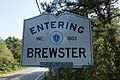 Brewster Massachusetts town sign.jpg 3,000 × 2,000; 1.92 MB
-
 Dennis Sign.JPG 2,280 × 2,280; 368 KB
-
 Dennis town sign (Massachusetts).jpg 2,000 × 3,000; 1.64 MB
-
 Eastham Massachusetts town sign.jpg 3,000 × 3,000; 2.09 MB
-
 First Encounter Beach.jpg 3,168 × 4,752; 11.04 MB
-
 Harwich Massachusetts town sign.jpg 3,000 × 2,000; 2.43 MB
-
 MA Route 130 northbound entering Mashpee MA.jpg 2,592 × 1,944; 1.28 MB
-
 MA Route 6A westbound entering Sandwich MA.jpg 3,264 × 2,176; 1.25 MB
-
 Mashpee Wampanoag Indian Museum.jpg 2,448 × 3,264; 3.36 MB
-
 MashpeeMA AvantHouse.jpg 1,024 × 680; 324 KB
-
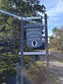
 Old Colony Nature Pathway sign, Provincetown MA.jpg 4,032 × 3,024; 5.28 MB
-
 Province Lands Bike Trail.jpg 3,000 × 2,250; 3.54 MB
-
 Provincetown bike trail - panoramio.jpg 2,048 × 1,536; 1.84 MB
-
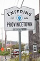 Provincetown Massachusetts town sign.jpg 2,000 × 3,000; 1.1 MB
-
 Sandwich (Massachusetts) Town Sign.jpg 2,250 × 3,000; 2.09 MB
-
 Truro Massachusetts town sign.jpg 3,000 × 3,000; 1.87 MB
-
 US Route 6 eastbound entering Truro MA.jpg 3,260 × 2,175; 1.31 MB
-
 Wellfleet Massachusetts town sign.jpg 3,000 × 3,000; 2.36 MB
-
 Yarmouth town sign (Massachusetts).jpg 2,000 × 3,000; 2.19 MB


.jpg)


_Town_Sign.jpg)


.jpg)