Category:Siedlung Halen
Jump to navigation
Jump to search
| Object location | | View all coordinates using: OpenStreetMap |
|---|
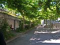
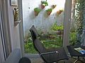
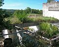
housing estate with terraced houses with a total of 79 residential units in Herrenschwanden in the canton of Bern, Switzerland  | |||||
| Upload media | |||||
| Instance of | |||||
|---|---|---|---|---|---|
| Part of | |||||
| Location |
| ||||
| Street address |
| ||||
| Architect | |||||
| Heritage designation | |||||
| Inception |
| ||||
 | |||||
Media in category "Siedlung Halen"
The following 20 files are in this category, out of 20 total.
-
 Halen 002 cropped.jpg 2,036 × 869; 1.9 MB
-
 Halen 002.jpg 3,644 × 2,292; 9.42 MB
-
 Halen 015.JPG 2,288 × 1,712; 451 KB
-
 Halen 020.JPG 2,288 × 1,712; 274 KB
-
 Halen 022.jpg 2,029 × 1,612; 426 KB
-
 Halen im Dezember1a.jpg 4,103 × 2,735; 3.78 MB
-
 Halen Sambatreppe.jpg 1,388 × 1,851; 261 KB
-
 Halengeist Luginbühl.JPG 3,240 × 4,320; 1.94 MB
-
 Halenladen.jpg 2,083 × 1,567; 254 KB
-
 Kirchlindach. Case a schiera dell'insediamento di Halen.jpg 3,000 × 2,035; 634 KB
-
 Kirchlindach. Dettaglio di un giardino dell'insediamento di Halen (DOI 21549).jpg 3,000 × 2,074; 1.17 MB
-
 Kirchlindach. Dettaglio di un giardino dell'insediamento di Halen (DOI 21551).jpg 2,024 × 3,000; 979 KB
-
 Kirchlindach. Dettaglio di un giardino dell'insediamento di Halen.jpg 3,000 × 2,050; 964 KB
-
 Kirchlindach. Dettaglio di un muro in cemento dell'insediamento di Halen.jpg 3,000 × 2,007; 710 KB
-

-

-
 Kirchlindach. Dettaglio di una delle case a schiera dell'insediamento di Halen.jpg 1,988 × 3,000; 732 KB
-

-

-


.jpg)
.jpg)


.jpg)
.jpg)

.jpg)
.jpg)
