Category:Sidewalks in Utah
Jump to navigation
Jump to search
States of the United States: Alabama · Alaska · Arizona · Arkansas · California · Colorado · Connecticut · Delaware · Florida · Georgia · Hawaii · Idaho · Illinois · Indiana · Iowa · Kansas · Kentucky · Louisiana · Maryland · Massachusetts · Michigan · Minnesota · Mississippi · Missouri · Montana · Nebraska · Nevada · New Hampshire · New Jersey · New Mexico · New York · North Carolina · North Dakota · Ohio · Oklahoma · Oregon · Pennsylvania · Rhode Island · South Carolina · South Dakota · Tennessee · Texas · Utah · Vermont · Virginia · Washington · West Virginia · Wisconsin · Wyoming – Washington, D.C.
Media in category "Sidewalks in Utah"
The following 200 files are in this category, out of 200 total.
-
 13thnear17th.jpg 1,600 × 1,200; 387 KB
-
 186bythecapitol.jpg 1,600 × 1,200; 356 KB
-
 225 S 100 E, Springville 1.jpg 2,272 × 1,704; 2.03 MB
-
 306 S, 200 W, Springville 2.JPG 2,272 × 1,704; 1.34 MB
-
 39 E 200 N, Springville.JPG 2,272 × 1,704; 1.62 MB
-

-
 9 more Seconds - panoramio.jpg 3,000 × 4,000; 4.21 MB
-
 American Fork Police Department & 4th District Court, American Fork, Utah, Jun 16.jpg 2,592 × 1,944; 2.38 MB
-
 Beautiful House at Salt Lake City UT - panoramio.jpg 2,304 × 1,728; 2.05 MB
-
 Bicycle lockers at River Trial, Jan 16.jpg 2,816 × 2,112; 2.68 MB
-
 Bicycle racks at Murray North station, Murray, Utah, Aug 16.jpg 2,592 × 1,944; 2.05 MB
-
 Brinker Ave fourplex Ogden Utah.jpg 2,560 × 1,920; 1.13 MB
-
 Bus stands at Jordan Valley station, Apr 16.jpg 2,592 × 1,944; 2.31 MB
-
 Bus stands at Murray North station, Aug 16.jpg 2,592 × 1,944; 2.41 MB
-
 BYU HR04.jpg 2,304 × 1,728; 970 KB
-
 BYU HR13.jpg 2,304 × 1,728; 1 MB
-
 BYU HR17.jpg 2,304 × 1,728; 950 KB
-
 BYU HRCN.jpg 2,304 × 1,728; 1.06 MB
-
 BYU Risk Management Building (RMB) (B49).jpg 4,032 × 3,024; 4.75 MB
-
 Canopy Group buildings and dead end sign.jpg 2,304 × 1,536; 736 KB
-
 Central Bank Downtown Provo, Utah, University Avenue.jpg 1,200 × 900; 643 KB
-
 DownTown - panoramio.jpg 3,000 × 4,000; 3.64 MB
-
 Downtown provo utah 2009.jpg 1,000 × 750; 377 KB
-
 DowntownOgdenWashBlvd.jpg 1,000 × 750; 184 KB
-
 East at Child Park in Springville, Utah, Sep 16.jpg 2,592 × 1,944; 2.3 MB
-
 East at Gunnison Valley High School in Utah, Nov 15.jpg 2,816 × 2,112; 2.1 MB
-
 East at Gunnison Valley High School LDS seminary building, Nov 15.jpg 2,816 × 2,112; 2.7 MB
-
 East at I-15 & SR-145 interchange, American Fork, Utah, Aug 16.jpg 2,592 × 1,944; 2.36 MB
-
 East at Salem Hills High School LDS seminary building, May 16.jpg 2,592 × 1,944; 2.31 MB
-
 East at SR-198 & SR-115 junction, Payson, Utah, May 16.jpg 2,592 × 1,944; 2.34 MB
-
 East at SR-92 & SR-129 in Highland, Utah, Jun 16.jpg 2,592 × 1,944; 2.35 MB
-
 East at Timpview High School front, Provo, Utah, Jun 16.jpg 2,592 × 1,944; 2.36 MB
-
 East at US-89 & SR-52 junction in Orem, Utah Apr 16.jpg 2,592 × 1,944; 2.34 MB
-

-
 East on E Canyon Crest Rd, Alpine, Utah, Jun 16.jpg 2,592 × 1,944; 2.4 MB
-
 East on SR-147 under US-6,.jpg 2,592 × 1,944; 2.38 MB
-
 East on W Utah Ave at SR-198, Payson, Utah, Jun 16.jpg 2,592 × 1,944; 2.34 MB
-
 East southeast past Pioneer Rd from Draper Town Center station, Jan 15.jpg 2,816 × 2,112; 2.75 MB
-
 Error US 73 (30275851367).jpg 4,032 × 3,024; 2.22 MB
-
 F-22, F-35 aircraft facilities near completion at Hill Air Force Base (12758377685).jpg 4,712 × 3,072; 3.35 MB
-
 Fenn-Bullock House Vernal Utah.jpeg 2,560 × 1,920; 1.03 MB
-
 Fire hydrant in Stansbury Park, Utah, Mar 16.jpg 2,592 × 1,944; 2.35 MB
-
 First National Bank Layton Utah.jpeg 2,560 × 1,920; 1.1 MB
-
 First NB US-189 Shield - panoramio.jpg 1,600 × 1,200; 520 KB
-
 Foothill Treatment Center, Spanish Fork, Utah, May 16.jpg 2,592 × 1,944; 2.38 MB
-
 Frank M. Orem House.jpg 2,592 × 1,944; 2.6 MB
-
 Free creative commons suburban middle class neighborhood in Layton, Utah (9394736640).jpg 5,616 × 3,744; 14.36 MB
-

-
 Full Gutters dyeclan.com - panoramio (1).jpg 3,264 × 2,448; 2.59 MB
-

-

-
-
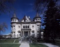 Governor's Mansion, Salt Lake City, Utah LCCN2011633359.tif 7,319 × 5,675; 237.69 MB
-
 Grantsville Utah City Office.jpeg 2,560 × 1,920; 999 KB
-
 HeberValleyRR4.JPG 2,816 × 2,112; 1.48 MB
-
 HelperUtah.jpeg 1,920 × 2,560; 1.06 MB
-

-

-

-

-

-

-
 Historic Sandy Station-northwest side.JPG 3,296 × 2,472; 1.11 MB
-
 Hotel Howard - Brigham City.jpg 1,836 × 3,264; 702 KB
-
 Hotel Victor.JPG 1,224 × 1,632; 739 KB
-
 IC, the rescue abduction, SLC.jpg 2,816 × 2,112; 546 KB
-
 James G. McAllister House.jpg 2,592 × 1,944; 2.51 MB
-
 James McAllister House.jpg 2,592 × 1,944; 2.51 MB
-
 John Cunningham House Park City Utah.jpeg 3,008 × 2,000; 1.47 MB
-
 Jordan Valley station main parking garage closer up, Apr 16.jpg 2,592 × 1,944; 2.41 MB
-
 Junction UT-129 on EB UT-92 - panoramio.jpg 1,600 × 1,200; 672 KB
-
 Kelly House Springville Utah.jpeg 3,008 × 2,000; 1.62 MB
-
 Logan17.jpg 1,000 × 750; 208 KB
-
 Loofbourow House Price Utah.jpeg 3,296 × 2,472; 1.83 MB
-
 Mapleton Elementary School (Utah).JPG 2,816 × 2,112; 2.59 MB
-
 Meneray House Springville Utah.jpeg 3,008 × 2,000; 1.25 MB
-
 Millard County Courthouse, Oct 16.jpg 2,592 × 1,944; 2.42 MB
-
 Moab, Utah looking south.JPG 3,264 × 2,448; 1.71 MB
-
 Monte L. Bean Life Science Museum east side, Jun 16.jpg 2,592 × 1,944; 2.35 MB
-
 Museum of Art stop for The Ryde at BYU.JPG 2,816 × 2,112; 2.45 MB
-
 North along S 100 East in Pleasant Grove, Utah, Jun 16.jpg 2,592 × 1,944; 2.41 MB
-
 North along South State Street, Apr 16.jpg 2,592 × 1,944; 2.33 MB
-
 North along SR-74 in American Fork, Utah, Jun 16.jpg 2,592 × 1,944; 2.33 MB
-

-
 North at I-15 & SR-115 interchange, Payson, UT, Jun 16.jpg 2,592 × 1,944; 2.34 MB
-
 North at I-15 & SR-180 interchange, American Fork, Utah, Aug 16.jpg 2,592 × 1,944; 2.35 MB
-
 North at Salem Hills High School, May 16.jpg 2,592 × 1,944; 2.32 MB
-

-
 North in at PC-SLC Connect bus stop, Park City, Apr 16.jpg 2,592 × 1,944; 2.34 MB
-
 North Lake Elementary School, Tooele, Utah, Mar 16.jpg 2,592 × 1,944; 2.38 MB
-
 North on SR-198 at W Utah Ave, Payson, Utah, Jun 16.jpg 2,592 × 1,944; 2.36 MB
-
 North on US-89 (N State St), American Fork, Utah, Aug 16.jpg 2,592 × 1,944; 2.33 MB
-

-
 North temple-400 west (44303581645).jpg 4,032 × 3,024; 1.78 MB
-
 North Tooele Park and Ride lot, Mar 16.jpg 2,592 × 1,944; 2.35 MB
-
 North toward merge of US-89 and SR-51, Apr 16.jpg 2,592 × 1,944; 2.44 MB
-
 Northbound SR-68 at SR-140 in Bluffdale.jpg 2,176 × 1,632; 1.71 MB
-
 Northeast at intersection of SR-51 & Expressway Ln, Apr 16.jpg 2,592 × 1,944; 2.38 MB
-
 Northeast bound bus stop adjacent to 4800 W Old Bingham Hwy station, Apr 16.jpg 2,592 × 1,944; 2.39 MB
-
 Northwest across Tooele Valley, Mar 16.jpg 2,592 × 1,944; 2.32 MB
-
 Northwest at E 900 North and N 700 East in Provo, Mar 15.jpg 2,816 × 2,112; 2.46 MB
-
 Northwest at SR-224 & SR-248 junction in Park City, Utah, Apr 16.jpg 2,592 × 1,944; 2.36 MB
-
 Northwest at the Ulmus Americana at Utah County complex, Jul 15.jpg 2,816 × 2,112; 2.81 MB
-
 Northwest at West Lake High School, Mar 16.jpg 2,592 × 1,944; 2.36 MB
-
 Northwest on N State St (US-89), Lindon, Utah, Jun 16.jpg 2,592 × 1,944; 2.39 MB
-
 Old PG Town Hall.jpg 1,280 × 1,104; 319 KB
-
 Ottinger Hall.JPG 4,000 × 3,000; 4.45 MB
-
 Park City Downtown 4.jpg 3,024 × 4,032; 3.84 MB
-
 Park City Transit bus at The Lodge, Apr 16.jpg 2,592 × 1,944; 2.36 MB
-
 Payson, Utah Post Office, May 2016.jpg 2,592 × 1,944; 2.41 MB
-
 Penstemon on roadside - Flickr - andrey zharkikh.jpg 3,648 × 2,736; 2.29 MB
-
 Pioneer Camping Grounds.jpg 6,000 × 4,000; 5.4 MB
-
 Police Station in Payson, Utah, Jun 16.jpg 2,592 × 1,944; 2.34 MB
-
 Provo Seminary (33367459726).jpg 5,151 × 1,821; 2.02 MB
-
 Provo Towne Centre northbound bus stop, Mar 15.jpg 2,816 × 2,112; 2.66 MB
-
 Public Library in Spanish Fork, Utah.JPG 2,816 × 2,112; 2.6 MB
-
 Relief Society House Main Street Santa Clara Utah.JPG 4,496 × 3,000; 5.19 MB
-
 Relief Society House Santa Clara.JPG 2,876 × 3,774; 1.28 MB
-
 Relief Society House.jpg 3,264 × 2,448; 3.12 MB
-
-
 Rich-Steeper House Centerville Utah.jpeg 3,008 × 2,000; 2.94 MB
-
 Richmond Utah Interurban Depot.jpeg 2,560 × 1,920; 1.08 MB
-
 Riverton Elementary 24SEP2012.JPG 4,592 × 3,056; 5.34 MB
-
 Roswell Darius Bird, Sr. House, May 16.jpg 2,592 × 1,944; 2.38 MB
-
 S. Main Street in Milford, Utah.jpg 3,456 × 2,304; 2 MB
-
 Sage Creek Elementary School (Springville, Utah), older section, Aug 15.jpg 2,816 × 2,112; 2.39 MB
-
 Salem Elementary School (Utah), May 16.jpg 2,592 × 1,944; 2.35 MB
-
 Salt lake broadway strip.jpg 1,000 × 750; 244 KB
-
 Salt Lake City - panoramio (1).jpg 2,592 × 1,753; 2.82 MB
-
 Salt Lake City, Utah (2021) - 206.jpg 3,000 × 4,000; 3.85 MB
-
 Salt Lake City, Utah (2021) - 377.jpg 3,000 × 4,000; 2.73 MB
-
 Silver Brothers Iron Works.JPG 4,000 × 3,000; 4.68 MB
-
 Smyth House Ogden Utah.jpeg 2,560 × 1,920; 1.13 MB
-
-
 South along Dry Creek from W 3200 N, Spanish Fork, UT, Mar 17.jpg 2,592 × 1,944; 2.36 MB
-
 South along tracks from Meadowbrook station, Aug 16.jpg 2,592 × 1,944; 2.44 MB
-

-

-
 South at Big Hollow Park in Springville, Utah, Jun 15.jpg 2,816 × 2,112; 2.68 MB
-
 South at Child Park in Springville, Utah, Sep 16.jpg 2,592 × 1,944; 2.35 MB
-
 South at level crossing west of 2700 W Sugar Factory Rd, Apr 16.jpg 2,592 × 1,944; 2.35 MB
-
 South at Main St & SR-198 intersection in Salem, Utah, May 16.jpg 2,592 × 1,944; 2.39 MB
-
 South at SR-114 & W 800 S intersection in Orem, Utah, Jun 16.jpg 2,592 × 1,944; 2.33 MB
-
 South at SR-164 & SR-198 junction in Spanish Fork, Utah, May 16.jpg 2,592 × 1,944; 2.37 MB
-
 South at SR-198 & SR-115 junction, Payson, Utah, May 16.jpg 2,592 × 1,944; 2.37 MB
-
 South at TImpview High School LDS seminary building, Provo, Utah, Jun 16.jpg 2,592 × 1,944; 2.36 MB
-
 South at TImpview High School, Provo, Utah, Jun 16.jpg 2,592 × 1,944; 2.3 MB
-
 South at US-89 & SR-52 junction in Orem, Utah Apr 16.jpg 2,592 × 1,944; 2.32 MB
-

-

-

-
 South on SR-68 at 14000 S in Bluffdale, Nov 16.jpg 2,592 × 1,944; 2.43 MB
-
 Southeas at White Church in Mapleton, Utah, Mar 17.jpg 2,592 × 1,944; 2.26 MB
-
 Southeast at Old Town Transit Center in Park City, Utah, Apr 16.jpg 2,592 × 1,944; 2.33 MB
-
 Southeast at West University Pkwy & S 400 E in Orem, Mar 15.jpg 2,816 × 2,112; 2.28 MB
-

-
 Southwest along tracks & across W 650 S in Heber City, Utah, Apr 16.jpg 2,592 × 1,944; 2.3 MB
-
 Southwest at Edgemont Elementary School, Provo, Utah, Jun 16.jpg 2,592 × 1,944; 2.35 MB
-
 Southwest at N 700 East and E 900 North in Provo, Mar 15.jpg 2,816 × 2,112; 2.47 MB
-
 Southwest at White Church in Mapleton, Utah, Jul 15.jpg 2,816 × 2,112; 2.65 MB
-
 Southwest bound bus stop across from 4800 W Old Bingham Hwy station, Apr 16.jpg 2,592 × 1,944; 2.4 MB
-
 Southwest bound bus stop adjacent to 4800 W Old Bingham Hwy station, Apr 16.jpg 2,592 × 1,944; 2.35 MB
-
 Spanish Fork fairgrounds.JPG 2,816 × 2,112; 2.55 MB
-
 Splash pad, Springville, Utah, Jun 15.jpg 2,816 × 2,112; 2.53 MB
-
 State-named "TO I-15" Shield in Sandy - panoramio.jpg 1,600 × 1,200; 598 KB
-
 Statue at County Building Salt Lake City UT - panoramio.jpg 2,304 × 1,728; 1.43 MB
-
 Students and two of The Ryde's buses at the MoA stop.JPG 2,816 × 2,112; 2.63 MB
-
 Taylor Elementary School in Payson, Utah, Jun 16.jpg 2,592 × 1,944; 2.31 MB
-
 The Historic Peery Apartments.jpg 3,264 × 1,952; 6.28 MB
-
 The metro condos salt lake.jpg 750 × 1,000; 178 KB
-
 Typical UTA bus stop without shelter, Jul 15.jpg 2,816 × 2,112; 2.51 MB
-
 US Highway 191 - Utah - 7688690138.jpg 3,072 × 2,304; 536 KB
-
 US Highway 89 - Utah - 9078731183.jpg 3,072 × 2,304; 1.17 MB
-
 US-89-50 Split, UT-24 Junction - panoramio.jpg 1,600 × 1,200; 571 KB
-
 UTA bus at Meadowbrook station (Route 39), Aug 16.jpg 2,592 × 1,944; 2.39 MB
-
 UTA bus stop at This Is The Place Heritage Park, Mar 17.jpg 2,592 × 1,944; 2.4 MB
-
 UTA bus stop in west Salt Lake City, Aug 14, 2015.jpg 2,816 × 2,112; 2.58 MB
-
 UTA bus stop, North Tooele Park and Ride lot, Mar 16.jpg 2,592 × 1,944; 2.41 MB
-
 Vista Heights Middle School, Saratoga Springs, Utah, Mar 16.jpg 2,592 × 1,944; 2.44 MB
-
 Walker Bank Building (6).jpg 6,000 × 4,000; 4.63 MB
-
 Wardleigh Rowhouse Ogden Utah.jpeg 4,288 × 3,216; 7.02 MB
-
 Wells Fargo Bank in Springville, Utah, Aug 15.jpg 2,816 × 2,112; 2.54 MB
-
 Wells Fargo bank on West North Temple, Aug 15.jpg 2,816 × 2,112; 2.41 MB
-

-
 West at GREENbike Squatter Station, Apr 15.jpg 2,816 × 2,112; 2.39 MB
-
 West at Payson High School LDS seminary building, Payson, Utah, Jun 16.jpg 2,592 × 1,944; 2.43 MB
-
 West at pedestrian crossing north of Murray North station, Aug 16.jpg 2,592 × 1,944; 2.26 MB
-
 West at Springville Community Pool, Aug 15.jpg 2,816 × 2,112; 2.29 MB
-
 West at the UVU eastbound bus stop, Mar 15.jpg 2,816 × 2,112; 2.37 MB
-
 West at US-89 & SR 147 (W Maple St) junction, Apr 16.jpg 2,592 × 1,944; 2.42 MB
-
 West at US-89 & SR-52 junction in Orem, Utah Apr 16.jpg 2,592 × 1,944; 2.35 MB
-
 West at west end of SR-92 in Lehi, Utah, Apr 16.jpg 2,592 × 1,944; 2.31 MB
-
 West down tracks from west end of North Temple Bridge, Aug 15.jpg 2,816 × 2,112; 2.3 MB
-
 West Fireclay Ave TRAX level crossing, Murray, Utah, Aug 16.jpg 2,592 × 1,944; 2.39 MB
-
 West on N 2100 W in Utah County, Utah, Oct 16.jpg 2,592 × 1,944; 2.3 MB
-
 Western General Agency Bldg.jpg 4,000 × 3,000; 2.67 MB
-
 Western Mining and Railroad Museum, May 17.jpg 2,592 × 1,944; 2.39 MB
-
 Westpointe homes.jpg 3,200 × 2,368; 1.23 MB
-
 WSU Downtown.jpg 3,280 × 4,928; 10.56 MB
-
 Yalecrest Laird Streetscape.jpg 3,264 × 2,448; 3.79 MB


_(B49).jpg)


.jpg)
.jpg)


.jpg)
.jpg)


.JPG)


,_American_Fork,_Utah,_Aug_16.jpg)
.jpg)


,_Lindon,_Utah,_Jun_16.jpg)


,_older_section,_Aug_15.jpg)
,_May_16.jpg)

.jpg)
_-_206.jpg)
_-_377.jpg)


,_Aug_16.jpg)


.jpg)


_junction,_Apr_16.jpg)


.jpg)