Category:Siddal, West Yorkshire
Jump to navigation
Jump to search
Subcategories
This category has the following 6 subcategories, out of 6 total.
Media in category "Siddal, West Yorkshire"
The following 78 files are in this category, out of 78 total.
-
 "The School Yard", Siddal - geograph.org.uk - 2043521.jpg 640 × 480; 101 KB
-
 Adgil Crescent - Cain Lane - geograph.org.uk - 3460936.jpg 640 × 480; 62 KB
-
 Barker House - geograph.org.uk - 2041844.jpg 640 × 480; 93 KB
-
 Bridge - Bottoms - geograph.org.uk - 736602.jpg 640 × 480; 82 KB
-
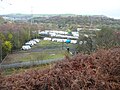 Caravans seen from Elland FP102, Greetland - geograph.org.uk - 4756709.jpg 2,048 × 1,536; 1.04 MB
-
 Chimneys, Cinderhill Works, Halifax - geograph.org.uk - 2137578.jpg 553 × 640; 86 KB
-
 Cross Keys Inn (11108096283).jpg 1,786 × 2,076; 3.73 MB
-
 Cross Keys, Siddal (10932849354).jpg 1,407 × 2,256; 3.42 MB
-
 Disused canal bridge - geograph.org.uk - 4381543.jpg 2,000 × 1,500; 1.38 MB
-
 Drainage outfall into the Hebble Brook - geograph.org.uk - 2041769.jpg 480 × 640; 197 KB
-

-

-

-
 Exercise equipment on the Hebble Trail - geograph.org.uk - 4381564.jpg 2,000 × 1,500; 1.36 MB
-
 Exercise machines on the Hebble Trail - geograph.org.uk - 4381547.jpg 2,000 × 1,435; 1.35 MB
-
 Footbridge, Mansion Lane to Shaw Lane - geograph.org.uk - 1819411.jpg 640 × 480; 191 KB
-
 Footpath - Backhold Drive - geograph.org.uk - 3464397.jpg 480 × 640; 67 KB
-
 Footpath - New Lane - geograph.org.uk - 3463959.jpg 640 × 480; 107 KB
-
 Footpath - Siddal Lane - geograph.org.uk - 3463840.jpg 480 × 640; 90 KB
-
 Footpath - Whitegate - geograph.org.uk - 3463950.jpg 480 × 640; 119 KB
-
 Footpath 691 in a canyon, Halifax - geograph.org.uk - 5217986.jpg 1,500 × 2,000; 818 KB
-
 Footpath 691 in the underworld, Halifax - geograph.org.uk - 5217994.jpg 2,000 × 1,500; 666 KB
-
 Footpath 691 opposite the end of Sedburgh Road, Halifax - geograph.org.uk - 5217977.jpg 2,000 × 1,496; 783 KB
-
 Footpath from Mansion Lane to Shaw Lane - geograph.org.uk - 1819413.jpg 640 × 480; 161 KB
-
 Former Hebble Brook Mill - geograph.org.uk - 2041762.jpg 640 × 480; 143 KB
-
 Have a seat (16065344704).jpg 2,283 × 3,424; 7.76 MB
-
 Hebble Brook - Bottoms - geograph.org.uk - 736588.jpg 640 × 480; 102 KB
-
 Hebble Court Mill - geograph.org.uk - 1843176.jpg 640 × 480; 94 KB
-
 Hebble Trail near Phoebe Lane - geograph.org.uk - 2041808.jpg 640 × 480; 217 KB
-
 Hebble Water - geograph.org.uk - 1843192.jpg 480 × 640; 106 KB
-
 Hens on Phoebe Lane - geograph.org.uk - 2041820.jpg 640 × 480; 228 KB
-
 Johal's Booze - geograph.org.uk - 2041823.jpg 640 × 480; 138 KB
-
 Kirkdale Laundry - geograph.org.uk - 2041836.jpg 640 × 480; 131 KB
-
 Looking down Whitegate Top - geograph.org.uk - 3343410.jpg 640 × 480; 172 KB
-
-
 Mill, Bailey Hall Road, Halifax (5555685167).jpg 1,808 × 1,882; 1.66 MB
-
 Mills, from Trooper Lane, Halifax (2577837625).jpg 2,191 × 1,507; 4.19 MB
-
 Millside Way - geograph.org.uk - 2041772.jpg 640 × 480; 78 KB
-
 Old canal footbridge - geograph.org.uk - 2041787.jpg 640 × 480; 219 KB
-
 Old quarry car park - geograph.org.uk - 2041781.jpg 640 × 480; 129 KB
-
 Ordnance Survey Cut Mark - geograph.org.uk - 3282829.jpg 1,944 × 2,592; 793 KB
-
 Park Lane, Siddal - geograph.org.uk - 6149496.jpg 1,024 × 768; 220 KB
-
 Path to Beacon Hill (3048855762).jpg 2,560 × 1,920; 5.82 MB
-
 Siddal (2570421283).jpg 1,609 × 1,244; 2.36 MB
-
 Siddal (9108926145).jpg 2,777 × 2,777; 6.39 MB
-
 Siddal bowling green - geograph.org.uk - 2041832.jpg 640 × 480; 96 KB
-
 Siddal bowling green, Halifax - geograph.org.uk - 5377024.jpg 2,000 × 1,485; 721 KB
-

-

-
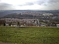
 Siddal in the evening sun - geograph.org.uk - 984747.jpg 640 × 428; 54 KB
-
 Siddal Lane - viewed from New Lane - geograph.org.uk - 3463905.jpg 640 × 480; 51 KB
-

-
 Siddal Lane, Halifax - geograph.org.uk - 1614339.jpg 640 × 472; 81 KB
-
 Siddal Motors - geograph.org.uk - 2041828.jpg 640 × 480; 107 KB
-
 Siddal New Road, Siddal, Halifax - geograph.org.uk - 998817.jpg 640 × 480; 111 KB
-
 Siddal Place, Oxford Road - geograph.org.uk - 1843164.jpg 640 × 480; 74 KB
-
 Siddal Primary School - Jubilee Road - geograph.org.uk - 736652.jpg 640 × 447; 42 KB
-
 Siddal Rugby Club (15461658295).jpg 3,993 × 2,246; 5.51 MB
-
 Siddal Street - Oxford Lane - geograph.org.uk - 3464382.jpg 640 × 480; 91 KB
-
 Siddal Street - Siddal Lane - geograph.org.uk - 3463842.jpg 640 × 480; 71 KB
-
 Siddal Surgery - geograph.org.uk - 2043445.jpg 640 × 480; 177 KB
-
 Siddal Surgery - Oxford Lane - geograph.org.uk - 736670.jpg 640 × 473; 71 KB
-
 Siddal Top (16480371567).jpg 2,744 × 1,963; 3.72 MB
-

-
 Siddal Wells (16521128539).jpg 2,645 × 3,427; 6.66 MB
-
 Stile, Siddal Top (16521120309).jpg 2,857 × 4,000; 8.11 MB
-
 Stoney Royd Terrace - geograph.org.uk - 1819426.jpg 480 × 640; 133 KB
-
 Substation on Backhold Lane - geograph.org.uk - 2043598.jpg 640 × 480; 166 KB
-
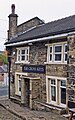
 The Cross Keys, Whitegate, Halifax - geograph.org.uk - 1819423.jpg 640 × 480; 140 KB
-
 The Hebble Brook, Halifax - geograph.org.uk - 6407478.jpg 800 × 574; 197 KB
-
 The Hebble Trail Cycle Route - geograph.org.uk - 4381549.jpg 2,000 × 1,500; 1.5 MB
-
 The Hebble Trail Cycle Route passing Millside Way - geograph.org.uk - 4381556.jpg 2,000 × 1,500; 1,012 KB
-
 The new Siddal primary school - geograph.org.uk - 2043591.jpg 640 × 480; 122 KB
-
 The School Yard, Siddal (housing) - geograph.org.uk - 2043492.jpg 640 × 480; 98 KB
-
 The top of Bottoms - geograph.org.uk - 2043466.jpg 640 × 480; 161 KB
-
 Town 25 minutes - geograph.org.uk - 2043544.jpg 480 × 640; 132 KB
-
 View from Rosemary Hill Cottage - geograph.org.uk - 2713431.jpg 640 × 480; 76 KB
-
 Wall without capstones - geograph.org.uk - 2041816.jpg 480 × 640; 186 KB


.jpg)
.jpg)


.jpg)


.jpg)
.jpg)


.jpg)
.jpg)


.jpg)


.jpg)

.jpg)
.jpg)


_-_geograph.org.uk_-_2043492.jpg)


.jpg)