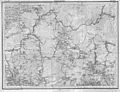
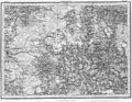
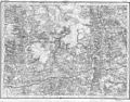
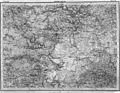
Category:Shubert's maps of Smolensk Governorate
Jump to navigation
Jump to search
Media in category "Shubert's maps of Smolensk Governorate"
The following 27 files are in this category, out of 27 total.
-
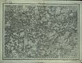
 Shubert map - R09L10.jpg 8,025 × 5,826; 16.83 MB
-
 Shubert map - R09L11.jpg 7,606 × 5,756; 11.8 MB
-
 Shubert map - R10L10.jpg 7,350 × 5,636; 30.53 MB
-
 Shubert map - R10L11.jpg 7,318 × 5,612; 26.2 MB
-
 Shubert map - R10L12.jpg 7,731 × 5,973; 10.46 MB
-
 Shubert map - R10L13.jpg 7,816 × 5,981; 10.19 MB
-
 Shubert map - R11L10.jpg 7,320 × 5,584; 27.27 MB
-
 Shubert map - R11L11.jpg 7,102 × 5,532; 27.39 MB
-
 Shubert map - R11L12.jpg 7,118 × 5,680; 29.29 MB
-
 Shubert map - R11L13.jpg 7,148 × 5,720; 23.61 MB
-
 Shubert map - R12L09.jpg 3,603 × 2,823; 8.38 MB
-
 Shubert map - R12L10.jpg 7,220 × 5,624; 30.06 MB
-
 Shubert map - R12L11.jpg 7,230 × 5,652; 30.62 MB
-
 Shubert map - R12L12.jpg 7,222 × 5,672; 29.94 MB
-
 Shubert map - R12L13.jpg 7,222 × 5,564; 27.7 MB
-
 Shubert map - R13L09.jpg 7,230 × 5,612; 27.45 MB
-
 Shubert map - R13L10.jpg 7,286 × 5,652; 30.46 MB
-
 Shubert map - R13L11.jpg 7,052 × 5,560; 26.82 MB
-
 Shubert map - R13L12.jpg 7,166 × 5,564; 30.05 MB
-
 Shubert map - R13L13.jpg 7,174 × 5,580; 28.4 MB
-
 Shubert map - R14L09.jpg 7,814 × 6,014; 17.42 MB
-
 Shubert map - R14L10.jpg 7,254 × 5,664; 30.78 MB
-
 Shubert map - R14L11.jpg 7,262 × 5,652; 31.67 MB
-
 Shubert map - R15L10.jpg 7,843 × 6,015; 18.32 MB
-
 Shubert map - R15L11.jpg 7,222 × 5,636; 24.58 MB
-
 Shubert map - R16L10.jpg 8,131 × 5,977; 16.83 MB
-
 Shubert map - R16L11.jpg 7,270 × 5,692; 25.56 MB


