Category:Shore Road, Birkenhead
Jump to navigation
Jump to search
| Object location | | View all coordinates using: OpenStreetMap |
|---|

Road in the docks area of Birkenhead running between Woodside and Tweve Quays.
Subcategories
This category has the following 4 subcategories, out of 4 total.
Media in category "Shore Road, Birkenhead"
The following 7 files are in this category, out of 7 total.
-
 Benchmark on Shore Road, Woodside.jpg 4,320 × 3,132; 8.31 MB
-
 Bus and Trams on Shore Road, Birkenhead.jpg 800 × 600; 125 KB
-
 London buses in Birkenhead (29898386580).jpg 2,560 × 1,536; 1.71 MB
-
 Lucy box on Shore Road, Birkenhead.jpg 3,113 × 4,497; 15.67 MB
-
 MTPS Memorial Garden, Shore Road, Birkenhead.JPG 4,320 × 3,240; 6.45 MB
-
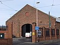 Pacific Road Arts Centre, Birkenhead - DSCF0040.JPG 4,000 × 3,000; 2.87 MB
-
 Wastewater treatment plant, Birkenhead - DSCF0042.JPG 4,000 × 3,000; 2.92 MB


.jpg)


