Category:Shire of Goomalling
Jump to navigation
Jump to search
local government area in the Wheatbelt region of Western Australia  | |||||
| Upload media | |||||
| Instance of |
| ||||
|---|---|---|---|---|---|
| Location | Western Australia, AUS | ||||
| Population |
| ||||
| Elevation above sea level |
| ||||
| official website | |||||
 | |||||
Subcategories
This category has the following 7 subcategories, out of 7 total.
Media in category "Shire of Goomalling"
The following 6 files are in this category, out of 6 total.
-
 CSIRO ScienceImage 1474 Jennacubbine WA Rainbow over Lupins.jpg 1,772 × 1,416; 1.78 MB
-
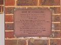 Goomalling masonic SC plaque.jpg 1,600 × 1,200; 587 KB
-
 Goomalling Road distance marker.jpg 1,600 × 1,200; 972 KB
-
 Goomalling Road S from Goomalling.jpg 1,600 × 1,200; 832 KB
-
 Goomalling shire sign Jennapullin.jpg 1,600 × 1,200; 635 KB
-
 Goomalling shire sign.jpg 1,600 × 1,200; 566 KB


