Category:Shipwreck maps
Jump to navigation
Jump to search
Nederlands: Categorie:Zeekaarten met locaties van scheepswrakken.
Subcategories
This category has the following 4 subcategories, out of 4 total.
Media in category "Shipwreck maps"
The following 41 files are in this category, out of 41 total.
-

-
 Al-Salam Boccaccio Nasa.jpg 1,024 × 702; 242 KB
-
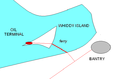 Bantry.PNG 594 × 391; 11 KB
-
 Belitung shipwreck location.jpg 2,584 × 1,706; 356 KB
-
 Bermuda St Georges Island with Sea Venture 1609.png 600 × 300; 42 KB
-
 Bikiniatoll.jpg 529 × 427; 36 KB
-
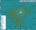 Cape Matapan wreck map.png 6,559 × 5,534; 1.58 MB
-
 Cawarra location.jpg 821 × 1,024; 69 KB
-
 Edmond Fitzgerald relative position of wreck.jpg 999 × 872; 99 KB
-
 Edmund Fitzgerald Trackline.jpg 695 × 954; 182 KB
-
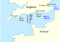 English Channel location map - Halsewell.svg 955 × 665; 192 KB
-
 Erika littoral pollution map-fr.svg 867 × 578; 443 KB
-
 FMIB 43966 Shipwrecks in the Mediterranean.jpeg 857 × 427; 116 KB
-

-
 Graveyard of the Pacific.jpg 625 × 509; 94 KB
-
 Great Lakes 1913 Storm Shipwrecks.png 4,000 × 2,400; 799 KB
-
 Hastings Tugboat Sinking Location.jpg 1,213 × 907; 341 KB
-
 Hunley location.png 6,000 × 5,857; 58.42 MB
-
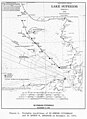
 Isle Royale shipwrecks Lake Superior.jpg 1,190 × 550; 124 KB
-
 LarkAndCerberusWreckMap.jpg 600 × 450; 72 KB
-
 Map depicting the location where the SS Cornwallis was sunk.png 907 × 907; 126 KB
-
 Map of Sunken Battlecruisers version 2.png 4,500 × 2,234; 264 KB
-
 Map of Sunken Battlecruisers.png 4,500 × 2,234; 210 KB
-
 Map of Sunken Battleships Revised.png 4,500 × 2,234; 1.16 MB
-
 Map of Sunken Battleships.png 4,500 × 2,234; 212 KB
-
 Map of the Fuegian Archipelago, with shipwrecks of the early 20th century.png 2,872 × 2,095; 2.36 MB
-
 Matagorda Bay Texas 1689.JPG 917 × 602; 67 KB
-
 Pamir Position.jpg 400 × 400; 85 KB
-

-
 Sea accidents 1750 to 1950 Scania Sweden.jpg 1,717 × 2,362; 349 KB
-
 Shipwreck Chart Life-boat Committee Washington 1851 118.jpg 7,679 × 5,156; 1.87 MB
-
 Sketch of Skuldelev shipwreck.svg 700 × 430; 8 KB
-
 Thames Estuary airports proposed locations SS Richard Montgomery.png 1,075 × 692; 318 KB
-
 Thames Estuary airports proposed locations.gif 1,075 × 692; 322 KB
-
 Tragedy of Otranto.png 545 × 600; 103 KB
-
 Uida mapa.jpg 255 × 222; 49 KB
-
 Uluburun Shipwreck Location.svg 1,219 × 930; 57 KB
-
 Whydah-map.jpg 580 × 919; 273 KB
-
 Wisconsin Shipwreck Coast National Marine Sancutary NOAA map 2021.PNG 753 × 867; 894 KB
-
-
 Айрон-Боттом-Саунд.svg 914 × 737; 546 KB
.jpg)


_(14802419223).jpg)


.jpg)
