Category:Shipley, West Yorkshire
Jump to navigation
Jump to search
town in the City of Bradford, West Yorkshire, England  | |||||
| Upload media | |||||
| Instance of |
| ||||
|---|---|---|---|---|---|
| Location | Bradford, West Yorkshire, Yorkshire and the Humber, England | ||||
| Population |
| ||||
| Different from | |||||
 | |||||
Subcategories
This category has the following 16 subcategories, out of 16 total.
Media in category "Shipley, West Yorkshire"
The following 200 files are in this category, out of 1,485 total.
(previous page) (next page)-
 "Alpaca", Aire Sculpture Trail - geograph.org.uk - 6739312.jpg 2,000 × 1,314; 2.96 MB
-
 "Alpaca", Aire Sculpture Trail - geograph.org.uk - 6739319.jpg 2,190 × 3,000; 5.74 MB
-
 "Are-Jay-Bargie", Leeds and Liverpool Canal, Saltaire - geograph.org.uk - 6677087.jpg 2,000 × 1,438; 2.95 MB
-
 "Dinghy Dog", Baildon Bridge, Shipley - geograph.org.uk - 6721399.jpg 2,000 × 1,613; 3.65 MB
-
 "Dog", Aire Sculpture Trail - geograph.org.uk - 6739327.jpg 1,660 × 2,000; 3.89 MB
-
 "Dog", Aire Sculpture Trail - geograph.org.uk - 6739330.jpg 1,678 × 2,000; 3.16 MB
-
 "Frog on Leaf", Aire Sculpture Trail - geograph.org.uk - 6739281.jpg 2,000 × 1,500; 2.93 MB
-
 "Frog on Leaf", Aire Sculpture Trail - geograph.org.uk - 6739290.jpg 1,382 × 2,000; 3.09 MB
-
 "Octopus", Aire Sculpture Trail - geograph.org.uk - 6739527.jpg 2,000 × 1,998; 3.81 MB
-
 "Octopus", Aire Sculpture Trail - geograph.org.uk - 6739532.jpg 1,330 × 2,000; 2.71 MB
-
 "Pirate Ship", Aire Sculpture Trail - geograph.org.uk - 6739519.jpg 2,000 × 1,478; 3.07 MB
-
 "Salt Pot Slug", Aire Sculpture Trail - geograph.org.uk - 6739357.jpg 1,396 × 2,000; 3.11 MB
-

-
 "Salts Mill" - Hockney painting on display at the mill - geograph.org.uk - 5196384.jpg 1,600 × 1,172; 304 KB
-
 "Submarine". Aire Sculpture Trail - geograph.org.uk - 6739303.jpg 2,000 × 1,167; 3.32 MB
-
 "Submarine". Aire Sculpture Trail - geograph.org.uk - 6739306.jpg 2,000 × 1,803; 4 MB
-
 "The Shuttle", a fabric shop, Baildon Bridge - geograph.org.uk - 6382186.jpg 2,000 × 1,489; 2.44 MB
-
 1853 Gallery, Saltaire - geograph.org.uk - 6389628.jpg 1,024 × 768; 912 KB
-
 1891 map of Windhill West Yorks.jpg 1,500 × 1,069; 1.65 MB
-
 62 - 64, Victoria Rd - geograph.org.uk - 6639566.jpg 1,024 × 685; 167 KB
-
 79, Victoria Rd - geograph.org.uk - 6639498.jpg 1,024 × 684; 177 KB
-
 A path in Northcliffe Woods - geograph.org.uk - 6507984.jpg 1,024 × 683; 294 KB
-
 A path through Northcliffe Woods - geograph.org.uk - 6508004.jpg 1,024 × 683; 287 KB
-
 A rusty footbridge - geograph.org.uk - 5380356.jpg 1,024 × 768; 95 KB
-

-
 A650 Bingley Road at Nab Wood - geograph.org.uk - 5421503.jpg 640 × 481; 76 KB
-
 A650, Bingley Rd - geograph.org.uk - 6650391.jpg 1,024 × 684; 131 KB
-
 Above Hirst Mill lock - geograph.org.uk - 1848504.jpg 640 × 480; 152 KB
-
 Across Caroline Street Allotments - geograph.org.uk - 5655834.jpg 1,000 × 662; 1,004 KB
-
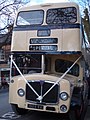 AEC Bridgemaster, Victoria Road, Saltire - geograph.org.uk - 4340711.jpg 1,920 × 2,560; 1.08 MB
-
 Airedale Way Footpath - Otley Road - geograph.org.uk - 1593870.jpg 480 × 640; 111 KB
-
 Aireside Road - geograph.org.uk - 6519212.jpg 1,024 × 617; 146 KB
-
 Al Furqaan Education Centre, Shipley - geograph.org.uk - 6397159.jpg 1,024 × 768; 98 KB
-
 Al-Furqaan Education Centre and Northcliffe Church - geograph.org.uk - 6077112.jpg 2,000 × 911; 1.55 MB
-
 Albert Road - geograph.org.uk - 3767688.jpg 4,320 × 3,240; 6.09 MB
-
 Albert Terrace - geograph.org.uk - 6650493.jpg 1,024 × 684; 209 KB
-
 Alexandra Square - geograph.org.uk - 6645898.jpg 1,024 × 684; 252 KB
-
 AlexSandra Hair Salon - Windsor Road - geograph.org.uk - 2618870.jpg 480 × 640; 83 KB
-
 Alley between Cliffe Wood Avenue and Rae Road - geograph.org.uk - 6195918.jpg 1,550 × 2,000; 3.47 MB
-
 Alley between Springwood Avenue and Springwood Place - geograph.org.uk - 6195856.jpg 2,000 × 1,500; 2.48 MB
-
 Allotments - off Northcliffe Park - geograph.org.uk - 2680662.jpg 640 × 480; 79 KB
-
 Allotments - Victoria Road - geograph.org.uk - 2787209.jpg 640 × 499; 123 KB
-
 Allotments in Northcliffe Park, Shipley - geograph.org.uk - 4958674.jpg 1,600 × 1,065; 590 KB
-
 Alpaca - geograph.org.uk - 3565408.jpg 812 × 1,206; 318 KB
-
 Amber Wharf , Shipley - geograph.org.uk - 1737822.jpg 640 × 480; 75 KB
-
 Amber Wharf - geograph.org.uk - 964635.jpg 640 × 480; 77 KB
-
 Amelia St - geograph.org.uk - 6650528.jpg 1,024 × 684; 200 KB
-

-

-
 Approach road to Shipley Station - geograph.org.uk - 1997882.jpg 1,024 × 768; 156 KB
-

-
 Asda car park - geograph.org.uk - 6077429.jpg 2,000 × 1,160; 1.87 MB
-
 Asda, Manor Road, Shipley - geograph.org.uk - 6381348.jpg 2,000 × 1,130; 795 KB
-
 ASE Autogate Ltd, Bridge House, Dock Lane, Shipley - geograph.org.uk - 6179959.jpg 1,600 × 1,200; 495 KB
-
 Ashmoor Day Nursery - Ashfield Road - geograph.org.uk - 2796131.jpg 640 × 502; 97 KB
-
 Avondale Grove, Shipley - geograph.org.uk - 4148208.jpg 5,184 × 3,456; 7.57 MB
-
 Avondale Road, Moorhead - geograph.org.uk - 4958652.jpg 1,600 × 1,065; 807 KB
-
 Back Baker Street, Shipley - geograph.org.uk - 6232124.jpg 2,000 × 1,542; 2.41 MB
-
 Back George St - geograph.org.uk - 6645963.jpg 1,024 × 684; 223 KB
-
 Baildon Bridge (A6038) flooded by the River Aire - geograph.org.uk - 6387023.jpg 2,000 × 1,137; 2.25 MB
-
 Baildon Bridge during a flood - geograph.org.uk - 6787240.jpg 2,000 × 1,247; 2.93 MB
-
 Baker Street, Shipley - geograph.org.uk - 6232133.jpg 2,000 × 1,433; 2.43 MB
-
 Ballast Train at Shipley - geograph.org.uk - 2569464.jpg 2,592 × 1,944; 3.1 MB
-
 Bank Street, Shipley - geograph.org.uk - 6390172.jpg 2,000 × 1,196; 857 KB
-
 Barden Aqueduct at Hirst Wood - geograph.org.uk - 5879069.jpg 1,024 × 768; 350 KB
-
 Bargain Booze - geograph.org.uk - 6645930.jpg 1,024 × 684; 169 KB
-
 Bargrange Avenue - geograph.org.uk - 6183971.jpg 2,000 × 1,500; 2.57 MB
-
 Bargrange Avenue - geograph.org.uk - 6183973.jpg 2,000 × 1,475; 2.39 MB
-
 Bargrange Avenue, Shipley - geograph.org.uk - 6766840.jpg 2,000 × 1,234; 2.71 MB
-
 Basin, Leeds ^ Liverpool Canal - geograph.org.uk - 6635350.jpg 1,024 × 684; 237 KB
-
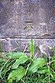
 Benchmark and frog metal sculpture - geograph.org.uk - 4590369.jpg 683 × 1,024; 268 KB
-

-
 Benchmark on 'The Rosse Saltaire' - geograph.org.uk - 4577763.jpg 683 × 1,024; 291 KB
-
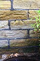
 Benchmark on Bridge 208 Leeds ^ Liverpool Canal - geograph.org.uk - 5639209.jpg 683 × 1,024; 244 KB
-
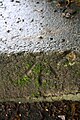
 Benchmark on bridge on Shipley Station approach - geograph.org.uk - 1997869.jpg 768 × 1,024; 248 KB
-
 Benchmark on Dockfield Mills - geograph.org.uk - 5639282.jpg 1,024 × 683; 391 KB
-
 Benchmark on Eddy's Moto - geograph.org.uk - 1997960.jpg 1,024 × 768; 204 KB
-
 Benchmark on Gallows Bridge Cottage - geograph.org.uk - 5639632.jpg 654 × 1,024; 165 KB
-

-

-

-
 Benchmark on gatepost of ^83 Moorhead Lane - geograph.org.uk - 4568267.jpg 683 × 1,024; 277 KB
-
 Benchmark on Odd Fellows Hall - geograph.org.uk - 5640185.jpg 683 × 1,024; 261 KB
-

-
 Benchmark on pier at ^51 Bingley Road - geograph.org.uk - 4204134.jpg 1,024 × 683; 252 KB
-
 Benchmark on railway bridge beside canal - geograph.org.uk - 2982988.jpg 683 × 1,024; 301 KB
-

-
 Benchmark on Shipley Station booking office - geograph.org.uk - 5642012.jpg 683 × 1,024; 275 KB
-
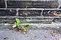
 Benchmark on Station Road wall - geograph.org.uk - 1998199.jpg 768 × 1,024; 348 KB
-
 Benchmark on step from Salts Cricket Club - geograph.org.uk - 4782916.jpg 683 × 1,024; 201 KB
-

-
 Benchmark on The Sun Hotel, ^3 Kirkgate - geograph.org.uk - 6506350.jpg 1,024 × 683; 184 KB
-
 Benchmark on The Victoria pub - geograph.org.uk - 4203118.jpg 683 × 1,024; 197 KB
-
 Benchmark on Victoria Bridge canal wall - geograph.org.uk - 4782169.jpg 1,024 × 683; 294 KB
-

-
 Benchmark on wall beside Aire Sculpture Trail - geograph.org.uk - 4590554.jpg 683 × 1,024; 294 KB
-
 Benchmark on wall beside canal - geograph.org.uk - 4782509.jpg 1,024 × 683; 269 KB
-

-

-
 Benchmark on wall of Hirst Lane - geograph.org.uk - 4577271.jpg 683 × 1,024; 239 KB
-

-
 Benchmark on wall outside ^1 Bingley Road - geograph.org.uk - 4531200.jpg 1,024 × 683; 273 KB
-
 Benchmark on Wycliffe CE Primary School - geograph.org.uk - 4205100.jpg 683 × 1,024; 296 KB
-
 Benchmark on ^1 Fern Place - geograph.org.uk - 4204776.jpg 683 × 1,024; 214 KB
-
 Benchmark on ^1 Lockwood Street - geograph.org.uk - 4203499.jpg 683 × 1,024; 268 KB
-
 Benchmark on ^1 Titus Street - geograph.org.uk - 4203130.jpg 683 × 1,024; 274 KB
-
 Benchmark on ^15 Fernhill Road - geograph.org.uk - 4567806.jpg 683 × 1,024; 275 KB
-
 Benchmark on ^15 Victoria Road - geograph.org.uk - 4203914.jpg 683 × 1,024; 172 KB
-
 Benchmark on ^199 Bingley Road - geograph.org.uk - 4577307.jpg 1,024 × 683; 278 KB
-
 Benchmark on ^22 Albert Terrace - geograph.org.uk - 4568318.jpg 683 × 1,024; 271 KB
-
 Benchmark on ^23 Nab Wood Drive - geograph.org.uk - 4576856.jpg 683 × 1,024; 313 KB
-
 Benchmark on ^3 Albert Road - geograph.org.uk - 4577159.jpg 683 × 1,024; 288 KB
-
 Benchmark on ^34 Titus Road - geograph.org.uk - 4204456.jpg 683 × 1,024; 237 KB
-
 Benchmark on ^63 Albert Road - geograph.org.uk - 4577922.jpg 794 × 1,024; 207 KB
-
 Benchmark on ^65 Victoria Road - geograph.org.uk - 4204160.jpg 683 × 1,024; 168 KB
-
 Benchmark on ^7 Albert Terrace - geograph.org.uk - 4568561.jpg 693 × 1,024; 297 KB
-
 Benchmark on ^75 Moorhead Lane - geograph.org.uk - 4567993.jpg 1,024 × 683; 258 KB
-
 Between the canal and the railway, Shipley - geograph.org.uk - 6179961.jpg 1,600 × 1,200; 384 KB
-
 Bingley Rd - geograph.org.uk - 6645909.jpg 962 × 1,024; 234 KB
-
 Bingley Rd - geograph.org.uk - 6645912.jpg 1,024 × 680; 171 KB
-
 Bingley Rd - geograph.org.uk - 6650392.jpg 1,024 × 684; 107 KB
-
 Bingley Road (A650), Saltaire, Shipley - geograph.org.uk - 6674696.jpg 1,768 × 2,000; 2.75 MB
-
 Bingley Road (A650), Saltaire, Shipley - geograph.org.uk - 6674700.jpg 2,000 × 1,403; 2.39 MB
-
 Bingley Road (A650), Shipley - geograph.org.uk - 6791806.jpg 2,000 × 1,428; 2.77 MB
-
 Bingley Road outside ^128 - geograph.org.uk - 4576981.jpg 1,024 × 683; 196 KB
-
 Bingley Road, Saltaire - geograph.org.uk - 4130725.jpg 1,600 × 1,200; 469 KB
-
 Bird - geograph.org.uk - 3565428.jpg 1,200 × 1,600; 496 KB
-
 Bird-feeding station, Northcliffe Woods - geograph.org.uk - 5210867.jpg 1,024 × 768; 251 KB
-
 Birklands Road, Shipley - geograph.org.uk - 5921459.jpg 640 × 480; 87 KB
-
 Blossom, Northcliffe Park, Shipley - geograph.org.uk - 6793652.jpg 2,000 × 1,170; 3.21 MB
-
 Blow It in the Leeds and Liverpool Canal at Shipley (7315244504).jpg 2,496 × 3,242; 4.77 MB
-
 Bottom of the bywash channel, Hirst Lock - geograph.org.uk - 5879026.jpg 1,024 × 767; 376 KB
-
 Boundary Stone (16325126560).jpg 3,541 × 2,729; 9.98 MB
-
 Bowling green, Crowgill Park, Shipley - geograph.org.uk - 6347899.jpg 2,000 × 1,019; 2.08 MB
-
 Bowling green, Northcliffe Park - geograph.org.uk - 6195858.jpg 2,000 × 882; 1.2 MB
-
 Bowling Greens - Northcliffe Park - geograph.org.uk - 453633.jpg 640 × 420; 46 KB
-
 Box junction, A657 - geograph.org.uk - 6650600.jpg 1,024 × 685; 161 KB
-
 Bradford Beck - geograph.org.uk - 6635357.jpg 1,024 × 684; 298 KB
-
 Bradford Beck, Shipley - geograph.org.uk - 6401565.jpg 2,000 × 1,331; 3.29 MB
-
 Bradford Road (A650) seen from Bargrange Avenue, Shipley - geograph.org.uk - 6766841.jpg 2,000 × 1,501; 3.53 MB
-
 Bradford Road - geograph.org.uk - 6183968.jpg 2,000 × 1,028; 1.62 MB
-

-
 Bridge 207 Hirst Mill Swing Bridge - geograph.org.uk - 2124047.jpg 640 × 480; 87 KB
-
 Bridge 208 on Leeds and Liverpool Canal - geograph.org.uk - 5639214.jpg 1,024 × 683; 173 KB
-

-

-

-
 Bridge TJC3-53 - Victoria Road - geograph.org.uk - 2787206.jpg 640 × 480; 66 KB
-
 Bridge ^207, Leeds ^ Liverpool Canal - geograph.org.uk - 6635368.jpg 1,024 × 684; 166 KB
-
 Bridge ^208, Leeds ^ Liverpool Canal - geograph.org.uk - 6635352.jpg 1,024 × 685; 169 KB
-
 Bridge ^208, Leeds ^ Liverpool Canal - geograph.org.uk - 6635354.jpg 1,024 × 684; 200 KB
-
 Bridge, Valley Road - geograph.org.uk - 1041848.jpg 1,024 × 683; 139 KB
-
 Briggate (A657), Shipley - geograph.org.uk - 6402043.jpg 2,000 × 1,141; 2.42 MB
-
 Briggate (A657), Shipley - geograph.org.uk - 6671493.jpg 2,000 × 1,172; 2.1 MB
-
 Briggate (A657), Shipley - geograph.org.uk - 6701311.jpg 2,000 × 1,236; 2.74 MB
-
 Briggate, Shipley - geograph.org.uk - 3304694.jpg 1,024 × 682; 192 KB
-
 Briggate, Shipley - geograph.org.uk - 6402037.jpg 2,000 × 1,134; 2.56 MB
-
 Brighton Street - Hird Street - geograph.org.uk - 2618545.jpg 640 × 480; 58 KB
-
 Bring a Book, Take a Book - geograph.org.uk - 6086097.jpg 600 × 800; 621 KB
-
 Bromley Road - Bingley Road - geograph.org.uk - 1085489.jpg 640 × 428; 165 KB
-
 Bromley Road - Kendall Avenue - geograph.org.uk - 2796939.jpg 640 × 480; 72 KB
-
 Building site, Shipley - geograph.org.uk - 191054.jpg 640 × 470; 66 KB
-
-
 Bywash below Hirst Lock (no 19) - geograph.org.uk - 4900313.jpg 1,024 × 768; 174 KB
-
 Canal aqueduct near Dowley Gap - geograph.org.uk - 3767673.jpg 4,320 × 3,240; 2.59 MB
-
 Canal at Saltaire - geograph.org.uk - 5570843.jpg 640 × 480; 274 KB
-
 Canal at Shipley - geograph.org.uk - 5570767.jpg 640 × 480; 190 KB
-
 Canal basin and warehouse - geograph.org.uk - 6635420.jpg 1,024 × 684; 125 KB
-
 Canal bridge 209A and rail bridge GUE2-1 - geograph.org.uk - 2982995.jpg 1,024 × 683; 166 KB
-
 Canal bridge no. 208 - geograph.org.uk - 5431673.jpg 1,024 × 641; 536 KB
-

-
 Canal Towpath approaching Saltaire Mills - geograph.org.uk - 4404546.jpg 640 × 480; 310 KB
-
 Canal Warehouse - geograph.org.uk - 6635400.jpg 685 × 1,024; 122 KB
-
 Canal Warehouse - geograph.org.uk - 6635403.jpg 1,024 × 684; 150 KB
-
 Canal Warehouse - geograph.org.uk - 6635405.jpg 1,024 × 684; 130 KB
-
 Canal Warehouse - geograph.org.uk - 6635407.jpg 1,024 × 684; 135 KB
-
 Canal wharf at Shipley - geograph.org.uk - 2992344.jpg 2,048 × 1,536; 627 KB
-
 Cap and Collar - geograph.org.uk - 6650394.jpg 685 × 1,024; 140 KB
-
 Car park, Saltaire - geograph.org.uk - 2746549.jpg 640 × 480; 98 KB
-
 Carlton Avenue - Albert Road - geograph.org.uk - 1086405.jpg 640 × 480; 202 KB
-
 Carlton Avenue - Hirst Lane - geograph.org.uk - 1085517.jpg 640 × 431; 161 KB
-
 Carmona Avenue - Carmona Gardens - geograph.org.uk - 1366444.jpg 640 × 480; 257 KB
-
 Carmona Gardens - Wharncliffe Road - geograph.org.uk - 1050137.jpg 640 × 429; 218 KB
-
 Caroline St - geograph.org.uk - 6639502.jpg 1,024 × 684; 204 KB
-
 Caroline St - geograph.org.uk - 6639503.jpg 1,024 × 684; 193 KB
-
 Caroline St - geograph.org.uk - 6650467.jpg 1,024 × 684; 211 KB
-
 Caroline St - geograph.org.uk - 6650480.jpg 1,024 × 684; 173 KB
-
 Caroline Street in Saltaire - geograph.org.uk - 2660309.jpg 1,500 × 1,000; 196 KB
-
 Caroline Street, Saltaire - geograph.org.uk - 4958519.jpg 1,600 × 1,065; 491 KB
-
 Caroline Street, Saltaire - geograph.org.uk - 5177251.jpg 640 × 425; 136 KB
-
 Castle Street - geograph.org.uk - 6077428.jpg 2,000 × 1,147; 2.14 MB
-
 Cat Bath - geograph.org.uk - 3565432.jpg 1,600 × 1,200; 439 KB
-
 Cat Bath - geograph.org.uk - 3565435.jpg 1,600 × 1,200; 449 KB
-
 Central Avenue seen from Market Street - geograph.org.uk - 6533735.jpg 2,000 × 1,027; 1.81 MB
-
 Central Avenue, Shipley - geograph.org.uk - 6726463.jpg 2,000 × 1,062; 1.98 MB
-
 Central Avenue, Shipley - geograph.org.uk - 6806903.jpg 2,000 × 1,306; 2.69 MB
-
 Centre for Spiritual Discovery, Shipley - geograph.org.uk - 6397150.jpg 1,024 × 768; 224 KB
-
 Chamber on the south side of the River Aire - geograph.org.uk - 4900316.jpg 1,024 × 768; 256 KB
-
 Change to collection times from this postbox - geograph.org.uk - 1041792.jpg 683 × 1,024; 120 KB
-
 Chimney on Victoria Mills, Shipley - geograph.org.uk - 6724913.jpg 410 × 640; 47 KB


_flooded_by_the_River_Aire_-_geograph.org.uk_-_6387023.jpg)


,_Saltaire,_Shipley_-_geograph.org.uk_-_6674696.jpg)
,_Saltaire,_Shipley_-_geograph.org.uk_-_6674700.jpg)
,_Shipley_-_geograph.org.uk_-_6791806.jpg)


.jpg)

.jpg)


_seen_from_Bargrange_Avenue,_Shipley_-_geograph.org.uk_-_6766841.jpg)


,_Shipley_-_geograph.org.uk_-_6402043.jpg)
,_Shipley_-_geograph.org.uk_-_6671493.jpg)
,_Shipley_-_geograph.org.uk_-_6701311.jpg)


_-_geograph.org.uk_-_4900313.jpg)


