Category:Shimpling, Suffolk
Jump to navigation
Jump to search
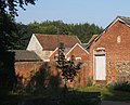
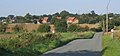
English: Shimpling is a village and civil parish in south Suffolk, England. Located around 7 miles from Bury St Edmunds, it is part of Babergh district. The village is essentially split into two halves, the newer Shimpling Street and around 2 miles away the actual village of Shimpling.
village and civil parish in Suffolk, England, UK | |||||
| Upload media | |||||
| Instance of | |||||
|---|---|---|---|---|---|
| Location | Babergh, Suffolk, East of England, England | ||||
| Population |
| ||||
| Different from | |||||
 | |||||
Subcategories
This category has the following 3 subcategories, out of 3 total.
Media in category "Shimpling, Suffolk"
The following 103 files are in this category, out of 103 total.
-
 18 th Century cottages - geograph.org.uk - 2077379.jpg 640 × 480; 103 KB
-
 5 Bar Gate - geograph.org.uk - 2700143.jpg 1,024 × 768; 293 KB
-
 A134 towards Bury St Edmunds - geograph.org.uk - 5400505.jpg 640 × 480; 70 KB
-
 Aveley Lane - geograph.org.uk - 5525664.jpg 640 × 480; 49 KB
-

-
 Aveley Lane, Shimpling - geograph.org.uk - 4631324.jpg 1,240 × 930; 426 KB
-
 Aveley Lane, Shimpling - geograph.org.uk - 5525662.jpg 640 × 480; 50 KB
-
 Bridleway by Chadacre Park - geograph.org.uk - 2078606.jpg 3,648 × 2,736; 1.58 MB
-
 Buildings at Shimpling Park Farm - geograph.org.uk - 971210.jpg 640 × 516; 93 KB
-
 Chadacre Hall and lake - geograph.org.uk - 3935161.jpg 2,816 × 2,112; 797 KB
-

-
 Clockhouse Farm, Shimpling - geograph.org.uk - 5525660.jpg 640 × 480; 56 KB
-
 Close up, Elizabeth II postbox on Aveley Lane, Shimpling - geograph.org.uk - 5526195.jpg 1,394 × 2,318; 704 KB
-
 Coal House, built 1861 - geograph.org.uk - 2077385.jpg 640 × 480; 111 KB
-
 Coppin's Farm - geograph.org.uk - 2700192.jpg 1,024 × 768; 182 KB
-
 Corrugated iron farm buildings - geograph.org.uk - 2077394.jpg 640 × 480; 85 KB
-
 Country Road - geograph.org.uk - 1501711.jpg 640 × 480; 83 KB
-
 Crop field off the A134 - geograph.org.uk - 5400502.jpg 640 × 480; 59 KB
-

-
 Daffodil-lined drive - geograph.org.uk - 3935153.jpg 2,816 × 2,112; 1.19 MB
-
 Drainage ditch near Shimpling Park Farm - geograph.org.uk - 1092084.jpg 427 × 640; 100 KB
-
 Driveway south of Chadacre Park - geograph.org.uk - 971334.jpg 640 × 480; 94 KB
-

-
 Elizabeth II postbox, Chadacre - geograph.org.uk - 5526181.jpg 480 × 640; 138 KB
-
 Entering Shimpling - geograph.org.uk - 1501738.jpg 640 × 480; 94 KB
-
 Entering Shimpling - geograph.org.uk - 5525656.jpg 640 × 480; 87 KB
-
 Entering Shimpling - geograph.org.uk - 5525670.jpg 640 × 480; 86 KB
-
 Entrance - geograph.org.uk - 2620447.jpg 1,024 × 768; 330 KB
-
 Entrance to Chadacre Hall - geograph.org.uk - 2078615.jpg 3,648 × 2,736; 2.3 MB
-
 Farm Only - geograph.org.uk - 2620456.jpg 768 × 1,024; 303 KB
-

-
 Farmland near Shimpling Park Farm - geograph.org.uk - 2077400.jpg 640 × 480; 92 KB
-
 Field beside drain, Shimpling - geograph.org.uk - 5525658.jpg 640 × 480; 60 KB
-
 Field near New Hall Farm - geograph.org.uk - 5525673.jpg 640 × 480; 94 KB
-
 Food for Free - geograph.org.uk - 2076680.jpg 640 × 480; 152 KB
-
 Footbridge And Footpath Sign - geograph.org.uk - 2620434.jpg 1,024 × 768; 274 KB
-
 Footbridges - geograph.org.uk - 2620430.jpg 1,024 × 768; 357 KB
-
 Footpath - geograph.org.uk - 2700122.jpg 1,024 × 768; 356 KB
-
 Footpath near Shimpling Street - geograph.org.uk - 2854000.jpg 3,648 × 2,736; 2.82 MB
-
 Footpath, Mill Hill Cottages - geograph.org.uk - 5525667.jpg 640 × 480; 102 KB
-

-
 Grazing, Clockhouse Farm - geograph.org.uk - 5525661.jpg 640 × 480; 72 KB
-
 Hare on Farmland - geograph.org.uk - 6220734.jpg 576 × 1,024; 109 KB
-

-
 House on Aveley Lane, Shimpling - geograph.org.uk - 5525665.jpg 640 × 480; 64 KB
-
 Junction on Aveley Lane, Shimpling - geograph.org.uk - 5526198.jpg 2,848 × 2,136; 1.33 MB
-
 Keepers House - geograph.org.uk - 1498107.jpg 640 × 480; 91 KB
-
 Keepers House. - geograph.org.uk - 1501724.jpg 640 × 480; 90 KB
-

-

-
 Lane near Dales Farm - geograph.org.uk - 5525655.jpg 640 × 480; 100 KB
-
 Lane towards Shimpling - geograph.org.uk - 971746.jpg 640 × 410; 66 KB
-
 Lane towards Shimpling from the west - geograph.org.uk - 971760.jpg 640 × 468; 107 KB
-
 Lane west of Shimpling Street - geograph.org.uk - 971295.jpg 640 × 298; 51 KB
-
 Lodge in grounds of Chadacre Park - geograph.org.uk - 2076684.jpg 640 × 480; 90 KB
-
 Looking down Shimpling Street to Thorn Corner - geograph.org.uk - 2110061.jpg 3,648 × 2,736; 1.84 MB
-
 May in April - geograph.org.uk - 3935150.jpg 2,816 × 2,112; 1.25 MB
-
 Minor road near New House Farm - geograph.org.uk - 5525674.jpg 640 × 480; 63 KB
-
 Minor road out of Shimpling - geograph.org.uk - 5525672.jpg 640 × 480; 65 KB
-
 Minor road, Mill Hill - geograph.org.uk - 5525668.jpg 640 × 480; 85 KB
-
 Minor road, Shimpling - geograph.org.uk - 5525659.jpg 640 × 480; 56 KB
-
 Mount Farm - geograph.org.uk - 2700168.jpg 1,024 × 768; 220 KB
-
 Muddy road and sugar beet harvesting - geograph.org.uk - 4365455.jpg 4,320 × 3,240; 3.67 MB
-
 Mulleys bus at Shimpling, Suffolk (23 May 2014).JPG 3,296 × 2,472; 1.78 MB
-
 New house, Little Chadacre Farm House - geograph.org.uk - 3586349.jpg 640 × 447; 110 KB
-
 Nice Entrance - geograph.org.uk - 2620459.jpg 1,024 × 768; 250 KB
-
 Old Bury Road - geograph.org.uk - 2402867.jpg 1,600 × 1,200; 481 KB
-
 Old Rectory Lane, Shimpling - geograph.org.uk - 971806.jpg 640 × 427; 94 KB
-
 On a track from Tower Lodge - geograph.org.uk - 2076674.jpg 640 × 480; 64 KB
-

-
 Overgrown Brook near Shimpling - geograph.org.uk - 6220740.jpg 576 × 1,024; 132 KB
-
 Overlooking Chadacre Park - geograph.org.uk - 971325.jpg 640 × 495; 111 KB
-
 Part of Gifford's Hall Vineyard - geograph.org.uk - 2078548.jpg 3,545 × 2,437; 1.01 MB
-
 Place Farm, Shimpling Street - geograph.org.uk - 2077391.jpg 640 × 480; 68 KB
-
 Public Footpath Narrows at back of Stables - geograph.org.uk - 6220728.jpg 576 × 1,024; 137 KB
-
 Public Notice - geograph.org.uk - 1501921.jpg 640 × 480; 71 KB
-
 Road Junction - geograph.org.uk - 1498295.jpg 640 × 480; 117 KB
-

-
 Shimpling Road, heading towards Lawshall - geograph.org.uk - 2457350.jpg 3,648 × 2,736; 1.34 MB
-
 Shimpling village sign - geograph.org.uk - 6655690.jpg 3,072 × 3,072; 1.55 MB
-
 Shimpling village sign at Shimpling Street - geograph.org.uk - 6655830.jpg 4,608 × 3,072; 5.52 MB
-
 Signs On Footbridge - geograph.org.uk - 1501943.jpg 480 × 640; 62 KB
-
 Stubble field towards Aveley Wood - geograph.org.uk - 5525663.jpg 640 × 480; 60 KB
-
 The 'secret' War Memorial at Shimpling St. George - geograph.org.uk - 4632065.jpg 3,456 × 2,592; 3.97 MB
-
 The 'secret' WW2 Memorial at Shimpling St. George - geograph.org.uk - 4632102.jpg 3,456 × 2,592; 3.76 MB
-
 Track (footpath) to Hunt's Moat - geograph.org.uk - 5400495.jpg 640 × 480; 102 KB
-
 Track and Hedge - geograph.org.uk - 6220737.jpg 1,024 × 576; 137 KB
-
 Track corner - geograph.org.uk - 971184.jpg 640 × 425; 107 KB
-
 Track through the woods... - geograph.org.uk - 296252.jpg 640 × 479; 152 KB
-
 Track to Shimpling - geograph.org.uk - 6220738.jpg 576 × 1,024; 95 KB
-
 Track towards Shimpling Park Farm - geograph.org.uk - 971190.jpg 640 × 429; 88 KB
-

-
 Village Halls, old and new - geograph.org.uk - 2077374.jpg 640 × 480; 57 KB
-
 Woods in the mist - geograph.org.uk - 296251.jpg 640 × 480; 71 KB
-
 Bridleway to Chadacre Park - geograph.org.uk - 196075.jpg 640 × 427; 133 KB
-
 Bridleway to Shimpling Street - geograph.org.uk - 196235.jpg 640 × 427; 65 KB
-
 Bridleway to Stanstead - geograph.org.uk - 196295.jpg 640 × 427; 53 KB
-
 Fields at Shimpling - geograph.org.uk - 196289.jpg 640 × 427; 59 KB
-
 Fields between Shimpling and Alpheton - geograph.org.uk - 198263.jpg 640 × 427; 75 KB
-
 Mount Farm, Stanstead - geograph.org.uk - 198243.jpg 640 × 427; 71 KB
-
 Old barns at Kiln Farm - geograph.org.uk - 296246.jpg 640 × 480; 76 KB
-
 Rowhedge Farm - geograph.org.uk - 296248.jpg 640 × 480; 78 KB
-
 Shimpling, Suffolk - geograph.org.uk - 179168.jpg 640 × 480; 80 KB


_to_Hunt%27s_Moat_-_geograph.org.uk_-_5400495.jpg)


.JPG)