Category:Shillingford St. George
Jump to navigation
Jump to search
English: Shillingford St. George is a village on the outskirts of Exeter, East Devon, England. It is about 5km south of the City of Exeter.
village and civil parish in Devon, United Kingdom  | |||||
| Upload media | |||||
| Instance of | |||||
|---|---|---|---|---|---|
| Location | Teignbridge, Devon, South West England, England | ||||
| Population |
| ||||
 | |||||
Subcategories
This category has the following 2 subcategories, out of 2 total.
P
S
Media in category "Shillingford St. George"
The following 156 files are in this category, out of 156 total.
-
 1-3 mile to the A30 divides to the M5 and A38 - geograph.org.uk - 6225989.jpg 1,024 × 772; 107 KB
-
 A30 - Motorway or Non-motorway^ - geograph.org.uk - 6225978.jpg 807 × 631; 106 KB
-
 A30 bypassing Alphington - geograph.org.uk - 6433991.jpg 1,600 × 1,200; 676 KB
-
 A30 crossed by Shillingford Road - geograph.org.uk - 3226201.jpg 3,215 × 1,941; 1,015 KB
-
 A30 east of Shillingford Abbot - geograph.org.uk - 3226205.jpg 3,648 × 2,048; 1.8 MB
-
 A30 Eastbound, M5 junction half a mile ahead - geograph.org.uk - 3649379.jpg 1,915 × 1,224; 1.03 MB
-
 A30 in a cutting near Peamore Wood - geograph.org.uk - 6434079.jpg 1,600 × 1,200; 676 KB
-
 A30 near Alphington - geograph.org.uk - 5564905.jpg 2,039 × 1,485; 197 KB
-
 A30 to the far west - geograph.org.uk - 6263159.jpg 1,024 × 684; 265 KB
-
 A379 Bridge, A30 - geograph.org.uk - 5254250.jpg 640 × 426; 59 KB
-

-
 A379 dual carriageway at Peamore - geograph.org.uk - 2164686.jpg 640 × 480; 266 KB
-
 A379 Near Peamore Farm - geograph.org.uk - 1368564.jpg 640 × 455; 95 KB
-
 A379 South of A30 - geograph.org.uk - 1368574.jpg 640 × 455; 86 KB
-
 A379, Peamore Arch - geograph.org.uk - 1368559.jpg 640 × 455; 93 KB
-
 Approach to Shillingford Abbot - geograph.org.uk - 1601756.jpg 640 × 480; 99 KB
-

-
 Arable land, south of Shillingford Abbot - geograph.org.uk - 1348075.jpg 640 × 480; 123 KB
-
 Barrack Lane, Shillingford Abbot - geograph.org.uk - 1348089.jpg 640 × 480; 81 KB
-
 Barton Lane, Shillingford Abbot - geograph.org.uk - 1348107.jpg 640 × 480; 79 KB
-
 Boundary stone at Markham Cross - geograph.org.uk - 2434715.jpg 800 × 600; 500 KB
-
 Bowhay farm, Shillingford Abbot - geograph.org.uk - 155266.jpg 640 × 480; 88 KB
-
 Bridleway to Shillingford St George - geograph.org.uk - 3263520.jpg 640 × 480; 81 KB
-
 Bridleway, near Peamore Arch - geograph.org.uk - 1457970.jpg 640 × 480; 143 KB
-
 Cabbage field next to Manstree Road - geograph.org.uk - 3663473.jpg 640 × 480; 90 KB
-
 Cedar tree, Shillingford St George - geograph.org.uk - 6434038.jpg 1,200 × 1,600; 1,010 KB
-
 Chickens at Shillingford - geograph.org.uk - 155637.jpg 640 × 480; 85 KB
-
 Contrasting hedges, Shillingford St George - geograph.org.uk - 6434017.jpg 1,600 × 1,200; 851 KB
-
 Cottage at Shillingford Abbot - geograph.org.uk - 155640.jpg 640 × 480; 97 KB
-
 Cow and Gate - geograph.org.uk - 1577669.jpg 640 × 480; 185 KB
-
 Cows near Markham Lane, Ide - geograph.org.uk - 6631448.jpg 1,600 × 1,200; 790 KB
-
 Crest of a hill on Shillingford Road - geograph.org.uk - 6433995.jpg 1,600 × 1,200; 788 KB
-

-
 Cutting south of Shillingford Abbot - geograph.org.uk - 6434004.jpg 1,600 × 1,200; 794 KB
-
 Cutting through woodland, north of Shillingford St George - geograph.org.uk - 6434011.jpg 1,600 × 1,200; 1.06 MB
-
 Dadmouth, nr Kennford - geograph.org.uk - 130970.jpg 640 × 480; 93 KB
-
 End of Barton Lane, Shillingford Abbot - geograph.org.uk - 6434000.jpg 1,600 × 1,200; 661 KB
-
 End of Waybrook Lane, Shillingford Abbot - geograph.org.uk - 6434003.jpg 1,600 × 1,200; 738 KB
-
 Entrance to Peamore House - geograph.org.uk - 2164649.jpg 640 × 480; 283 KB
-
 Exeter , The A30 Dual Carriageway - geograph.org.uk - 2490761.jpg 4,288 × 2,848; 5.25 MB
-
 Farm buildings at Bowhay - geograph.org.uk - 155632.jpg 640 × 480; 106 KB
-
 Farm entrance, on Markham Lane - geograph.org.uk - 1964958.jpg 1,024 × 768; 119 KB
-

-
 Farmland near Dadmouth Cottage - geograph.org.uk - 3263486.jpg 640 × 365; 71 KB
-
 Field and farm track south of Markham Lane, Ide - geograph.org.uk - 6631463.jpg 1,600 × 1,200; 892 KB
-
 Field by Markham Cross - geograph.org.uk - 5923091.jpg 4,288 × 2,848; 2.18 MB
-
 Field by Markham Cross - geograph.org.uk - 5923108.jpg 3,645 × 2,221; 1.75 MB
-
 Field by Markham Lane, Ide - geograph.org.uk - 6631451.jpg 1,600 × 1,200; 1,010 KB
-
 Field near Peamore House - geograph.org.uk - 3263477.jpg 640 × 480; 123 KB
-
 Field near Shillingford St George - geograph.org.uk - 5923027.jpg 4,108 × 2,335; 887 KB
-
 Fields by Bowhay Farm - geograph.org.uk - 1589720.jpg 640 × 480; 55 KB
-
 Fields west of Alphington, looking west - geograph.org.uk - 1577867.jpg 640 × 480; 162 KB
-
 Fields, above Dadmouth - geograph.org.uk - 1457991.jpg 640 × 480; 76 KB
-
 Footpath to Barton Lane, Shillingford Abbot - geograph.org.uk - 6434050.jpg 1,600 × 1,200; 961 KB
-
 Footpath. Shillingford - geograph.org.uk - 5923035.jpg 4,288 × 2,848; 2.83 MB
-
 Gate of Shillingford St George church - geograph.org.uk - 6434027.jpg 1,200 × 1,600; 1,011 KB
-
 Harvested field south of Ide - geograph.org.uk - 6263321.jpg 1,024 × 684; 215 KB
-
 House at road junction, Shillingford St George - geograph.org.uk - 6434020.jpg 1,600 × 1,200; 784 KB
-

-

-

-
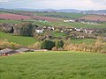
 Landscape near Shillingford St George - geograph.org.uk - 5919203.jpg 4,283 × 2,730; 1.78 MB
-
 Lane from Ide to Dunchideock - geograph.org.uk - 6263328.jpg 1,024 × 684; 303 KB
-
 Lay-by on the A30 near Alphington - geograph.org.uk - 1914481.jpg 640 × 480; 66 KB
-
 Lay-by on westbound A30 - geograph.org.uk - 6263154.jpg 1,024 × 684; 228 KB
-

-
 Looking south-east to Shillingford Plantation - geograph.org.uk - 6434048.jpg 1,600 × 1,200; 970 KB
-
 Markham Cross - geograph.org.uk - 5923085.jpg 4,042 × 2,473; 1.35 MB
-
 Markham Lane - geograph.org.uk - 1964985.jpg 1,200 × 1,600; 531 KB
-
 Markham Lane - geograph.org.uk - 5923064.jpg 2,590 × 4,037; 1.49 MB
-
 Markham Lane heading towards Alphington - geograph.org.uk - 1577845.jpg 640 × 480; 166 KB
-

-
 Markham Lane, Ide - geograph.org.uk - 6631453.jpg 1,600 × 1,200; 994 KB
-

-
 Minor road, to Dunchideock - geograph.org.uk - 1458030.jpg 640 × 480; 74 KB
-
 Oak Close, Shillingford Abbot - geograph.org.uk - 1348079.jpg 640 × 480; 81 KB
-

-
 Orange Way in Devon and Torbay (180) - geograph.org.uk - 2701391.jpg 1,024 × 768; 227 KB
-
 Orange Way in Devon and Torbay (181) - geograph.org.uk - 2701407.jpg 1,024 × 768; 228 KB
-
 Orange Way in Devon and Torbay (182) - geograph.org.uk - 2701418.jpg 1,024 × 821; 227 KB
-
 Orange Way in Devon and Torbay (183) - geograph.org.uk - 2701467.jpg 1,024 × 768; 188 KB
-
 Orange Way in Devon and Torbay (184) - geograph.org.uk - 2701474.jpg 1,024 × 768; 268 KB
-
 Orange Way in Devon and Torbay (187) - geograph.org.uk - 2701561.jpg 1,024 × 772; 227 KB
-
 Orange Way in Devon and Torbay (188) - geograph.org.uk - 2701514.jpg 1,024 × 768; 210 KB
-
 Orange Way in Devon and Torbay (189) - geograph.org.uk - 2701537.jpg 1,024 × 768; 226 KB
-
 Orange Way in Devon and Torbay (190) - geograph.org.uk - 2701541.jpg 1,024 × 702; 166 KB
-
 Orange Way in Devon and Torbay (191) - geograph.org.uk - 2702049.jpg 1,024 × 768; 133 KB
-
 Orange Way in Devon and Torbay (192) - geograph.org.uk - 2702052.jpg 1,024 × 768; 231 KB
-
 Orange Way in Devon and Torbay (193) - geograph.org.uk - 2702053.jpg 1,024 × 768; 172 KB
-
 Peamore House - geograph.org.uk - 2164695.jpg 640 × 480; 240 KB
-
 Pengellys, Shillingford Abbot - geograph.org.uk - 155624.jpg 640 × 480; 109 KB
-

-
 Place Farm, Shillingford St George - geograph.org.uk - 1457999.jpg 640 × 480; 63 KB
-
 Polehouse Lane - geograph.org.uk - 2434396.jpg 800 × 600; 424 KB
-
 Pond and trees, Bowhay - geograph.org.uk - 155634.jpg 640 × 480; 79 KB
-

-
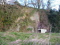 Quarry, Shillingford - geograph.org.uk - 155511.jpg 640 × 480; 157 KB
-

-

-
 Road near Westbury - geograph.org.uk - 4997993.jpg 2,048 × 3,072; 1.26 MB
-

-
 Road past Marshall Farm - geograph.org.uk - 4997102.jpg 1,920 × 1,335; 926 KB
-

-
 Road to Clapham, Shillingford St George - geograph.org.uk - 6434035.jpg 1,600 × 1,200; 1,009 KB
-
 Road to Haldon Hills - geograph.org.uk - 1577891.jpg 640 × 480; 176 KB
-
 Road to Ide - geograph.org.uk - 1577894.jpg 640 × 480; 170 KB
-
 Sampson's Hill, Shillingford St George - geograph.org.uk - 6434041.jpg 1,600 × 1,200; 941 KB
-
 Sheep grazing in the valley west of Shillingford Abbot - geograph.org.uk - 6434058.jpg 1,600 × 1,200; 855 KB
-
 Shillingford Abbot from the south - geograph.org.uk - 6434056.jpg 1,600 × 1,200; 902 KB
-
 Shillingford Lane - geograph.org.uk - 1457981.jpg 640 × 480; 112 KB
-
 Shillingford Lane - geograph.org.uk - 1457988.jpg 640 × 480; 98 KB
-
 Shillingford Road - geograph.org.uk - 5923031.jpg 2,705 × 3,572; 1.73 MB
-
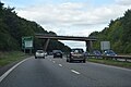
 Shillingford Road bridge over A30 - geograph.org.uk - 6433987.jpg 1,600 × 1,200; 931 KB
-
 Shillingford Road bridge over the A30 - geograph.org.uk - 6225973.jpg 1,024 × 698; 92 KB
-
 Shillingford Road Bridge, A30 - geograph.org.uk - 5254254.jpg 640 × 426; 56 KB
-
 Shillingford Road crossing the A30 - geograph.org.uk - 6434080.jpg 1,600 × 1,200; 881 KB
-
 Shillingford St George , Manstree Vineyard - geograph.org.uk - 5059850.jpg 6,000 × 4,000; 6.27 MB
-
 Shillingford St George , The Willows - geograph.org.uk - 5059854.jpg 6,000 × 4,000; 7.12 MB
-
 Shillingford St George - geograph.org.uk - 155255.jpg 640 × 480; 90 KB
-
 Shillingford St George church - geograph.org.uk - 6434032.jpg 1,600 × 1,200; 1.04 MB
-
 Shillingford St George from the south - geograph.org.uk - 155514.jpg 640 × 480; 83 KB
-
 Shillingford St George, 2000 - geograph.org.uk - 5561260.jpg 850 × 575; 55 KB
-
 Shillingford village hall, Shillingford St George - geograph.org.uk - 6434043.jpg 1,600 × 1,200; 955 KB
-
 Sign for Shillingford Abbot village - geograph.org.uk - 6433997.jpg 1,600 × 1,200; 1.04 MB
-
 Sign for Shillingford St George - geograph.org.uk - 6434006.jpg 1,600 × 1,200; 964 KB
-
 Teignbridge , The A30 - geograph.org.uk - 3861405.jpg 4,288 × 2,848; 5.06 MB
-
 Teignbridge , The A30 - geograph.org.uk - 3861407.jpg 4,288 × 2,848; 4.96 MB
-
 Teignbridge , The A379 - geograph.org.uk - 3659892.jpg 4,284 × 2,842; 6.6 MB
-
 Thatched house, Shillingford St George (geograph 6434023).jpg 1,600 × 1,200; 1.02 MB
-
 The A30 towards the A377 turn off - geograph.org.uk - 3510917.jpg 1,024 × 768; 206 KB
-
 The A30 westbound near Shillingford - geograph.org.uk - 3498124.jpg 800 × 600; 126 KB
-
 The Barton, Shillingford Abbot - geograph.org.uk - 155275.jpg 640 × 480; 81 KB
-
 The end of Barrack Lane, Shillingford Abbot - geograph.org.uk - 6434067.jpg 1,600 × 1,200; 886 KB
-
 The extension of Markham Lane at Markham Cross - geograph.org.uk - 6631467.jpg 1,200 × 1,600; 1.09 MB
-
 The Matford Brook, Shillingford Abbot - geograph.org.uk - 6434055.jpg 1,200 × 1,600; 1.06 MB
-
 The Shillingford Road goes over The A30 - geograph.org.uk - 3498132.jpg 800 × 600; 127 KB
-
 Track (footpath) at Peamore Arch - geograph.org.uk - 2164682.jpg 640 × 480; 291 KB
-
 Track to Bowhay Farm - geograph.org.uk - 4998078.jpg 1,920 × 1,280; 862 KB
-
 Track to farm building and field - geograph.org.uk - 2774870.jpg 600 × 800; 497 KB
-
 Trees by Shillingford Road, Shillingford St George - geograph.org.uk - 6434014.jpg 1,600 × 1,200; 1.04 MB
-
 Valley of the Matford Brook, Shillingford St George - geograph.org.uk - 6434010.jpg 1,600 × 1,200; 804 KB
-
 Victorian postbox, Shillingford Abbot - geograph.org.uk - 1306933.jpg 640 × 481; 168 KB
-
 Victorian wallbox in Shillingford Abbot - geograph.org.uk - 1149525.jpg 416 × 570; 214 KB
-
 View from church car park, Shillingford St George - geograph.org.uk - 6434033.jpg 1,600 × 1,200; 902 KB
-
 View from Markham Cross - geograph.org.uk - 128224.jpg 640 × 480; 75 KB
-
 View from Markham Cross - geograph.org.uk - 5923098.jpg 3,880 × 2,238; 1.86 MB
-

-
 View near Shillingford Abbot - geograph.org.uk - 128223.jpg 640 × 480; 66 KB
-
 View to the south, from Markham Cross - geograph.org.uk - 1964981.jpg 1,600 × 1,200; 500 KB
-
 Village cross, Shillingford St George - geograph.org.uk - 1308199.jpg 479 × 640; 243 KB
-
 Village Hall, Shillingford St George - geograph.org.uk - 1149484.jpg 570 × 427; 206 KB
-
 Village scene, Shillingford Abbot - geograph.org.uk - 1306929.jpg 640 × 480; 170 KB
-
 Waybrook Lane, Shillingford Abbot - geograph.org.uk - 6434069.jpg 1,600 × 1,200; 959 KB
-

-

-
 Wyndburgh, near Alphington - geograph.org.uk - 1348124.jpg 640 × 480; 84 KB


.jpg)
_-_geograph.org.uk_-_2701391.jpg)
_-_geograph.org.uk_-_2701407.jpg)
_-_geograph.org.uk_-_2701418.jpg)
_-_geograph.org.uk_-_2701467.jpg)
_-_geograph.org.uk_-_2701474.jpg)
_-_geograph.org.uk_-_2701561.jpg)
_-_geograph.org.uk_-_2701514.jpg)
_-_geograph.org.uk_-_2701537.jpg)
_-_geograph.org.uk_-_2701541.jpg)
_-_geograph.org.uk_-_2702049.jpg)
_-_geograph.org.uk_-_2702052.jpg)
_-_geograph.org.uk_-_2702053.jpg)


.jpg)


_at_Peamore_Arch_-_geograph.org.uk_-_2164682.jpg)


