Category:Shiel Bridge, Wester Ross
Jump to navigation
Jump to search
village in Ross-shire, Highland, Scotland, United Kingdom  | |||||
| Upload media | |||||
| Instance of | |||||
|---|---|---|---|---|---|
| Location |
| ||||
 | |||||

English: Shiel Bridge is a village on the south east mouth of Loch Duich and confluence of the small loch in Glen Shiel and the River Shiel, in the Scottish Highlands and is in the council area of Highland.
Subcategories
This category has only the following subcategory.
B
Media in category "Shiel Bridge, Wester Ross"
The following 62 files are in this category, out of 62 total.
-
 A seat on the beach - geograph.org.uk - 3150655.jpg 640 × 478; 74 KB
-
 Achnangart Vodafone - O2 Tower - geograph.org.uk - 86470.jpg 450 × 600; 83 KB
-
 Boats on Loch Duich - geograph.org.uk - 2989066.jpg 640 × 480; 33 KB
-
 Cemetery at Shiel Bridge.jpg 1,799 × 1,221; 465 KB
-
 Fishing boat by Loch Duich - geograph.org.uk - 3376648.jpg 800 × 530; 88 KB
-
 Forecourt with a view, Shiel Bridge - geograph.org.uk - 3920989.jpg 1,024 × 678; 195 KB
-
 Hauled out by Invershiel - geograph.org.uk - 3356575.jpg 1,200 × 803; 315 KB
-
 Jetty at Kintail - geograph.org.uk - 2335980.jpg 640 × 480; 114 KB
-
 Kintail Estate sign, Shiel Bridge - geograph.org.uk - 1962562.jpg 1,000 × 667; 733 KB
-
 Kintail Lodge Hotel - geograph.org.uk - 1407870.jpg 640 × 480; 59 KB
-
 Loch Duich - geograph.org.uk - 2336011.jpg 640 × 480; 98 KB
-
 Loch Duich - geograph.org.uk - 3629834.jpg 3,648 × 2,736; 3.46 MB
-
 Loch Duich and Ratagan - geograph.org.uk - 3920971.jpg 1,024 × 678; 144 KB
-
 Loch Duich in 1984 - geograph.org.uk - 2611026.jpg 640 × 419; 66 KB
-

-

-
 Low tide at Loch Duich - geograph.org.uk - 5688911.jpg 3,264 × 2,448; 1.16 MB
-
 Old boat - geograph.org.uk - 2335990.jpg 640 × 480; 114 KB
-
 Petrol pumps, Shiel Bridge - geograph.org.uk - 2973530.jpg 640 × 360; 236 KB
-
 Petrol Station and Shop Sheil Bridge - geograph.org.uk - 3689342.jpg 640 × 396; 66 KB
-
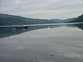
 Reflections in Loch Duich - geograph.org.uk - 3377478.jpg 800 × 530; 141 KB
-
 Scenic road (5690267365).jpg 3,872 × 2,592; 5.15 MB
-
 Sheil Bridge from Ratagan - geograph.org.uk - 965780.jpg 640 × 480; 204 KB
-
 Shiel Bridge - geograph.org.uk - 123665.jpg 640 × 575; 102 KB
-
 Shiel Bridge geograph-1662919-by-K--A.jpg 640 × 537; 83 KB
-
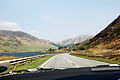
 The road to Skye (32184311278).jpg 5,904 × 2,804; 8.54 MB
-
 View from Shiel bridge campsite - geograph.org.uk - 1227495.jpg 640 × 480; 180 KB
-

-

-
 A'Mhuing ridge - geograph.org.uk - 1457813.jpg 640 × 480; 41 KB
-
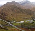
 A87, Glen Shiel - geograph.org.uk - 1186834.jpg 640 × 359; 58 KB
-
 Achadh na Seileach - geograph.org.uk - 684517.jpg 640 × 426; 236 KB
-
 Achnagart Farm - geograph.org.uk - 343029.jpg 640 × 480; 105 KB
-
 Achnangart - geograph.org.uk - 589978.jpg 640 × 480; 118 KB
-
 Achnangart driveway - geograph.org.uk - 589987.jpg 640 × 480; 101 KB
-
 Achnangart farm Glenshiel - geograph.org.uk - 1407892.jpg 640 × 480; 76 KB
-
 Allt a Choire Chaoil - geograph.org.uk - 1457855.jpg 480 × 640; 63 KB
-
 Alluvial fan, Glen Shiel - geograph.org.uk - 1155872.jpg 640 × 480; 118 KB
-
 Biod an Fhithich Summit - geograph.org.uk - 829745.jpg 640 × 480; 82 KB
-
 Biod an Fhitich - geograph.org.uk - 71053.jpg 640 × 480; 54 KB
-
 Biod an Fhitich. - geograph.org.uk - 71055.jpg 640 × 480; 58 KB
-
 Cnoc Dubh Achadh Arsgalain. - geograph.org.uk - 71048.jpg 640 × 449; 64 KB
-

-
 Glen Shiel - geograph.org.uk - 1417737.jpg 640 × 480; 266 KB
-
 Going down An Gleannan - geograph.org.uk - 318347.jpg 640 × 480; 69 KB
-

-
 Grazing land, Achnangart - geograph.org.uk - 589976.jpg 640 × 480; 95 KB
-
 Head of Loch Duich, from the Ratagan road - geograph.org.uk - 600941.jpg 640 × 464; 121 KB
-

-
 Loch a Choire Uaine The Saddle Glen Sheil - geograph.org.uk - 26573.jpg 480 × 640; 108 KB
-
 Loch Coire nan Crogachan - geograph.org.uk - 197033.jpg 640 × 480; 142 KB
-
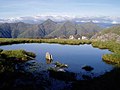
 Lochan below Sgurr a' Gharg Gharaidh - geograph.org.uk - 197024.jpg 640 × 480; 86 KB
-
 Looking towards Coire Caol. - geograph.org.uk - 318333.jpg 640 × 480; 52 KB
-
-

-
 Shieling on Sgurr an Airgid - geograph.org.uk - 483746.jpg 800 × 600; 266 KB
-
 Shielshop and Five Sisters Restaurant - geograph.org.uk - 393607.jpg 640 × 480; 71 KB
-
 Summit of Sgurr Leac nan Each - geograph.org.uk - 197021.jpg 640 × 480; 92 KB
-
 The cairn at the bealach - geograph.org.uk - 318343.jpg 640 × 480; 77 KB
-
 The Saddle from Sgurr na Forcan - geograph.org.uk - 628406.jpg 640 × 433; 114 KB
-
 The Summit Ridge of The Saddle - geograph.org.uk - 628408.jpg 640 × 431; 104 KB
-
 Trees bordering The River Shiel - geograph.org.uk - 233318.jpg 640 × 480; 192 KB


.jpg)


.jpg)


