Category:Sherburn in Elmet
Jump to navigation
Jump to search
village in North Yorkshire, England, UK  Eglwys yr Holl Saint, Sherburn-in-Elmet | |||||
| Upload media | |||||
| Instance of | |||||
|---|---|---|---|---|---|
| Location | Selby, North Yorkshire, Yorkshire and the Humber, England | ||||
| Population |
| ||||
| official website | |||||
 | |||||
Cymraeg: Pentref yn Gorllewin Swydd Efrog, Lloegr, yw Sherburn in Elmet. Mae'n gorwedd ger tref Selby. Poblogaeth: 5,750 (Cyfrifiad 2001).
English: Sherburn in Elmet is a village and civil parish in the Selby district of North Yorkshire, England, situated close to Selby. It is one of only three places in the area to be explicitly associated with the ancient Celtic kingdom of Elmet via featuring the kingdom's title in its name, the others being Barwick-in-Elmet and Scholes-in-Elmet. According to the 2001 census, Sherburn has a population of 6,221.
Subcategories
This category has the following 9 subcategories, out of 9 total.
Media in category "Sherburn in Elmet"
The following 200 files are in this category, out of 415 total.
(previous page) (next page)-
 A broken road bridge near Rest Park - geograph.org.uk - 2153677.jpg 800 × 600; 299 KB
-

-
-

-
 A lay-by on the B1222 - geograph.org.uk - 2153728.jpg 800 × 600; 273 KB
-
 A private track near Low Rest Park Farm - geograph.org.uk - 2153668.jpg 800 × 600; 321 KB
-
 A sledgehammer to crack a nut^ - geograph.org.uk - 2736238.jpg 1,024 × 768; 189 KB
-
 A Sub Station on Fenton Lane - geograph.org.uk - 3564036.jpg 1,024 × 768; 205 KB
-
 A162 - geograph.org.uk - 2891031.jpg 480 × 640; 41 KB
-
 A162 by Spital Moor - geograph.org.uk - 2891047.jpg 480 × 640; 31 KB
-
 A162 Roundabout - geograph.org.uk - 253286.jpg 640 × 475; 41 KB
-
 Access track to Copley Lane Quarry - geograph.org.uk - 4808831.jpg 1,024 × 768; 581 KB
-

-
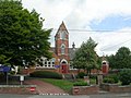
 All Saints Church, Sherburn in Elmet - geograph.org.uk - 5733467.jpg 1,600 × 1,200; 489 KB
-

-
 Ambulance Station - North Drive - geograph.org.uk - 1357651.jpg 640 × 480; 228 KB
-
 Appletree Way - Moor Lane - geograph.org.uk - 1359646.jpg 640 × 480; 233 KB
-
 Athelstans Court - Low Garth Link - geograph.org.uk - 1358232.jpg 640 × 480; 255 KB
-
 B1222 lay-by - geograph.org.uk - 4751009.jpg 640 × 480; 49 KB
-
 B1222 towards Sherburn - geograph.org.uk - 2414529.jpg 1,600 × 1,200; 414 KB
-

-
 Beech Grove - Finkle Street - geograph.org.uk - 1357629.jpg 640 × 480; 260 KB
-

-
 Beechwood Close - New Lane - geograph.org.uk - 1358976.jpg 640 × 480; 235 KB
-
 Beechwood Glade - Beechwood Close - geograph.org.uk - 1358977.jpg 640 × 480; 230 KB
-
 Birds over a ploughed field, near the B1222 - geograph.org.uk - 2736246.jpg 1,024 × 768; 125 KB
-
 Bishop Dike - geograph.org.uk - 2413875.jpg 1,600 × 1,200; 678 KB
-
 Bishop Dike - geograph.org.uk - 2413883.jpg 1,600 × 1,200; 510 KB
-
 Bishop Dike beside the B1222 - geograph.org.uk - 2414521.jpg 1,600 × 1,200; 441 KB
-
 Bishop Dike near Sherburn - geograph.org.uk - 2414527.jpg 1,600 × 1,200; 550 KB
-
 Bishop Dike, Sherburn in Elmet - geograph.org.uk - 606782.jpg 467 × 640; 57 KB
-
 Bishop Dyke - geograph.org.uk - 3311037.jpg 4,608 × 3,456; 5.51 MB
-
 Bishop Dyke and Hodgson's Lane - geograph.org.uk - 5733446.jpg 1,600 × 1,200; 645 KB
-
 Bishop Dyke at Sherburn Common - geograph.org.uk - 4095541.jpg 1,600 × 1,064; 584 KB
-
 Bishop Dyke at Sherburn Common - geograph.org.uk - 4095550.jpg 1,600 × 1,064; 862 KB
-
 Bishop Dyke at Sherburn Common - geograph.org.uk - 4095563.jpg 1,600 × 1,064; 653 KB
-
 Bishop Dyke, Sweeming Bridge - geograph.org.uk - 2022486.jpg 640 × 480; 106 KB
-
 Bishop Wood - geograph.org.uk - 2409708.jpg 640 × 430; 30 KB
-
 Bishop Wood - geograph.org.uk - 4252312.jpg 640 × 361; 24 KB
-
 Bishopdike Road at North Sweeming Road - geograph.org.uk - 2363666.jpg 800 × 600; 266 KB
-

-
 Bridge taking Fenton Lane over a dyke - geograph.org.uk - 5733451.jpg 1,600 × 1,200; 835 KB
-

-

-
 British Gypsum Factory - geograph.org.uk - 293510.jpg 640 × 480; 83 KB
-
 British Gypsum Plasterboard Plant - geograph.org.uk - 2757134.jpg 3,720 × 2,276; 1.49 MB
-
 Bungalows on Kirkgate, Sherburn in Elmet - geograph.org.uk - 4093009.jpg 1,600 × 1,064; 664 KB
-
 But I'm not trespassing - geograph.org.uk - 2153696.jpg 800 × 600; 352 KB
-
 By-Pass Park Estate, Sherburn-in-Elmet - geograph.org.uk - 4092447.jpg 1,600 × 1,064; 546 KB
-

-
 Cardinal Close - Moor Lane - geograph.org.uk - 1358207.jpg 640 × 480; 219 KB
-

-
 Carousel Walk - The Fairway - geograph.org.uk - 1358990.jpg 640 × 480; 228 KB
-
 Carr Avenue - Low Garth Road - geograph.org.uk - 1358235.jpg 640 × 469; 174 KB
-
 Carr Dike - geograph.org.uk - 388740.jpg 640 × 480; 121 KB
-
 Carr Dike near Lennerton Farm - geograph.org.uk - 5602027.jpg 1,600 × 1,064; 791 KB
-
 Cereal crop south of New Lane - geograph.org.uk - 2736233.jpg 1,024 × 768; 195 KB
-
 Church Hill Guest House - Church Hill - geograph.org.uk - 1359649.jpg 640 × 480; 227 KB
-
 Church Meadow - Church Hill - geograph.org.uk - 1359665.jpg 640 × 490; 195 KB
-
 Church Mews - Church View - geograph.org.uk - 1358218.jpg 640 × 480; 253 KB
-
-
 Coal train passing Gascoigne Wood - geograph.org.uk - 2502842.jpg 1,600 × 1,015; 239 KB
-
 Coat of arms, Sherburn in Elmet (8051391301).jpg 2,712 × 3,479; 6.72 MB
-
 Coldhill - geograph.org.uk - 5372610.jpg 640 × 427; 200 KB
-
 Coldhill Lane - geograph.org.uk - 252800.jpg 640 × 480; 48 KB
-
 Coldhill Lane - geograph.org.uk - 2755052.jpg 640 × 480; 61 KB
-
 Coldhill Lane - geograph.org.uk - 2755058.jpg 640 × 480; 61 KB
-
 Coldhill Lane - geograph.org.uk - 2755062.jpg 640 × 480; 42 KB
-
 Coldhill Lane - geograph.org.uk - 2755065.jpg 640 × 480; 94 KB
-
 Coldhill Lane Aberford - geograph.org.uk - 2267458.jpg 800 × 600; 189 KB
-
 Coldhill Lane Aberford - geograph.org.uk - 2267465.jpg 800 × 600; 187 KB
-
 Coldhill Lane and Coldhill Pond - geograph.org.uk - 4807042.jpg 1,024 × 768; 143 KB
-
 Coldhill Lane, looking east - geograph.org.uk - 4807084.jpg 1,024 × 768; 134 KB
-
 Coldhill Pond - geograph.org.uk - 2755066.jpg 640 × 480; 70 KB
-
 Coldhill Pond - geograph.org.uk - 5372605.jpg 640 × 427; 203 KB
-
 Constar International at Sherburn - geograph.org.uk - 2568600.jpg 640 × 463; 68 KB
-
 Copperfield Close - Pasture View - geograph.org.uk - 2663160.jpg 640 × 601; 88 KB
-
 Copperfield Close, Sherburn in Elmet - geograph.org.uk - 4092701.jpg 1,600 × 1,064; 524 KB
-
 Corn Mill Court - Church View - geograph.org.uk - 2662990.jpg 640 × 480; 82 KB
-
 Country road - geograph.org.uk - 4751011.jpg 640 × 480; 31 KB
-
 Cricketers Way - Low Street - geograph.org.uk - 1358229.jpg 640 × 480; 256 KB
-
 Croft Way - Kirkgate - geograph.org.uk - 1359647.jpg 640 × 480; 246 KB
-
 Croftway - Kirkgate - geograph.org.uk - 2662889.jpg 640 × 480; 71 KB
-
 Cumin's Indian Restaurant on the B1222 - geograph.org.uk - 2363624.jpg 800 × 600; 193 KB
-
 Deighton Avenue - Eversley Court - geograph.org.uk - 1358954.jpg 640 × 480; 234 KB
-

-

-
 Drain on the east side of Fenton Lane - geograph.org.uk - 4808846.jpg 768 × 1,024; 566 KB
-
 Drainage ditch off Coldhill Lane - geograph.org.uk - 2755047.jpg 640 × 480; 72 KB
-
 East Coast Main Line near Bishop Wood - geograph.org.uk - 112299.jpg 640 × 480; 81 KB
-
 ECML at Bishop Wood - geograph.org.uk - 3585530.jpg 640 × 427; 100 KB
-

-
 Ellarfield Lane, Sherburn in Elmet - geograph.org.uk - 5733444.jpg 1,600 × 1,200; 752 KB
-
 Ellarfield Lane, Sherburn in Emlet - geograph.org.uk - 2274720.jpg 800 × 600; 290 KB
-
 Elmete Avenue - Carr Avenue - geograph.org.uk - 1358236.jpg 640 × 480; 221 KB
-
 Elmete Avenue - Park Avenue - geograph.org.uk - 1358241.jpg 640 × 480; 248 KB
-
 Elmete Social Club - Low Street - geograph.org.uk - 1358213.jpg 640 × 413; 205 KB
-
 Elmete Social Club, Sherburn in Elmet - geograph.org.uk - 5733462.jpg 1,600 × 1,200; 391 KB
-
 Entering Sherburn in Elmet - geograph.org.uk - 2755040.jpg 640 × 480; 51 KB
-
 Entrance to Coldhill Farm - geograph.org.uk - 4807049.jpg 768 × 1,024; 530 KB
-
 Entrance to EDM, Sherburn Enterprise Park - geograph.org.uk - 4813679.jpg 1,024 × 768; 143 KB
-
 Entrance to scrapyard, New Lane - geograph.org.uk - 2736219.jpg 1,024 × 768; 166 KB
-
 Eversley Court - Park Avenue - geograph.org.uk - 1358951.jpg 640 × 480; 251 KB
-

-

-
 Eversley Garth Crescent - Low Street - geograph.org.uk - 1358961.jpg 640 × 480; 232 KB
-
 Fairfield Close - Fairfield Link - geograph.org.uk - 2663154.jpg 640 × 480; 59 KB
-

-
 Fairfield Link - The Fairway - geograph.org.uk - 1359000.jpg 640 × 480; 263 KB
-

-
 Fairway Close - The Fairway - geograph.org.uk - 1358993.jpg 640 × 480; 242 KB
-
 Farm bridge over Bishop Dyke - geograph.org.uk - 4095588.jpg 1,600 × 1,064; 780 KB
-
-
 Farm Track near Rest Park Farm - geograph.org.uk - 5602033.jpg 1,600 × 1,064; 1.02 MB
-
 Farm track off Laith Staid Lane - geograph.org.uk - 4093113.jpg 1,600 × 1,064; 392 KB
-
 Farm track off Mile Hill - geograph.org.uk - 2755055.jpg 640 × 480; 73 KB
-
 Farmland and woodland near Mattram Hall - geograph.org.uk - 2413870.jpg 1,600 × 1,200; 423 KB
-
 Farmland at Windy Ridge Farm - geograph.org.uk - 2568597.jpg 640 × 427; 54 KB
-

-
 Farmland between Oldgate and Coldhill Lanes - geograph.org.uk - 4807067.jpg 1,024 × 614; 94 KB
-
 Farmland from railway near Mile Hill - geograph.org.uk - 3987901.jpg 640 × 371; 33 KB
-
 Farmland in the valley of Stream Dike - geograph.org.uk - 4807100.jpg 1,024 × 768; 164 KB
-
 Farmland near Lennerton Farm - geograph.org.uk - 2413890.jpg 1,600 × 1,200; 323 KB
-
 Farmland near Sherburn Airfield - geograph.org.uk - 2629099.jpg 1,600 × 1,159; 239 KB
-
 Farmland near Sherburn Lodge - geograph.org.uk - 2414532.jpg 1,600 × 1,200; 383 KB
-
 Farmland near South Milford - geograph.org.uk - 2629079.jpg 1,600 × 1,178; 318 KB
-
 Farmland off Coldhill Lane - geograph.org.uk - 2755049.jpg 640 × 480; 66 KB
-
 Farmland off Finkle Hill - geograph.org.uk - 2628840.jpg 1,600 × 1,200; 489 KB
-
 Farmland off the B1222 - geograph.org.uk - 2755039.jpg 640 × 480; 65 KB
-

-
 Farmland, Mile Hill - geograph.org.uk - 2681210.jpg 640 × 480; 31 KB
-
 Fenton Dene on Fenton Lane - geograph.org.uk - 3564024.jpg 1,024 × 768; 193 KB
-
 Fenton Lane heading north - geograph.org.uk - 2414534.jpg 1,600 × 1,200; 378 KB
-
 Fenton Lane towards Church Fenton - geograph.org.uk - 3564020.jpg 1,024 × 768; 139 KB
-
 Fenton Lane, between two 8 metre spot heights - geograph.org.uk - 4808843.jpg 1,024 × 768; 169 KB
-

-
 Fields beside Copley Lane - geograph.org.uk - 5372613.jpg 640 × 427; 200 KB
-
 Fields near Low Grange - geograph.org.uk - 241499.jpg 640 × 480; 55 KB
-
 Fields on edge of Sherburn in Elmet - geograph.org.uk - 6604959.jpg 1,024 × 666; 121 KB
-
 Fields south of Sherburn-in-Elmet - geograph.org.uk - 253284.jpg 640 × 323; 26 KB
-
 Finger post on Pasture Way, Sherburn in Elmet - geograph.org.uk - 4092685.jpg 1,600 × 1,064; 806 KB
-
 Finkle Hill heading north - geograph.org.uk - 2628845.jpg 1,600 × 1,200; 507 KB
-
 Fishing pond beside the railway - geograph.org.uk - 5785163.jpg 800 × 600; 157 KB
-
 Fishing Pond, Sherburn in Elmet - geograph.org.uk - 6604958.jpg 1,024 × 646; 140 KB
-
 Flat field - geograph.org.uk - 5305038.jpg 640 × 426; 29 KB
-
 Flats on Milford Road - geograph.org.uk - 2628828.jpg 1,600 × 1,200; 427 KB
-
 Flood warning, Coldhill Lane - geograph.org.uk - 4807127.jpg 1,024 × 768; 137 KB
-
 Football pitch on Pasture Way, Sherburn in Elmet - geograph.org.uk - 4092656.jpg 1,600 × 1,064; 656 KB
-

-
 Footbridge over Mill Dyke - geograph.org.uk - 5602002.jpg 1,600 × 1,064; 1,002 KB
-
 Footpath - Kirkgate - geograph.org.uk - 2662885.jpg 539 × 640; 63 KB
-
 Footpath - Low Street - geograph.org.uk - 2662997.jpg 480 × 640; 64 KB
-
 Footpath - Moor Lane - geograph.org.uk - 2662718.jpg 480 × 640; 123 KB
-
 Footpath - Moor Lane - geograph.org.uk - 2662722.jpg 480 × 640; 63 KB
-
 Footpath - The Fairway - geograph.org.uk - 2663158.jpg 480 × 640; 91 KB
-
 Footpath and Green Dyke through Sherburn Enterprise Park - geograph.org.uk - 5733454.jpg 1,600 × 1,200; 562 KB
-
 Footpath at Melton Leys - geograph.org.uk - 3351503.jpg 1,600 × 1,066; 929 KB
-
 Footpath crossing the railway south of Church Fenton - geograph.org.uk - 3409831.jpg 2,048 × 1,536; 443 KB
-
 Footpath leading to Copperfield Close - geograph.org.uk - 4092690.jpg 1,600 × 1,064; 600 KB
-
 Footpath leading to Low Street, Sherburn in Elmet - geograph.org.uk - 4092725.jpg 1,600 × 1,064; 573 KB
-
 Footpath leading to Sherburn-in-Elmet - geograph.org.uk - 4092455.jpg 1,600 × 1,064; 616 KB
-
 Footpath leading to Sherburn-in-Elmet - geograph.org.uk - 4092457.jpg 1,600 × 1,064; 503 KB
-
 Footpath leading to Sherburn-in-Elmet - geograph.org.uk - 4092630.jpg 1,600 × 1,064; 697 KB
-
 Footpath off Laith Staid Lane - geograph.org.uk - 4093085.jpg 1,600 × 1,064; 858 KB
-
 Footpath to Barkston Ash - geograph.org.uk - 252694.jpg 640 × 480; 38 KB
-
 Former School - Kirkgate - geograph.org.uk - 1357577.jpg 640 × 480; 265 KB
-

-
 Former School on Kirkgate, Sherburn in Elmet - geograph.org.uk - 4092958.jpg 1,600 × 1,064; 737 KB
-
 Foster Walk - Tomlinson Way - geograph.org.uk - 1359663.jpg 640 × 480; 265 KB
-
 Future house building land, by the looks of it - geograph.org.uk - 4092620.jpg 1,600 × 1,064; 574 KB
-
 Garden Close - Garden Lane - geograph.org.uk - 1359660.jpg 640 × 480; 259 KB
-
 Garden Lane - Church Hill - geograph.org.uk - 1359658.jpg 640 × 480; 233 KB
-
 Gas Installation - off Finkle Hill - geograph.org.uk - 2662880.jpg 640 × 480; 99 KB
-
 Gascoigne Wood Sidings - geograph.org.uk - 4614749.jpg 640 × 426; 54 KB
-
 Gascoigne wood signal box - geograph.org.uk - 2373922.jpg 882 × 1,024; 278 KB
-
 Gated level crossing on Moor Lane - geograph.org.uk - 2628855.jpg 1,600 × 1,200; 477 KB
-
 Grass-filled ditch, south side, Coldhill Lane - geograph.org.uk - 4807114.jpg 1,024 × 768; 144 KB
-
 Green Dike, Sherburn Enterprise Park (1) - geograph.org.uk - 4813001.jpg 1,024 × 768; 182 KB
-
 Green Dike, Sherburn Enterprise Park (2) - geograph.org.uk - 4813672.jpg 1,024 × 768; 196 KB
-
 Gypsum stockpile, Gascoigne Wood - geograph.org.uk - 3489811.jpg 1,024 × 768; 131 KB
-
 Gypsum works near Sherburn in Elmet - geograph.org.uk - 4847126.jpg 640 × 482; 131 KB
-
 Hall Garth Mews - Kirkgate - geograph.org.uk - 1357580.jpg 640 × 480; 223 KB
-
 Hall Garth Mews, Sherburn in Elmet - geograph.org.uk - 4092951.jpg 1,600 × 1,064; 643 KB
-
 Hay and straw stores - geograph.org.uk - 3410154.jpg 2,048 × 1,536; 537 KB
-
 Hazard in a field south of Coldhill Lane - geograph.org.uk - 4807118.jpg 1,024 × 768; 154 KB
-
 High Trees Court - Low Street - geograph.org.uk - 1358967.jpg 640 × 480; 302 KB
-
 Hodgson's Lane towards Sherburn in Elmet - geograph.org.uk - 4095594.jpg 1,600 × 1,064; 783 KB
-
 Hodgson's Lane towards Sherburn in Elmet - geograph.org.uk - 4095607.jpg 1,600 × 1,064; 714 KB
-
 Hodgson's Lane, Sherburn in Elmet - geograph.org.uk - 4095628.jpg 1,600 × 1,064; 784 KB
-
 House on Kirkgate, Sherburn in Elmet - geograph.org.uk - 4093012.jpg 1,600 × 1,064; 629 KB
-
 House on Moor Lane, Sherburn-in-Elmet - geograph.org.uk - 4092440.jpg 1,600 × 1,064; 637 KB
-
 Houses on Copperfield Close, Sherburn in Elmet - geograph.org.uk - 4092712.jpg 1,600 × 1,064; 510 KB
-
 Houses on Hall Garth Mews, Sherburn in Elmet - geograph.org.uk - 4092918.jpg 1,600 × 1,064; 758 KB
-
 Housing development - Church Hill - geograph.org.uk - 1359666.jpg 640 × 444; 181 KB
-
 Hungate Road - Duffield Crescent - geograph.org.uk - 1357666.jpg 640 × 480; 249 KB
-
 Hurricane Way, western end - geograph.org.uk - 4809340.jpg 1,024 × 768; 129 KB
-
 Industrial premises, Sherburn Enterprise Park - geograph.org.uk - 4813673.jpg 1,024 × 615; 363 KB
-

-
 Industrial units on Moxon way - geograph.org.uk - 2566946.jpg 640 × 368; 62 KB
-
 Industrial units, Moor Lane Trading Estate - geograph.org.uk - 2629069.jpg 1,600 × 872; 192 KB


.jpg)


_-_geograph.org.uk_-_4813001.jpg)
_-_geograph.org.uk_-_4813672.jpg)


