Category:Shepton Beauchamp
Jump to navigation
Jump to search
English: Shepton Beauchamp is a village and civil parish, north east of Ilminster between the Blackdown Hills and the Somerset Levels in the South Somerset district of Somerset, England.
village in the United Kingdom  | |||||
| Upload media | |||||
| Instance of | |||||
|---|---|---|---|---|---|
| Location | South Somerset, Somerset, South West England, England | ||||
 | |||||
Subcategories
This category has the following 2 subcategories, out of 2 total.
D
Media in category "Shepton Beauchamp"
The following 79 files are in this category, out of 79 total.
-
 Arable land near Marsh Lane - geograph.org.uk - 5117796.jpg 1,024 × 768; 215 KB
-
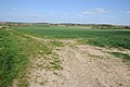 Arable land near Shepton Beauchamp - geograph.org.uk - 3937929.jpg 800 × 531; 118 KB
-
 Barrington Court from the south - geograph.org.uk - 3292831.jpg 3,888 × 2,592; 467 KB
-
 Burrow Hill from Barrington - geograph.org.uk - 3292826.jpg 3,888 × 2,592; 656 KB
-
 Clinging on - geograph.org.uk - 5974856.jpg 460 × 640; 297 KB
-
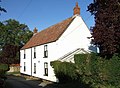 Cottage at Wash Cross - geograph.org.uk - 513386.jpg 640 × 471; 90 KB
-
 Cottages on Silver St - geograph.org.uk - 3304967.jpg 640 × 480; 92 KB
-
 Cottages, Shepton Beauchamp - geograph.org.uk - 5117791.jpg 1,024 × 880; 227 KB
-
 Crossroads on Muckleditch Lane - geograph.org.uk - 4960355.jpg 1,024 × 768; 239 KB
-
 Drain off Sheepwash Lane - geograph.org.uk - 5974778.jpg 427 × 640; 174 KB
-

-
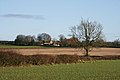
 Farmland at Shepton Beauchamp - geograph.org.uk - 5635667.jpg 640 × 478; 68 KB
-
 Farmland near Shepton Beauchamp - geograph.org.uk - 5974732.jpg 460 × 640; 200 KB
-
 Field at Kelly's Farm, Shepton Beauchamp - geograph.org.uk - 5974685.jpg 640 × 427; 146 KB
-

-
 Field on Lincoln Hill - geograph.org.uk - 2930420.jpg 800 × 600; 421 KB
-
 Field to the north of Shepton Beauchamp - geograph.org.uk - 5974909.jpg 640 × 427; 141 KB
-
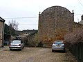
 Fives Court Wall, Shepton Beauchamp - geograph.org.uk - 4960321.jpg 1,024 × 768; 228 KB
-
 Fives court wall, Shepton Beauchamp - geograph.org.uk - 510736.jpg 640 × 404; 78 KB
-
 Fives Wall - geograph.org.uk - 1553824.jpg 640 × 486; 92 KB
-
 Footpath near Shell's Farm - geograph.org.uk - 5605453.jpg 640 × 427; 130 KB
-

-
 Greenway Lane - geograph.org.uk - 4959940.jpg 1,024 × 831; 187 KB
-
 Higher Road Shepton Beauchamp - geograph.org.uk - 3305263.jpg 640 × 480; 132 KB
-
 Holloway, Shepton Beauchamp - geograph.org.uk - 3447770.jpg 640 × 480; 146 KB
-
 Houses on Lambrook Street - geograph.org.uk - 4959957.jpg 1,024 × 831; 137 KB
-
 Lake Farm and farm land from the south - geograph.org.uk - 3292812.jpg 3,888 × 2,592; 627 KB
-
 Lake Farm and scenery from the south - geograph.org.uk - 3292817.jpg 3,888 × 2,592; 829 KB
-
 Lambrook Road - geograph.org.uk - 3472923.jpg 640 × 387; 57 KB
-
 Lambrook Road, Shepton Beauchamp - geograph.org.uk - 3472970.jpg 640 × 444; 58 KB
-
 Lane south of Barrington - geograph.org.uk - 1380640.jpg 640 × 480; 100 KB
-
 Lincoln's Hill - geograph.org.uk - 2930427.jpg 600 × 800; 378 KB
-
 Marsh Lane, near Shepton Beachamp - geograph.org.uk - 5974748.jpg 460 × 640; 186 KB
-
 Marsh Lane, near Shepton Beauchamp - geograph.org.uk - 5974756.jpg 640 × 427; 148 KB
-
 Marsh Lane, near Shepton Beauchamp - geograph.org.uk - 5974765.jpg 640 × 427; 150 KB
-
 North Street, Shepton Beauchamp - geograph.org.uk - 4959968.jpg 1,024 × 872; 237 KB
-
 Old cottages and school, Shepton Beauchamp - geograph.org.uk - 3292796.jpg 3,888 × 2,592; 734 KB
-

-
 Path to Hill Side Farm - geograph.org.uk - 2930423.jpg 800 × 600; 392 KB
-
 Piece Lane houses and open space - geograph.org.uk - 2930436.jpg 800 × 600; 385 KB
-
 Ponds near Home Farm - geograph.org.uk - 3292805.jpg 3,888 × 2,592; 1.23 MB
-

-

-
 Rodwell Manor from the west - geograph.org.uk - 3292820.jpg 3,888 × 2,592; 814 KB
-
 Salisbury House, Shepton Beauchamp - geograph.org.uk - 5635440.jpg 3,008 × 2,000; 2.84 MB
-
 School and post office, Shepton Beauchamp - geograph.org.uk - 3292793.jpg 3,888 × 2,592; 766 KB
-
 Sheep Way - geograph.org.uk - 4960347.jpg 1,024 × 829; 185 KB
-
 Shell's Farm from the east - geograph.org.uk - 3292816.jpg 3,888 × 2,592; 1.06 MB
-
 Shepton Beauchamp - geograph.org.uk - 11191.jpg 640 × 480; 126 KB
-
 Shepton Beauchamp church primary school.jpg 6,000 × 4,000; 14.23 MB
-
 Shepton Beauchamp, Sub Post Office - geograph.org.uk - 1745234.jpg 799 × 568; 367 KB
-
 Shepton Beauchamps Fives Wall - geograph.org.uk - 2241908.jpg 640 × 480; 81 KB
-
 Shops in Shepton Beauchamp - geograph.org.uk - 4959984.jpg 1,024 × 876; 208 KB
-
 Showers building to the south - geograph.org.uk - 5974898.jpg 640 × 426; 168 KB
-
 Site of Shepton Beauchamp flour mill - geograph.org.uk - 3292808.jpg 3,888 × 2,592; 1.06 MB
-
 St Michael's Church, Shepton Beauchamp - geograph.org.uk - 5635450.jpg 1,993 × 2,769; 2.19 MB
-
 T junction at the end of Greenway Lane - geograph.org.uk - 5117799.jpg 1,024 × 768; 239 KB
-

-
 Terraced Cottages, Middle Street - geograph.org.uk - 4960337.jpg 1,024 × 768; 183 KB
-
 Thatchers at Shepton Beauchamp - geograph.org.uk - 3292798.jpg 3,888 × 2,592; 1.07 MB
-
 Village pump in Shepton Beauchamp - geograph.org.uk - 2930440.jpg 800 × 600; 396 KB
-
 West Lambrook from the south west - geograph.org.uk - 3292813.jpg 3,888 × 2,592; 912 KB
-
 At Dinnington - geograph.org.uk - 1503568.jpg 640 × 480; 94 KB
-
 Dillington Park - geograph.org.uk - 492341.jpg 640 × 480; 100 KB
-
 Dillington Park Farm - geograph.org.uk - 492352.jpg 640 × 477; 123 KB
-
 Emergency access slip road to A303 - geograph.org.uk - 493214.jpg 640 × 480; 114 KB
-
 Field beside A303 - geograph.org.uk - 493303.jpg 640 × 480; 142 KB
-
 Field beside Wood Close Lane - geograph.org.uk - 492837.jpg 640 × 480; 113 KB
-
 Field near Higher Farm - geograph.org.uk - 508007.jpg 640 × 480; 142 KB
-
 Fields beside the A303 - geograph.org.uk - 493305.jpg 640 × 480; 138 KB
-
 Hurcott Copse - geograph.org.uk - 491867.jpg 640 × 480; 104 KB
-
 Hurcott Farm - geograph.org.uk - 510696.jpg 640 × 478; 87 KB
-
 Junction east of Whitelackington - geograph.org.uk - 493300.jpg 640 × 475; 129 KB
-
 Junction near Dinnington - geograph.org.uk - 548128.jpg 640 × 480; 150 KB
-
 Lane junction near Dinnington - geograph.org.uk - 491948.jpg 640 × 480; 119 KB
-
 Lane junction near Kingstone - geograph.org.uk - 491785.jpg 640 × 480; 105 KB
-
 Leafy lane - geograph.org.uk - 623855.jpg 640 × 480; 178 KB
-
 Mill Lane Fruit Farm - geograph.org.uk - 508054.jpg 640 × 480; 94 KB
-


