Category:Shenstone, Staffordshire
Jump to navigation
Jump to search
English: Shenstone is a village and civil parish in Staffordshire, England, close to Stonnall and between Lichfield and Birmingham. In a recent survey Shenstone was found to be one of the ten worst places in England for finding single women.

village and civil parish in Staffordshire, United Kingdom  | |||||
| Upload media | |||||
| Instance of | |||||
|---|---|---|---|---|---|
| Location | Lichfield, Staffordshire, West Midlands, England | ||||
| Said to be the same as | Shenstone (Wikimedia duplicated page, civil parish) | ||||
 | |||||
Subcategories
This category has the following 5 subcategories, out of 5 total.
L
M
- Mill Green, Staffordshire (1 F)
Media in category "Shenstone, Staffordshire"
The following 200 files are in this category, out of 308 total.
(previous page) (next page)-
 A look back - Little Aston, Staffordshire - geograph.org.uk - 3717657.jpg 2,993 × 2,304; 1.58 MB
-

-
 A38 southbound - geograph.org.uk - 2403136.jpg 640 × 395; 32 KB
-
 A4026 Blake Street, Hill Hook - geograph.org.uk - 3950652.jpg 640 × 480; 86 KB
-
 A5 West to Double Roundabout - geograph.org.uk - 2488491.jpg 640 × 428; 58 KB
-
 A5127 Approaching Shenstone - geograph.org.uk - 2730014.jpg 1,496 × 1,122; 470 KB
-
 A5127 heading north - geograph.org.uk - 3419554.jpg 640 × 480; 79 KB
-

-
 Ahead the golfers - Little Aston, Staffs - geograph.org.uk - 3717682.jpg 3,072 × 2,304; 3.17 MB
-
 Aldridge Road (A454) - geograph.org.uk - 3553266.jpg 640 × 480; 84 KB
-
 Aldridge Road A454 Little Aston - geograph.org.uk - 5537542.jpg 640 × 480; 88 KB
-

-

-
 Approaching Junction T4 on the M6 Toll - geograph.org.uk - 3195441.jpg 3,074 × 2,018; 1.29 MB
-
 Approaching Junction T4, M6 Toll Road - geograph.org.uk - 3670123.jpg 640 × 480; 250 KB
-
 Ashcroft Farm - geograph.org.uk - 2984451.jpg 640 × 358; 36 KB
-
 Ashcroft Farm - geograph.org.uk - 3419583.jpg 1,116 × 671; 168 KB
-
-
 Ashcroft Lane - geograph.org.uk - 3419590.jpg 640 × 480; 54 KB
-
 Back lane Footherley - geograph.org.uk - 1482465.jpg 640 × 480; 96 KB
-
 Barn conversion Moor Lane Footherley - geograph.org.uk - 309467.jpg 640 × 480; 89 KB
-

-
 Benchmark on Shenstone Bridge - geograph.org.uk - 4212000.jpg 2,560 × 1,920; 1.05 MB
-
 Bend on Walsall Road Littler Aston - geograph.org.uk - 5536685.jpg 640 × 480; 69 KB
-

-
 Birchbrook Industrial Park - geograph.org.uk - 2984461.jpg 640 × 250; 31 KB
-
 Birmingham Road (A5127) - geograph.org.uk - 3419536.jpg 640 × 480; 63 KB
-
 Birmingham Road (A5127) - geograph.org.uk - 3419562.jpg 640 × 480; 71 KB
-

-
 Birmingham Road - Shenstone, Staffordshire - geograph.org.uk - 6395958.jpg 1,024 × 683; 126 KB
-
 Birmingham Road bridge, M6 (Toll) - geograph.org.uk - 2661459.jpg 640 × 430; 44 KB
-

-
 Blake Street (A4026) - geograph.org.uk - 3418997.jpg 640 × 480; 76 KB
-
 Blake Street (A4026) - geograph.org.uk - 3419514.jpg 640 × 480; 82 KB
-

-
 Bosses - geograph.org.uk - 1220233.jpg 640 × 432; 64 KB
-

-
 Bridge over the M6 Toll - geograph.org.uk - 3195442.jpg 4,596 × 1,902; 1.79 MB
-
 Bridge over the M6 Toll Road - geograph.org.uk - 6304951.jpg 1,024 × 576; 65 KB
-
 Bridge over the old A5 - Wall, Staffordshire - geograph.org.uk - 6391878.jpg 1,024 × 683; 202 KB
-
 Bridleway and A5148 - geograph.org.uk - 6092230.jpg 2,272 × 1,704; 1.29 MB
-

-
 Bridleway skirting a field near Whitehouse Farm - geograph.org.uk - 6092207.jpg 2,272 × 1,704; 1.31 MB
-
 Bright shiny new stile - geograph.org.uk - 2764337.jpg 2,048 × 1,536; 683 KB
-
 Bus stop, Birmingham Road, Shenstone - geograph.org.uk - 1538008.jpg 640 × 480; 75 KB
-
 Cartersfield Lane - geograph.org.uk - 3553371.jpg 640 × 480; 71 KB
-
 Cartersfield Lane - geograph.org.uk - 3553622.jpg 640 × 480; 61 KB
-
 Cartersfield Lane Farm and cottages - geograph.org.uk - 1228899.jpg 640 × 480; 54 KB
-
 Copse off Cartersfield Lane - geograph.org.uk - 1141058.jpg 640 × 480; 80 KB
-
 Cottage for sale, Stonnall - geograph.org.uk - 3553351.jpg 640 × 480; 95 KB
-
 Court Drive - geograph.org.uk - 3419569.jpg 640 × 480; 101 KB
-
 Crane Brook - geograph.org.uk - 3419586.jpg 640 × 480; 130 KB
-
 Cranebrook Lane - geograph.org.uk - 3553630.jpg 640 × 480; 82 KB
-

-
 Crop field near Shenstone - geograph.org.uk - 3419557.jpg 640 × 480; 53 KB
-
 Crop field off Gravelly Lane - geograph.org.uk - 3553338.jpg 640 × 480; 89 KB
-
 Crop field, Bosses - geograph.org.uk - 3553283.jpg 640 × 480; 78 KB
-
 Crop field, Fighting Cock's Farm - geograph.org.uk - 3553376.jpg 640 × 480; 74 KB
-
 Crop field, Mill Green - geograph.org.uk - 3553257.jpg 640 × 480; 79 KB
-
 Cross city line - geograph.org.uk - 1482499.jpg 640 × 480; 68 KB
-
 Cross with caution - Little Aston, Staffordshire - geograph.org.uk - 3717708.jpg 3,072 × 2,304; 3.06 MB
-
 Crossroads on Lynn Lane, Lynn - geograph.org.uk - 2801122.jpg 640 × 428; 64 KB
-
 Cycling north on Wood Lane - geograph.org.uk - 3553315.jpg 640 × 480; 81 KB
-
 Dawn Eclipse - geograph.org.uk - 67284.jpg 1,600 × 1,200; 389 KB
-
 Derelict gatehouse, Lynn Lane - geograph.org.uk - 1228880.jpg 640 × 480; 109 KB
-

-
 Disused bridleway - geograph.org.uk - 6092194.jpg 2,212 × 1,659; 1.92 MB
-
 Driveway to Shenstone Court - geograph.org.uk - 323442.jpg 600 × 450; 255 KB
-

-
 Endwood Drive - geograph.org.uk - 3402231.jpg 800 × 600; 130 KB
-

-
 Entering Staffordshire on the A5127 - geograph.org.uk - 3419528.jpg 640 × 480; 82 KB
-
 Entrance to Aston Wood Golf Course - geograph.org.uk - 3418992.jpg 640 × 480; 48 KB
-
 Entrance to footpath at Moss Cottages - geograph.org.uk - 2764344.jpg 2,048 × 1,536; 659 KB
-
 Entrance to Little Aston Golf Club - geograph.org.uk - 2763779.jpg 2,048 × 1,536; 638 KB
-
 Entrance to Shenstone Court.jpg 640 × 428; 96 KB
-
 Extreme end of Moor Lane - geograph.org.uk - 1220239.jpg 640 × 480; 99 KB
-
 Farm access bridge, M6 (Toll) - geograph.org.uk - 2661483.jpg 640 × 430; 47 KB
-
 Farm building, Wood End Farm - geograph.org.uk - 3419550.jpg 640 × 480; 54 KB
-
 Farm track off Hook Lane - geograph.org.uk - 3553318.jpg 640 × 480; 80 KB
-
 Farmhouse on Cranebrook Lane - geograph.org.uk - 3553629.jpg 640 × 480; 63 KB
-
 Farmland east off Wood Lane - geograph.org.uk - 3553312.jpg 1,024 × 735; 197 KB
-
 Farmland near the railway - geograph.org.uk - 3419544.jpg 640 × 480; 62 KB
-
 Farmland off Birmingham Road - geograph.org.uk - 3419535.jpg 640 × 480; 52 KB
-
 Farmland off Lynn Lane - geograph.org.uk - 3419579.jpg 640 × 480; 62 KB
-
 Farmland, Hill Hook - geograph.org.uk - 3418996.jpg 640 × 480; 51 KB
-
 Farmland, Shenstone Court - geograph.org.uk - 3419567.jpg 640 × 480; 102 KB
-
 Farmland, Watford Gap - geograph.org.uk - 3419007.jpg 640 × 420; 48 KB
-

-
 Field entrance off Cranebrook Lane - geograph.org.uk - 3553634.jpg 640 × 480; 99 KB
-
 Field With Horses Shenstone Woodend - geograph.org.uk - 3480373.jpg 640 × 480; 61 KB
-

-
 Fields near Ryknild Street - geograph.org.uk - 6092187.jpg 2,272 × 1,704; 1.17 MB
-

-
 Footherley - geograph.org.uk - 1482479.jpg 640 × 480; 54 KB
-
 Footherley - geograph.org.uk - 1482487.jpg 640 × 480; 154 KB
-
 Footherley - geograph.org.uk - 2984562.jpg 640 × 354; 34 KB
-
 Footherley Brook Shenstone - geograph.org.uk - 3950653.jpg 640 × 480; 82 KB
-
 Footherley Hall Care Home - geograph.org.uk - 2804017.jpg 640 × 428; 70 KB
-
 Footherley lane - geograph.org.uk - 1482513.jpg 640 × 480; 66 KB
-
 Footherley Lane - geograph.org.uk - 3419542.jpg 640 × 480; 47 KB
-
 Footherley Lane - geograph.org.uk - 3553326.jpg 640 × 480; 83 KB
-

-

-
 Footpath Near Footherley - geograph.org.uk - 2737366.jpg 1,496 × 1,122; 706 KB
-
 Footpath Near Shenstone Court - geograph.org.uk - 2729997.jpg 1,496 × 1,122; 1.22 MB
-
 Footpath off Aldridge Road - geograph.org.uk - 3553263.jpg 640 × 480; 99 KB
-
 Footpath off Cartersfield Lane - geograph.org.uk - 3553369.jpg 640 × 480; 76 KB
-
 Footpath through fields near Shenstone Court - geograph.org.uk - 2764437.jpg 2,048 × 1,536; 741 KB
-
 Footpath To Footherley - geograph.org.uk - 2729992.jpg 1,496 × 1,122; 865 KB
-
 Footpath To Footherley - geograph.org.uk - 2735801.jpg 1,122 × 1,496; 1 MB
-
 Footpath To Footherley - geograph.org.uk - 2737371.jpg 1,496 × 1,122; 818 KB
-
 Forge Lane - geograph.org.uk - 3553271.jpg 640 × 480; 93 KB
-
 Forge Lane - geograph.org.uk - 3553276.jpg 640 × 480; 77 KB
-
 Forge Lane - geograph.org.uk - 3553280.jpg 640 × 480; 77 KB
-
 Forge Lane - geograph.org.uk - 911524.jpg 640 × 480; 88 KB
-
 Former chapel at Watford Gap - geograph.org.uk - 2764338.jpg 2,048 × 1,536; 701 KB
-
 Fotherley Brook - geograph.org.uk - 1220215.jpg 640 × 480; 132 KB
-
 Fotherley Brook Bridge - geograph.org.uk - 1220216.jpg 640 × 480; 129 KB
-
 Fox and Hounds, Shenstone.jpg 1,496 × 1,122; 271 KB
-
 From old A5 eastwards - Wall, Staffordshire - geograph.org.uk - 6389251.jpg 1,024 × 683; 120 KB
-

-

-
 Gravelly Lane - geograph.org.uk - 3553334.jpg 640 × 480; 82 KB
-
 Gravelly Lane - geograph.org.uk - 3553339.jpg 640 × 480; 82 KB
-
 Grazing off Forge Lane - geograph.org.uk - 3553273.jpg 640 × 480; 93 KB
-
 Grazing off Gravelly Lane - geograph.org.uk - 3553331.jpg 640 × 480; 68 KB
-
 Highbury Road, Streetly - geograph.org.uk - 3418982.jpg 640 × 480; 92 KB
-
 Home Farm, Footherley - geograph.org.uk - 2984503.jpg 640 × 367; 51 KB
-
 Hook Lane - geograph.org.uk - 3553319.jpg 640 × 480; 104 KB
-
 House on Blake Street - geograph.org.uk - 3419510.jpg 640 × 480; 71 KB
-

-

-
 Joining M6 Toll road at junction T5 - geograph.org.uk - 4566032.jpg 640 × 252; 41 KB
-
 JPE Shire Oak Quarry - geograph.org.uk - 6270706.jpg 4,000 × 2,667; 4.69 MB
-
 Junction Near Lynn Hall - geograph.org.uk - 1141050.jpg 640 × 480; 99 KB
-

-

-

-

-

-

-

-
 Junction of Moor Lane and Back Lane - geograph.org.uk - 1220237.jpg 640 × 480; 100 KB
-

-
 Junction of Wood Lane and Forge Lane - geograph.org.uk - 1220235.jpg 640 × 480; 78 KB
-

-

-
 Keepers Cottage Barn - geograph.org.uk - 2277066.jpg 800 × 600; 179 KB
-

-
 Little Hay Lane - geograph.org.uk - 2788869.jpg 3,648 × 2,736; 3.64 MB
-
 Little Hay Lane Junction - geograph.org.uk - 3402171.jpg 800 × 551; 59 KB
-
 Little Hay Mission Church - geograph.org.uk - 6328.jpg 600 × 450; 106 KB
-

-
 Little Hay Pumping Station - geograph.org.uk - 3862946.jpg 640 × 414; 80 KB
-
 Little Hay Pumping Station - geograph.org.uk - 923817.jpg 640 × 480; 140 KB
-

-
 Lodge to Shenstone Court - geograph.org.uk - 322921.jpg 600 × 450; 211 KB
-
 Looking Eastwards along Footherley Lane - geograph.org.uk - 2803987.jpg 640 × 428; 122 KB
-

-

-

-

-

-
 Lynn - geograph.org.uk - 1141045.jpg 640 × 480; 84 KB
-
 Lynn House, Lynn - geograph.org.uk - 1228883.jpg 640 × 480; 67 KB
-
 Lynn Lane - geograph.org.uk - 3419577.jpg 640 × 480; 73 KB
-
 Lynn Lane - geograph.org.uk - 3419580.jpg 640 × 480; 107 KB
-
 Lynn Lane Drive - geograph.org.uk - 2277059.jpg 800 × 600; 128 KB
-
 Lynn Lane House - geograph.org.uk - 1228871.jpg 640 × 480; 85 KB
-
 Lynn Lane Stile - geograph.org.uk - 2273899.jpg 800 × 600; 133 KB
-
 M6 Toll at junction T4 - geograph.org.uk - 2826058.jpg 640 × 480; 30 KB
-
 M6 Toll between junctions T5 and T4 - geograph.org.uk - 2825995.jpg 640 × 481; 30 KB
-
 M6 Toll exit slip - geograph.org.uk - 2412187.jpg 640 × 480; 58 KB
-
 M6 Toll Road Near Shenstone - geograph.org.uk - 3670122.jpg 640 × 480; 220 KB
-
 M6 Toll Road, Exit at Junction T4 - geograph.org.uk - 3671638.jpg 640 × 480; 240 KB
-
 M6 Toll Road, Exit at Junction T5 - geograph.org.uk - 3669781.jpg 640 × 480; 253 KB
-
 M6 Toll, west of Junction 5 - geograph.org.uk - 2326388.jpg 640 × 412; 66 KB
-
 Main Street, Stonnall - geograph.org.uk - 3553355.jpg 640 × 480; 60 KB
-
 Main Street, Stonnall - geograph.org.uk - 3553363.jpg 640 × 480; 57 KB
-
 Milepost at SK 112 048.jpg 600 × 450; 135 KB
-
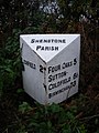
 Miles to Lichfield - Shenstone, Staffordshire - geograph.org.uk - 6385879.jpg 1,024 × 683; 305 KB
-
 Mill Court on Mill Lane Shenstone - geograph.org.uk - 2810671.jpg 640 × 428; 56 KB
-
 Mill Lane - geograph.org.uk - 3553259.jpg 640 × 480; 102 KB
-
 Mill Lane - geograph.org.uk - 3553327.jpg 640 × 480; 71 KB
-
 Mill Lane entering Lower Stonnall - geograph.org.uk - 2801037.jpg 640 × 428; 72 KB
-
 Moor Cottage Moor Lane, Footherley - geograph.org.uk - 308252.jpg 640 × 480; 99 KB
-
 Muddy Field and Toll Road - geograph.org.uk - 316456.jpg 640 × 480; 93 KB
-
 Narrow footpath near Shenstone Court - geograph.org.uk - 2764389.jpg 1,492 × 1,990; 689 KB
-
 New Bridge - geograph.org.uk - 4414347.jpg 640 × 426; 89 KB
-
 New entrance to Thickbroom Farm - geograph.org.uk - 323367.jpg 600 × 450; 227 KB
-
 New Wood - geograph.org.uk - 911518.jpg 640 × 480; 92 KB
-
 No entry, Stonall Village - geograph.org.uk - 2799606.jpg 640 × 428; 79 KB
-
 Oak Farm Green Barns Lane, Weeford - geograph.org.uk - 308260.jpg 640 × 480; 90 KB
-

-
 Old entrance to Thickbroom Farm - geograph.org.uk - 323353.jpg 400 × 533; 236 KB
-
-
 On the old A5 - Wall, Staffordshire - geograph.org.uk - 6391763.jpg 1,024 × 683; 182 KB
-
 Pigs - geograph.org.uk - 1194717.jpg 559 × 376; 48 KB
-
 Poplars Smallholding - geograph.org.uk - 2984553.jpg 640 × 405; 47 KB


_-_geograph.org.uk_-_3553266.jpg)


_-_geograph.org.uk_-_3419536.jpg)
_-_geograph.org.uk_-_3419562.jpg)
_heading_north_-_geograph.org.uk_-_3419559.jpg)

_-_geograph.org.uk_-_2661459.jpg)

_-_geograph.org.uk_-_3418997.jpg)
_-_geograph.org.uk_-_3419514.jpg)


_-_geograph.org.uk_-_2810973.jpg)


_-_geograph.org.uk_-_2661483.jpg)


,_Birmingham_Road,_Shenstone_Parish_(geograph_6038414).jpg)


