Category:Shelf, West Yorkshire
Jump to navigation
Jump to search
village in West Yorkshire, England  | |||||
| Upload media | |||||
| Instance of | |||||
|---|---|---|---|---|---|
| Location | Calderdale, West Yorkshire, Yorkshire and the Humber, England | ||||
 | |||||
English: Shelf is a village in West Yorkshire, England. The village is situated halfway between Bradford and Halifax. It has a population of 4,496.

Subcategories
This category has the following 10 subcategories, out of 10 total.
F
J
- Judy Woods (55 F)
P
R
- Royds Hall Beck (5 F)
S
- Shelf Hall Park (3 F)
- Sun Wood, Calderdale (4 F)
Media in category "Shelf, West Yorkshire"
The following 135 files are in this category, out of 135 total.
-
 Annet Hole Well - geograph.org.uk - 386512.jpg 439 × 640; 164 KB
-
 Annet Hole Well and footbridge, Shelf - geograph.org.uk - 6593887.jpg 2,000 × 1,500; 1.08 MB
-
 As the sign says Stocks Farm - geograph.org.uk - 1087373.jpg 640 × 480; 92 KB
-
 Ayreville Drive - Shelf Moor Road - geograph.org.uk - 1343538.jpg 640 × 480; 257 KB
-
 Bracken Beck - Cooper Lane - geograph.org.uk - 725843.jpg 640 × 481; 81 KB
-
 Bridle Stile, Shelf - geograph.org.uk - 209557.jpg 640 × 480; 118 KB
-
 Bridle Stile, Shelf - geograph.org.uk - 209572.jpg 640 × 480; 91 KB
-
 Broad Ings Farm - geograph.org.uk - 5888890.jpg 5,184 × 3,456; 5.52 MB
-
 Brook Farm Court - geograph.org.uk - 1851717.jpg 640 × 480; 120 KB
-

-

-
 Cabin Farm Barn - Pepper Hill - geograph.org.uk - 3083623.jpg 640 × 480; 79 KB
-
 Calderdale Way above North Wood - geograph.org.uk - 5889154.jpg 5,184 × 3,456; 6.58 MB
-
 Calderdale Way at Shelf Hall Park - geograph.org.uk - 2848994.jpg 3,072 × 2,304; 1.38 MB
-
 Calderdale Way near Pepper Hill - geograph.org.uk - 2848983.jpg 3,072 × 2,304; 1.16 MB
-
 Calderdale Way, Bridle Stile, Shelf - geograph.org.uk - 40020.jpg 640 × 427; 132 KB
-
 Cattle, Soaper Lane - geograph.org.uk - 47964.jpg 640 × 427; 117 KB
-
 Clough Mill, Shelf - geograph.org.uk - 948017.jpg 640 × 413; 60 KB
-
 Clough Mill, Shelf - geograph.org.uk - 950009.jpg 640 × 415; 53 KB
-
 Coal Pit Hills, Brackens Lane, Shelf - geograph.org.uk - 209531.jpg 640 × 469; 102 KB
-
 Coalpit Hills, Shelf - geograph.org.uk - 6611473.jpg 2,000 × 1,500; 1.16 MB
-
 Cock Hill - geograph.org.uk - 386537.jpg 640 × 480; 134 KB
-
 Cock Hill Spring - geograph.org.uk - 386546.jpg 640 × 490; 169 KB
-
 Coley Beck - geograph.org.uk - 386375.jpg 475 × 640; 148 KB
-
 Cooper Lane - Carr House Road - geograph.org.uk - 1343592.jpg 640 × 480; 214 KB
-
 Cottages - Carr House Lane - geograph.org.uk - 725819.jpg 640 × 424; 49 KB
-
 Cottages - Cooper Lane - geograph.org.uk - 725836.jpg 640 × 406; 48 KB
-
 Dean House Farm - geograph.org.uk - 2849491.jpg 3,072 × 2,304; 1.36 MB
-
 Dean House Farm - geograph.org.uk - 386422.jpg 640 × 440; 106 KB
-
 Downhill in the Second Half - geograph.org.uk - 386480.jpg 480 × 640; 186 KB
-
 Edge of the Shelf (2223197951).jpg 1,513 × 2,270; 3.38 MB
-

-
 Electricity Pylon - Cock Hill Lane - geograph.org.uk - 3083609.jpg 480 × 640; 50 KB
-
 Electricity Pylons - off Pepper Hill - geograph.org.uk - 3083613.jpg 640 × 448; 52 KB
-
 Enclosed track from Dean House approaching Shelf Hall Park - geograph.org.uk - 5748584.jpg 4,000 × 3,000; 4.48 MB
-
 Entrance to Shelf Business Park - geograph.org.uk - 1081244.jpg 640 × 480; 54 KB
-
 Entrance to Windmill Farm, Burned Road, Shelf.jpg 5,184 × 3,888; 9.54 MB
-
 Eroded footpath, Shelf - geograph.org.uk - 6600862.jpg 1,500 × 2,000; 1.2 MB
-
 Farm Buildings above Wood Fall Beck - geograph.org.uk - 5889157.jpg 5,177 × 3,246; 6.7 MB
-
 Farmhouse at Windmill Farm, Burned Road, Shelf.jpg 5,184 × 3,888; 5.17 MB
-
 Footbridge in Wood Fall, Shelf - geograph.org.uk - 209593.jpg 480 × 640; 126 KB
-
 Footbridge over Blackshaw Beck, Clayton - geograph.org.uk - 6611485.jpg 2,000 × 1,500; 1.94 MB
-
 Footpath - Brow Lane - geograph.org.uk - 2924724.jpg 480 × 640; 127 KB
-
 Footpath - Brow Lane - geograph.org.uk - 2924725.jpg 480 × 640; 146 KB
-
 Footpath - Brow Lane - geograph.org.uk - 2924727.jpg 640 × 480; 138 KB
-
 Footpath - Burnside Avenue - geograph.org.uk - 2924778.jpg 480 × 640; 83 KB
-
 Footpath - Coley Road - geograph.org.uk - 783770.jpg 640 × 480; 85 KB
-
 Footpath - Greenacres Grove - geograph.org.uk - 2924764.jpg 480 × 640; 110 KB
-
 Footpath - Shelf Hall Park Woods - geograph.org.uk - 1343224.jpg 640 × 480; 304 KB
-
 Footpath from Brow Lane to Shelf Hall Park via Annet Hole - geograph.org.uk - 6593896.jpg 2,000 × 1,500; 1.89 MB
-
 Footpath heading North towards Shelf - geograph.org.uk - 5889136.jpg 5,184 × 3,456; 6.7 MB
-
 Footpath leading to Carr House Road, Shelf - geograph.org.uk - 5163507.jpg 1,600 × 1,065; 532 KB
-
 Footpath leading to Carr House Road, Shelf - geograph.org.uk - 5163518.jpg 1,600 × 1,065; 511 KB
-
 Footpath leading to Carr House Road, Shelf - geograph.org.uk - 5164267.jpg 1,600 × 1,065; 645 KB
-
 Footpath off Carr House Road, Shelf - geograph.org.uk - 208632.jpg 640 × 476; 97 KB
-
 Footpath to Carr House Lane at Riding Hill, Shelf - geograph.org.uk - 6593913.jpg 1,501 × 2,000; 1.27 MB
-
 Gateway - geograph.org.uk - 1115586.jpg 640 × 480; 83 KB
-
 Glencoe - off Wade House Road - geograph.org.uk - 1343257.jpg 640 × 504; 261 KB
-
 Grassy glade in Jagger Park Wood, North Bierley - geograph.org.uk - 4496357.jpg 2,048 × 1,536; 1.25 MB
-
 Graveyard - geograph.org.uk - 1438976.jpg 640 × 480; 136 KB
-
 Green Lane (Track) - geograph.org.uk - 1851716.jpg 480 × 640; 91 KB
-
 Guide Stone, Shelf.jpg 457 × 760; 52 KB
-
 Hargreaves Head - geograph.org.uk - 1480753.jpg 640 × 480; 115 KB
-
 High Bentley, Shelf - geograph.org.uk - 1868888.jpg 640 × 480; 111 KB
-
 House, Brow Lane - geograph.org.uk - 1890538.jpg 2,560 × 1,920; 892 KB
-
 Laurel Close - Shelf Moor Road - geograph.org.uk - 1343534.jpg 640 × 480; 282 KB
-
 Lion on the Gate 1 (1507459368).jpg 2,592 × 3,872; 4.24 MB
-
 Lion on the Gate 2 (1506612841).jpg 3,560 × 2,102; 2.66 MB
-
 Lion on the Gate 3 (1507483460).jpg 3,554 × 2,543; 2.87 MB
-
 Lion on the Gate 4 (1506635111).jpg 3,750 × 1,878; 2.06 MB
-
 Low Bentley Farm - geograph.org.uk - 386364.jpg 640 × 458; 114 KB
-
 Lower Bowl Shaw - Whinney Royd Lane - geograph.org.uk - 3083698.jpg 640 × 480; 59 KB
-
 Lower Bracken Beds - geograph.org.uk - 354222.jpg 640 × 480; 106 KB
-
 Lower Giles Farm - geograph.org.uk - 1115598.jpg 640 × 480; 72 KB
-
 Messy part of the Calderdale Way near Stone Chair - geograph.org.uk - 2848988.jpg 3,072 × 2,304; 1.46 MB
-
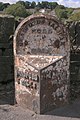
 Milestone, Shelf.jpg 1,200 × 1,600; 360 KB
-
 Moor Grove - Shelf Moor - geograph.org.uk - 1343551.jpg 640 × 480; 201 KB
-
 New access road off South Lane - geograph.org.uk - 2480738.jpg 640 × 480; 117 KB
-
 Northowram and Shelf Parish Boundary - geograph.org.uk - 386585.jpg 468 × 640; 140 KB
-
 Not today, thank you - geograph.org.uk - 3213999.jpg 2,048 × 1,536; 640 KB
-

-

-
 Old school - geograph.org.uk - 1438978.jpg 640 × 480; 66 KB
-
 Outfall Bay, Wood Fall, Shelf - geograph.org.uk - 209586.jpg 476 × 640; 151 KB
-
 Paddock beside Windmill Farm, Shelf - geograph.org.uk - 5889116.jpg 5,184 × 3,456; 6.85 MB
-
 Pastures beside Stanage Lane, Shelf - geograph.org.uk - 5889072.jpg 5,184 × 3,456; 7.56 MB
-
 Path in Jagger Park Wood, North Bierley - geograph.org.uk - 4496365.jpg 2,048 × 1,536; 1.05 MB
-
 Path to Wood Fall, Shelf - geograph.org.uk - 209595.jpg 469 × 640; 138 KB
-
 Pathway behind Shelf Hall Lane, Shelf.jpg 5,184 × 3,888; 1.78 MB
-
 Pathway next to Lidl, Shelf.jpg 5,184 × 3,888; 5.17 MB
-
 Public footpath off Brow Lane, Shelf - geograph.org.uk - 6593901.jpg 2,000 × 1,500; 1.05 MB
-
 Redundant Archway, Corner of Brackens and Stanage Lanes - geograph.org.uk - 5888994.jpg 5,184 × 3,456; 5.56 MB
-
 Riding Hill Bridge - geograph.org.uk - 386357.jpg 468 × 640; 163 KB
-
 Road to Field Bottoms Farm - geograph.org.uk - 1480758.jpg 640 × 480; 87 KB
-
 Rose Cottage Farm, Shelf - geograph.org.uk - 1868887.jpg 640 × 480; 98 KB
-
 Serbian Bellflower.jpg 2,944 × 2,944; 8.43 MB
-
 Shelf - Brow Lane.jpg 640 × 480; 141 KB
-
 Shelf Health Centre - Shelf Moor Road - geograph.org.uk - 1343527.jpg 640 × 480; 246 KB
-

-
 Shelf Moor (2947067439).jpg 1,396 × 2,095; 1.37 MB
-
 Shelf Moor - Shelf Moor Road - geograph.org.uk - 1343545.jpg 640 × 480; 206 KB
-

-
 Shelf Woods - geograph.org.uk - 5020972.jpg 1,195 × 1,600; 641 KB
-
 Shoulder of Mutton - geograph.org.uk - 1438974.jpg 640 × 480; 58 KB
-
 South Fields Farm and driveway, Shelf - geograph.org.uk - 209533.jpg 640 × 480; 96 KB
-
 Spring and trough, Riding Hill, Shelf - geograph.org.uk - 6593915.jpg 1,500 × 2,000; 1.13 MB
-

-
 Stable yard, Shelf New Hall, Shelf - geograph.org.uk - 209545.jpg 640 × 469; 103 KB
-
 Steps up from Wood Fall Beck - geograph.org.uk - 655862.jpg 640 × 639; 167 KB
-
 Stile near Shelf - geograph.org.uk - 5163511.jpg 1,600 × 1,065; 733 KB
-
 Stocks - Coley Road - geograph.org.uk - 783776.jpg 640 × 521; 68 KB
-
 Stone paving on Bridle Stile, Shelf - geograph.org.uk - 209589.jpg 480 × 640; 109 KB
-
 The Paddock, Shelf - geograph.org.uk - 386527.jpg 525 × 640; 210 KB
-
 The pinfold, Shelf - geograph.org.uk - 209563.jpg 640 × 480; 160 KB
-
 The top of the waterfall at Annet Hole, Shelf - geograph.org.uk - 6593892.jpg 2,000 × 1,502; 781 KB
-
 Top of pathway next to Lidl, Shelf.jpg 5,184 × 3,888; 5.05 MB
-
 Track from Dean House to Shelf - geograph.org.uk - 5748581.jpg 4,000 × 3,000; 3.79 MB
-

-
 View from Blackshaw Beck Lane, Shelf - geograph.org.uk - 6610681.jpg 2,000 × 1,500; 1.39 MB
-
 View from Corporal Lane - geograph.org.uk - 4347062.jpg 1,920 × 1,297; 585 KB
-

-
 Wade House Community Centre - Shelf - geograph.org.uk - 361657.jpg 622 × 416; 41 KB
-
 Wade House Road, Shelf.jpg 5,184 × 3,888; 1.76 MB
-
 Wade House Shelf. - geograph.org.uk - 527018.jpg 640 × 480; 113 KB
-
 Water supply for sheep, Shelf - geograph.org.uk - 209591.jpg 640 × 480; 118 KB
-
 Welcome to Shelf - geograph.org.uk - 1775150.jpg 640 × 480; 54 KB
-
 Windmill Farm - Burned Road - geograph.org.uk - 1343564.jpg 640 × 431; 162 KB
-
 Wood Fall - geograph.org.uk - 386457.jpg 640 × 480; 161 KB
-
 Woodland Path to the east of Dean House - geograph.org.uk - 4193992.jpg 4,000 × 3,000; 4.24 MB
-
 Bentley's restaurant Shelf. - geograph.org.uk - 527017.jpg 640 × 573; 125 KB
-
 Footpath to Riding Hill Farm - geograph.org.uk - 47965.jpg 640 × 427; 122 KB
-
 Footpath, Shelf - geograph.org.uk - 47456.jpg 640 × 427; 203 KB
-
 Milestone, Bradford and Halifax Road - geograph.org.uk - 40013.jpg 427 × 640; 114 KB
-
 Off wade House Road Shelf - geograph.org.uk - 361695.jpg 635 × 484; 39 KB
-
 Shelf Moor, Shelf - geograph.org.uk - 209539.jpg 640 × 419; 70 KB


_-_Carr_House_Lane_-_geograph.org.uk_-_725822.jpg)


.jpg)


_-_geograph.org.uk_-_1851716.jpg)


.jpg)
.jpg)
.jpg)
.jpg)


.jpg)


